DELISLE, Guillaume, & Philippe BUACHEBiblio.com
47 207 résultats
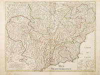
1730réf. 57564c 1730. This detailed and beautifully engraved map of the French/Italian Mediterranean coast from Nice to Montferrat has no cartouche- the title is written in the top border 3 scales inset map at lower right of Nice.The plates were originally made by De l'Isle around 1700. Covens and Mortimer reissued them in the Atlas Novissimo 1730-40. Phillipe Buache de l'Isle's successor and son in law continued to reissue de l'Isle's maps in the later eighteenth century. Copper engraving. Fine condition good margins edges a little browned Hand coloured. Size: 64 x 49 cm. unknown
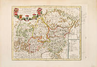
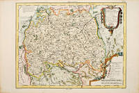
1787réf. 52368Atlas Universal 1787. Attractive map of Austria which at the time included most of Southern Germany part of northeast Italy the Czech Republic and Slovenia. Title cartouche at top right with five coats of arms. Key at lower right. Copper engraving. Fine condition. Later colouring. Size: 36 x 27 cm. 14 x 10½ inches. unknown
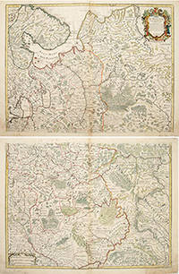
1706réf. 55266Atlas de Geographie. Guillaume Delisle Quai de Horloge. 1706. The map is in two parts north and south they are both of equal size. The northern map has a decorated cartouche and shows the north of white Russia and part of the arctic coast reaches as far south as the Principality of Galicz. The southern map stretches to the northern tip of the Black Sea the Volga in the East and a tiny bit of the Baltic Coast in the North West. There are some text on the map about the inhabitants rivers etc A very handsome pair of maps. The plates were originally made by Delisle around 1700. Covens and Mortimer reissued them in the Atlas Novissimo 1730-40. Phillipe Buache de l'Isle's successor and son in law continued to reissue Delisle's maps in the later eighteenth century. The price is for the pair. Copper engraving. Very good condition slightly browned margins some sporadic spotting. Some nicks lower margins. Original colour. Size: 66 x 50 cm. 26 x 19½ inches unknown
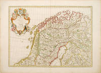
1788réf. 52804Dezauche Paris. 1788 French. Fine elaborate cartouche although the title suggests a map of Denmark this handsome map shows the northern halves of Sweden Norway and Finland. The plates were originally made by De l'Isle around 1700. Covens and Mortimer reissued them in the Atlas Novissimo 1730-40. Phillipe Buache de l'Isle's successor and son in law continued to reissue de l'Isle's maps in the later eighteenth century Copper engraving. Fine condition good margins a little browned Original colour. Size: 62 x 45 cm. 24½ x 17½ inches unknown
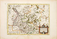
1790réf. 53072Paris. c. 1790. An attractive and detailed map of a part of the Rhine in central Germany. Interesting and decorative title cartouche. Copper engraving. Very good condition good margins waterstains along lower margin not affecting map Later colour. Size: 35 x 26 cm. unknown
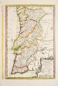
1773réf. 53884Cosmographie Universal. 1773. Attractive map of Portugal. Title and scales at lower right. Copper engraving. Fine condition. Original outline colour. Size: 270 x 375 mm. 10½ x 15 inches. unknown
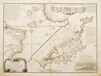
1737réf. 55258Atlas de Geographie. Sept 1737. An interesting geo-hydrographic map of the Atlantic Ocean and its islands. It is divided into two with one side showing the Atlantic Ocean and the coasts of Africa and Brazil and the other side a detailed examination of the archipelago of Fernando de Noronha. A note top left explains the purpose of the map which in brief is to give an idea of the variety of islands in the Atlantic Ocean. Another note top right explains a little about the cartographers and expedition members. Another explains about an embankment between islands on the archipelago. A cartouche top right contains a cross-section diagram of what is below sea level. Another below sea-level cross-section shows the particulars of Fernando de Noronha lower right corner. Copper engraving. Very good condition - slight dark patches to lower corners and repair to lower left margin. Some offsetting. Original colour. Size: 65 x 49.5 cm. 25½ x 19½ inches unknown
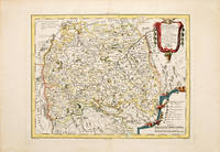
1787réf. 530901787. Map of south west Germany. Decorated cartouche at top right. 'Explication des Signes' and scales at lower left. Copper engraving. Fine condition. Later colour. 335 x 480 mm unknown
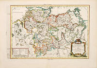
1787réf. 53092Paris. 1787. An attractive map of Lower Saxony with a pleasant title cartouche at lower right scales at lower left. From the Atlas Universal. Copper engraving. Fine condition Later colour. Size: 41 x 26 cm. unknown
1788réf. 52803Paris. 1788. Attractive ornamental cartouche Two secondary cartouches one containing nine scales the other is an ' Avertissement' explaining the depiction of the German provinces and enclaves. The map not only shows Germany but also the Low Countries Switzerland Austria parts of Poland and Hungary. The plates were originally made by De l'Isle around 1700. Covens and Mortimer reissued them. Phillipe Buache was de l'Isle's successor and son in law he continued to reissue de l'Isle's maps in the later eighteenth century. Copperplate engraving with later hand colour. Very good condition some watermarks on margins short closed tear at lower centrefold.some sporadic spotting and light browning on margins. Size: 64 x 49 cm. unknown
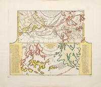
1752réf. 523481752. A fascinating map showing two early maps of the American north-west. the upper map shows the new discoveries in the northern Pacific. The coastline of Asia is more or less correctly drawn but America is wildly inaccurate. The lower part is an extract from a Japanese map brought back to Europe by Kaempfer for the collection of Hans Sloane. This shows the same area even more fancifully. The lower map is flanked by texts - an 'Avertissement'. and an extract from Kaempfer's travels. Worm hole in bottom margin not affecting the image Copper engraving. Fine condition good margins. Later colouring. Size: 40 x 32 cm. 15½ x 12½ inches. unknown
1787réf. 54682Atlas Universal. 1787. Map of south east Germany. Decorated cartouche at top right. 'Explication des Signes' and scales at lower left. Copper engraving. Fine condition. Later colour. Size: 34 x 26.5 cm. 13½ x 10½ inches. unknown
1999réf. 9007713Mansfield Centre CT: Martino 1999. Hardcover. Fine Condition. Facsimile of the first edition published in 1894 by Huard et Guillemin in Paris. Martino hardcover
2009réf. ZB745392Zurich : Schweizerische Geodatische Kommission 2009. Price HAS BEEN REDUCED by 10% until Monday Nov. 2 weekend sale item 155 pp. Paperback very good . - If you are reading this this item is actually physically in our stock and ready for shipment once ordered. We are not bookjackers. Buyer is responsible for any additional duties taxes or fees required by recipient's country. Photos available upon request. Zurich : Schweizerische Geodatische Kommission paperback
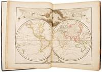
1789réf. 51612Paris: chez Dezauche 1789. Updating the work of "one of the key figures in the development of French cartography" First edition thus and uncommon with just four listings on WorldCat three of these for the BnF and no complete copy at auction for 30 years; an excellent complete and inclusive French atlas of the 18th century. Jean-Claude Dezauche 1745-1824 was one of the geographer-publishers most influential in the establishment of the French theoretical approach to cartography. This movement which downplayed the decorative elements valued by the Dutch school in favour of scientific rigour and accuracy can be traced back to the work of Guillaume Delisle - "one of the key figures in the development of French cartography" Tooley - who had studied under Jean-Dominique Cassini director of the Paris observatory. Delisle's business was inherited by his son-in-law Philippe Buache who had studied with him and who entered the Depôt des Cartes et Plans de Marine in 1721 in 1729 being appointed "premier géographe du roi" a position previously held by his father-in-law. On Buache's death his widow sold his work to Jean Nicholas Buache de la Neuville Philippe's nephew and in 1780 Dezauche bought it from him together with work by Delisle Jaillot and others. He in turn made his own alterations and improvements to the maps and then re-issued them in a revised form. For example the twin- and four-hemispheric world maps in volume I the former dated 1792 have been revised to include the latest discoveries from Cook's voyages. 2 vols folio 453 x 375 mm. Engraved allegorical title page and contents leaves to each and 151 double-page or folding maps all coloured in outline. Contemporary calf rebacked red morocco labels. Somewhat rubbed and with some restoration at the corners light dampstain in the lower margin of vol. I slightly heavier at the title page which has been reinforced with archival tissue map of Paris shaved to the ruled border at the upper margin a few minor splits and chips in the margins but overall very good. unknown
1997réf. 76362Froissart 1997. Book. As New. Soft cover. Inscribed by Authors. 8vo - over 7¾" - 9¾" tall. In-8 broché Comme Neuf tirage à 500 exemplaires envoi de l'auteur. Froissart Paperback
1997réf. 76903Caractères 1997. Book. As New. Soft cover. Inscribed by Authors. 12mo - over 6¾" - 7¾" tall. In-12 broché Comme Neuf envoi de l'auteur. Caractères Paperback
1969réf. 15031Planete 1969. Book. Very Good. Hardcover. 1st Edition. 4to - over 9¾" - 12" tall. 16 vols in4to la collection complete. Tous les volumes avec jaquettes mylar sauf l'an mille et les cathedrales qui n'ont pas des jaquettes seulement protection mylar L'etat de livres est Tres Bon jaquettes: Bon - Tres Bon. Les titres: La Prehistoire La Protohistoire Les Pyramides La Sagesse L' Universel La Barbarie La Guerre Sainte L' An Mille Les Cathedrales Les Decouvertes Les Renaissances Les Aventures Le Romantisme Le Realisme L' Abstrait L'An 2000 . Planete Hardcover
1985réf. 75521Le Préambule 1985. Book. Illus. by Luce Pelletier. As New. Soft cover. Inscribed by Authors. 8vo - over 7¾" - 9¾" tall. In-8 broché Comme Neuf envoi de l'auteur. Le Préambule Paperback
1988réf. 73861La Place Royale 1988. Book. Very Good. Soft cover. édition originale. 8vo - over 7¾" - 9¾" tall. In-8 broché Comme Neuf. La Place Royale Paperback
1943réf. 7879PUF 1943. Book. Good. Soft cover. 8vo - over 7¾" - 9¾" tall. In-8 broché Bon Etat. PUF Paperback
réf. 75519Adriana Russo Book. Illus. by L'auteur. As New. Soft cover. Inscribed by Authors. 8vo - over 7¾" - 9¾" tall. In-8 broché Comme Neuf envoi de l'auteur corrections manuscrites du texte par l'auteur. Adriana Russo Paperback
1981réf. 75520Louis Musin 1981. Book. Illus. by Yves Cantraine. As New. Soft cover. Inscribed by Authors. 8vo - over 7¾" - 9¾" tall. In-8 broché Comme Neuf envoi de l'auteur tirage limité à 500 exemplaires. Louis Musin Paperback
1934réf. ZB579561Paris: Cahiers de la quinzaine 1934. Price HAS BEEN REDUCED by 10% until Monday Nov. 2 weekend sale item 154 5 pp. issued as Cahiers de la quinzaine 24 serie 2 cahier; paper wrappers dark and chipped at extremities text browned reading copy. - If you are reading this this item is actually physically in our stock and ready for shipment once ordered. We are not bookjackers. Buyer is responsible for any additional duties taxes or fees required by recipient's country. Photos available upon request. Paris: Cahiers de la quinzaine, unknown
2004réf. ZB527023Academie royale de Belgique 2004. Price HAS BEEN REDUCED by 10% until Monday Nov. 2 weekend sale item 447 pp. softcover dust jacket fine. - If you are reading this this item is actually physically in our stock and ready for shipment once ordered. We are not bookjackers. Buyer is responsible for any additional duties taxes or fees required by recipient's country. Photos available upon request. Academie royale de Belgique paperback