42 291 résultats
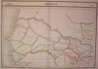
1827réf. 202219Brussels: Vandermaelen Philippe Marie 1827. unbound. very good. Map. Large format lithograph of West Africa with original hand coloring. Image measures 18.5" x 22.25". Includes Senegal and Gambia. Double page with centerfold. From Vandermaelen's 6 volume "Atlas universel de geographie physique politique statistique et mineralogique sur l'echelle de 1/16411836". Can be combined as gores to form an immense globe. The atlas was the first to map the world on a uniform scale. Vandermaelen, Philippe Marie unknown books
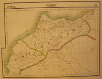
1827réf. 202378Brussels: Phillippe Marie Vandermaelen 1827. unbound. very good. Map. Large format lithograph with original hand coloring. Image measures 18.5" x 22.25". Double page with centerfold. From Vandermaelen's 6 volume "Atlas universel de geographie physique politique statistique et mineralogique sur l'echelle de 1/16411836". Can be combined as gores to form an immense globe. The atlas was the first to map the world on a uniform scale. Phillippe Marie Vandermaelen unknown books
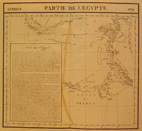
1827réf. 202377Brussels: Phillippe Marie Vandermaelen 1827. unbound. very good. Map. Large format lithograph with original hand coloring. Image measures 18.5" x 22.25". Includes northern Egypt and the northern section of the Nile as well as an inset with information on the area. Double page with centerfold. From Vandermaelen's 6 volume "Atlas universel de geographie physique politique statistique et mineralogique sur l'echelle de 1/16411836". Can be combined as gores to form an immense globe. The atlas was the first to map the world on a uniform scale. Phillippe Marie Vandermaelen unknown books
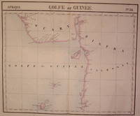
1827réf. 202223Brussels: Phillippe Marie Vandermaelen 1827. unbound. very good. Map. Large format lithograph of West Africa with original hand coloring. Image measures 18.5" x 22.25". Includes Nigeria and Cameroon. Double page with centerfold. From Vandermaelen's 6 volume "Atlas universel de geographie physique politique statistique et mineralogique sur l'echelle de 1/16411836". Can be combined as gores to form an immense globe. The atlas was the first to map the world on a uniform scale. Phillippe Marie Vandermaelen unknown books
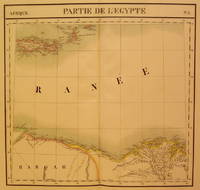
1827réf. 202376Brussels: Phillippe Marie Vandermaelen 1827. unbound. very good. Map. Large format lithograph with original hand coloring. Image measures 18.5" x 22.25". North Eastern coast of Africa and the Mediterranean Sea including the northern coast of Egypt the Nile delta and Crete. Double page with centerfold. From Vandermaelen's 6 volume "Atlas universel de geographie physique politique statistique et mineralogique sur l'echelle de 1/16411836". Can be combined as gores to form an immense globe. The atlas was the first to map the world on a uniform scale. Phillippe Marie Vandermaelen unknown books
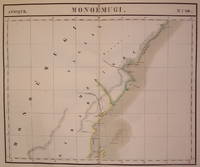
1827réf. 202229Brussels: Phillippe Marie Vandermaelen 1827. unbound. very good. Map. Large format lithograph of East Africa with original hand coloring. Image measures 18.5" x 22.25". Includes Kenya Mombasa Tanzania and Lamme Lamu. Double page with centerfold. From Vandermaelen's 6 volume "Atlas universel de geographie physique politique statistique et mineralogique sur l'echelle de 1/16411836". Can be combined as gores to form an immense globe. The atlas was the first to map the world on a uniform scale. Phillippe Marie Vandermaelen unknown books
1927réf. 202487Paris: Quatre Chemins 1927. First. paperback. very good. Frontispiece 39 plates. 4to plain wrappers with printed label; glassine dust wrapper; loss of paper at spine ends some signatures beginning to weaken glassine wrapper chipped. Paris: Editions des Quatre Chemins 1927. First Edition. Near fine. Ownership signature of art historian Meyer Schapiro Quatre Chemins unknown books
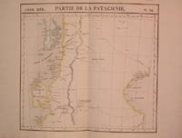
1827réf. 204795Brussels: Phillippe Marie Vandermaelen 1827. unbound. very good. Map. Lithograph with original hand outline. Image measures 18.75" x 20.5". Map of southern portion of Argentina and Chile from the Chonos Archipelago and the Golf of Corcouado in the west to the Golfe of St. George in the east. Double page with centerfold. From Vandermaelen's 6 volume "Atlas universel de geographie physique politique statistique et mineralogique sur l'echelle de 1/16411836". Can be combined as gores to form an immense globe. The atlas was the first to map the world on a uniform scale. Phillippe Marie Vandermaelen unknown books
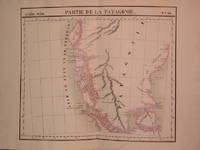
1827réf. 204810Brussels: Phillippe Marie Vandermaelen 1827. unbound. very good. Map. Lithograph with original hand outline. Image measures 19" x 22.5". Exquisite map of the southern portion of the continent including the Strait of Magellan and the Andes of Patagonia. Double page with centerfold. From Vandermaelen's 6 volume "Atlas universel de geographie physique politique statistique et mineralogique sur l'echelle de 1/16411836". Can be combined as gores to form an immense globe. The atlas was the first to map the world on a uniform scale. Phillippe Marie Vandermaelen unknown books
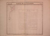
1827réf. 204796Brussels: Phillippe Marie Vandermaelen 1827. unbound. very good. Map. Lithograph with original hand outline. Image measures 18.5" x 20.75". Map of St. Joseph's Peninsula known today as the Valdes Peninsula south to Camarones. Includes notes in French on Chile perhaps in reference to an adjacent map. Double page with centerfold. From Vandermaelen's 6 volume "Atlas universel de geographie physique politque statistique et mineralogique sur l'echelle de 1/16411836". Can be combined as gores to form an immense globe. The atlas was the first to map the world on a uniform scale. Phillippe Marie Vandermaelen unknown books
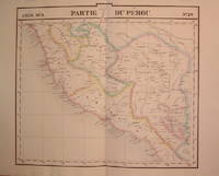
1827réf. 204788Brussels: Phillippe Marie Vandermaelen 1827. unbound. very good. Map. Lithograph with original hand outline. Image measures 19" x 21.5". Beautiful map of southern portion of Peru with Lake Titicaca in great detail. Also included is Cuzco the historic capital city of the Incan Empire where Machu Picchu was "discovered" in 1911. Double page with centerfold. From Vandermaelen's 6 volume "Atlas universel de geographie physique politique statistique et mineralogique sur l'echelle de 1/16411836". Can be combined as gores to form an immense globe. The atlas was the first to map the world on a uniform scale. Phillippe Marie Vandermaelen unknown books
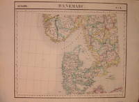
1827réf. 205010Brussels: Phillippe Marie Vandermaelen 1827. unbound. very good. Map. Lithograph with original hand outline. Image measures 19" x 22.5". Map of Denmark with rail lines. Map includes both Schleswig and Holstein while today part of the former and all of the latter are northern Germany. Also shows portion of Sweden and Norway. Double page with centerfold. From Vandermaelen's 6 volume "Atlas universel de geographie physique politique statistique et mineralogique sur l'echelle de 1/16411836". Can be combined as gores to form an immense globe. The atlas was the first to map the world on a uniform scale. Phillippe Marie Vandermaelen unknown books
réf. 40916Geneva. hardcover. very good. Color frontispiece 16 gravure and sepia plates tissue guards. 175pp. 4to marbled boards original wrappers bound in. Geneve 1930. Limited numbered edition. Very good . Geneva in the 19th century reproducing several of the paintings of Adam Topffer. One of 800 numbered copies on papier velin pur fil Lafuma. 2 decorative bookplates. unknown books
1969réf. 20635New York: Funk & Wagnalls 1969. hardcover. very good/very good-. xiii 400 pages short 8vo cloth d.w.; dust wrapper price clipped edgeworn. New York: Funk & Wangalls 1969. A very good copy in a very good- dust wrapper. Funk & Wagnalls unknown books
1972réf. 128018New York: Viking 1972. hardcover. very good. Illustrated with photos. 366 pages 8vo cloth-backed boards d.w. New York: Viking 1972. Very good. Viking unknown books
réf. 132953hardcover. 126 color illustrations 4to cloth; large ink stamp on flyleaf. N.Y.: Doubleday 1974. Very good in very good dust jacket. unknown books
réf. 169182hardcover. 2 volumes. 12mo cloth; corners bumped & cloth worn. Paris 1908. Ownership label of art historian Meyer Schapiro. unknown books
réf. 124977hardcover. very good/very good. 35 illustrations in colour 110 illustrations in black and white. 283pp. 8vo textured cloth. London: Frederick Muller Limited 1966. Very good copy in a good tattered dust wrapper. Archaeolia Mundi series unknown books
1907réf. 64919Paris: Librairie Commerciale 1907. hardcover. very good-. Volume of models only comprising 7 plates in color each with numerous flaps exposing the mechanism and parts of each machine. Oblong folio pictorial blue cloth; rubbed. Paris: Librairie Commerciale 1907. A very good- copy of this unusual book. Latest English locomotive; steam turbine; gazogene; Panhard automobile; Priestmann petroleum motor; electromotor; submarine with torpedo. Librairie Commerciale unknown books
1967réf. 123656New York: Harper 1967. First. hardcover. fine/fine. 96 pages of black & whigte illustrations. 308pp. tall 8vo cloth d.w. New York: Harper & Row 1967. First U.S. edition. A fine copy in a fine dust wrapper. Harper unknown books
1851réf. 139808Paris: Rovier 1851. hardcover. very good. Clinique Iconographique de l'Hopital des Veneriens. Extra illustrated title portrait & 67 superb chromolithographic plates with descriptive letterpress. Large 4to rebound in brown cloth leather spine label; some pages darkened and foxed. Paris: Rovier 1851. Very good. Fine atlas illustrating the case histories and the effects of venereal disease recorded at the hospital. Ricord born in Baltimore established the error of John Hunter's belief that gonorrhoea and syphilis were identical.Ricord was the first to establish the characteristic phenomena of the three stages of syphilis. Castiglioni pp. 735-6; Pusey the History and Epidemiology of Syphilis pp.559; The History of Dermatology pp. 120-23. GM 5202; 2381 Paris 1838 First Edition. Rovier unknown books
1964réf. 79904New York: Viking 1964. First. hardcover. near fine/very good. Lautrec. Translated & edited by Corrinne Bellow. Numerous illustrations mostly in color. 275pp. Large 4to blue cloth darkened d.w. New york: Viking 1964. First edition. A near fine copy in a very good dust wrapper. Contains a wealth of hitherto unpublished material including some from the artist's diaries and letters. Viking unknown books
réf. 80080hardcover. 8vo marbled boards rebacked in cloth; ex-lib foxed. Paris 1838. First Edition. This treatise is memorable in the history of medicine for overthrowing Hunter's erroneous ideas as to the identity of gonorrhea and syphilis establishing the autonomy of these diseases. Ricord 1800-1889 by his work in the Hopital du Midi Paris reestablished the fundamental part of our present knowledge of syphilis. His analysis of the course of syphilis into three stages which is of course conventional has however performed a great service in making it easier to comprehend the multiform symptoms which syphilis presents. unknown books
1984réf. 106025New York: Basil Blackwell 1984. hardcover. very good/very good. Illustrated. xvi 387pp. 8vo . tall 8vo cloth d.w. New York: Basil Blackwell 1984. A very good copy in a very good dust wrapper. Basil Blackwell unknown books
1969réf. 169914New York: Viking 1969. hardcover. very good/very good. Illustrated with many mounted plates in color and b/w. 137 pages 4to cloth d.w. New York: The Viking Press 1969. Very good. Viking unknown books