47 451 résultats
1995réf. 296363New York: STuart Tabori 1995. First. hardcover. fine/very good. Cecil Beaton. Over 265 photographs in full color & duotone tall 4to black cloth d.w stain on cover and worn at corners. New York: Stewart Tabori & Chang 1995. First American edition. Fine in very good dust wrapper. STuart Tabori unknown books
2002réf. 294228New York: Abrams 2002. hardcover. very good/very good. Bruegel. Profusely illustrated in color & b/w. 351 pages. Folio tan cloth d.w. New York: Harry N. Abrams 2002. A very good copy in a very good dust wrapper. Abrams unknown books
1983réf. 289817Birmingham: Classics of Medicine 1983. hardcover. fine. 288 pages. 8vo. gilt-stamped red leather. Limited edition. Birmingham AL: The Classics of Medicine Library 1983. Spine sunned else a fine copy. Classics of Medicine unknown books
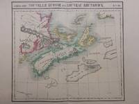
1827réf. 288092Brussels: Phillippe Marie Vandermaelen 1827. unbound. Map. Large format lithograph with original hand color wash. Image measures 18.25 x 20.75". Sheet measures 21.25 x 27.5". This scarce 1827 map of Nova Scotia and New Brunswick is one of the most detailed maps of the region published in the first half of the 19th century. It extends to Prince Edward Island St. John Cape Breton the Madelaine Islands and the Sable Islands. Topographical features of landforms water bodies and fishing banks are labeled in addition to geographical features such as ports counties towns and cities. As was typical of his cartographic style Vandermaelen has included notations throughout the map that describe the region. The map appeared in Vandermaelen's "Atlas Universal." The map is in excellent condition a dark impression on bright clean paper. Deluxe margins with no chips or tears minor wear to corners not affecting the image. Phillippe Marie Vandermaelen 1795-1869 was a Belgian cartographer and publisher. His Atlas universal was both the first lithograph atlas and the first atlas to map the world on a uniform scale. The maps were meant to join together to form a huge globe. This map is a fine example of his work. Phillippe Marie Vandermaelen unknown books
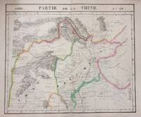
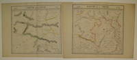
1827réf. 283424Brussels: Phillippe Marie Vandermaelen 1827. unbound. very good. Map diptych. Two double-page lithographs with original hand outline color. Each image measures 18.75" x 19 1/8". Sheets measure 21" x 27". Both show some foxing and some chips and tears to edges. Beautifully detailed map that shows northwest China including parts of the Silk Road. Mountains are delicately treated with hachure marks and major rivers and waterways are also shown. From Vandermaelen's 6 volume "Atlas universel de geographie physique politique statistique et mineralogique sur l'echelle de 1/16411836". The atlas was the first to map the world on a uniform scale; maps were meant to join together to form a huge globe. Phillippe Marie Vandermaelen 1795-1869 was a Belgian cartographer and publisher. This map is a fine example of his work. Phillippe Marie Vandermaelen unknown books
1967réf. 284384Paris: Planete 1967. hardcover. very good/very good-. Many illustrations. 253pp. 4to decorative cloth d.w.; cloth lightly rubbed dust wrapper worn. Paris: Planete 1967. A very good copy in a very good - dust wrapper. From the Series: Les Metamorphoses De L'Humanite Planete unknown books
1968réf. 285699Paris: Planete 1968. hardcover. very good/very good-. Extensively illustrated. 253 pages 4to pictorial purple cloth d.w.; cloth edgeworn dust wrapper torn. Paris: Editions Platete 1968. A very good copy in a very good- dust wrapper. Planete unknown books
1827réf. 283421Brussels: Vandermaelen Phillipe Marie 1827. unbound. very good. Map. Large format lithograph with original hand outline color. Image measures 18.75" x 19 1/8". Sheet measures 21" x 27". Shows some foxing and a few tears to edges. Beautifully detailed map that shows Bejing "Pekin" and surrounding provinces. Mountains are delicately treated with hachure marks and major rivers and waterways are also shown. From Vandermaelen's 6 volume "Atlas universel de geographie physique politique statistique et mineralogique sur l'echelle de 1/16411836". The atlas was the first to map the world on a uniform scale; maps were meant to join together to form a huge globe.Phillippe Marie Vandermaelen 1795-1869 was a Belgian cartographer and publisher. This map is a fine example of his work. Vandermaelen, Phillipe Marie unknown books
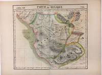
1827réf. 279853Brussels 1827. Map. Lithograph with original hand coloring. 18" x 21". Beautiful depiction of Western Mexico with a focus on elevation from Mazatlan to Manzanillo -Mexico's busiest Pacific port. Phillippe Marie Vandermaelen 1795-1869 was a Belgian cartographer and publisher. His Atlas universal was both the first lithograph atlas and the first atlas to map the world on a uniform scale. The maps were meant to join together to form a huge globe. This map is a fine example of his work. unknown books
1976réf. 277325New York: Rizzoli 1976. First. hardcover. very good/very good. Emile Galle. Frontispiece portrait and 194 illustrations including 34 in color. 167 pages. Slim 4to yellow gilt-lettered cloth d.w. New York: Rizzoli 1976. First edition. Minor stain along bottom edge of cloth but internally clean -- a very good copy in a very good dust wrapper. Rizzoli unknown books
1972réf. 277698Englewood Cliffs: Prentice-Hall 1972. hardcover. near fine/very good. Illus. Tall 8vo. 1/2 brown cloth d.w. Englewood Cliffs: Prentice-Hall 1971. A near fine copy. Prentice-Hall unknown books
1827réf. 278526Brussels: Phillippe Marie Vandermaelen 1827. unbound. Map. Lithograph with original hand outline. Image measures 18.5" x 22.25". Minimal yet beautiful map of east-central portion of the Argentine coast just south of Buenos Aires. Includes notes in French on the capital city. Double page with centerfold. From Vandermaelen's 6 volume "Atlas universel de geographie physique politique statistique et mineralogique sur l'echelle de 1/16411836". Phillippe Marie Vandermaelen 1795-1869 was a Belgian cartographer and publisher. His Atlas universal was both the first lithograph atlas and the first atlas to map the world on a uniform scale. The maps were meant to join together to form a huge globe. This map is a fine example of his work. Phillippe Marie Vandermaelen unknown books
1955réf. 274547New York: Julian Messner 1955. hardcover. near fine/very good. Illus. 8vo black cloth d.w. very slightly chipped. New York: Julian Messner 1955. Very good Julian Messner unknown books
réf. 273692New York: Tabard Press. hardcover. very good/very good-. Daumier Honore. 47 plates by Honore Daumier. 114pp. Small folio brown cloth d.w. sunned on spine portion with small chip to top of d.w. on spine portion d.w. lightly soiled bottom edges of cloth rubbed. New York: Tabard Press n.d. circa 1980 Political cartoons of Honore Daumier. Tabard Press unknown books
1685réf. 262811Lyons: Girin 1685. hardcover. very good. 3 full page copperplate engravings and 4 engraved chapter headings. Thick 12mo 22 445 5 pages rubricated title and edges full calf gilt spine chipped and worn. Lyons: Jean Girin & B. Riviere 1685. Scarce. Very good . Sabin 21146; Wellcome II p. 494; Bitting 134. Girin unknown books
2006réf. 231779New York: Thames & Hudson 2006. hardcover. fine/fine. With 129 color photographs. 207 pages square 4to red cloth dust wrapper. New York: Thames & Hudson 2006. A fine copy in a fine dust wrapper. Thames & Hudson unknown books
2003réf. 232389London: Philip Wilson Publishers 2003. hardcover. fine/fine. Many photographs. 141 pages 4to brown cloth dust wrapper. London: Brighton Museum & Art Gallery in conjunction with Philip Wilson Publishers 2003. A fine copy in a fine dust wrapper. Philip Wilson Publishers unknown books
1648réf. 227751Leide: Elzeviers 1648. hardcover. very good. Beautifully engraved title page with a small stamped crown monogram in the lower margin. 24 765 19 pages. Thick 12mo full contemporary vellum. Leide: Ezeviers. 1648. Le Dernier Edition. A very good copy of this rare edition. First Elzevir edition of these famous memoirs of the renowned French Renaissance historian 1445- 1509. A great classics of history. - Brunet II 191. Elzeviers unknown books
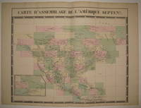
1827réf. 224090Brussels: Phillippe Marie Vandermaelen 1827. unbound. very good. Map. Large format lithograph with original hand color wash. Image and title measures 19 3/8" x 24 1/8". Beautiful double page map of North America. Shows states towns waterways and topographical and geographical features. Includes an inset of northeastern North America. From Vandermaelen's 6 volume "Atlas universel de geographie physique politique statistique et mineralogique sur l'echelle de 1/16411836" in which each map can be combined as gores to form an immense globe. The atlas was the first to map the world on a uniform scale. This map is the part of the assembly key with color coded and numbered squares indicating where each gore belongs. In excellent condition. Phillippe Marie Vandermaelen unknown books
1827réf. 220293Brussels: Phillippe Marie Vandermaelen 1827. unbound. very good. Map diptych. Large format lithograph with original hand outline color. Each image measures 18 3/8" x 19 1/8". Beautifully detailed set of two maps of eastern central China including part of Hubei Henan Anhui Jiangsu Shanxi Shandong Gansu Sichuan and Shaanxi provinces. Mountains are delicately treated with hachure marks and major rivers and waterways are also shown. Minor overall toning and a few tears to edges. From Vandermaelen's 6 volume "Atlas universel de geographie physique politique statistique et mineralogique sur l'echelle de 1/16411836". Can be combined as gores to form an immense globe. The atlas was the first to map the world on a uniform scale. Phillippe Marie Vandermaelen unknown books
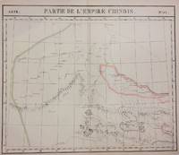
1827réf. 220303Brussels: Phillippe Marie Vandermaelen 1827. unbound. very good. Map set of 4. Large format lithograph with original hand outline color. Each image measures 18.75" x 20 5/8" 18 5/8" x 20 5/8" 18.5" x 20 3/8" Beautifully detailed set of four regional maps of northern China and southern Mongolia. Mountains are delicately treated with hachure marks and major rivers waterways and cities are also shown. Notable inclusions from the west to the east: Plate 44 shows the very northwestern tip of China Xinjiang province and part of south central Mongolia with Lac Nor and Hami. Plate 45 shows the eastern portion of Xinjiang province and western Mongolia with Karakorum called here Karakum the medieval capital of Ghengis Khan and the Mongol Empire. Plate 46 demarcates the tribal regions of Khalkha and Tzakhares Mongolians. Plate 47 shows the western portion of the Wall of China delineating the border between Tartary and China. Some minor offsetting several tears and chips to edges. From Vandermaelen's 6 volume "Atlas universel de geographie physique politique statistique et mineralogique sur l'echelle de 1/16411836". Can be combined as gores to form an immense globe. The atlas was the first to map the world on a uniform scale. Phillippe Marie Vandermaelen unknown books
2007réf. 212887Geneva: Aubanel 2007. First. paperback. fine. Profusely illustrated in color. Small slim 4to stiff pictorial wrappers. Geneva: Aubanel 2006 - 2007. First Edition. Fine. The titles are Jardins de Campagne de Feuillages d'eau. de Fleurs Urbains Les Allees Les Clotures et Les Escaliers et les Murets. Aubanel unknown books
2000réf. 213287Cologne: Taschen 2000. First. paperback. near fine. Profusely illustrated with color photographs. Thick small 8vo stiff yellow pictorial boards small blind stamp on fly-leaf. Cologne: Taschen 2000. First Edition. Near Fine. Text in English and German. Taschen unknown books
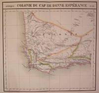
1827réf. 202230Brussels: Phillippe Marie Vandermaelen 1827. unbound. very good. Map. Large format lithograph of South Africa with original hand coloring. Image measures 18.5" x 22.25". Double page with centerfold. From Vandermaelen's 6 volume "Atlas universel de geographie physique politique statistique et mineralogique sur l'echelle de 1/16411836". Can be combined as gores to form an immense globe. The atlas was the first to map the world on a uniform scale. Phillippe Marie Vandermaelen unknown books
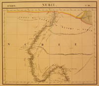
1827réf. 202375Brussels: Phillippe Marie Vandermaelen 1827. unbound. very good. Map. Large format lithograph with original hand coloring. Image measures 18.5" x 22.25". Includes Nubia Sudan and cities along the Nile River. Double page with centerfold. From Vandermaelen's 6 volume "Atlas universel de geographie physique politique statistique et mineralogique sur l'echelle de 1/16411836". Can be combined as gores to form an immense globe. The atlas was the first to map the world on a uniform scale. Phillippe Marie Vandermaelen unknown books