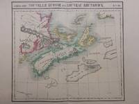
1827rif. 288092Brussels: Phillippe Marie Vandermaelen 1827. unbound. Map. Large format lithograph with original hand color wash. Image measures 18.25 x 20.75". Sheet measures 21.25 x 27.5". This scarce 1827 map of Nova Scotia and New Brunswick is one of the most detailed maps of the region published in the first half of the 19th century. It extends to Prince Edward Island St. John Cape Breton the Madelaine Islands and the Sable Islands. Topographical features of landforms water bodies and fishing banks are labeled in addition to geographical features such as ports counties towns and cities. As was typical of his cartographic style Vandermaelen has included notations throughout the map that describe the region. The map appeared in Vandermaelen's "Atlas Universal." The map is in excellent condition a dark impression on bright clean paper. Deluxe margins with no chips or tears minor wear to corners not affecting the image. Phillippe Marie Vandermaelen 1795-1869 was a Belgian cartographer and publisher. His Atlas universal was both the first lithograph atlas and the first atlas to map the world on a uniform scale. The maps were meant to join together to form a huge globe. This map is a fine example of his work. Phillippe Marie Vandermaelen unknown books
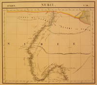
1827rif. 202375Brussels: Phillippe Marie Vandermaelen 1827. unbound. very good. Map. Large format lithograph with original hand coloring. Image measures 18.5" x 22.25". Includes Nubia Sudan and cities along the Nile River. Double page with centerfold. From Vandermaelen's 6 volume "Atlas universel de geographie physique politique statistique et mineralogique sur l'echelle de 1/16411836". Can be combined as gores to form an immense globe. The atlas was the first to map the world on a uniform scale. Phillippe Marie Vandermaelen unknown books
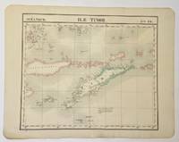
1827rif. 325002Brussels: Philippe Marie Vandermaelen 1827. Map. Hand colored engraving. Image measures 18 1/2" x 22" Beautiful and simple map of the island of Timor and surrounding islands. From Vandermaelen's 6 volume "Atlas universel de geographie physique politique statistique et mineralogique sur l'echelle.". Can be combined as gores to form an immense globe. Phillippe Marie Vandermaelen 1795-1869 was a Belgian cartographer and publisher. His Atlas universal was both the first lithograph atlas and the first atlas to map the world on a uniform scale. The maps were meant to join together to form a huge globe. Philippe Marie Vandermaelen unknown books
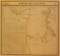
1827rif. 202377Brussels: Phillippe Marie Vandermaelen 1827. unbound. very good. Map. Large format lithograph with original hand coloring. Image measures 18.5" x 22.25". Includes northern Egypt and the northern section of the Nile as well as an inset with information on the area. Double page with centerfold. From Vandermaelen's 6 volume "Atlas universel de geographie physique politique statistique et mineralogique sur l'echelle de 1/16411836". Can be combined as gores to form an immense globe. The atlas was the first to map the world on a uniform scale. Phillippe Marie Vandermaelen unknown books
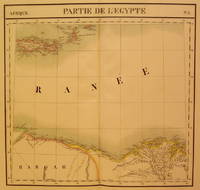
1827rif. 202376Brussels: Phillippe Marie Vandermaelen 1827. unbound. very good. Map. Large format lithograph with original hand coloring. Image measures 18.5" x 22.25". North Eastern coast of Africa and the Mediterranean Sea including the northern coast of Egypt the Nile delta and Crete. Double page with centerfold. From Vandermaelen's 6 volume "Atlas universel de geographie physique politique statistique et mineralogique sur l'echelle de 1/16411836". Can be combined as gores to form an immense globe. The atlas was the first to map the world on a uniform scale. Phillippe Marie Vandermaelen unknown books
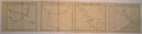
1827rif. 220303Brussels: Phillippe Marie Vandermaelen 1827. unbound. very good. Map set of 4. Large format lithograph with original hand outline color. Each image measures 18.75" x 20 5/8" 18 5/8" x 20 5/8" 18.5" x 20 3/8" Beautifully detailed set of four regional maps of northern China and southern Mongolia. Mountains are delicately treated with hachure marks and major rivers waterways and cities are also shown. Notable inclusions from the west to the east: Plate 44 shows the very northwestern tip of China Xinjiang province and part of south central Mongolia with Lac Nor and Hami. Plate 45 shows the eastern portion of Xinjiang province and western Mongolia with Karakorum called here Karakum the medieval capital of Ghengis Khan and the Mongol Empire. Plate 46 demarcates the tribal regions of Khalkha and Tzakhares Mongolians. Plate 47 shows the western portion of the Wall of China delineating the border between Tartary and China. Some minor offsetting several tears and chips to edges. From Vandermaelen's 6 volume "Atlas universel de geographie physique politique statistique et mineralogique sur l'echelle de 1/16411836". Can be combined as gores to form an immense globe. The atlas was the first to map the world on a uniform scale. Phillippe Marie Vandermaelen unknown books
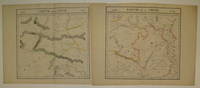
1827rif. 220293Brussels: Phillippe Marie Vandermaelen 1827. unbound. very good. Map diptych. Large format lithograph with original hand outline color. Each image measures 18 3/8" x 19 1/8". Beautifully detailed set of two maps of eastern central China including part of Hubei Henan Anhui Jiangsu Shanxi Shandong Gansu Sichuan and Shaanxi provinces. Mountains are delicately treated with hachure marks and major rivers and waterways are also shown. Minor overall toning and a few tears to edges. From Vandermaelen's 6 volume "Atlas universel de geographie physique politique statistique et mineralogique sur l'echelle de 1/16411836". Can be combined as gores to form an immense globe. The atlas was the first to map the world on a uniform scale. Phillippe Marie Vandermaelen unknown books
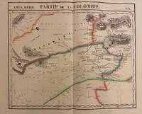
1827rif. 302381Brussels: Phillippe Marie Vandermaelen 1827. unbound. Map. Lithograph with original hand outline. Image measures 19" x 22.5". Exquisite map of the Amazon region at the borders of Colombia Venezuela and Brazil. Shows important rivers - Orinoco Guaviare Inirida and Rio Negro. Many native indigenous groups are labeled. Notations on the map describe the terrain the native peoples and colonial activities in the region. Double page with centerfold. From Vandermaelen's 6 volume "Atlas universel de geographie physique politique statistique et mineralogique". Can be combined as gores to form an immense globe. The atlas was the first to map the world on a uniform scale. Phillippe Marie Vandermaelen unknown books
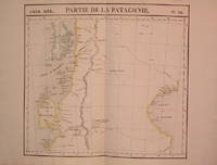
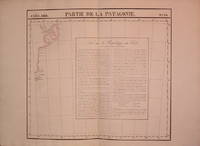
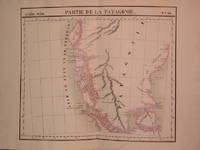
1827rif. 204795Brussels: Phillippe Marie Vandermaelen 1827. unbound. very good. Map. Lithograph with original hand outline. Image measures 18.75" x 20.5". Map of southern portion of Argentina and Chile from the Chonos Archipelago and the Golf of Corcouado in the west to the Golfe of St. George in the east. Double page with centerfold. From Vandermaelen's 6 volume "Atlas universel de geographie physique politique statistique et mineralogique sur l'echelle de 1/16411836". Can be combined as gores to form an immense globe. The atlas was the first to map the world on a uniform scale. Phillippe Marie Vandermaelen unknown books
1827rif. 204796Brussels: Phillippe Marie Vandermaelen 1827. unbound. very good. Map. Lithograph with original hand outline. Image measures 18.5" x 20.75". Map of St. Joseph's Peninsula known today as the Valdes Peninsula south to Camarones. Includes notes in French on Chile perhaps in reference to an adjacent map. Double page with centerfold. From Vandermaelen's 6 volume "Atlas universel de geographie physique politque statistique et mineralogique sur l'echelle de 1/16411836". Can be combined as gores to form an immense globe. The atlas was the first to map the world on a uniform scale. Phillippe Marie Vandermaelen unknown books
1827rif. 204810Brussels: Phillippe Marie Vandermaelen 1827. unbound. very good. Map. Lithograph with original hand outline. Image measures 19" x 22.5". Exquisite map of the southern portion of the continent including the Strait of Magellan and the Andes of Patagonia. Double page with centerfold. From Vandermaelen's 6 volume "Atlas universel de geographie physique politique statistique et mineralogique sur l'echelle de 1/16411836". Can be combined as gores to form an immense globe. The atlas was the first to map the world on a uniform scale. Phillippe Marie Vandermaelen unknown books
1827rif. 278526Brussels: Phillippe Marie Vandermaelen 1827. unbound. Map. Lithograph with original hand outline. Image measures 18.5" x 22.25". Minimal yet beautiful map of east-central portion of the Argentine coast just south of Buenos Aires. Includes notes in French on the capital city. Double page with centerfold. From Vandermaelen's 6 volume "Atlas universel de geographie physique politique statistique et mineralogique sur l'echelle de 1/16411836". Phillippe Marie Vandermaelen 1795-1869 was a Belgian cartographer and publisher. His Atlas universal was both the first lithograph atlas and the first atlas to map the world on a uniform scale. The maps were meant to join together to form a huge globe. This map is a fine example of his work. Phillippe Marie Vandermaelen unknown books
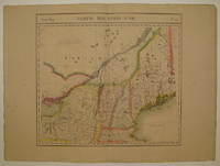
1827rif. 225532Brussels: Phillippe Marie Vandermaelen 1827. unbound. very good. Map. Large format lithograph with original hand color wash. Image measures 18.25" x 20". Beautiful double page map of New England showing Maine New Hampshire Vermont and parts of New York Massachusetts and Canada. Features counties towns waterways topographical and geographical features population size indicated in pink circles mineral deposits and the area of each state yellow circles. Minor wear to edges light scattered staining and offsetting. Expert repair to chip to bottom centerfold. From Vandermaelen's 6 volume "Atlas universel de geographie physique politique statistique et mineralogique sur l'echelle de 1/16411836" in which each map can be combined as gores to form an immense globe. The atlas was the first to map the world on a uniform scale as well as the first lithographed atlas. Phillippe Marie Vandermaelen unknown books
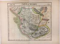
1827rif. 279853Brussels 1827. Map. Lithograph with original hand coloring. 18" x 21". Beautiful depiction of Western Mexico with a focus on elevation from Mazatlan to Manzanillo -Mexico's busiest Pacific port. Phillippe Marie Vandermaelen 1795-1869 was a Belgian cartographer and publisher. His Atlas universal was both the first lithograph atlas and the first atlas to map the world on a uniform scale. The maps were meant to join together to form a huge globe. This map is a fine example of his work. unknown books
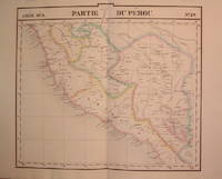
1827rif. 204788Brussels: Phillippe Marie Vandermaelen 1827. unbound. very good. Map. Lithograph with original hand outline. Image measures 19" x 21.5". Beautiful map of southern portion of Peru with Lake Titicaca in great detail. Also included is Cuzco the historic capital city of the Incan Empire where Machu Picchu was "discovered" in 1911. Double page with centerfold. From Vandermaelen's 6 volume "Atlas universel de geographie physique politique statistique et mineralogique sur l'echelle de 1/16411836". Can be combined as gores to form an immense globe. The atlas was the first to map the world on a uniform scale. Phillippe Marie Vandermaelen unknown books
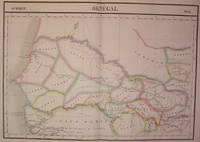
1827rif. 202219Brussels: Vandermaelen Philippe Marie 1827. unbound. very good. Map. Large format lithograph of West Africa with original hand coloring. Image measures 18.5" x 22.25". Includes Senegal and Gambia. Double page with centerfold. From Vandermaelen's 6 volume "Atlas universel de geographie physique politique statistique et mineralogique sur l'echelle de 1/16411836". Can be combined as gores to form an immense globe. The atlas was the first to map the world on a uniform scale. Vandermaelen, Philippe Marie unknown books
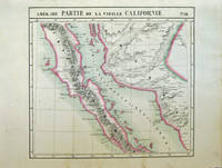
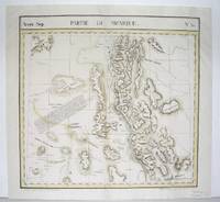
1827rif. 40378Bruxelles: Ph. Vandermaelen 1827. First edition. Very good bright copies a few minor spots or marginal finger soiling. 2 sheets. Hand-colored lithographic maps. 46 x 51 cm and 46 x 54 cm. Large scale map of Baja. Map 58 includes parts of Baja California Sonora Sinaloa and Chihuahua. Map 65 includes the tip of Baja California and the "Iles Revillagigedo" and a text box: Note sur le Mexique . de Humboldt. Sheets from Phillipe Vandermaelen Atlas universel de geographie physique politique statistique et mineralogique. a magnificent and ground breaking six volume atlas of the entire world which was the first Atlas to use lithography to show the entire world using such a large uniform scale approcimately 26 miles to the inch and which was designed to be joined together into a three-dimensional globe with a diameter of approximately 25 feet. Phillips 749. Sabin 43762. [Ph. Vandermaelen] unknown books
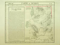
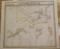
1827rif. 40379Bruxelles: Ph. Vandermaelen 1827. First edition. A very good sharp copy. 1 sheet. Hand-colored lithographic map. 47 x 57 cm. Shows the ranges of eight Indian tribes. Covers parts of Utah Colorado and northern Arizona and New Mexico. Includes text: Note sur le Mexique. At a time when American map publishers were virtually ignoring the western United States Vandermaelen's large scale work -which includes sections of Utah Wyoming Arizona and Nevada then still considered part of Mexico along with the location of Indian tribes and shows Lake Timpanagos- was a landmark in the history the cartography of the Transmississippi West. Large text box on the left entitled: Note sur le Mexique by A. Delavault. From Phillipe Vandermaelen Atlas universel de geographie physique politique statistique et mineralogique. a magnificent and ground breaking six volume atlas of the entire world which was the first atlas to use lithography to show the entire world using such a large uniform scale approximately 26 miles to the inch and which was designed to be joined together into a three-dimensional globe with a diameter of approximately 25 feet. Wheat Transmississippi 378. Sabin 43762. Phillips 749. [Ph. Vandermaelen] unknown books
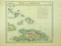
1827rif. 40377Bruxelles: Ph. Vandermaelen 1827. First edition. Very good bright copies a few minor spots or marginal finger soiling. 2 sheets. Hand-colored lithographic maps. 46 x 53 cm and 50 x 56 cm. Large scale map of Haiti on two sheets usually sold separately. 1. Amer. Sep. Haiti ou St. Domingue. No. 68. Also includes parts of Cuba and the Bahamas and has a text box entitled: Iles Bahamas ou Lucayes. with 2. Amèr. Sep. Curacao. No. 74. Includes the southern and remaining portion of Haiti plus Aruba Bonaire and small parts of Puerto Rico and Venezuela. Text box entitled: Republique d'Haiti. Redigee par A. Delavault. Sheets from Phillipe Vandermaelen "Atlas universel de geographie physique politique statistique et mineralogique." a magnificent and ground breaking six volume atlas of the entire world which was the first Atlas to use lithography to show the entire world using such a large uniform scale approximately 26 miles to the inch and which was designed to be joined together into a three-dimensional globe with a diameter of approximately 25 feet. [Ph. Vandermaelen] unknown books
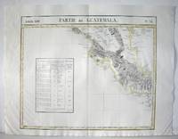
1827rif. M2904Bruselles 1827. Excellent. Size : 464x557 mm 18.25x21.875 Inches Coloring: Original Outline Coloring Category: ; Maps Central America unknown
1827rif. M2726Bruxelles 1827. Good; some worming on the upper and lower parts of the fold. Notes: From Vandermaelen's "Atlas Universel de Geographie Physique Politique Statistique et Mineralogique" Brusseles 1827. "The map trade in the 1820s had taekn notice of the enormous interest in Texas and had begun to supply maps catering to it. In 1827 Phillipe van der Maelen's 'Atlas Universel' the most lavish and detailed cartographic production of the decade and the first major lithographed atlas included five maps depicting parts of Texas. These maps were based primarily on the outmoded models of Humboldt and Pike and contributed no new knowledge." Martin & Martin 32 Size : 470x515 mm 18.5x20.25 Inches Coloring: Original Outline Coloring Reference: Martin & Martin 32 Category: ; Maps United States South Texas unknown
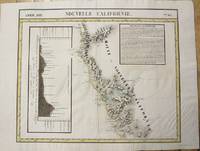
1827rif. M2722Bruxelles 1827. Very Good; several wormholes on the upper and lower parts of the fold. Notes: From Vandermaelen's "Atlas Universel de Geographie Physique Politique Statistique et Mineralogique" Brusseles 1827. Size : 472x572 mm 18.625x22.5 Inches Coloring: Original Outline Coloring Category: Maps United States West California unknown
1827rif. M2724Bruxelles 1827. Good; some worming on the upper and lower parts of the fold wormholes professionally filled. Notes: From Vandermaelen's "Atlas Universel de Geographie Physique Politique Statistique et Mineralogique" Brusseles 1827. Size : 468x490 mm 18.375x19.25 Inches Coloring: Original Outline Coloring Category: Maps United States West States; unknown
1827rif. M2720Bruxelles 1827. Very Good; several wormholes on the upper and lower parts of the fold. Notes: From Vandermaelen's "Atlas Universel de Geographie Physique Politique Statistique et Mineralogique" Brusseles 1827. Size : 460x554 mm 18.125x21.75 Inches Coloring: Original Outline Coloring Category: Maps United States West States; unknown
1827rif. 40379Bruxelles: Ph. Vandermaelen 1827. First edition. A very good sharp copy. 1 sheet. Hand-colored lithographic map. 47 x 57 cm. Shows the ranges of eight Indian tribes. Covers parts of Utah Colorado and northern Arizona and New Mexico. Includes text: Note sur le Mexique. At a time when American map publishers were virtually ignoring the western United States Vandermaelen's large scale work -which includes sections of Utah Wyoming Arizona and Nevada then still considered part of Mexico along with the location of Indian tribes and shows Lake Timpanagos- was a landmark in the history the cartography of the Transmississippi West. Large text box on the left entitled: Note sur le Mexique by A. Delavault. From Phillipe Vandermaelen Atlas universel de geographie physique politique statistique et mineralogique. a magnificent and ground breaking six volume atlas of the entire world which was the first atlas to use lithography to show the entire world using such a large uniform scale approximately 26 miles to the inch and which was designed to be joined together into a three-dimensional globe with a diameter of approximately 25 feet. Wheat Transmississippi 378. Sabin 43762. Phillips 749. [Ph. Vandermaelen] unknown