42.291 resultados
ref. A17163Gallimard POCHE NEUF EXCELLENTE CONDITION
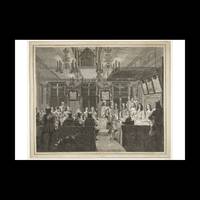
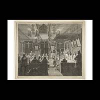
ref. 2260985Contentum Ltd. Loose sheet. New. High-quality art print based on an original work from the Rijksmuseum. Created in the 17th century 1660. Professionally printed on premium fine-art paper Museum Etching museum quality in size A2. The artwork is printed with a white border museum-style presentation. Contentum Ltd. unknown
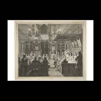
ref. 2260982Contentum Ltd. Loose sheet. New. High-quality art print based on an original work from the Rijksmuseum. Created in the 17th century 1660. Professionally printed on premium fine-art paper Museum Etching museum quality in size A3. The artwork is printed with a white border museum-style presentation. Contentum Ltd. unknown
ref. 2260983Contentum Ltd. Loose sheet. New. High-quality art print based on an original work from the Rijksmuseum. Created in the 17th century 1660. Professionally printed on premium fine-art paper Photo Matt Fibre in size A2. The artwork is printed with a white border museum-style presentation. Contentum Ltd. unknown
ref. 2260984Contentum Ltd. Loose sheet. New. High-quality art print based on an original work from the Rijksmuseum. Created in the 17th century 1660. Professionally printed on premium fine-art paper Photo Rag Bright White premium quality in size A2. The artwork is printed with a white border museum-style presentation. Contentum Ltd. unknown
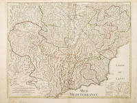
1730ref. 57564c 1730. This detailed and beautifully engraved map of the French/Italian Mediterranean coast from Nice to Montferrat has no cartouche- the title is written in the top border 3 scales inset map at lower right of Nice.The plates were originally made by De l'Isle around 1700. Covens and Mortimer reissued them in the Atlas Novissimo 1730-40. Phillipe Buache de l'Isle's successor and son in law continued to reissue de l'Isle's maps in the later eighteenth century. Copper engraving. Fine condition good margins edges a little browned Hand coloured. Size: 64 x 49 cm. unknown
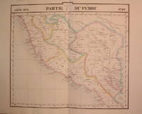
1827ref. 204788Brussels: Phillippe Marie Vandermaelen 1827. unbound. very good. Map. Lithograph with original hand outline. Image measures 19" x 21.5". Beautiful map of southern portion of Peru with Lake Titicaca in great detail. Also included is Cuzco the historic capital city of the Incan Empire where Machu Picchu was "discovered" in 1911. Double page with centerfold. From Vandermaelen's 6 volume "Atlas universel de geographie physique politique statistique et mineralogique sur l'echelle de 1/16411836". Can be combined as gores to form an immense globe. The atlas was the first to map the world on a uniform scale. Phillippe Marie Vandermaelen unknown books
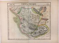
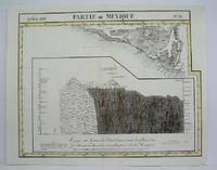
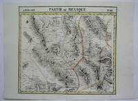
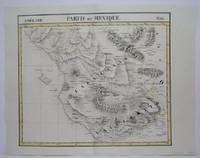
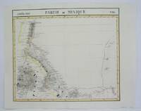
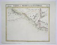
1827ref. 279853Brussels 1827. Map. Lithograph with original hand coloring. 18" x 21". Beautiful depiction of Western Mexico with a focus on elevation from Mazatlan to Manzanillo -Mexico's busiest Pacific port. Phillippe Marie Vandermaelen 1795-1869 was a Belgian cartographer and publisher. His Atlas universal was both the first lithograph atlas and the first atlas to map the world on a uniform scale. The maps were meant to join together to form a huge globe. This map is a fine example of his work. unknown books
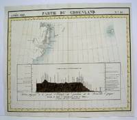
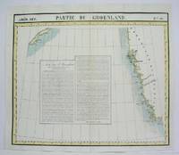
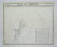
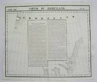
1825ref. M4477Brussels 1825. Excellent. Notes: The first atlas of the world on a uniform scale. If assembled as a globe gores forms a very large globe. Size : 480x577 mm 18.875x22.75 Inches Coloring: Original Outline Coloring Category: Maps Polar Arctic Regions Alaska Greenland Iceland; unknown
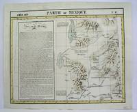
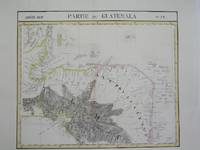
1825ref. M4484Brussels 1825. Very Good minor worming on upper and lower portion of map along the central fold proficiently repaired. Notes: The first atlas of the world on a uniform scale. If assembled as a globe gores forms a very large globe. Size : 465x580 mm 18.25x22.875 Inches Coloring: Original Outline Coloring Category: Maps Central America Mexico unknown
1825ref. M4487Brussels 1825. Excellent. Notes: The first atlas of the world on a uniform scale. If assembled as a globe gores forms a very large globe. Size : 480x563 mm 18.875x22.125 Inches Coloring: Original Outline Coloring Category: Maps Polar Arctic Regions Alaska Greenland Iceland; unknown
1825ref. M4470Brussels 1825. Very Good minor worming holes along the lower portion of the central fold proficiently repaired. Notes: The first atlas of the world on a uniform scale. If assembled as a globe gores forms a very large globe. Size : 465x566 mm 18.25x22.25 Inches Coloring: Original Outline Coloring Category: Maps United States West States; unknown
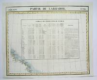
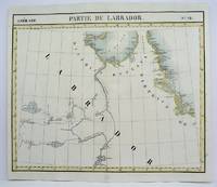
1825ref. M4505Brussels 1825. Excellent. Size : 484x580 mm 19x22.875 Inches Coloring: Original Outline Coloring Category: Maps Canada East Newfoundland unknown
1825ref. M4519Brussels 1825. Very Good minor worming on upper and lower portion of the map along the central fold proficiently repaired. Notes: The first atlas of the world on a uniform scale. If assembled as a globe gores forms a very large globe. Size : 465x520 mm 18.25x20.5 Inches Coloring: Original Outline Coloring Category: Maps Central America Mexico unknown
1825ref. M4492Brussels 1825. Excellent. Notes: The first atlas of the world on a uniform scale. If assembled as a globe gores forms a very large globe. Size : 485x580 mm 19.125x22.875 Inches Coloring: Black & White Category: Maps Polar Arctic Regions Alaska Greenland Iceland; unknown
1827ref. M3736Bruxelles 1827. Very Good. Size : 465x550 mm 18.25x21.625 Inches Coloring: Original Hand Coloring Category: ; Maps Central America unknown
1825ref. M4488Brussels 1825. Excellent. Notes: The first atlas of the world on a uniform scale. If assembled as a globe gores forms a very large globe. Size : 475x570 mm 18.75x22.375 Inches Coloring: Original Outline Coloring Category: Maps Canada East Newfoundland unknown
1825ref. M4520Brussels 1825. Very Good minor worming on upper and lower portion of the map along the central fold proficiently repaired. Notes: The first atlas of the world on a uniform scale. If assembled as a globe gores forms a very large globe. Size : 460x535 mm 18.125x21 Inches Coloring: Original Outline Coloring Category: Maps Central America Mexico unknown
1825ref. M4474Brussels 1825. Excellent. Notes: The first atlas of the world on a uniform scale. If assembled as a globe gores forms a very large globe. Size : 485x580 mm 19.125x22.875 Inches Coloring: Black & White Category: Maps Polar Arctic Regions Alaska Greenland Iceland; unknown
1825ref. M4514Brussels 1825. Very Good minor worming on upper and lower portion of the map along the central fold proficiently repaired. Notes: The first atlas of the world on a uniform scale. If assembled as a globe gores forms a very large globe. Size : 465x540 mm 18.25x21.25 Inches Coloring: Original Outline Coloring Category: Maps Central America Mexico unknown
1825ref. M4501Brussels 1825. Good some browning. Notes: The first atlas of the world on a uniform scale. If assembled as a globe gores forms a very large globe. Size : 475x570 mm 18.75x22.375 Inches Coloring: Original Outline Coloring Category: Maps Canada East Newfoundland unknown
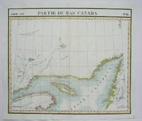
1825ref. M4510Brussels 1825. Excellent. Notes: The first atlas of the world on a uniform scale. If assembled as a globe gores forms a very large globe. This map shows the area of the Gulf of St. Lawrence and the surrounding coastlines such as the district of Gaspe and the west coast of Newfoundland. Size : 480x565 mm 18.875x22.25 Inches Coloring: Original Outline Coloring Category: Maps Canada East Quebec unknown
1825ref. M4521Brussels 1825. Very Good minor worming on upper and lower portion of the map along the central fold proficiently repaired. Notes: The first atlas of the world on a uniform scale. If assembled as a globe gores forms a very large globe. Size : 465x551 mm 18.25x21.625 Inches Coloring: Original Outline Coloring Category: Maps Central America Mexico unknown
1827ref. 279853Brussels 1827. Map. Lithograph with original hand coloring. 18" x 21". Beautiful depiction of Western Mexico with a focus on elevation from Mazatlan to Manzanillo -Mexico's busiest Pacific port. Phillippe Marie Vandermaelen 1795-1869 was a Belgian cartographer and publisher. His Atlas universal was both the first lithograph atlas and the first atlas to map the world on a uniform scale. The maps were meant to join together to form a huge globe. This map is a fine example of his work. unknown
1827ref. 204788Brussels: Phillippe Marie Vandermaelen 1827. unbound. very good. Map. Lithograph with original hand outline. Image measures 19" x 21.5". Beautiful map of southern portion of Peru with Lake Titicaca in great detail. Also included is Cuzco the historic capital city of the Incan Empire where Machu Picchu was "discovered" in 1911. Double page with centerfold. From Vandermaelen's 6 volume "Atlas universel de geographie physique politique statistique et mineralogique sur l'echelle de 1/16411836". Can be combined as gores to form an immense globe. The atlas was the first to map the world on a uniform scale. Phillippe Marie Vandermaelen unknown