Vandermaelen, Philippe Marie GuillaumeBiblio.com
42.291 resultados
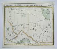
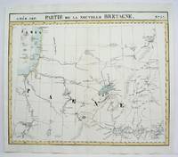
1825ref. M4478Brussels 1825. Excellent. Notes: The first atlas of the world on a uniform scale. If assembled as a globe gores forms a very large globe. This map shows the area from Hudson Bay to Lake Abbitibbe and notes the location of various Native tribes and trade houses. Size : 470x565 mm 18.5x22.25 Inches Coloring: Original Outline Coloring Category: Maps Canada East Quebec unknown
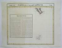
1825ref. M4473Brussels 1825. Excellent. Notes: The first atlas of the world on a uniform scale. If assembled as a globe gores forms a very large globe. Size : 475x552 mm 18.75x21.75 Inches Coloring: Original Hand Coloring Category: Maps Polar Arctic Regions Alaska Greenland Iceland; unknown
1825ref. M4518Brussels 1825. Very Good minor worming on upper and lower portion of the map along the central fold proficiently repaired. Notes: The first atlas of the world on a uniform scale. If assembled as a globe gores forms a very large globe. Size : 465x540 mm 18.25x21.25 Inches Coloring: Original Outline Coloring Category: Maps Central America Mexico unknown
1825ref. M4480Brussels 1825. Excellent. Notes: The first atlas of the world on a uniform scale. If assembled as a globe gores forms a very large globe. This map show the region from Hudson Bay to Lake Superior. Noted in the map are the locations of different French forts and Native tribes. Northwest of Ontario Size : 470x563 mm 18.5x22.125 Inches Coloring: Original Outline Coloring Category: Maps Canada Ontario North; unknown
1827ref. 278526Brussels: Phillippe Marie Vandermaelen 1827. unbound. Map. Lithograph with original hand outline. Image measures 18.5" x 22.25". Minimal yet beautiful map of east-central portion of the Argentine coast just south of Buenos Aires. Includes notes in French on the capital city. Double page with centerfold. From Vandermaelen's 6 volume "Atlas universel de geographie physique politique statistique et mineralogique sur l'echelle de 1/16411836". Phillippe Marie Vandermaelen 1795-1869 was a Belgian cartographer and publisher. His Atlas universal was both the first lithograph atlas and the first atlas to map the world on a uniform scale. The maps were meant to join together to form a huge globe. This map is a fine example of his work. Phillippe Marie Vandermaelen unknown
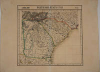
1827ref. 16375Brussels 1827. Scarce original hand colored lithographed map of Georgia South Carolina North Carolina & Northern Florida. From the six volume atlas by Vandermaelen 'Atlas Universel de Geographie.'. This atlas was the first lithographed world atlas and the first of the entire world with all the maps on the same scale. Image size: 21 5/8 x 18 3/4". Paper size: 29 1/2 x 22". Very good condition. unknown
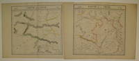
1827ref. 220293Brussels: Phillippe Marie Vandermaelen 1827. unbound. very good. Map diptych. Large format lithograph with original hand outline color. Each image measures 18 3/8" x 19 1/8". Beautifully detailed set of two maps of eastern central China including part of Hubei Henan Anhui Jiangsu Shanxi Shandong Gansu Sichuan and Shaanxi provinces. Mountains are delicately treated with hachure marks and major rivers and waterways are also shown. Minor overall toning and a few tears to edges. From Vandermaelen's 6 volume "Atlas universel de geographie physique politique statistique et mineralogique sur l'echelle de 1/16411836". Can be combined as gores to form an immense globe. The atlas was the first to map the world on a uniform scale. Phillippe Marie Vandermaelen unknown
1827ref. 220303Brussels: Phillippe Marie Vandermaelen 1827. unbound. very good. Map set of 4. Large format lithograph with original hand outline color. Each image measures 18.75" x 20 5/8" 18 5/8" x 20 5/8" 18.5" x 20 3/8" Beautifully detailed set of four regional maps of northern China and southern Mongolia. Mountains are delicately treated with hachure marks and major rivers waterways and cities are also shown. Notable inclusions from the west to the east: Plate 44 shows the very northwestern tip of China Xinjiang province and part of south central Mongolia with Lac Nor and Hami. Plate 45 shows the eastern portion of Xinjiang province and western Mongolia with Karakorum called here Karakum the medieval capital of Ghengis Khan and the Mongol Empire. Plate 46 demarcates the tribal regions of Khalkha and Tzakhares Mongolians. Plate 47 shows the western portion of the Wall of China delineating the border between Tartary and China. Some minor offsetting several tears and chips to edges. From Vandermaelen's 6 volume "Atlas universel de geographie physique politique statistique et mineralogique sur l'echelle de 1/16411836". Can be combined as gores to form an immense globe. The atlas was the first to map the world on a uniform scale. Phillippe Marie Vandermaelen unknown
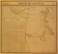
1827ref. 202377Brussels: Phillippe Marie Vandermaelen 1827. unbound. very good. Map. Large format lithograph with original hand coloring. Image measures 18.5" x 22.25". Includes northern Egypt and the northern section of the Nile as well as an inset with information on the area. Double page with centerfold. From Vandermaelen's 6 volume "Atlas universel de geographie physique politique statistique et mineralogique sur l'echelle de 1/16411836". Can be combined as gores to form an immense globe. The atlas was the first to map the world on a uniform scale. Phillippe Marie Vandermaelen unknown
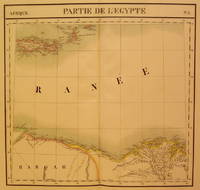
1827ref. 202376Brussels: Phillippe Marie Vandermaelen 1827. unbound. very good. Map. Large format lithograph with original hand coloring. Image measures 18.5" x 22.25". North Eastern coast of Africa and the Mediterranean Sea including the northern coast of Egypt the Nile delta and Crete. Double page with centerfold. From Vandermaelen's 6 volume "Atlas universel de geographie physique politique statistique et mineralogique sur l'echelle de 1/16411836". Can be combined as gores to form an immense globe. The atlas was the first to map the world on a uniform scale. Phillippe Marie Vandermaelen unknown
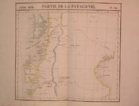
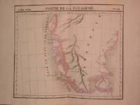
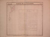
1827ref. 204795Brussels: Phillippe Marie Vandermaelen 1827. unbound. very good. Map. Lithograph with original hand outline. Image measures 18.75" x 20.5". Map of southern portion of Argentina and Chile from the Chonos Archipelago and the Golf of Corcouado in the west to the Golfe of St. George in the east. Double page with centerfold. From Vandermaelen's 6 volume "Atlas universel de geographie physique politique statistique et mineralogique sur l'echelle de 1/16411836". Can be combined as gores to form an immense globe. The atlas was the first to map the world on a uniform scale. Phillippe Marie Vandermaelen unknown
1827ref. 204810Brussels: Phillippe Marie Vandermaelen 1827. unbound. very good. Map. Lithograph with original hand outline. Image measures 19" x 22.5". Exquisite map of the southern portion of the continent including the Strait of Magellan and the Andes of Patagonia. Double page with centerfold. From Vandermaelen's 6 volume "Atlas universel de geographie physique politique statistique et mineralogique sur l'echelle de 1/16411836". Can be combined as gores to form an immense globe. The atlas was the first to map the world on a uniform scale. Phillippe Marie Vandermaelen unknown
1827ref. 204796Brussels: Phillippe Marie Vandermaelen 1827. unbound. very good. Map. Lithograph with original hand outline. Image measures 18.5" x 20.75". Map of St. Joseph's Peninsula known today as the Valdes Peninsula south to Camarones. Includes notes in French on Chile perhaps in reference to an adjacent map. Double page with centerfold. From Vandermaelen's 6 volume "Atlas universel de geographie physique politque statistique et mineralogique sur l'echelle de 1/16411836". Can be combined as gores to form an immense globe. The atlas was the first to map the world on a uniform scale. Phillippe Marie Vandermaelen unknown
ref. B175772-1Garges-les-Gonesse Éditions Méru 1993. 6pp. 3ff. with 6 typographic compositions and 1 photographic plate. Signatures loose secured with cord as issued. Folio. Publishers cloth chemise with wrap-around title band. Edition limited to 15 hand-numbered copies printed in part of heavy wove stock. Loosely inserted: Petit Philippe. Cinq procès en marge de Particolare détail Méru été 1993. 2 51 5pp. Self-wraps. N.p. Blanc Réservé 1993. Garges-les-Gonesse [Éditions Méru], 1993. hardcover books
2013ref. x-3642414001Springer Verlag 2013. Hardcover. New. 2014 edition. 429 pages. 9.25x6.25x1.00 inches. Springer Verlag hardcover
2016ref. x-3662514346Springer Verlag 2016. Paperback. New. reprint edition. 440 pages. 9.25x6.10x1.04 inches. Springer Verlag paperback
ref. 10626-3662602555Paperback. New. Book Condition is in New Paperback Eastern Economy Edition/Indian Edition textbook with identical content as the US version. May have been Printed in India with cover stating Not for sale in US. Fast shipping through the DHL FedEx Aramex And Delivered In 8-12 Days to all worldwide. paperback
2020ref. Star-9783662602553Springer 2020. Paperback. New. Springer paperback
2020ref. Star-9783662602553Springer 2020. Paperback. New. Springer paperback
1827ref. 801Brussels: Vandermaelen Phillipe 1827. 19 3/4 x 18 1/2 inches. Very good condition. Vandermaelens map sheet on California and the coast. It shows the Westcoast line of Southern California A very nice map and the earliest us of lithography in a cartographic enterprise. Senefelder published his volume on lithography in 1819 in French. Vandermaelen, Phillipe unknown
1827ref. 798Brussels: Vandermaelen Philippe 1827. 18 1/2 x 20 1/2 inches. Very good. An antique map of epic proportions for the Texas collector. This map shows Arkansas and portions of eastern Texas in 1827. It has place names and locations of Native American tribes. Multiple rivers are shown and details of topography well labeled. Overall this is a fine cartographic presentation in the for of a rare map. Vandermaelen, Philippe unknown
ref. Bloomsbury-9781859842416Verso Books. Trade Paperback. New. pages Verso Books paperback
ref. Bloomsbury-9781859842416Verso Books. Trade Paperback. New. pages Verso Books paperback
ref. 2352600014.Gpaperback. Good. Access codes and supplements are not guaranteed with used items. May be an ex-library book. paperback
ref. ria9782322260898_inpPaperback. New. New Book; Fast Shipping from UK; Not signed; Not First Edition; Voilà près de cinquante ans que la formation des sports collectifs en particulier du football se gangrène d'illusions de méprises et d'absurdités. La psychologie cognitive incomprise et dévoyée s'enracine chaque jour un peu plus su paperback