11 944 résultats
1920Very Good Turkish, Ottoman (1500-1928) Original illustrated wrappers. Chipping on top edge and front cover. Occasional foxing on pages. Overall a good copy. Roy. 8vo. (23 x 15 cm). In Ottoman script (Old Turkish with Arabic letters). 103 p., b/w plates (19 unnumbered b/w plates and 1 map). First edition of this extremely rare first-hand and historically significant eyewitness account of the Syrian and the Suez Canal Operations during the Great War by an Ottoman soldier and statesman. Erden describes in this book his return to Istanbul after his military attaché duty in Paris and his departure to Damascus to join the 4th Army in Syria under the command of Cemal Pasha (1872-1922). He then discusses the Arab Revolt in Hejaz and its possible effects on the Ottoman Empire (The Arab Uprising was initiated by Sharif Hussein bin Ali in June 1916 during the Great War with the aim of creating an independent and united Arab state comprising of Aden in Yemen and Aleppo in Syria against the Imperial Ottoman). After disclosing his views and the actions of the army in the region, he goes on to describe Jerusalem, the Suez Canal, and the wars that took place there. Erden gave new information on the reasons and results of the Canal operation, the condition of the Turkish army along Palestine and Syria fronts, the relations among the Turkish staff, and the nature of the Arab revolt through his views and observations in Egypt, Palestine, and Syria fronts accumulated as he was Cemal Pasha's chief of staff. Erden was a Turkish soldier and war historian. After graduating from the Military Academy in 1903, he worked in the units and headquarters in Yemen, as the staff of the 3rd Corps in the Balkan War and as the Paris Military Attaché. During the Great War, he served as the Chief of Staff of the 4th Army within the entourage of Admiralty Minister Cemal Pasha in Syria. Özege 16174. Kursun p. 51.
1896Very Good Turkish, Ottoman (1500-1928) Original wrappers. 16mo. (14,5 x 10,5 cm). In Ottoman script (Old Turkish with Arabic letters). 20 p. First and only edition of this extremely rare pamphlet includes the chapters of 'From Marseilles to Gabon' and 'From Libreville to Banguela' of Trivier's expeditions in Africa. First chapter includes Trivier's Mozambique travel by ship over the Strait of Gibraltar. In this chapter, Trivier described the purpose of his voyage as "After returning to France from my last trip in January 1890, I declared that many more places should be seen. I have written many articles about the necessity of looking for new ways to eliminate the fears and worries caused by McKinley tariffs that are harmed everywhere. As a nice result of this, the Paris City Council and the Bordeaux Chamber of Commerce decided not to be dispatched to the hometown of Africans with an amount of money close to 11,000 francs.". In the second chapter, he describes Congo and other parts of Central Africa. French explorer Elisee Trivier followed in the footsteps of Scottish missionary David Livingstone in his attempt to explore the interior of Africa. Trivier's expedition traveled in 1889 up the Congo and across Africa to the island of Zanzibar on the eastern coast. Trivier is considered the first French explorer to have crossed Africa. Hegira: 1313 = Gregorian: 1896 Özege 21221.; Not in OCLC.
1906Very Good Turkish, Ottoman (1500-1928) Original wrappers. Foolscap 8vo. (17 x 12 cm). In Ottoman script (Old Turkish with Arabic letters). 152 p. Roumi: 1324 = Gregorian: 1906. Taken from a volume including multiple books. Spine is restored. A very good copy. First and only edition of this early and extensively rare book including a first-hand account of the topography and descriptions of Hejaz, Mecca, and other parts of Arabian Peninsula such as Taif and Yemen by Sadiq Sherif, who was the first person to take photographs of Mecca, Medina, and the Hajj in 1880 and 1881 as well. Sadiq Sherif was the grandson of Serif Abdulmuttalib, the Emîr of Mecca. This book written by Sherif was dedicated to 'the Progress and Union Society' [i.e. Ittihad ve Terakki Cemiyeti]. The book describes the way of administration and territorial division of Hejaz after giving some information of its geography, borders, tribes and natives, mountains, rivers, crops and products, and animals of this Ottoman 'vilâyat' [i.e. province]. Sherif gives detailed information on how and when the Ottoman Empire ruled Hejaz, the location of Mecca city, its borders, physical and social geography, crops in Mecca and around, its flora, fauna, demographic structure, 'nahiyes', Kâba's construction, and its history, sacred places around, Masjid-i Haram and other masjids, cemeteries, mountains, gifts by Ottoman caliphs to Kaba, 'Taif' area, people who were 'Emîr' of Mecca from the period of Mohammad, Wahhabism and its birth, etc. At the last, Sherif gives place to his personal letter (layihâ) including 49 articles. The letter was about the reforms that Hejaz needs and it was sent to the Ottoman 'sadâret' [i.e. prime ministry]. (Source: History of geographical literature during the Ottoman Empire, Edited by Ihsanoglu). Muhammad Sadiq Sherif Bey was the first person to take photographs of Mecca, Medina, and the Hajj in 1880 and 1881. Sadiq Bey trained as a military engineer after completing his studies in Cairo and at the École Polytechnique in Paris. It is not known when, or from whom, Sadiq Bey learned to take photographs but it was most probably through one of the resident photographers in Egypt. In 1861, prompted by the need to carry out more extensive military land surveys of the area between Wajh and Medina, Sadiq Bey made his first journey to Arabia. He took a camera along with his surveying equipment and took his very first photographs of Medina. In a series of articles published in the Egyptian Military Gazette in 1877, he refers to his early photography at Medina describing the use of a 'photographia'. Sadly, however, none of the photographs from this first journey has survived. In 1880 he was appointed as the treasurer of the Mahmal, the ornate cloth to cover the Ka'ba brought each year on a special litter to Mecca. He accompanied the Mahmal to Medina and Mecca from September 1880 until January 1881. Again equipped with his camera, he succeeded in producing the series of photographs that are now considered some of the earliest known photographs of the region, those of the Ka'ba, taken under great secrecy. Sadiq Bey published various accounts of his travels in Arabia in military journals, through the Emiry Grand Press in Cairo, but the 1880/81 series of photographs appear to have been issued separately for wider distribution through the Société Khédiviale de Géographie. The society's secretary, Dr. Frederic Bonola, advertised sets of photographs for sale. In January and April 1880 Sadiq Bey gave a talk and report to the society on his earlier 1861 expedition, and on 20 May 1881 he presented a report on his recent journey to Mecca; detailed accounts were published in the society's bulletins, numbers 9/10 and 12. (Source: Christie's). Özege 11888.; Karatay, TM II: 695.; MKAHTBK, II: 991.; OCLC 248374684 / 4082352.
1909Very Good Turkish, Ottoman (1500-1928) Original illustrated wrappers. Cr. 8vo. (19 x 13 cm). In Ottoman script (Old Turkish with Arabic letters). 105 p., 8 b/w plates. First edition of this illustrated travel account of one of the exiled Young Turks to Afghanistan, who was invited to the country by the reformist Afghan Emir Habibullah Khan (1872-1919), who was the ruler of Afghanistan from 1901 to 1919. The news that the reformist Afghan Emir Hamidullah Khan was looking for well-educated Turkish youth to help the development of his country, reached the Young Turks in exile in Egypt. The author of this book, Mehmet Fazli was one of the Young Turks (A reformist group in the early 20th century that favored the replacement of the Ottoman Empire's absolute monarchy with a constitutional government), and he followed this royal invitation and set off with his friends. He reached Kabul via an adventurous journey through Austria-Hungary, Russia, Azerbaijan, Turkmenistan, and Iran. With his guide and friend who was an Afghan and his Turkish friend Hüseyin Hüsni Bey, Fazli met in Cairo and they went to Afghan lands. He described Kabul, Herat, Ghazna, Belh, and Kandahar cities during their travel, wrote about the Afghan Emîr and the dynasty. His book revolves around the many details on Afghan peoples' customs, social life, education, industry, roads, antiquity, postage system and organization, arms and army, etc. The book has a photo of the Afghan Emir beside other attractive illustrations and photographs. (Sources: Afganistan'da Bir Jöntürk: Misir Sürgününden Afgan Reformuna., Prep. by Kenan Karabulut.; History of Geographical Literature during the Ottoman Period., Edited by Ekmeleddin Ihsanoglu). Özege 16749.; OCLC 868007927.; MKAHTBK, II 948.
1960Very Good Urdu Extremely rare first and only edition (not in institutional catalogues and market) of this travel book to America in the mid 20th century by Pakistani journalist and intellectual Sharif Farooq, who was invited to visit the USA on the Leader Specialist Programme in 1958. Sharif Farooq visited America in 1958. In his travelogue, he highlights the lifestyle, educational system, and foreign policy of America in detail. He also introduces the economical situation of the country, economical trends, and the condition of different institutions. Reports of press conferences are also a part of this travelogue. (Source: Travelogues of America in the Urdu Language: Trends and Tradition). "Wherever the Americans deserve appreciation for their intense patriotism and enthusiasm for labor, the author has given unstinted praise but where criticism is due he has not spared them, though the language used is very sober and moderate. I am confident that this book will be widely read and aimed as one of the good travel books written about America". (From the preface of the book by advocate-general Muhammad Ali). In original boards with lettering in both Latin and Arabic, spine missing. Otherwise a good copy. Demy 8vo. (22 x 14 cm). Text is in Urdu with a one-page English preface. 387, [1] p. In the Land of Lincoln. First Edition. No copy in OCLC.
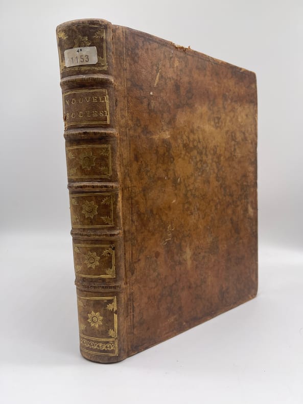
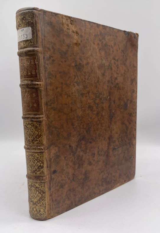
réf. 017371[Jansénisme] Nouvelles ecclésiastiques ou mémoires pour servir à l'histoire de la Constitution Unigenitus pour l'année M.DCC.XXXIII. [et] M.DCC.XXXIV. Paris, s.n., 1733-1734. In-4, front.-220-front.-228p. Deux années complètes de cet important journal publié clandestinement à partir de 1728 et jusqu'en 1803, farouchement militant pour les jansénistes et contre les partisans de la Bulle Unigenitus. On notera la présence de 4 gravures dont 2 frontispices et 2 portraits, placés en 1733, d'Alexandre Levier (p.44) et Firmin Tournus (p.196). Les frontispices semblent être en supplément, l'un deux portant un prix, 6 sols, en pied. Ils sont néanmoins particulièrement révélateurs de l'esprit des rédacteurs. Le numéro du 10 janvier 1734 est absent et a été remplacé à l'époque par une copie manuscrit de 8p. Plein veau, dos à nerfs orné, pièces de titre, tranches rouges. Coins supérieurs écrasés par une chute, tache brune sur 3 feuilles de 1733, légers défauts. Etiquette sur le dos, cachet sur la première page, répété p.100 (petit séminaire de Caen).
réf. 017372[Jansénisme] Nouvelles ecclésiastiques ou mémoires pour servir à l'histoire de la Constitution Unigenitus pour l'année M.DCC.XXXI. [et] M.DCC.XXXII. Paris, s.n., 1731-1732. In-4, 280-252-XIIp. Deux années complètes de cet important journal publié clandestinement à partir de 1728 et jusqu'en 1803, farouchement militant pour les jansénistes et contre les partisans de la Bulle Unigenitus. Ex-libris « Caroli Du Ruisseau in supremo senatu Patroni », Charles du Ruisseau, avocat au parlement de Paris en 1735 (base AFCEL D1915). Plein papier d'époque, dos à nerfs, pièces de titre, tranches rouges. Papier parfois un peu usé, reliure parfaitement solide. Etiquette sur le dos, cachet sur la première page, répété p.100 (petit séminaire de Caen). Quelques rares feuillets avec petit manque de papier marginal.
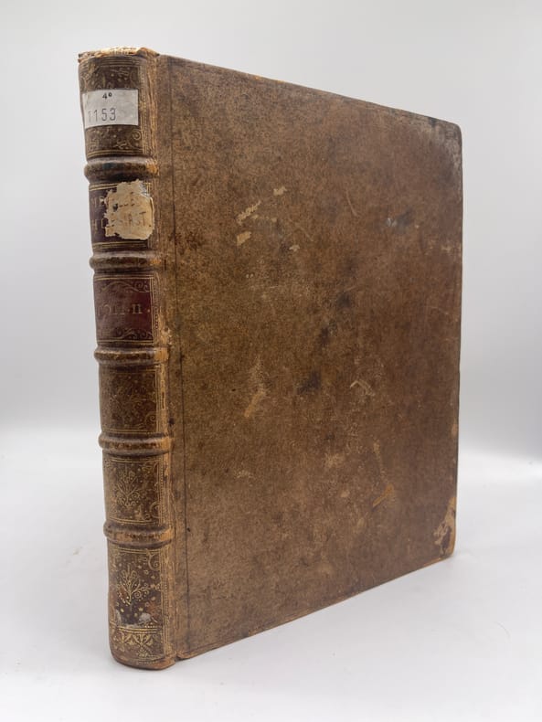
réf. 017373[Jansénisme] Nouvelles ecclésiastiques ou mémoires pour servir à l'histoire de la Constitution Unigenitus pour l'année M.DCC.XXVIII. Paris, s.n., 1728. In-4, environ 370p, paginations diverses. Année 1728 complète, commençant le 23 février 1728, avec des formats légèrement différents (certains numéros sont remargés à l'époque) et similaire à l'exemplaire de la BnF (numérisé sur gallica). Toutefois le volume débute par 5 feuilles « extrait d'une lettre de. » datées d'août à octobre 1727 (9 feuillets). On voit la trace de deux feuillets retirés (un autre extrait) et un exemplaire de « l'extrait d'une lettre d'Ambrun du 11 août 1727 » a été ajouté (volant). A la fin du volume se trouvent diverses pièces : « Supplément aux recueils des ordres émanés de la cour », un « avis de l'éditeur », une « ordonnance de Monseigneur l'évêque d'Auxerre » et une « très humble remontrance de M. de Montempuis au R.P. du Cerceau ». On remarquera que le volume, dont la reliure est d'époque, porte toutefois « tome II ». En effet, rapidement après la publication, un volume fut publié pour la période 1713-1728, considéré probablement comme le tome I. Provenance : Charles-Armand-René de La Trémoille (1708-1741), membre de l'Académie française, avec une grande vignette à ses armes en garde. TOUTEFOIS, nous supposons cette provenance purement fantaisiste, cela ressemblant à une vignette découpée (même si un second volume dans la même reliure porte la même vignette). Plein veau, dos à nerfs orné, pièces de titre et tomaison, tranches rouges. Coiffe supérieure arasées, étiquette sur le dos, cachet du petit séminaire de Caen p.100.
réf. 017374[Jansénisme] Nouvelles ecclésiastiques ou mémoires pour servir à l'histoire de la Constitution Unigenitus pour l'année M.DCC.XXIX. Paris, s.n., 1729. In-4, environ 345p, paginations diverses. Année 1729 complète, commençant le 15 février 1729, avec des formats légèrement différents (certains numéros sont remargés à l'époque). La numérotation manuscrite ajoutée à l'époque commence à la page 11, comme si le commanditaire de la reliure pensait qu'il manquait des numéros. Toutefois, l'exemplaire est similaire à celui de la BnF, ce qui nous fait dire que l'année est bien complète ainsi. A partir de la page 325 de notre exemplaire, plusieurs corrections manuscrites, similaires là-aussi avec celles de l'exemplaire de la BnF. A la fin du volume se trouvent diverses pièces : « Ordonnance de son éminence Monseigneur le Cardinal de Noailles » du 12 novembre 1716 [publié en 1729 par Delespine], « Lettre de Monseigneur l'Eveque de Montpellier au Roy au sujet de l'exil du sieur Esteve » et « Le Guichotisme nouveau ou le formulaire » [qui aurait été publié en 1727, un feuillet déchiré et réparé à l'époque]. On remarquera que le volume de cette deuxième année, dont la reliure est d'époque, porte toutefois « tome III ». En effet, rapidement après la publication, un volume fut publié pour la période 1713-1728, considéré probablement comme le tome I. Provenance : Charles-Armand-René de La Trémoille (1708-1741), membre de l'Académie française, avec une grande vignette à ses armes en garde. TOUTEFOIS, nous supposons cette provenance purement fantaisiste, cela ressemblant à une vignette découpée (même si un second volume dans la même reliure porte la même vignette). Plein veau, dos à nerfs orné, pièces de titre et tomaison, tranches rouges. Accroc en pied d'un mors, manque sur une coupe, cachet du petit séminaire de Caen.
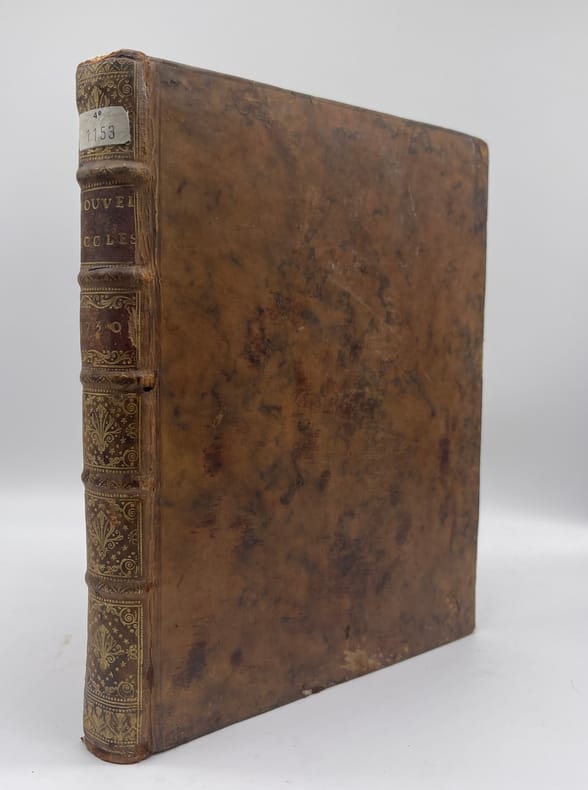
réf. 017375[Jansénisme] Nouvelles ecclésiastiques ou mémoires pour servir à l'histoire de la Constitution Unigenitus pour l'année M.DCC.XXX. Paris, s.n., 1730. In-4, environ 353p, paginations diverses. Année 1730 complète, truffé de 3 belles gravures au format in-folio et donc pliées : « Les premiers deffenseurs de l'Eglise contre la Constitution Unigenitus » (p.1, portraits de 9 appelants, cartouche de titre ajouté, collé en tête) ; un portrait de Charles-Joachim Colbert de Croissy (1667-1738) entouré d'une liste de ses oeuvres (p.83) ; un portrait de Jean Soanen (1647-1740) entouré lui aussi de la liste de ses oeuvres (p.195). Après les 258p de l'année (numérotées à l'encre) se trouvent différents textes : « relation de ce qui s'est passé au parlement de Rouen » du 28 avril au 19 mai 1730 ; « Lettre du père Chamillart jésuite au sujet du bruit qui avait couru de sa mort. » ; « Lettre d'un jésuite de Paris à un prélat au sujet d'une calomnie atroce. » (Paris, Herault, 30 mars 1732) ; « déclaration du père Tournemine jésuite sur des écrits supposés. » (Paris, Herault, 19 mars 1732) ; « Lettre au révérend père de Tournemine jésuite. » ; « Mandement de Monseigneur l'archevêque de Paris portant condamnation de plusieurs libelles qui ont pour titre Nouvelles ecclésiastiques » (Paris, P Simon, 1732) et une table pour les années 1730 et 1731. Plein veau, dos à nerfs orné, pièces de titre, tranches rouges. Petits défauts usuels, accroc à la coiffe supérieure, petite mouillure claire en tête (marginale).
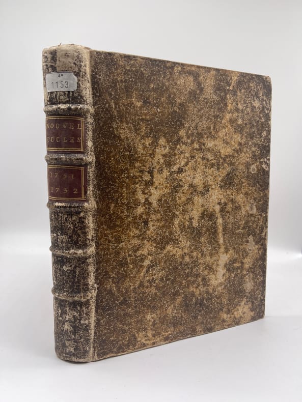
réf. 017376[Jansénisme] Nouvelles ecclésiastiques ou mémoires pour servir à l'histoire de la Constitution Unigenitus pour l'année M.DCC.XLIX., M.DCC.L et M.DCC.LI Paris, s.n., 1749-1751. In-4, 208-208-204p. Trois années de cet important journal, la dernière étant incomplète (elle devrait avoir 208p). A la fin se trouvent des numéros éparses dont les pages 1 à 32 et 81 à 84 de 1752, 145 à 148 de 1732, 169 à 172 et 177 à 180 de 1753, 141 à 148, 153 à 160, 85 à 88, 61 à 68, 137 à 140, 181 à 184, 193 à196 de 1756. Plein veau, dos à nerfs orné, pièce de titre tranches rouges. Mors supérieur fendu en tête, manque à une coupe, quelques manques marginaux, quelques déchirures dans les numéros supplémentaires.
1942Very Good Turkish Original wrappers. Roy. 8vo. (23 x 15,5 cm). In Turkish. 117 p. Uncommon enlarged second edition of this account of the Russo-Japanese War in 1905 describing rising Japanese nationalism at the beginning of the 20th century, by Demirhan (1871-1964), sent with reference of Goltz Pasha (Colmar von der Goltz, 1843-1916) to Manchuria to observe the war in the ranks of the Japanese army as a Turkish colonel. He stayed for two months in Japan and more than a year in Manchuria. In addition to writing down his observations in the field of war in detail, he also took on the duty of ambassador due to the Ottoman Empire's lack of diplomatic relations with Japan and contributed to the development of relations between the two countries. He received a medal from the Japanese Emperor Meiji and returned home with the gifts that Emperor Meiji presented to Sultan Abdulhamid. His account was published first in 1937 in book form. Sait Pertev Demirhan, (1871-1964), was a Turkish soldier and politician. He is a graduate of Erkân-i Harbiye. He was an author, intellectual, Erkân-i Harbiye School teacher, 6. Army chief of staff, Harbiye Undersecretariat, 3rd Army Chief of Staff, 1st Corps, and 4. Corps Commands, Military Schools Inspector, Member of History and Geography Councils, Member of Military Appeals Court, a deputy of Erzurum. He was the son of Yanyali Mustafa Pasha. He graduated from Harbiye as a staff captain (1892). In 1894 he was sent to Germany to advance his military education. After being a colonel, he was appointed to the Staff School as a teacher (1904). He was sent to the Russo-Japanese War as an observer. He returned to Istanbul in 1906 and was promoted to "Pasha", and was appointed as the 6th Army Chief of Staff. He participated in the Balkan Wars (1912-1913) and was in the Caucasian Theater during the First World War. He was sent to Vienna as a military diplomat. Upon his return, he moved to Anatolia to participate in the Greco-Turkish War (1919-1922). Only three copies are located in OCLC, two copies are in Turkish libraries, and one is in a German library; not in the US libraries. OCLC 60522483.
Very Good German Original color lithograph maps in 7 special cloth cases. Cases large 8vo., only seventh one is smaller which is covered by European marbling. Bookseller and bibliothek stamps on some maps, plans and sketches; and cases interior. A fine map collection. Contents: V.1: Includes 1 map, 2 plans and 5 skecthes, 1 uebersichtskarte. Uebersichtskarte für die Geschichte des Iten und IIten schlesisschen Krieges von 1740-1745. Kriege Friedrichs des Grossen. 1/740000. 73x81 cm.; Plan zur Erstürmung von Glogam am 9 Marz 1741 (Entworfen nach alten Planen). 1/6250 / 1/100000. 48x52 cm; Plan der Schlach bei Mollwitz am 10 April 1741. 1/25000. 43x59 cm.; (Skizze) Stellung der preussischen und oesterreichischen Truppenam, 3 Januar 1741. 1/740000. 30x30 cm.; Skizze zum Scharmützel bei Ellguth und zum Gefecht bei Ottomachall am 9. Januar 1741. 1/67500. 34x26 cm.; Skizze zu den Winterquartieren des preussen mit Stellung der Truppen am 20 Februar 1741. 1/740000. 46x52 cm.; Skizze zum Ueberfall bei Baumgarten am 27 Feb. 1741. 1/50000. 29x34 cm.; Marsch der oesterreichischen Armee unter F. M. Neipperg und der preussischen Truppen unter dem Könige von der Schlacht bei Mollwitz. 1/1480000. 36x42 cm.; [.] Standorte des preussischen Heeres bei Ausbruch des Krieges 1740. 1/2400000. 34x55 cm.; V.2: 12 pieces: 3 uebersichtskarten, 2 planen, 7 skizzen. ... von Europa im Jahre 1756. 1/18000000. 33x46 cm.; ... des südöstlichen Kriegsschauplatzes. 1/740000. 65x95 cm.; Standorte des preussischen uns sachsischen Heeres und Stellung des oestreichischen Truppen in Böhmen, Mahren, oestrç Schlesen und Erzth. oesterreich var Beginn des siebenjahrigen Krieges. 1/2200000. 56x72 cm.; Plan der Schlacht bei Lobositz am 1. Oktober 1756. Verlauf des Schlact bis etwa 12 Uhr Mittags. 1/25000. 47x60cm (Also includes Plan der 2ten Attacke des preussischen Kavallerie and Skizze des beiderseitigen Vormarsches am 30ten September 1756).; ... Weiterer Verlaufdes Schlact bis etwa 3 Uhr Nachtmittags. 1/25000. 47x60 cm.; Skizzen: 1. Vormarssch 28. 8 bis 10.9.56. 2.-3. Pirna 1.10.56. 4. Bewegungen Schwerins 56. 5. Pirna 10.10.56. 6. Pirna 12.10.56. 7. Pirna 13.10.56. V.3: 5 skizzen (No: 8-12) und 3 plannen (No: 3, 4-A, 4-B). Plan 4-A-4-B: Prag, 6.5.1757.; Plan 3: Reichenberg, 21.4.57. Skizze 8: Postrungen und Winterquartiere Dezember 56 (Huge size).; Versammlung der Heere, Marz und April 57.; Einmarsch bis 30.4.57.; Stellungen am 1.5.57.; Stellungen am 5.5.57. V.4: Karten 1,2,3,5 (4 is missing); skies 31,32; uebersichtskarte 5; Plan 12-B. ... des nordöstlischen Kriegsschauplatzes (Huge size).; Skizze 31: Heeresbewegungen vom 11.11.57 bs zum Einrücken in die Winterquartiere, Winter 1757-58.; (World War 1): Karte 1: Belgien und nordost-frankreich. Ostpreussen, polen, kurland, Weissrussland.; Galizien und Wolkynien.; Kleinasien , Schweizes Meer, Kaukasien, Kurdistan, Armenien, Aserbeidschan, Arabier, Mittellandisches Meer: Vordasien map. V.5: Sizzen 20-24 - Planen 6-A, 6-B - 9. Planen: Gr. Jagersdorf, 30.8.57.; Jager b. Goerlitz, 31.8.-9.9.57. Moys, 7.9.57.; Breslau, 22.11.57.; Schweidnitz, 24.10-12.11.57.; Skizze 20: Feldzung in ostpreussen Vormarsch des russischen Heeres bis 6.7.57.; 21: Heeresbewegungen vom 6.7.57 bis zur Schlact bei Gr. Jagersdorf. 22: ... nach der Schlact bei Gr.-Jagersdorf bis zum Schluss.; 23: Bewegungen i. d. Lausitz u. i. Schleisen, 20.8.-30.11.57.; 24: Lager bei Liegnitz, 19.-27.9.57. V.6: Plan 5-A, 5-B - Skizzen no: 13-19. Plans: Kolin, 18.6.57.; Kolin, 18.6.57.; Skizzen 13: Beiderseitige Stellungen 8.5.57.; 14: Operationen Beverns u. d. Königs gegen Daun 10.5.-17.6.57.; Bewegungen vom 20.6.-1.7.57. Stellungen vom 1.7.57.; Rechten Elbufer in der ersten Halfte des Juli 1757.; ... vor Zittau, 12.-20.8.57. V.7: 4 plans in cloth covered with European marbling. These last 4 plans from "Suworow und Polens untergang. Nach archivalischen Quellen dargestellt" von Friedrich von Smitt, 1858 First Edition. Pl. 1: Der Schlact am Rymnik den 11/22 Septeember 1789. Pl. 2: ... der
1935Very Good Turkish, Ottoman (1500-1928) Original manuscript book of the registers of the conjurations sessions by the first Turkish spiritualist group. 20x15 cm. In Ottoman script (Turkish with Arabic letters). [154] p., several hand-drawn ills. Group has Bedri Ruhselman, (1898-1960), Albert Braun, (Violinist and Ruhselman's violin teacher of German origin), Hans Ianma (Violin teacher), Hasan Saadeddin Bey, (Turkish spiritualist), and Doctor Zühdü Riza Bey, (Turkish musician, Kemençe teacher, a friend of Sadeddin Arel). Dr. Bedri Ruhselman (1898-1960), the founder of NeoSpiritism and "the Experimental New Spiritism". Ruhselman's point of view and a new perspective to the concepts such as creation, spirit, afterlife, birth incarnation, and rebirth-reincarnation are pioneers in the Early Turkish Republican period. Ruhselman's empirical perspective on "afterlife", one of the most important and primary subjects of theology, has made important contributions to spiritism, out of the classical standpoint. (Source: Ruhselman and his metaphysical vision, Kestel). Albert Braun was Ruhselman's violin teacher and his friend. It's said this early spiritualist group is the pioneer and elitist of Neo-Spiritualism in Turkey. He is considered a Mission Medium, a very rare category within spiritual mediumship. By definition, every medium has a varying degree of ability to tune in to spiritual "frequencies". But not all "reception" (coming from those frequencies) convey a meaningful message (sometimes if any). While mediumship is a gift (meaning that; one either has it or not); very few mediums are actually knowledgeable in spiritual matters. They simply transfer what they capture from their sensitive channels. And once in a while, mainstream media picks on certain mediums, especially when he/she delivers sensational predictions (i.e. Edgar Cayce). Bedri Ruhselman's both interest and gift was manifested since his early childhood. He was conducting spiritual sessions when he was only 12 years old. While continuing his musical education in the Prague Conservatory, in the 1920s, he studied the pioneers of classic spiritualism like Allen Kardec, Gustave Geley, Charles Richet, Leon Denis, William Crooks and become experienced in hypnotism and spiritual sessions. He also completed his medical education and graduated as a medical doctor. In 1950 by establishing Metapsychic Investigations and Scientific Research Society, he gifted an institutional identity to Neo-Spiritualism. His true duty started in 1958 by means of spiritual sessions with a guide being from higher spiritual plans which identified itself as "The Master". Ruhselman and his carefully selected mediums received a vast amount of knowledge via these sessions during a few months. That body of knowledge has been compiled as a book, which Ruhselman never claimed any ownership (stating that it's purely a gift from the higher spiritual plan). The plan has instructed that; the book was only to be released in the future - to be identified by a certain sign. That point alone commends recognition for pure selfless devotion towards undertaken duty. If the ego was in play; one would usually do anything for fame or at least to cash on the subject. But Ruhselman completes his true duty and hands over the book for safekeeping without ever mentioning one word about the content. He passes away a few months after (1960). (Source: Indication23). This manuscript includes their registers of the conjurations sessions with some illustrations which have "table order" of the sessions at a house in Sisli, Istanbul. In the illustrations, given the locations of the goods in the room like piano, wardrobe, chair, etc. Registers including the sessions between the years of 1935-1936. Scripts were written by M. Zühdü Pektas mostly, by various fountain pens with blue and black inks. Some registers are taken by a pencil. An extremely rare stylish manuscript. Unpublished.
Very Good Turkish, Ottoman (1500-1928) Original color map. Atlas folio. (65 x 44 cm). In Ottoman script. Scale: 1/400.000. [MAP] Kars, Kutayisi, Tiflis, Batum. [Kars, Kutaisi, Tbilis, Batoum]. Extremely rare. Not in TBMM Library Map collection.
1921Very Good Turkish, Ottoman (1500-1928) Original map. Oblong elephant folio. (50 x 60 cm). In Ottoman script. Scale: 1/200.000. [MAP of Ankara city]. Ankara. Gerede, Keskin, Sivrihisar. A rare Ottoman map printed in last period shows Ankara city with detailed place names. This is one the serie of the Bonn projection maps which are the first map series in modern techniques in Turkey and the Ottoman Empire. In order to produce these maps covering Turkish territory, Reconnaissance Branch was incorporated into The Mapping Commission. The maps were produced in the datum based on the latitude and longitude of Ayasofya Mosque in equal area Bonn Projection. The field works for the 123 sheets covering the country were conducted by 76 staff. The production was completed in 18 years starting from east west. Field works continued without stopping except in years 1914 and 1920. This map series called also reconnaissance maps contributed a lot to producing 1:25.000 scale maps.
Very Good Turkish, Ottoman (1500-1928) Original color map. Atlas folio. (65 x 45 cm). In Ottoman script. [MAP of CAUCASIA: GEORGIA - ARMENIA] Tiflis, Erivan, Kutayisi. [Tbilisi, Yerevan, Kutaisi]. Not in TBMM Library Map Collection. Extremely rare.
Very Good Turkish, Ottoman (1500-1928) Original color map. Atlas folio. (56 x 46 cm). In Ottoman script. [MAP of CAUCASIA] Bepagliya, Batum, Yeysk. [Pelapaglia, Batoum, Yeysk]. Not in TBMM Library Map Collection. Extremely rare.
Very Good Turkish, Ottoman (1500-1928) Original color map. Atlas folio. (55 x 46 cm). In Ottoman script. Scale: 1/400.000. [OTTOMAN MAP of CAUCASIA] Yekaterinodar - Yeysk - Maykob - Anapa. Shows Krasnodar, Maikop, Yeysk, Anapa and shores of Black Sea. At northeast, map shows Kuban river (Kuban nehri) and its basin in Circassia (Republic of Adygea). Maykop is the capital city of the Republic of Adygea in Russia, located on the right bank of the Belaya River (a tributary of the Kuban River). Yekaterinodar (Krasnodar) at north of map, near to Maykop. From northwest to south east, map shows Black Sea shores of the extensive area with interesting details in Ottoman Turkish script. Also shown Belaya, Chokhrak and Dakh Rivers in addition all south land of Krasnodar Krai of the Northwestern Caucasus until southern Georgian borders and Georgia. Almost all toponyms are in Ottoman Turkish.
Very Good Turkish, Ottoman (1500-1928) Original color map. Atlas folio. (66 x 46 cm). In Ottoman script. Scale: 1/400.000. [MAP of GEORGIA - SHORES of BLACK SEA] Batum, Keskim, Kutayisi. [Batoum, Kutaisi, Keskim]. Shows all toponym of shores of Black Sea of Georgia including Ottoman fortresses, villages etc. Not in TBMM Library Map Collection. Extremely rare.
1916Very Good Turkish, Ottoman (1500-1928) Original map. Oblong elephant folio. (50 x 60 cm). In Ottoman script. Scale: 1/200.000. [MAP of Kharpout]. Harput. Dersim, Palu, Malatya, Siverek. Rare Ottoman map shows Elaziz (Elazig), Dersim, ancient Harput et environment. This is one the serie of the Bonn projection maps which are the first map series in modern techniques in Turkey and the Ottoman Empire. This is one the serie of the Bonn projection maps which are the first map series in modern techniques in Turkey and the Ottoman Empire. In order to produce these maps covering Turkish territory, Reconnaissance Branch was incorporated into The Mapping Commission. The maps were produced in the datum based on the latitude and longitude of Ayasofya Mosque in equal area Bonn Projection. The field works for the 123 sheets covering the country were conducted by 76 staff. The production was completed in 18 years starting from east west. Field works continued without stopping except in years 1914 and 1920. This map series called also reconnaissance maps contributed a lot to producing 1:25.000 scale maps.
Very Good Turkish, Ottoman (1500-1928) Original color map. Elephant folio. (60 x 50 cm). In Ottoman script. Scale: 1/300.000. [MAP of KRASNODAR - YEYSK] Yeysk. Bedlapaglia, Yekaterinodar, Anapa. Shows Yeysk, a port and a resort town in Krasnodar Krai, Russia, situated on the shore of the Taganrog Gulf of the Sea of Azov in north, Yekaterinodar (Krasnodar) in south, Anapa (Bigurkal) etc.
Very Good Turkish, Ottoman (1500-1928) Original color map. Atlas folio. (77 x 100 cm). In Ottoman script. Scale: 1/840.000. [MAP] Mufassal Büyük Sark Vilâyeti, Dogu Karadeniz kiyilari, Van Gölü, Gürcistan, Ermenistan [General map of East Province of Ottoman Empire, Eastern Black Sea coasts, Georgia, Armenia, Eastern borders, Van Lake]. Detailed place names. Extremely rare.
1948Good Good English Paperback. Pbo. Dust wrapper. Roy. 8vo. (23 x 16 cm). In French. 10 volumes: ([iv], 436 p.; [viii], 390, [1] p.; [x], 387 p.; [viii], 421, [1] p.; [12], [iv], 509, [1] p.; [x], 462, [1] p.; [viii], [iv], 498, [1] p.; [viii], 563, [3] p.; [4], [iv], 382, [1] p.; [viii], 389, [1] p.). French Edition of Churchill's 'Second World War': [Memoires sur la] Le Deuxieme Guerre mondiale. 10 volumes. [Second World War]. Vol. I: L'orage approche. D'une Guerre a l'autre, 1919-1939. Vol. II: La 'drôle de Guerre'. Vol. III: L'heure tragique. Mai-Decembre 1940, La chute de la France. Vol. IV: Seuls. Vol. V: Le grande alliance. La Russie envahie, 1er Janvier - 22 Juin 1941. Vol. VI: L'Amerique en guerre. 23 Juin 1941 - 17 Janvier 1942. Vol. VII: Le tournant du destin. La ruee Japonaise, 18 Janvier - 3 Juillet 1942. Vol. VIII: L'Afrique sauvee. 4 Juillet 1942 - 5 Juin 1943. Vol. IX: L'Etau se referme. L'Italie capitule. 6 Juin - 12 Novembre 1943. Vol. X: De Teheran a Rome. 13 Novembre 1943 - 5 Juin 1944.