4 114 résultats
2021réf. BN521953Noordhoff Uitgevers 2021. 2021. Jonge lijsters: Overspoeld Jonge lijsters: Overspoeld Gideon Samson Noordhoff Uitgevers unknown
1986réf. BN715650New York: The Judaica Press 1986. 1986. The Pentateuch with a translation by Samson Raphael Hirsch and excerpts from the Hirsch Commentary. Edited by Ephraim Oratz. English translation from the original german by Gertrude Hirschler. The Pentateuch with a translation by Samson Raphael Hirsch and excerpts from the Hirsch Commentary. Edited by Ephraim Oratz. English translation from the original german by Gertrude Hirschler. Hirsch Samson Raphael Transl. und Ephraim Otatz Ed. New York: The Judaica Press unknown
1988réf. BN110877Cambridge University Press 1988. 1988. Hardcover. Chopin Studies 1 Chopin Studies 1 Cambridge University Press hardcover
réf. 202201920Paris, Les Heures Claires, 1970 ; grand in-8, 160 pp., cartonnage de l'éditeur. Très bon état sous étuis - en très bon état - exemplaire sur vélin pur fil de rives avec un dessin original et une suite des gravures avec remarques. N°10 (pointes sèches gravées sur cuivre) en tête de chapitre, sous serpentes.Intéressante mention de provenance de l"ancien propriétaire sur feuillet mobile. 21 cahiers non reliés sous couverture rempliée imprimée, et forte couverture dos imprimé, emboîtage assorti. 21x27cm, 159 pp. Très bel état.
réf. 201221954Paris, Les Heures Claires, s.d. (vers 1970) ; grand in-8, 160 pp., cartonnage de l'éditeur. Très bon état sous étuis - en très bon état - exemplaire sur vélin pur fil de rives avec un dessin original et une suite des gravures avec remarques. N°10 (pointes sèches gravées sur cuivre) en tête de chapitre, sous serpentes.Intéressante mention de provenance de l"ancien propriétaire sur feuillet mobile. 21 cahiers non reliés sous couverture rempliée imprimée, et forte couverture dos imprimé, emboîtage assorti. 21x27cm, 159 pp. Très bel état.
1888réf. 34050Lib. agricole de la raison rustique | Paris 1888-1893 | 11.50 x 18.50 cm | 5 volumes reliés
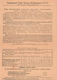
réf. P6364Moscow: Tip. "Sovremennaia kul'tura" 1928. Single leaf printed to recto with partial text to lower verso once folded measuring 35 × 21 cm. Very good. This prospectus addressed to heads of public educational institutions and educational inspectors announces the new subscription year of two chief publications of the League of Militant Atheists a volunteer based organization that served as the spearhead of Soviet anti-religious activism. Founded in 1925 the organization counted three million members by 1940. The League held educational congresses and workshops at schools factories and in the countryside published periodicals such as Bezbozhnik and Antireligioznik. Its activities also enabled the persecution and exile of clergy and religious communities by the Soviet government throughout the 1920s and 1930s. The sternly worded memo notes that despite a number of recent educational decrees many educational institutions still do not subscribe to the publications "which causes a disruption of anti-religious work" and advises that all educational institutions comply with the new directives. The memo is signed by the head of the organizational division of the union one Oleshchuk. Fedor Nesterovich Oleshchuk himself a son of a priest joined the party in 1921 and headed the committee for many years. The memo also provides all relevant subscription information. unknown
réf. 332102 pages in8 - bon état -
1996réf. 73801996 Mémoire de Maitrise d'histoire année universitaire 1996-1997 Université Paris IV la sorbonne IN4 broché 267 pages très nombreuses illustrations
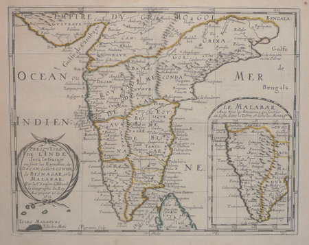
réf. 14036India & South East Asia, Paris, 1654 -1679, copperplate, Original o/l colour. 52.5 x 38cms [21 x 15ins] A good map of peninsula India, Ceylon and Southeast Asia including Sumatra and present-day Singapore from Nicolas Sanson's "Cartes Generales ...". Sanson was the major French mapmaker of the period and produced a number of important maps from information supplied by travellers and missionaries. This map marks an advance on those being produced in Amsterdam based on details from the 1620s and 30s.
1862réf. 26951Paris Du Pray De La Mahérie et Cie 1862 Forts In-8 6 tomes en 3 volumes , 432-437 + 481-451 + 417-544 pp, un ff de table par tome non chiffré
réf. 5102Paris, Librairie agricole de la maison rustique, 1877-82. 4 vol. in-12, demi-reliure.
réf. 3251Americas: Amsterdam Francois Halma 1705. Copper engraved map of Chili by N. Sanson from Halma's Algemeene Werelde Beschryving Vol. 3 Black and white; title in Dutch; verso blank; strapwork title cartouche. Small version of Sanson's important map of Chili showing the Cuyo provinces. The map is based on the descriptions of Alfonso de Ovalle. This map appeared in Algemeene Weereld-Beschryving nae de Rechte Verdeeling der Landschappen Plaetsen Zeeën Rivieren &c. Geographisch Politisch Historisch Chronologisch en Genealogisch a Dutch edition of A. Phérotée de la Croix's Nouvelle Methode Pour Apprendre Facilement la Geographie Universelle which first appeared in 1690. Dark impression. Nicolas Sanson d'Abbeville.1600-67 ' father of the French cartography' and founder of the Sanson firm. Atlas ' Cartes générales de toutes les parties du Monde' 1658-70 and a pocket atlas in 4 parts 1652-1705. Sanson's small maps from A. Phérotée de la Croix's Nouvelle Methode Pour Apprendre Facilement la Geographie Universelle. first published in 1652 and engraved by A. Peyrounin were copied several times by various map publishers. Johann David Zunners made copies of Sanson's maps for his German translation of Die Gantze Erd-Kugel in 1679. Johannes Ribbius and Simon de Vries published copies in 1682 and 1683 with new maps engraved by Antoine d'Winter. The plates were later sold to Francois Halma who used them in 1699 and then again in 1705 with the titles re-engraved in Dutch. François Halma 1653 - 1722 Dutch publisher/printer; dealer/auction house. Cartographer and publisher of maps active in Utrecht Amsterdam Franeker and Leeuwarden. Published 'Description de l'Univers' 1700; 'Algemene Wereldtbescrijving' 1705; 'Corpus Inscriptionum' 1707 and 'Lexicon Philosophicum' 1713. Keoman: Hal 1; Phillips 528. Americas South America Chili Amsterdam Francois Halma 1705 unknown
réf. 3247Americas: Amsterdam Francois Halma 1705. Copper engraved map of Guyana by N. Sanson from Halma's Algemeene Werelde Beschryving Vol. 3 Black and white; title in Dutch; verso blank; strapwork title cartouche. The map shows a large lake or inland sea Lac ou Mer que les Caribes appellent Parime les Iaoyi Roponowini. and located on its shores the mythical city of El Dorado or Manoa. Lake Parime or Lake Parima is a legendary lake located in South America. It was reputedly the location of the fabled city of El Dorado also known as Manoa much sought-after by European explorers. Repeated attempts to find the lake failed to confirm its existence and it was dismissed as a myth along with the city. The search for Lake Parime led explorers to map the rivers and other features of southern Venezuela northern Brazil and southwestern Guyana before the lake's existence was definitively disproved in the early 19th century. Some explorers proposed that the seasonal flooding of the Rupununi savannah may have been misidentified as a lake. Recent geological investigations suggest that a lake may have existed in northern Brazil but that it dried up some time in the 18th century. Both "Manoa" Arawak language and "Parime" Carib language are believed to mean "big lake". This map appeared in Algemeene Weereld-Beschryving nae de Rechte Verdeeling der Landschappen Plaetsen Zeeën Rivieren &c. Geographisch Politisch Historisch Chronologisch en Genealogisch a Dutch edition of A. Phérotée de la Croix's Nouvelle Methode Pour Apprendre Facilement la Geographie Universelle which first appeared in 1690. Dark impression. Nicolas Sanson d'Abbeville.1600-67 ' father of the French cartography' and founder of the Sanson firm. Atlas ' Cartes générales de toutes les parties du Monde' 1658-70 and a pocket atlas in 4 parts 1652-1705. Sanson's small maps from A. Phérotée de la Croix's Nouvelle Methode Pour Apprendre Facilement la Geographie Universelle. first published in 1652 and engraved by A. Peyrounin were copied several times by various map publishers. Johann David Zunners made copies of Sanson's maps for his German translation of Die Gantze Erd-Kugel in 1679. Johannes Ribbius and Simon de Vries published copies in 1682 and 1683 with new maps engraved by Antoine d'Winter. The plates were later sold to Francois Halma who used them in 1699 and then again in 1705 with the titles re-engraved in Dutch. François Halma 1653 - 1722 Dutch publisher/printer; dealer/auction house. Cartographer and publisher of maps active in Utrecht Amsterdam Franeker and Leeuwarden. Published 'Description de l'Univers' 1700; 'Algemene Wereldtbescrijving' 1705; 'Corpus Inscriptionum' 1707 and 'Lexicon Philosophicum' 1713. Keoman: Hal 1; Phillips 528. Americas South America Guyana Guiana Amsterdam Francois Halma 1705 unknown
réf. 3250Americas: Amsterdam Francois Halma 1705. Copper engraved map of Paraguayby N. Sanson from Halma's Algemeene Werelde Beschryving Vol. 3 Black and white; title in Dutch; verso blank; strapwork title cartouche. The map shows the region of present day Paraguay Uruguay northern Argentina and southern Brazil. The Rio de la Plata is the main feature of the map along with the mountains and volcanoes of the Cordillera de los Andes. Engraved by Antoine de Winter. This map appeared in Algemeene Weereld-Beschryving nae de Rechte Verdeeling der Landschappen Plaetsen Zeeën Rivieren &c. Geographisch Politisch Historisch Chronologisch en Genealogisch a Dutch edition of A. Phérotée de la Croix's Nouvelle Methode Pour Apprendre Facilement la Geographie Universelle which first appeared in 1690. Dark impression; minor dampstain at top of centre fold. Nicolas Sanson d'Abbeville.1600-67 ' father of the French cartography' and founder of the Sanson firm. Atlas ' Cartes générales de toutes les parties du Monde' 1658-70 and a pocket atlas in 4 parts 1652-1705. Sanson's small maps from A. Phérotée de la Croix's Nouvelle Methode Pour Apprendre Facilement la Geographie Universelle. first published in 1652 and engraved by A. Peyrounin were copied several times by various map publishers. Johann David Zunners made copies of Sanson's maps for his German translation of Die Gantze Erd-Kugel in 1679. Johannes Ribbius and Simon de Vries published copies in 1682 and 1683 with new maps engraved by Antoine d'Winter. The plates were later sold to Francois Halma who used them in 1699 and then again in 1705 with the titles re-engraved in Dutch. François Halma 1653 - 1722 Dutch publisher/printer; dealer/auction house. Cartographer and publisher of maps active in Utrecht Amsterdam Franeker and Leeuwarden. Published 'Description de l'Univers' 1700; 'Algemene Wereldtbescrijving' 1705; 'Corpus Inscriptionum' 1707 and 'Lexicon Philosophicum' 1713. Keoman: Hal 1; Phillips 528. Americas South America Paraguay Uraguay Amsterdam Francois Halma 1705 unknown
réf. 3252Americas: Amsterdam Francois Halma 1705. Copper engraved map of Peru by N. Sanson from Halma's Algemeene Werelde Beschryving Vol. 3 Black and white; title in Dutch; verso blank; strapwork title cartouche. The map shows the western part of the continent and the full course of the Amazon. The spurious Lac ou Mer de Parime is prominent as is the location of the mythical city Manoa el Dorado. This map appeared in Algemeene Weereld-Beschryving nae de Rechte Verdeeling der Landschappen Plaetsen Zeeën Rivieren &c. Geographisch Politisch Historisch Chronologisch en Genealogisch a Dutch edition of A. Phérotée de la Croix's Nouvelle Methode Pour Apprendre Facilement la Geographie Universelle which first appeared in 1690. Dark impression. Upper margin short cut to plate mark. Nicolas Sanson d'Abbeville.1600-67 ' father of the French cartography' and founder of the Sanson firm. Atlas ' Cartes générales de toutes les parties du Monde' 1658-70 and a pocket atlas in 4 parts 1652-1705. Sanson's small maps from A. Phérotée de la Croix's Nouvelle Methode Pour Apprendre Facilement la Geographie Universelle. first published in 1652 and engraved by A. Peyrounin were copied several times by various map publishers. Johann David Zunners made copies of Sanson's maps for his German translation of Die Gantze Erd-Kugel in 1679. Johannes Ribbius and Simon de Vries published copies in 1682 and 1683 with new maps engraved by Antoine d'Winter. The plates were later sold to Francois Halma who used them in 1699 and then again in 1705 with the titles re-engraved in Dutch. François Halma 1653 - 1722 Dutch publisher/printer; dealer/auction house. Cartographer and publisher of maps active in Utrecht Amsterdam Franeker and Leeuwarden. Published 'Description de l'Univers' 1700; 'Algemene Wereldtbescrijving' 1705; 'Corpus Inscriptionum' 1707 and 'Lexicon Philosophicum' 1713. Halma acquired many of the plates for Algemeene Weereld-Beschryving from Joannes Ribbius who had enlisted the services of engraver Antoine de Winter to make copies of the maps in Nicolas Sanson's quarto atlases of the four continents. De Winter made very few geographical changes and maintained the attribution to Sanson on the newly engraved plates. Halma supplemented the Sanson maps with about a dozen new maps engraved in the same style as Sanson's without any attribution on the maps as well as 23 panoramic views of famous cities around the world. Keoman: Hal 1; Phillips 528. Americas South America Peru Amsterdam Francois Halma 1705 unknown
réf. 3248Americas: Amsterdam Francois Halma 1705. Copper engraved map of Colombia Venezuela and Panama by N. Sanson from Halma's Algemeene Werelde Beschryving Vol. 3 Black and white; title in Dutch; verso blank; strapwork title cartouche. The map shows the Isthmus of Panama and North Western South America including most of present day Columbia and part of Venezuela. Regional boundaries are shown along with missions towns major rivers and mountains. The mythical Lage de Parime with the fabled city of Manoa del Dorado is shown at bottom right. This map appeared in Algemeene Weereld-Beschryving nae de Rechte Verdeeling der Landschappen Plaetsen Zeeën Rivieren &c. Geographisch Politisch Historisch Chronologisch en Genealogisch a Dutch edition of A. Phérotée de la Croix's Nouvelle Methode Pour Apprendre Facilement la Geographie Universelle which first appeared in 1690. Dark impression. Nicolas Sanson d'Abbeville.1600-67 ' father of the French cartography' and founder of the Sanson firm. Atlas ' Cartes générales de toutes les parties du Monde' 1658-70 and a pocket atlas in 4 parts 1652-1705. Sanson's small maps from A. Phérotée de la Croix's Nouvelle Methode Pour Apprendre Facilement la Geographie Universelle. first published in 1652 and engraved by A. Peyrounin were copied several times by various map publishers. Johann David Zunners made copies of Sanson's maps for his German translation of Die Gantze Erd-Kugel in 1679. Johannes Ribbius and Simon de Vries published copies in 1682 and 1683 with new maps engraved by Antoine d'Winter. The plates were later sold to Francois Halma who used them in 1699 and then again in 1705 with the titles re-engraved in Dutch. François Halma 1653 - 1722 Dutch publisher/printer; dealer/auction house. Cartographer and publisher of maps active in Utrecht Amsterdam Franeker and Leeuwarden. Published 'Description de l'Univers' 1700; 'Algemene Wereldtbescrijving' 1705; 'Corpus Inscriptionum' 1707 and 'Lexicon Philosophicum' 1713. Keoman: Hal 1; Phillips 528. Americas South America Colombia Venezuela Amsterdam Francois Halma 1705 unknown
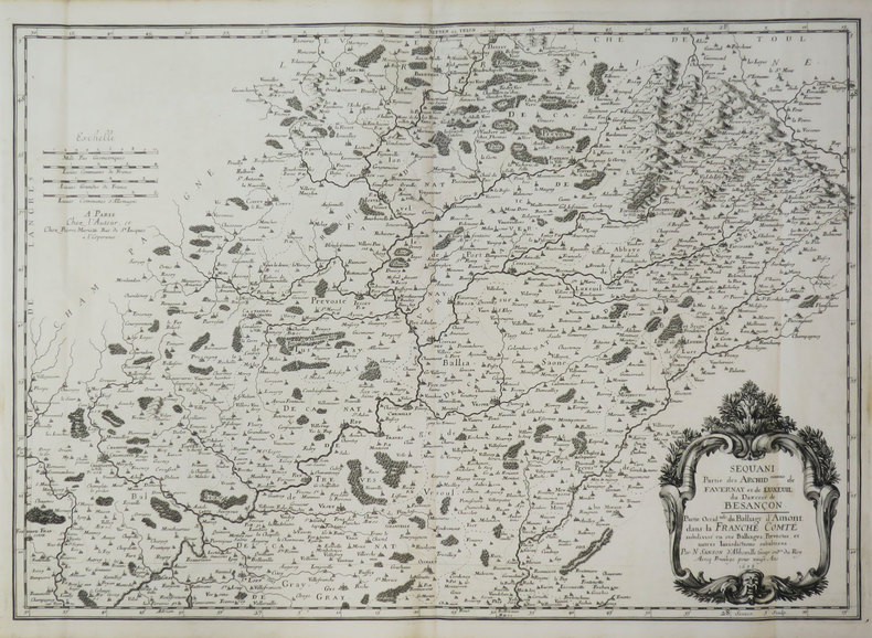
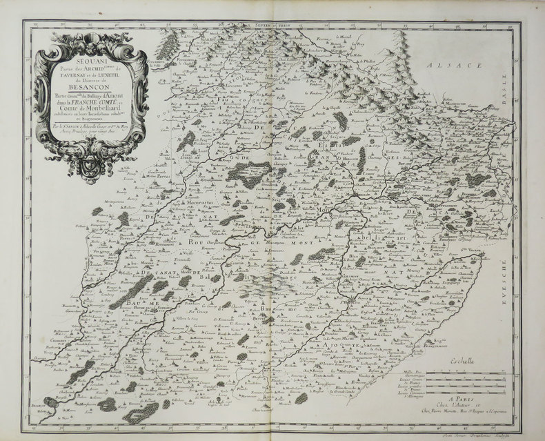
1660réf. LBW-3667Paris, P. Mariette, 1660. 354 x 555 mm.
1656réf. LBW-5321Paris, chez l'auteur, 1656. 420 x 552 mm.
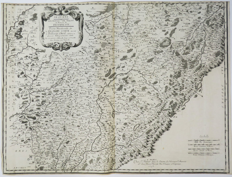
1658réf. LBW-3648Paris, chez l'auteur, 1658. 427 x 565 mm.
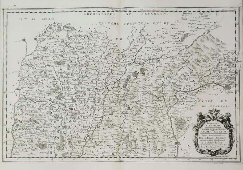
1658réf. LBW-3419Paris, chez l'auteur, 1658. 397 x 560 mm.
1658réf. LBW-3669Paris, chez l'auteur, 1658. 396 x 483 mm.
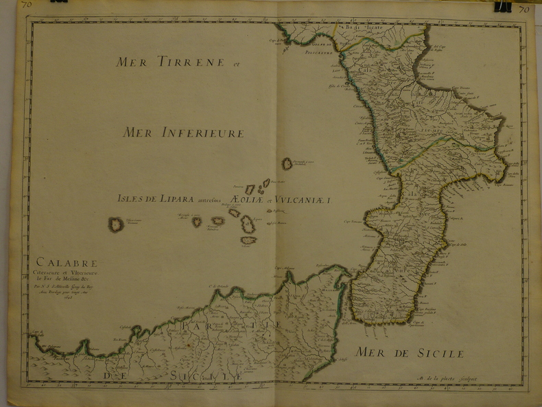
1648réf. LBW-9691648 409 x 558 mm.
1657réf. LBW0418dParis chez l'autheur 1657 191 x 253 mm.
1652réf. LBW041971652 192 x 243 mm.