SANSON, NicolasBiblio.com

4.086 Ergebnisse
1700Best.-Nr. 54022Nicolas Bion: L'Usage des Globes. Amsterdam: Francois Halma. 1700. Attractive map of north eastern Africa including Egypt and northern Libya. Much of the charm of early maps of Africa lies in how they show the interior of the continent which was not explored until the 19th century. Maps by Sanson in original colour are rare. Nicolas Sanson was founder of the French school of mapmakers at a time when the leadership in European cartography passed from the Low Countries to France. This map was published in Brion's treatise on globes. Nicolas Brion was a famous French mathematical and scientific instrument maker. Copper engraving. Very good condition. Darkened edges to margins. Faint inkstamp on right margin not affecting map. Original colour. Size: 27 x 17 cm. 10½ x 6½ inches. unknown
1953Best.-Nr. ZB691256Paris: Presses Universitaires de France 1953. 366 pp. rebound in buckram hardcover ex library else text and binding clean and tight. - If you are reading this this item is actually physically in our stock and ready for shipment once ordered. We are not bookjackers. Buyer is responsible for any additional duties taxes or fees required by recipient's country. Paris: Presses Universitaires de France hardcover
1680Best.-Nr. 024707London: William Berry 1680. .Kingdoms and States which are found there at present/Described by Sanson/Corrected and amended By William Berry =Kopftitel; Text der figürlich reich verzierten Kartusche oben rechts: Asia Divided into its Principall Regions in which may be seen the extent of the Empires Monarchies Kingdoms and States which at present divide Asia/To the Most serene and Most Sacred Majesty of Charles II./By the Grace of God King of Great Britain France and Ireland/This Map of Asia is humbly Dedicated and Presented By Your Majesties Loyal Subject and Servand William Berry; Text der reich verzierten Kartusche links oben: Scale es folgen Maßstäbe verschiedener Länder/London/Sold by William Berry at the Sign of the Globe between Charing-Cross and White-Hall/1680; SW-Kupferstich-Landkarte nach Nicolas Sanson d'Abbeville gestochen von William Berry; ca. 51 x 39 cm; Falzspuren einige Tintenflecken hauptsächlich ausserhalb des Druckbildes mässige Lichtverfärbung; professionell hinter Glas gerahmt in schwarzem Holzrahmen; äußerst selten; for description in other languages of this extremely rare map please don't hesitate to contact me. . Gut. Landkarte. William Berry unknown
1974Best.-Nr. ZB504791Heinemann Medical 1974. 109 pp. hardcover ex library else text clean & binding tight. - If you are reading this this item is actually physically in our stock and ready for shipment once ordered. We are not bookjackers. Buyer is responsible for any additional duties taxes or fees required by recipient's country. Heinemann Medical hardcover
2003Best.-Nr. 374680Woodstock VT: Countryman Press 2003. hardcover. very good/very good. 8vo large. pp.219. Countryman Press hardcover
1980Best.-Nr. mon0000190832Longman Publishing Group 1980-01T. paperback. Good. in x in x in. Clean text solid binding. Ex-library with usual flaws. We are a small business and are slowly adding photos and more information for this listing for our new website. Please email for photos. Longman Publishing Group paperback
1980Best.-Nr. 163476Warminster: Aris & Phillips 1980. 1st edition. Nice copy. small folio. hardback with dust jacket ix 144pp. b/w plates text ills. bibliog. indexes Detailed illustrated catalogue of statues statuettes reliefs inlays and other objects collected by Flinders Petrie from Tell el-Amarna the ancient Egyptian city of Akhenaten Aris & Phillips hardcover
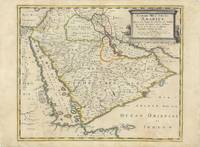
Best.-Nr. 62978Paris Chez Pierre Mariette 1654. Original copper-engraved map of the Arabian Peninsula 43.5 x 59 cm with contemporary outline colour refreshed and adorned with a large columnar style title cartouche. A dark impression. Paper has been washed and strengthened due to foxing. Rare map of the Arabian Peninsula first published in 1654 and one of the first large maps focused specifically on the Arabian Peninsula. Sanson's map of the Arabian Peninsula continued to influence maps of the region throughout the latter part of the 17th century. Here Arabia is divided into three regions: Arabia Petraea the northwestern area encompassing the Sinai Peninsula and Jordan Arabia Deserta the northernmost area just south of the Tigris and Euphrates rivers and Arabia Felix by far the largest territory covering most of the peninsula and extending from the holy cities of Mecca and Medina in the northwest to the coasts of the Arabian Sea and the Gulf of Oman. There is great detail of mountains and rivers although there are clear geographical errors such as the exaggerated extent of the mountain ranges. Numerous villages are depicted including stopping places on the pilgrimage to Mecca Iathreb Badrahenen Gioffa and Cadaid among others as well as towns that appeared for the first time on a map of Arabia Hagair Hadrama Salamia and Iamama. Bahrain is demarcated along the northwestern shore of the Arabian Gulf. Nicolas Sanson was to bring about the rise of French cartography although the fierce competition of the Dutch would last until the end of the century. His success was partly owing to the partnership with the publisher Pierre Mariette. In 1644 the latter had purchased the business of Melchior Tavernier and helped Sanson with financial support in producing the maps. In 1657 Pierre Marriette died however his son also named Pierre co-published Les Cartes Générales de toutes les parties du Monde the following year. It was the first folio French produced world atlas. Tibbetts 98; Ankary p.98 Paris, Chez Pierre Mariette, 1654. unknown
Best.-Nr. B9783985540983Hardback. New. hardcover
Best.-Nr. B9786208119553Paperback / softback. New. paperback
Best.-Nr. 42486Limoges typographie de J. B. Chatras 1861. 20 pages. 21x135 Cm. Couverture muette de l'époque. Trace de pli. Petits accrocs. Rarissime mémoire provincial exposant les avantages de l'ophtalmoscope dans l'établissement du diagnostic de certaines affections oculaires. L'auteur décrit longuement le principe du nouvel instrument et les maladies que l'examen ophtalmoscopique peut déceler. Rousseurs et quelques taches. Bon exemplaire. Traces de plis. Limoges, typographie de J. B. Chatras, 1861. unknown
Best.-Nr. A9781803551593Hardback. New. hardcover
Best.-Nr. A9780313353260Hardback. New. This hard-hitting analysis of the U.S. missile defense program explains the system's limitations and argues that it is not nearly as effective as Americans have been led to believe. hardcover
Best.-Nr. B9781793649263Paperback / softback. New. paperback
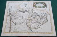
1668Best.-Nr. 014632Paris: Cartes Generales de Toutes les Parties du Monde. 1668. Hand coloured. Map measures 55x40.cm plus margin. Some light surface wear or dust marking. Map in good condition. Boldly engraved map of the region of present day Paraguay Uruguay northern Argentina and parts of Chile and Brazil. The Rio de la Plata is the main feature of the map which extends north to the mythical Lago de los Xarayes. The mountains and volcanoes of the Cordillera de los Andes are also prominently shown. There is good detail of topography missions and villages. The decorative title cartouche is adorned with two female figures fruit and flowers. Very Good. Cartes Generales de Toutes les Parties du Monde.. unknown
Best.-Nr. ria9781788314442_inpPaperback. New. New Book; Fast Shipping from UK; Not signed; Not First Edition; The vast military campaigns in Africa during World War I were among the most ambitious of the Great War. Many histories however have regarded these campaigns as side-shows to the war on the Western Front. World War One in Africa looks paperback
Best.-Nr. A9781682857274Hardback. New. hardcover
Best.-Nr. B9781943444205Hardback. New. hardcover
Best.-Nr. B9783337233051Paperback / softback. New. paperback
Best.-Nr. B9783030570453Hardback. New. This book investigates desert islands in postwar anglophone popular culture exploring representations in radio print and screen advertising magazine cartoons cinema video games and comedy drama and reality television. hardcover
Best.-Nr. B9783540539810Paperback / softback. New. The proceedings of TAPSOFT '91 are organized into three parts: - Advances in Distributed Computing ADC - Colloquium on Trees in Algebra and Programming CAAP - Colloquium on Combining Paradigms for Software Development CCPSD The proceedings are published in two volumes. paperback
Best.-Nr. B9783540539827Paperback / softback. New. - Application of discrete structures in computer science: syntax and semantics of programming languages operational semantics logic programming algorithms and data structures complexity of algorithms and implementation aspects proof techniques for nonnumerical algorithms formal specifications and visualization of structured objects. paperback
Best.-Nr. B9781516536177Paperback / softback. New. Examines the full range of challenges that social workers around the world are called to address including forced migration environmental justice human trafficking and more. This text bridges the gap between community-based social work and global systems encouraging students and practitioners to broaden their perspectives. paperback
Best.-Nr. A9780415881661Paperback / softback. New. paperback
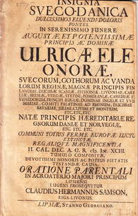
Best.-Nr. 107610Leipzig Stanno Georgiano 1693. Folio. 28 s. Hårt skuren titelbladet med delförlust av bokstäver. Arket med ”Ad orationem parentalum” löst. Tagen ur band. Delvis bortskuren namnteckning på titelbladet. VD17 1:033780V. Warmholtz 6601 som anger 1694 som tryckår. Med tryckt dedikation till änklingen Karl XI. Claudius Hermann Samson 1670-1737 var son till borgmästaren i Riga Hermann Samson. Han studerade i Leipzig och blev 1697 assessor och slutligen hovrättsassessor i Riga. Hans litterära produktion består av dels denna parentation vid Ulrika Eleonoras begravning och dels av två hyllningar vid hennes död en på tyska och en på tyska samt parentationer till två andra personer. Ulrika Eleonora d.ä. 1656-93 från Danmark var gift med Karl XI och var svensk drottning från 1680 till sin död. Hon dog på Karlberg 26 juli 1693. unknown