Aigbe Osalumese SamsonBiblio.com

4.086 Ergebnisse
Best.-Nr. B9781796034264Paperback / softback. New. paperback
Best.-Nr. B9783639265651Paperback / softback. New. paperback
Best.-Nr. B9783030933791Paperback / softback. New. This book deals with existing technologies of solar energy conversion as well as novel methods under consideration in academic and commercial R&D sites. paperback
Best.-Nr. B9783656274902Paperback / softback. New. paperback
Best.-Nr. B9783659758836Paperback. New. paperback
Best.-Nr. B9783659374692Paperback / softback. New. paperback
Best.-Nr. B9783659759802Paperback. New. paperback
Best.-Nr. B9782869785885Paperback / softback. New. paperback
Best.-Nr. B9783961102136Hardback. New. hardcover
Best.-Nr. B9783845438108Paperback / softback. New. paperback
Best.-Nr. B9781855661684Hardback. New. An assessment of the life work and reputation of Spain's leading Golden Age dramatist hardcover
Best.-Nr. B9781943444212Hardback. New. hardcover
Best.-Nr. B9781788314442Paperback / softback. New. paperback
Best.-Nr. 0752401033.Ghardcover. Good. Access codes and supplements are not guaranteed with used items. May be an ex-library book. hardcover
Best.-Nr. B9780367397968Paperback / softback. New. paperback
Best.-Nr. B9781494090326Paperback / softback. New. paperback
Best.-Nr. B9781636482354Paperback / softback. New. paperback
1700Best.-Nr. 17404CB1700. Amsterdam Mortier about 1700. Octav. 56 pages; 16 pages index. With 12 maps. 10 detailled maps and 2 overview maps all with contemporary coloured frontier lines and an engraved mileage scale. Contemporary marbled cardboard. A bit waterstained. The spine has been restored professionally. Private stamp on title otherwise fine and complete. Rare pocket atlas ! Published by Mortier 1661-1711 who published major atlases and maps mostly of French cartographers. This atlas was important for the French troops / Bourbone regime who attacked Northern Italy after 1700. unknown
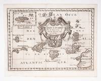
Best.-Nr. 53608c.1700. Original engraved map 19 x26.5 cm. overall sheet size 22 x 29 cm. of the Canaries with inset of Madeira. Central vertical fold. [c.1700] unknown
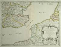
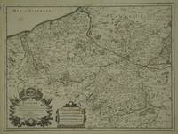
Best.-Nr. 28812Paris: Sanson. 1654. 36.6 x 48 cm. Original outline colour. Double page map of the south east England shown with the adjacent coastline of France and Belgium. Title cartouche to lower right corner. Blank on verso. Wear to centrefold with some loss Paris: (Sanson). 1654 unknown
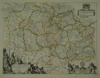
Best.-Nr. 28798Paris: Pierre Mariette. c. 1658. 37.4 x 49.5 cm. Original outline colour. Double page map of Maine northern France. Title cartouche to lower left corner dedication cartouche to Christophe de Justel to upper right corner with the coat of arms of his family. Blank on verso. Small tears without loss to left and lower margins. Light stains to lower margin otherwise in good condition. Paris: Pierre Mariette. [c. 1658] unknown
Best.-Nr. 30600Paris: Jaillot. 1689. 43.1 x 57 cm. Original outline colour. Single page folio map of southern Flanders and Artois. Blank on verso. Small tear without loss at upper edge just touching image. Small section of upper margin missing though not affecting map. Small brown spot to centre of lower edge. Paris: Jaillot. 1689 unknown
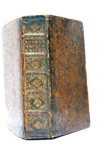
Best.-Nr. 48297Paris Lutetiae Parisiorum Sumptibus et Impensis Autoris 1647. 3 ouvrages en 1 volume. 1. 2 feuillets blancs. 8 feuillets. 246 pages. 2. 13 feuillets. 283 pages. 3. 2 feuillets blancs. Page de titre. Carte gravée. 11 feuillets. 2 feuillets blancs. 15x9 Cm. Plein veau de l'époque. Dos à nerfs orné et doré un peu frotté. Pièce de titre doré. Charnières fendues. Petits accidents aux coiffes. Rousseurs et quelques taches. Les deux premiers ouvrages sont des critiques très rares du "Pharum Gallia Antiquae" de Philippe Labbé que Sanson rectifie sur plusieurs points. À la suite on trouve une courte description de la Judée accompagnée d'une belle carte dépliante. Bon exemplaire comportant l'exlibris gravé d'Henri Liébaux. Paris, Lutetiae Parisiorum Sumptibus et Impensis Autoris, 1647. unknown
Best.-Nr. 73602Paris Pierrr Mariette 1656/ca. 1950. 13 x 17.5 cm 26 x 30 cm Rahmen vergoldet unter Passepartout Min. gebrauchspurig sonst tadell. Handkolorierte Faksimile. - Nicolas Sanson der Ältere auch: Nicolas Sanson d’Abbeville 1600 in Abbeville Frankreich- 1667 in Paris französischer Kartograph. Er gilt als der Vater der Geographie in Frankreich.In den Jahren 1618 bis 1667 schuf Sanson etwa 300 einzelne Karten sowie Atlanten und illustrierte Texte. Er wurde zum Geographe Ordinaire du Roy königlicher Kartenmacher ernannt und unterrichtete die Könige Ludwig XIII. und Ludwig XIV. in Geographie. 010 Paris, Pierrr Mariette, 1656/ca. 1950 unknown
Best.-Nr. 52827Paris Editions d’art les heures Claires ca.1950. Gr.8° 24 lose Bl. Bütten 12 pointes sèches Orig.- Radierungen handkoloriert in Mappe in Schuber Lose Bl. in Kart.-Hülle in Schuber Mappe und Schuber gebräunt innen tadell. Hübsches bibliophiles Werk über den Geburtsort der modernen Kunst. André Warnod 1885 -1960 franz. Schriftsteller Kunstkritiker und Zeichner. 010 Paris, Editions d’art les heures Claires, ca.1950 unknown