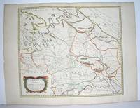
1666rif. M1204Paris: Mariette Pierre 1666. Very Good. Size : 410x555 mm 16.125x21.875 Inches Coloring: Hand Colored Reference: Mojski Piotr Maria "Cartographia Rappersviliana Polonorum" page 388 number 32; Category: ; Maps Europe Poland Lithuania Mariette, Pierre unknown
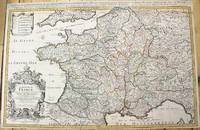
1760rif. M7988Paris: Sr. Delamarche c.1760. Very Good. Notes: Engraved by Delahaye. Large scale attractive map of France. Size : 493x668 mm 19.41x26.30 Inches Coloring: Original Hand Coloring Category: Maps Europe France; Sr. Delamarche unknown
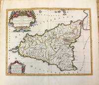
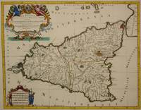
1692rif. M7516Paris: Hubert Jaillot c. 1692. Very Good. Notes: Title cartouche in upper left features Sicilian coat of arms winged angels and merpeople while the scale in the lower left is held on each side by allegorical figures of labour and harvest. Mount Etna is represented pictorially. Size : 418x530 mm 16.46x20.87 Inches Coloring: Hand Colored in Outline Category: Maps Mediterranean Islands; Hubert Jaillot unknown
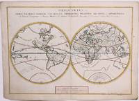
1657rif. M8883Paris 1657 . Very Good. Notes: A handsome 17th century map of the known world typifying Sanson's scientific style of cartography. Embodying the most up to date information of the period Sanson's map depicts California as an island with Antarctica and Australia still largely unknown. A land bridge connects Asia to North America and touches Japan. A very accurate map for the period. Nicolas Sanson 1600–1667 was a French cartographer termed by some the creator of French geography in which he's been called the "father of French cartography." Size : 380x537 mm 14.96x21.14 Inches Coloring: Original Hand Coloring Reference: Shirley R.W. World 400; Pastoureau M. Sanson V A 98. Category: Maps World; unknown
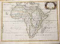
1650rif. M6678Paris: Pierre Mariette c. 1650. Very Good;. Notes: Title cartouche bordered by two outward-facing birds of prey. Norwich writes: "This is an early Sanson map. An odd feature is the name Barditus Mons given to a long chain of mountains running continuously from somewhere in Angolato Algoa Bay. No place names appear even on the coast of the southern part of the continent which is labelled 'Agi Symba' a name usually referring to the northern African region and inhabitants are 'Anthropophagi Aethiopes' or cannibals." Size : 396x553 mm 15.59x21.77 Inches Coloring: Hand Colored Reference: Norwich's Map 35. Category: Maps Africa Continent; Pierre Mariette unknown
1656rif. B2984Paris: Nicolas Sanson c. 1656. Lower right corner of the first eight leaves strengthened otherwise a very good copy maps and text are clean and crisp. In protective cloth slipcase. Edition: First edition. Binding: Full contemporary calf expertly rebacked with spine in six compartments of raised bands and finely-gilt motifs morocco label on two edges speckled red. Notes: This atlas was dedicated to the Superintendent of Finances at the time Nicolas Fouquet. Regarding a map of South and Central Africa published the year before which bears resemblance to this map of South Africa--‘Pays et Costes des Caffres’--in particular Norwich writes: “This map although a fine example of cartography is based on very little information; for example the desert-like coast of South West Africa is presented as a land rich in rivers. The fictitious states are given fictitious boundaries and the interior is marked with large cities such as Vigiti Magna and Monomotapa. This information led to subsequent exploration in search of these fabulous cities. Although the map is dated three years after the foundation of a settlement at the Cape by Jan van Riebeeck no mention is made of any European settlement anywhere in the south.” Size: 4to Illustration: Recent stencilled title. Complete with 18 maps of Africa and its territories in original outline colour. References: Tooley IV:103; Tooley Africa 100 Peyrounin edition; Norwich 37 & 158. Pages: P. 1-96. Category: Book Africa General; Book Atlas & Cartography Nicolas Sanson hardcover
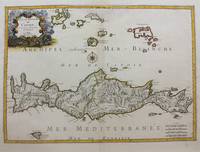
1658rif. M9417Paris: Nicolas Sanson c.1658. Very Good upper fold area expertly repaired. Notes: A fine map of Crete from the mid 17th century. The map also shows nearby islands such as Santorini Stampalia and Milo. The map has a decorative cartouche and details cities borders and geographical features. Size : 394x553 mm 15.51x21.77 Inches Coloring: Hand Colored Category: Maps Europe Greece Macedonia; Nicolas Sanson unknown
1654rif. M2853Paris 1654. Excellent. Size : 415x483 mm 16.375x19 Inches Coloring: Original Outline Coloring Category: Maps Russia unknown
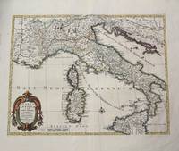
1702rif. M10242Amsterdam: Jean Covens & Corneille Mortier c.1702. Very Good. Size : 420x528 mm 16.54x20.79 Inches Coloring: Hand Colored Category: Maps Europe Italy; Maps Mediterranean Islands; Jean Covens & Corneille Mortier unknown
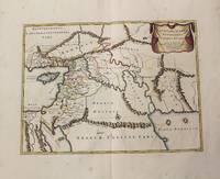
1710rif. M10250Amsterdam: Jean Covens & Corneille Mortier c.1710. Very Good. Size : 370x493 mm 14.57x19.41 Inches Coloring: Original Hand Coloring Category: Maps Asia Middle East Holy Land & Palestine; Maps Asia Middle East Iran Iraq; Jean Covens & Corneille Mortier unknown
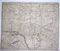
1690rif. M2919Amsterdam 1690. Good; fold reinforced. Size : 480x596 mm 18.875x23.5 Inches Coloring: Black & White Category: ; Maps Europe Hungary; Maps Europe Poland Lithuania unknown
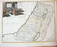
1660rif. M7049Paris 1660. Very Good;. Notes: French map of the Holy Land with a decorative cartouche. Nicolas Sanson 1600–1667 was a renowned French cartographer termed by some as the "father of French cartography." His works are known for their incorporation of the most up to date information of the time and their clean modern style. Size : 385x485 mm 15.16x19.09 Inches Coloring: Hand Colored Category: Maps Asia Middle East Holy Land & Palestine; unknown
1696rif. M10189Amsterdam: Covens & Mortier c.1696. Very Good. Size : 420x540 mm 16.54x21.26 Inches Coloring: Hand Colored Category: Maps Mediterranean Islands; Covens & Mortier unknown
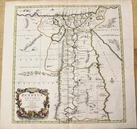
1696rif. M10206Amsterdam: Covens & Mortier c.1696. Very Good. Size : 485x450 mm 19.09x17.72 Inches Coloring: Hand Colored Category: Maps Africa North Egypt; Covens & Mortier unknown
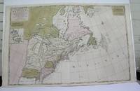
1698rif. M3704Paris 1698. Excellent. Notes: Rather rare original coloured version of this map an important 17th century map of the Great Lakes and East coast with an inset map of Boston. Cumming qtd in Arkway: "in spite of its scope and size it has a good deal of information for the Carolina Coast". This map by Sanson first appeared in Mortier's sea atlas "Le Neptune Francois"; interestingly it is not generally found in Sanson or Jaillot atlases. Size : 650x924 mm 25.625x36.375 Inches Coloring: Original Hand Coloring Reference: Arkway 58:23 Category: Maps Canada East; Maps United States New England unknown
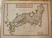
1656rif. M8114Paris c.1656. Very Good. Size : 375x521 mm 14.76x20.51 Inches Coloring: Original Hand Coloring Category: Maps Asia Far East Japan & Korea; unknown
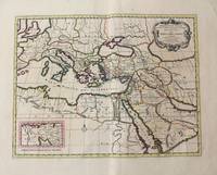
1710rif. M10321Amsterdam: Jean Covens & Corneille Mortier c.1710. Very Good. Size : 402x520 mm 15.83x20.47 Inches Coloring: Original Hand Coloring Category: Maps Mediterranean Sea; Maps Asia Middle East; Jean Covens & Corneille Mortier unknown
1690rif. M10380Paris: H. Jaillot c.1690. Very Good backed on acid free tissue paper for long term preservation. Notes: Large and detailed map of France with a large decorative cartouche in the lower left two sheets joined. Size : 565x896 mm 22.24x35.28 Inches Coloring: Original Outline Coloring Category: Maps Europe France; H. Jaillot unknown
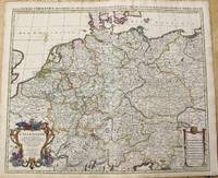
1700rif. M7994Paris c. 1700. Very Good. Notes: Engraved by Cordier. A map of Central Germany. Frankfurt appears at the south-center of the map. Size : 457x648 mm 17.99x25.51 Inches Coloring: Original Hand Coloring Category: Maps Europe Germany; unknown
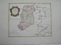
1778rif. M3768Paris 1778. Excellent. Size : 405x501 mm 15.875x19.75 Inches Coloring: Hand Colored Category: ; Maps Europe Ireland unknown
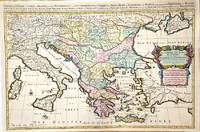
1720rif. M8856Amsterdam: Pierre Mortier 1720. Very Good. Notes: A fine large scale map of Mediterranean Sea Italy Greece Eastern Europe Turkey. The map depicts the Ottoman Empire in the mid to late seventeenth century. Size : 530x864 mm 20.87x34.02 Inches Coloring: Original Hand Coloring Category: Maps Europe Balkans; Maps Mediterranean Sea; Maps Europe Italy; Maps Europe Greece Macedonia; Maps Asia Near East Turkey; Pierre Mortier unknown
1696rif. M10211Amsterdam: Covens & Mortier c.1696. Very Good. Size : 510x605 mm 20.08x23.82 Inches Coloring: Original Outline Coloring Category: Maps Europe Germany; Covens & Mortier unknown
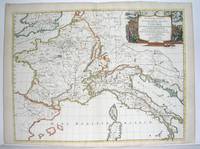
1667rif. M2849Paris 1667. Excellent. Size : 424x563 mm 16.625x22.125 Inches Coloring: Original Outline Coloring Category: ; Maps Europe France; Maps Europe Italy unknown
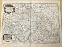
1785rif. M10271Paris c.1785. Very Good. Size : 470x658 mm 18.50x25.91 Inches Coloring: Original Outline Coloring Category: Maps Europe Czech Republic Slovakia; Maps Europe Germany; unknown
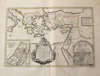
1710rif. M10319Amsterdam: Jean Covens & Corneille Mortier c.1710. Very Good. Notes: With 2 inset maps showing the Holy Land and Hierusalem. Size : 375x550 mm 14.76x21.65 Inches Coloring: Original Hand Coloring Category: Maps Asia Near East Turkey; Maps Asia Middle East Holy Land & Palestine; Maps Mediterranean Sea; Jean Covens & Corneille Mortier unknown