4014 risultati
2011rif. 1-3845443480Lap Lambert Academic Publishing 2011. Paperback. New. 148 pages. 8.66x5.91x0.34 inches. Lap Lambert Academic Publishing paperback
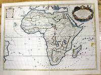
1700rif. M11022Paris c.1700. Very Good. Notes: French map of Africa as a continent. Size : 462x645 mm 18.19x25.39 Inches Coloring: Hand Colored Category: Maps Africa Continent; unknown
rif. Z1-S-019-02596Cornell University Press. Used - Good. Ships from UK in 48 hours or less usually same day. Your purchase helps support Sri Lankan Children's Charity 'The Rainbow Centre'. Ex-library so some stamps and wear but in good overall condition. 100% money back guarantee. We are a world class secondhand bookstore based in Hertfordshire United Kingdom and specialize in high quality textbooks across an enormous variety of subjects. We aim to provide a vast range of textbooks rare and collectible books at a great price. Our donations to The Rainbow Centre have helped provide an education and a safe haven to hundreds of children who live in appalling conditions. We provide a 100% money back guarantee and are dedicated to providing our customers with the highest standards of service in the bookselling industry. Cornell University Press unknown
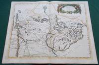
1668rif. 014632Paris: Cartes Generales de Toutes les Parties du Monde. 1668. Hand coloured. Map measures 55x40.cm plus margin. Some light surface wear or dust marking. Map in good condition. Boldly engraved map of the region of present day Paraguay Uruguay northern Argentina and parts of Chile and Brazil. The Rio de la Plata is the main feature of the map which extends north to the mythical Lago de los Xarayes. The mountains and volcanoes of the Cordillera de los Andes are also prominently shown. There is good detail of topography missions and villages. The decorative title cartouche is adorned with two female figures fruit and flowers. Very Good. Cartes Generales de Toutes les Parties du Monde.. unknown
1988rif. 092991Cambridge New York: Cambridge University Press 1988. viii 258 S.; mit Notenbeispielen u. Register. Erste Auflage. Pappband. Sehr gut/kein Schutzumschlag. 233 cm. Cambridge University Press Hardcover
rif. ria9781788314442_inpPaperback. New. New Book; Fast Shipping from UK; Not signed; Not First Edition; The vast military campaigns in Africa during World War I were among the most ambitious of the Great War. Many histories however have regarded these campaigns as side-shows to the war on the Western Front. World War One in Africa looks paperback
1925rif. 326925New York: Brentano's 1925. 153pp. 8vo. Blue cloth paper label & patterned boards. Very Good. 153pp. 8vo. Signed by the author on the ffep. This movie is considered the first talkie. Brentano's unknown
rif. 6394879806H N H International Limited . Papeback. New. H N H International Limited unknown
1922rif. 394271922. Klin. Wschr. 1/13. - Berlin Verlag von Julius Springer u. München J.F.Bergmann 25. März 1922 4° pp.609-664 feine Broschur. First Edition! Samson Hirsch established the value of theophylinne in the management of asthma. Garrison & Morton No.3197.2 unknown
rif. OTF-9780801422805Cornell University Press. New. BRAND NEW GIFT QUALITY! NOT OVERSTOCKS OR MARKED UP REMAINDERS! DIRECT FROM THE PUBLISHER! Cornell University Press unknown
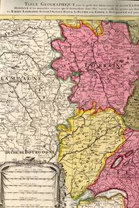
1700rif. BB614331700. unknown. gebraucht gut gefaltete Landkarte mit Mittelfalz Papier altersbedingt etwas fleckig und gebräunt sonst GUTES EXEMPLAR. 442 x 575 cm. Blatt: 535 x 605 cm. l'Archevesche et l'Elctorat de Mayence et le Palatinat du Rhein Lorraine Suisse l'Alsace Sueve la Duche et la Comte de Bourgogne et d'autres Provinces voisines de France et Italie. Altkolorierter Kupferstich um 1700 Für Ihre Zufriedenheit versenden wir mit DHL und ausschließlich mit Trackingcode für eine sichere Sendungsverfolgung! Weitere Angebote unter antiquariat-kastanienhof unknown
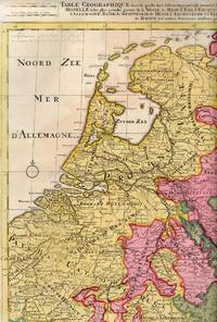
1710rif. BB614341710. unknown. gebraucht gut gefaltete Landkarte mit Mittelfalz Papier altersbedingt etwas fleckig und gebräunt sonst GUTES EXEMPLAR. 445 x 575 cm. du Rhein Meuse Moselle et les plus grandes parties de le Weser le Mein l'Ems l'Escault l'Issel et les autres rivieres qui fe dechargent dans elles comme aussi les Provinces d'Allemagne Basse de Westphalie de Hesse l'Archeveche et l'Elctorat de Cologne et de Treves avec les parties de Majence et le Palatinat du Rhein et d'autres Provinces voisines. Altkolorierter Kupferstich um 1710 Blatt: 535 x 605 cm Für Ihre Zufriedenheit versenden wir mit DHL und ausschließlich mit Trackingcode für eine sichere Sendungsverfolgung! Weitere Angebote unter antiquariat-kastanienhof unknown
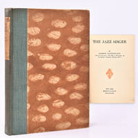
1925rif. 47252New York: Brentano's 1925. First Edition. Hardcover. Very good. 153p octavo. A very good copy in patterned boards and green cloth. Inscribed by the author to author Fred Hummel known as "The King of East Long Island" "January 1926 to the George F Hummels -grand people- from Damson Raphaelson" The book was the source for the first "Talkie" "The Jazz Singer" starring Al Jolson. Brentano's hardcover
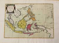
1654rif. M10780Paris 1654. Very Good. Notes: Detailed map of Southeast Asia by Nicholas Sanson 1600-1667 renowned French cartographer. Size : 402x560 mm 15.83x22.05 Inches Coloring: Original Hand Coloring Category: Maps Asia South East Indonesia & Papua New Guinea; Maps Asia South East Thailand Laos Vietnam Cambodia & Burma / Myanmar; Maps Asia South East Philippines; unknown
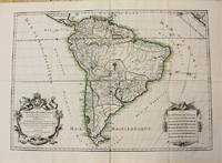
1698rif. M10786Paris 1698. Very Good. Notes: A charming large scale 17th century map of South America with two decorative cartouches and original outline colouring. Size : 460x648 mm 18.11x25.51 Inches Coloring: Original Outline Coloring Category: Maps South America Continent; unknown
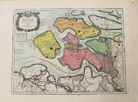
1693rif. M10774Paris 1693. Very Good. Notes: Map of the county of Zeeland. Size : 440x575 mm 17.32x22.64 Inches Coloring: Original Hand Coloring Category: Maps Europe Benelux; unknown
2011rif. x-0197264832Oxford Univ Pr 2011. Hardcover. New. 1st edition. 420 pages. 8.75x5.25x0.25 inches. Oxford Univ Pr hardcover
2000rif. DADAX1531602959Arcadia Publishing Library Editions 2000-10-30. hardcover. New. 6.69x0.38x9.61. Buy with confidence. Excellent Customer Service & Return policy. Arcadia Publishing Library Editions hardcover
rif. 79697Jerusalem 1998 Hardcover. 3 Vols. Slipcased. Very Good Jerusalem, 1998 hardcover
2022rif. x-0198855907Oxford Univ Pr 2022. Hardcover. New. 1st edition. 598 pages. 9.75x7.00x1.50 inches. Oxford Univ Pr hardcover
rif. 0847864251.Ghardcover. Good. Access codes and supplements are not guaranteed with used items. May be an ex-library book. hardcover
rif. 10-18965See notes 23377. Hardcover. New. In shrink wrap. See notes hardcover
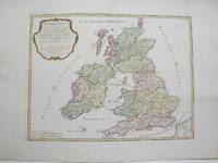
1754rif. M3766Paris 1754. Excellent. Size : 410x540 mm 16.125x21.25 Inches Coloring: Hand Colored Category: ; Maps Europe Ireland;; Maps Europe United Kingdom unknown
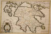
1692rif. M7546Paris: H. Jaillot c. 1692. Very Good;. Notes: The title cartouche in the lower left corner is encased in a floral wreath at the bottom of which sits a winged lion wielding a sword and standing at a pulpit. At the top of the wreath sits a coat of arms held by two winged putti. Encircling the wreath are little diagrams of various fortifications around Greece. Size : 565x845 mm 22.24x33.27 Inches Coloring: Original Outline Coloring Category: Maps Europe Greece Macedonia; H. Jaillot unknown
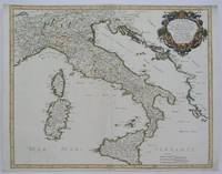
1665rif. M5118Paris 1665. Very Good central fold reinfrced. Notes: There is a water mark on the right hand portion of the map. Size : 435x540 mm 17.125x21.25 Inches Coloring: Original Outline Coloring Category: ; Maps Europe Italy unknown