SANSON, NicolasBiblio.com
4 034 résultats
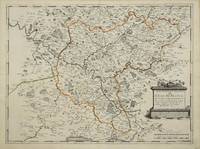
réf. 3135Paris: 1651. No binding. Very Good. 390 x 525 mm. early outline colour good condition. Beautifully engraved by Jean Sommer this map is of the region around Paris. Pastoureau Sanson V B no. 127. 1651 unknown
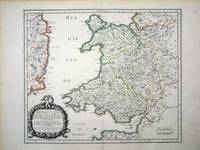
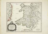
réf. 6460Paris: 1658. No binding. Very Good. 370 x 435 mm. in fine early outline colour good condition. An attractive map of the whole of Wales first published in Nicolas Sanson's 'Les Cartes Generales de Toutes les Parties du Monde' in 1658. Sanson was France's premier cartographer and helped to lift the field onto another level during his career. With an attractive title cartouche lower left in a nice dark impression. The cartography is derived from that of John Speed and includes the neighbouring English counties including Herefordshire Shropshire Worcestershire Cheshire parts of Gloucestershire and Staffordshire. To the west the proximity of the Irish coast is depicted. Not in Booth; Pastoureau M. Sanson V 27; Roberts Iolo & Menai 'Printed Maps of the whole of Wales 1573-1837' Part 1 in 'The Map Collector' no. 68 pp. 34-9; Shirley 2004 T.San 2a no. 13. 1658 unknown
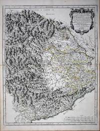
réf. 8636Paris: 1658-65. No binding. Very Good. 550 x 435 mm. early outline colour in good condition. This map of the Piedmont region of Italy was published in Paris by Pierre Mariette. It centres on Turin and extends from Antibe on the French coast to Savona. Nicolas Sanson's 'Les Cartes Generales' was first published in 1658. This map was introduced in 1665 this example is a later state with the imprint altered to 'Chez l'Autheur'. Sanson was France's premier cartographer and helped to lift French work in this area to another level. His atlas is the first full world atlas to be produced in France. This work had been in development for several years as the dates on the various maps attest. Pastoureau Sanson Vb no. 147. 1658-[65] unknown
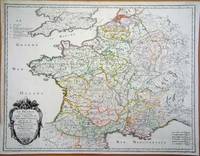
réf. 6420Paris: 1693. No binding. Good. 440 x 570 mm. early outline colour in good condition. A particularly attractive map of France or ancient Gaul. It famously depicts the country before Louis XIV lost a third of his territory to mapmakers who concluded that the longitudinal width of the country was not as great as was depicted! Not in Pastoureau 1984. 1693 unknown
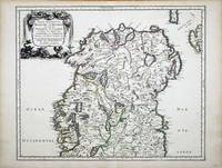
réf. 6991Paris: 1665. No binding. Very Good. 400 x 490 mm. in fine early outline colour in very good condition. This map of northern Ireland was published in Paris by Pierre Mariette. It was first introduced in to a later edition of Nicolas Sanson's ""Les Cartes Generales"" in 1665. Nicolas Sanson was to bring about the rise of French cartography although the fierce competition of the Dutch would last until the end of the century. This shift in cartographic centres shadowed the relative fortunes of the two countries; France under Louis XIV was a growing power in Europe. Born in Abbeville in the Picardy region of France 1600 Sanson studied history and turned to cartography as a means of recording it. In 1630 he was made Géographe Ordinaire du Roi and was to become one of the tutors to Louis XIV. However his future success was partly owing to the partnership he made with the publisher Pierre Mariette. In 1644 the latter had purchased the business of Melchoir Tavernier and helped Sanson with financial support in producing the maps for the planned atlas. His atlas is the first full world atlas to be produced in France. This work had been in development for several years as the dates on the various maps attest. A fine example of the first state. Bonar-Law 1997 no. 11 st. 1; Pastoureau 1984 Sanson Vb no. 124. 1665 unknown
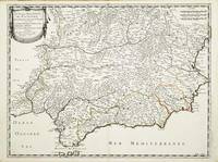
réf. 10313Paris: Pierre Mariette. 1652. No binding. Good. 410 x 540 mm. early outline colour in excellent condition. An attractive map of the south of Spain the Costa del Sol. First published in Nicolas Sanson's 'Les Cartes Generales' in 1658. Sanson was France's premier cartographer and helped to lift the field onto another plain during his career. The map extends from Faro in Portugal in the west eastwards to Valencia. Pastoureau Sanson Va no. 69; Phillips P.L. Atlases 4260-67. Pierre Mariette. 1652 unknown
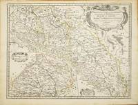
réf. 10820Paris: 1679. No binding. Good. 420 x 550 mm. early outline colour in good condition. This map of part of a portion of Eastern Europe includes Bohemia Silesia Moravia and Lusatia. It was published in Paris by Pierre Mariette in Nicolas Sanson's 'Les Cartes Generales' first published in 1658. This example is the second state dated 1679. It includes Frankfurt am oder in the upper left Glogow and Breslau Wroclaw. An inset of Moravia is centred on Olmutz present day Olomouc. Sanson was France's premier cartographer and helped to lift French work in this area to another level. His atlas is the first full world atlas to be produced in France. This work had been in development for several years as the dates on the various maps attest. Pastoureau M. Sanson V 59; Phillips P.L. Atlases 4260. 1679 unknown
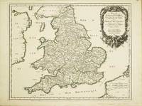
réf. 10525Paris: 1665. No binding. Very Good. 400 x 510 mm. superb early outline colour very good condition. A FIRST STATE example of an ornate map of England and Wales first published in Nicolas Sanson's 'Les Cartes Generales de Toutes les Parties du Monde' in 1665. Sanson 1600-67 was France's premier cartographer and helped to lift the field onto another level during his career. In 1665 two folio maps were issued one of the British Isles and this of England and Wales. The map outlines the modern counties along with the traditional Anglo-Saxon heptarchy which are here outlined in colour. With an attractive cartouche upper right. The cartography is derived from that of John Speed Willem Blaeu and Johannes Jansson. This is an example of the first state dated 1665 according to Shirley however since then two further states dated similarly have been identified. This example remains the first state. Provenance Doreen Green 2003. Pastoureau M. Sanson V B 117; Shirley R.W. Sanson 3.1. 1665 unknown
réf. 10634Paris: 1658. No binding. Very Good. 370 x 435 mm. in fine early outline colour good condition. An attractive map of the whole of Wales first published in Nicolas Sanson's 'Les Cartes Generales de Toutes les Parties du Monde' in 1658. Sanson was France's premier cartographer and helped to lift the field onto another level during his career. With an attractive title cartouche lower left in a nice dark impression. The cartography is derived from that of John Speed and includes the neighbouring English counties including Herefordshire Shropshire Worcestershire Cheshire parts of Gloucestershire and Staffordshire. To the west the proximity of the Irish coast is depicted. Provenance: Doreen Green 1996; private collection. Not in Booth 1977; Pastoureau 1980 Sanson V 27; Roberts 1994 14; Shirley 2004 T.San 2a no. 13. 1658 unknown
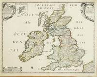
réf. 10523Paris: 1640-c.48. No binding. Good. 405 x 530 mm. early outline colour small lower margin centrefold split repaired otherwise in good condition. A rare map in this second produced by Nicolas Sanson 1600-67 and published by Melchoir Tavernier 1594-1665 and Pierre Mariette c.1602-58. Separately published the map displays a shortened Scotland and exaggerated south west north east slant to Ireland. In later states it would be published in Pierre Mariette's 'Les Cartes Generales de Toutes les Parties du Monde' from 1658. Sanson was France's premier cartographer and helped to lift the field onto another level during his career. With an attractive cartouche upper left and right and an inset map of the Shetland Islands. This second state is determined by the addition of Mariette's imprint to the cartouche upper right. Provenance: private English collection since 2006. Pastoureau 1984 Tavernier IIE 106; Shirley R.W. BI to 1650 506 pl. 80 st. 1. 1640-[c.48] unknown
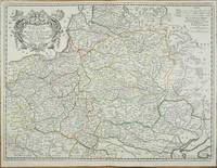
réf. 11195Paris: 1655-1703. No binding. Good. 435 x 580 mm. early outline colour in good condition. A fine detailed map of Poland Lithuania Latvia present day Belarus and Ukraine published by Nicolas Sanson 1600-67. The map was first published in 1655 with at least one later state dated 1663. Here it is dated 1703 upper right. Sanson was to bring about the rise of French cartography although the fierce competition of the Dutch would last until the end of the century. This shift in cartographic centres shadowed the relative fortunes of the two countries; France under Louis XIV was a growing power in Europe. Born in Abbeville in the Picardy region of France 1600 Sanson studied history and turned to cartography as a means of recording it. In 1630 he was made Géographe Ordinaire du Roi and was to become one of the tutors to Louis XIV. However his future success was partly owing to the partnership he made with the publisher Pierre Mariette. In 1644 the latter had purchased the business of Melchoir Tavernier and helped Sanson with financial support in producing the maps for the planned atlas. In 1657 Pierre Mariette died which delayed publication of Sanson's atlas. However his son also named Pierre co-published Les Cartes Générales de toutes les parties du Monde the following year. It was the first folio French produced world atlas. Pastoureau 1984 Sanson V A 65. 1655-1703 unknown
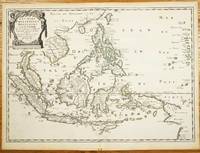
réf. 10922Paris: Pierre Mariette. 1654. No binding. Good. 400 x 555 mm. in early outline colour with light vertical folds to right of centrefold two small wormholes at lower edge of margin otherwise in good condition. Nicolas Sanson's fine map of the East Indies extending from the south coast of China to the northern tip of the York Peninsula in Australia. It also includes much of southeast Asia and a portion of New Guinea. The island of Taiwan is featured near the top with a prominent Philippine Island group below. Published by Pierre Mariette in 1654 it would later be included in the first edition of 'Les Cartes Generales de Toutes les Parties du Monde' in 1658. It is engraved by Jean Somer. Nicolas Sanson 1600-67 was to bring about the rise of French cartography although the fierce competition of the Dutch would last until the end of the century. This shift in cartographic centres shadowed the relative fortunes of the two countries; France under Louis XIV was a growing power in Europe. Born in Abbeville in the Picardy region of France 1600 Sanson studied history and turned to cartography as a means of recording it. In 1630 he was made Géographe Ordinaire du Roi and was to become one of the tutors to Louis XIV. However his future success was partly owing to the partnership he made with the publisher Pierre Mariette. In 1644 the latter had purchased the business of Melchoir Tavernier and helped Sanson with financial support in producing the maps for the planned atlas. In 1657 Pierre Mariette died which delayed publication of Sanson's atlas. However his son also named Pierre co-published 'Les Cartes Générales de toutes les parties du Monde' the following year. It was the first folio French produced world atlas. Parry 2005 East Indian Islands S. 154; Pastoureau 1984 Sanson V A no. 12; Quirino S. 106; Shirley 2004 T.SAN-2a; Tooley Australia 1979 1111. Pierre Mariette. 1654 unknown
réf. 1019577312.Ghardcover. Good. Access codes and supplements are not guaranteed with used items. May be an ex-library book. hardcover
réf. 0313298734.Ghardcover. Good. Access codes and supplements are not guaranteed with used items. May be an ex-library book. hardcover
réf. 1430450878.Gpaperback. Good. Access codes and supplements are not guaranteed with used items. May be an ex-library book. paperback
réf. ria9798374983111_inpPaperback. New. New Book; Fast Shipping from UK; Not signed; Not First Edition; As of January 2023 The Space Economy is valued at over $503B dollars. Additionally many economic forecast place the value of The Space Economy between $4T and $10T dollars by the mid 2040s. This almanac is produced by MilkyWayEconomy t paperback
réf. ria9798863230016_inpPaperback. New. New Book; Fast Shipping from UK; Not signed; Not First Edition; Over the past 100 years angel Jibril Gabriel had revealed to Prophet Mirza Ghulam Ahmad 1835-1908 the codes which were to be applied in the ultimate understanding of the Holy Quran. These 15 codes are: Boron-5 Cobalt-27 Helium-2 paperback
réf. ria9798870577470_inpPaperback. New. New Book; Fast Shipping from UK; Not signed; Not First Edition; This book has segregated neither the Torah nor the Bible nor the Holy Quran. It is about a higher level of understanding God in both the spiritual realm and the mind. The book is exposing God as the only source of everything material s paperback
réf. ria9798218527815_inpPaperback. New. New Book; Fast Shipping from UK; Not signed; Not First Edition; A gray area text"Verily I said unto you. There are some standing here who shall not taste of death till they see the son of Man coming in his kingdom"Heaven's interpretation: When the lord said that there was a rumor that he said that paperback
réf. ria9798535888323_inpPaperback. New. New Book; Fast Shipping from UK; Not signed; Not First Edition; A Teoria do Multiverso da hipótese de um conjunto de vários universos possíveis incluindo o que vivemos é defendida por grandes nomes da Astrofísica da moderna Cosmologia e na Teoria Quântica.No drama de ficção-científica 'Lucília paperback
réf. A9780521700771Paperback / softback. New. This book details the key frameworks and topics related to the productive systems and functions of all organisations. It describes how to organise making the firm's goods and service most effective. paperback
réf. mon0003595943The Multi-Faith Centre at the Un. paperback. Good. 0.2362 11.2598 9.2913. The Multi-Faith Centre at the Un paperback
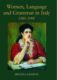
réf. A9780197264836Hardback. New. In the sixteenth century Italian was a literary language not accessible to the less educated among them women who would instead speak a local dialect. Little attention has been paid to women's linguistic education but this study shows the vital role they played in developing Italian as a true mother tongue. hardcover
réf. A9781788314442Paperback / softback. New. paperback
réf. B9781107679948Paperback / softback. New. This comprehensive overview of music in the nineteenth century draws on the most recent scholarship in the field. It is divided into two parts 1800-1850 and 1850-1900 each of which approaches the major repertory of the period through investigations into the intellectual and socio-political history of the time. paperback