((Procurador)), SansonBiblio.com

4 133 résultats
réf. 1024372820.Ghardcover. Good. Access codes and supplements are not guaranteed with used items. May be an ex-library book. hardcover
1656réf. 76600Paris 1656. 4to. Samtidig mykt helpergamentbind. 100 s. 2 s. annonser. Med 18 dobbeltsidige grensekolorerte kart. 4to. Contemporary limp vellum. Unpaginated. 100 pp. In addition two pages of advertisements. 18 engraved double page maps. Boundaries coloured. Chez l’Autheur. Fransk. Noen få sider med små rifter affiserer ikke teksten eller kartene. Noe gulnet i ytterkantene.A few pages with small tears not affecting text nor maps. Some browning to extremities. Nicolas Sanson d’Abbeville 1600-1667 “considered by many to be the founder of the French school of cartography” Tooley. hardcover
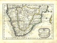
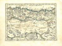
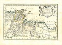
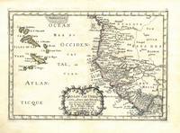
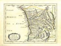
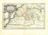
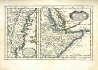
1656réf. 78507Uten sted. Paris 1656. Tverr4to. Arkets størrelse : 335 cm X 245 cm. Med samtidig grensekolorering. Fransk. Nicolas Sanson 1600-1667 blir regnet for å være grunnleggeren av fransk kartografi. Kommer fra atlaset “L’Afrique” med flere senere utgivelser. unknown
1656réf. 78505Uten sted. Paris 1656. Tverr4to. Arkets størrelse : 335 cm X 245 cm. Med samtidig grensekolorering. Fransk. Nicolas Sanson 1600-1667 blir regnet for å være grunnleggeren av fransk kartografi. Kommer fra atlaset “L’Afrique” med flere senere utgivelser. unknown
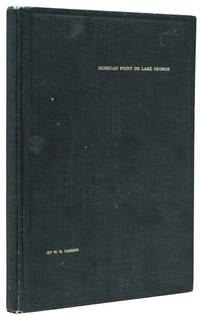
1913réf. 238650New York: Privately printed 1913. First edition no. 96 of 200 copies initialed and numbered on the half-title. With frontispiece 19 plates including 2 group portraits double map of Lake George around Bolton Landing at back. 65 pp. 1 vols. 8vo. Original green cloth titled in gilt on upper board. Bixby bookplate of Mohican Point house on front pastedown. Fine. First edition no. 96 of 200 copies initialed and numbered on the half-title. With frontispiece 19 plates including 2 group portraits double map of Lake George around Bolton Landing at back. 65 pp. 1 vols. 8vo. Inscribed on flyleaf "Mr. & Mrs. A. B. P- names partly effaced with sincere regards of Mr. & Mrs. W.K. Bixby St. L. 5/18/14" "Includes 12 pages of text on fishing for smallmouth bass lake trout and land-locked salmon. one of the few early books to contain as much material on fishing in Lake George" Heller. An important and rare book. Plum Adirondack Bibliography 568; Bruns S27; Heller 1:716 Privately printed unknown
1913réf. 238650New York: Privately printed 1913. First edition no. 96 of 200 copies initialed and numbered on the half-title. With frontispiece 19 plates including 2 group portraits double map of Lake George around Bolton Landing at back. 65 pp. 1 vols. 8vo. Original green cloth titled in gilt on upper board. Bixby bookplate of Mohican Point house on front pastedown. Fine. First edition no. 96 of 200 copies initialed and numbered on the half-title. With frontispiece 19 plates including 2 group portraits double map of Lake George around Bolton Landing at back. 65 pp. 1 vols. 8vo. Inscribed on flyleaf "Mr. & Mrs. A. B. P- names partly effaced with sincere regards of Mr. & Mrs. W.K. Bixby St. L. 5/18/14" "Includes 12 pages of text on fishing for smallmouth bass lake trout and land-locked salmon. one of the few early books to contain as much material on fishing in Lake George" Heller. An important and rare book. Plum Adirondack Bibliography 568; Bruns S27; Heller 1:716 Privately printed unknown books
1656réf. 78504Uten sted. Paris 1656. Tverr4to. Arkets størrelse : 335 cm X 245 cm. Med samtidig grensekolorering. Fransk. Nicolas Sanson 1600-1667 blir regnet for å være grunnleggeren av fransk kartografi. Kommer fra atlaset “L’Afrique” med flere senere utgivelser. unknown
réf. 5777Paris, Editions Milieu du Monde, 1948. In-8 broché, 309 pp. Nombreuses illustrations photographiques en noir.
1647réf. 75287Paris Uten år. 1647-1665. 4to. Samtidig helskinnbind med opphøyde ryggbånd og ryggforgylling. Ryggen rebacked med bruk av den gamle ryggstripen. Håndkolorert gravert dobbeltsidig tittelblad og dedikasjonsblad. Upaginert. 30 bl. Med 12 dobbeltsidige håndkolorerte kart. 4to. Contemporary full calf with raised bands spine gilt. Spine rebacked by using of the old spine. Handcoloured doublepage title and handcoloured doublepage dedication. Not paginated. 30 leaves. With 12 doublepage handcoloured copper engraved maps. Chez Pierre Mariette. Fransk. “Nicolas Sanson le fils 1625 - 1648. Son of Nicolas and his intended heir prevented by his premature death from gunshot wounds. Only three known works. L’Europe 12 maps ca. 1648 compiled by N. Sanson fils engraved by A. Peyrounin theoretically published by Nicolas fils himself but may have been published posthumously by his father republished by Mariette 1660 1665. Tooley’s Dictionary of mapmakers. Revised edition. hardcover
1862réf. 1862SansonEXECUTIONS IN FRANCE Sept Générations d'Exécuteurs 1688-1847: Mémoires des Sanson mis en ordre rédigés et publiés par H. Sanson. Paris: Dupray de la Mahérie 1862-1863. Six volumes each complete with half-title and probably large-paper copies but IV 67/68 with partial loss in lower blank. Tall 8vo unusually clean with hardly any spotting; gilt-stamped leather spines with matching black boards. First edition of this apocryphal memoir of the Sanson family based on family diaries and correspondence by the journalist D'Olbreuse detailing all the major executions from the late 17th century thru middle 19th century. The most famous member of the family is Charles-Henri Sanson 1739–1806 who served as the chief executioner of Paris during the French Revolution. He executed thousands of people—including King Louis XVI Marie Antoinette Danton and Robespierre. He was also closely involved in testing and adopting the guillotine as a more humane method of execution. The family's tenure ended in 1847 when Charles-Henri's grandson Henri-Clément Sanson was dismissed from office and arrested after pawning the family's official guillotine to cover mounting debts and gambling losses. Tulard 1316 - Fierro 1315. Dupray de la Mahérie hardcover
1862réf. 1862SansonEXECUTIONS IN FRANCE Sept Générations d'Exécuteurs 1688-1847: Mémoires des Sanson mis en ordre rédigés et publiés par H. Sanson. Paris: Dupray de la Mahérie 1862-1863. Six volumes each complete with half-title and probably large-paper copies but IV 67/68 with partial loss in lower blank. Tall 8vo unusually clean with hardly any spotting; gilt-stamped leather spines with matching black boards. First edition of this apocryphal memoir of the Sanson family based on family diaries and correspondence by the journalist D'Olbreuse detailing all the major executions from the late 17th century thru middle 19th century. The most famous member of the family is Charles-Henri Sanson 1739–1806 who served as the chief executioner of Paris during the French Revolution. He executed thousands of people—including King Louis XVI Marie Antoinette Danton and Robespierre. He was also closely involved in testing and adopting the guillotine as a more humane method of execution. The family's tenure ended in 1847 when Charles-Henri's grandson Henri-Clément Sanson was dismissed from office and arrested after pawning the family's official guillotine to cover mounting debts and gambling losses. Tulard 1316 - Fierro 1315. Dupray de la Mahérie hardcover books
réf. 1172009236.Gpaperback. Good. Access codes and supplements are not guaranteed with used items. May be an ex-library book. paperback
1656réf. 78503Uten sted. Paris 1656. Tverr4to. Arkets størrelse : 335 cm X 245 cm. Med samtidig grensekolorering. Fransk. Nicolas Sanson 1600-1667 blir regnet for å være grunnleggeren av fransk kartografi. Kommer fra atalset “L’Afrique” med flere senere utgivelser. unknown
1656réf. 78506Uten sted. Paris 1656. Tverr4to. Arkets størrelse : 335 cm X 245 cm. Med samtidig grensekolorering. Fransk. Nicolas Sanson 1600-1667 blir regnet for å være grunnleggeren av fransk kartografi. Kommer fra atlaset “L’Afrique” med flere senere utgivelser. unknown
1656réf. 78509Uten sted. Paris 1656. Tverr4to. Arkets størrelse : 335 cm X 245 cm. Med samtidig grensekolorering. Fransk. Nicolas Sanson 1600-1667 blir regnet for å være grunnleggeren av fransk kartografi. Kommer fra atlaset “L’Afrique” med flere senere utgivelser. unknown
1880réf. 7284New York: National Temperance Society and Publication House 1880. First Edition. Cloth. Very Good. 5 1/8 X 7 5/8 Inches. 326 PP. Original green cloth with gitl title-stamping to spine. A history of the use of alcohol throughout the world. Scathing attack on fermented wines and intoxication. Book supposes one of the main issues with alcohol in America is due to the immigrant and his evil ways. "G.S. McKinney & Co. / Ripley TN" store stamp to front pastedown. Small tear to top edge of FFEP. Light scuffing and wear to edges and spine ends. National Temperance Society and Publication House unknown
1901réf. b40089Washington: Government Printing Office 1901. First Edition . Hardcover. Very Good. Very good in original blue cloth-covered boards with gilt stamping. Brief rubbing at the extremites a small scratch on the first panel and a somewhat shaken binding. This is one of a handful of presentation copies given to members of the Citizens' Committee of the National Capital Centennial Celebration 1900 The presentation inscription in this copy to Henry W. Samson appears on the front pastedown. Uncommon. Government Printing Office hardcover
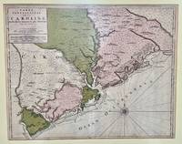
1696réf. 48399Amsterdam: Pierre Mortier 1696. Engraved broadside map 19 x 23 5/8 inches plate mark dimensions with extensive pink and green wash. Some light browning but an attractive copy. Matted glazed and framed. One of two issues of this map this one being a bit larger based on the Thornton-Morden map of circa 1685. Pictures the colony from the Santee River to the South Edisto River and well inland up the Cooper River. Physical features and names of plantation and land owners are given in English "Nouveau Londre" on the Edistow sic River being exceptions; soundings are given at river mouths in Charleston Harbor and in the ocean along some beaches. Cumming Southeast in Early Maps 121. Kendall Early Maps of Carolina 17c: "This map has a wealth of names of owners of land in Carolina. Pierre Mortier unknown
1696réf. 48399Amsterdam: Pierre Mortier 1696. Engraved broadside map 19 x 23 5/8 inches plate mark dimensions with extensive pink and green wash. Some light browning but an attractive copy. Matted glazed and framed. One of two issues of this map this one being a bit larger based on the Thornton-Morden map of circa 1685. Pictures the colony from the Santee River to the South Edisto River and well inland up the Cooper River. Physical features and names of plantation and land owners are given in English "Nouveau Londre" on the Edistow sic River being exceptions; soundings are given at river mouths in Charleston Harbor and in the ocean along some beaches. Cumming Southeast in Early Maps 121. Kendall Early Maps of Carolina 17c: "This map has a wealth of names of owners of land in Carolina. Pierre Mortier unknown books
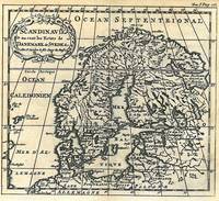
1752réf. 54049Amsterdam. Uten år. 1752. Originalt kobberstikk. Arkets størrelse : 175 cm X 164 cm. Fransk. Med en brett.Fra 'La Science des Personnes de Cour d'Epee et de Robe' by Z. Chatelain. unknown
1650réf. 24869London 1650. 1 vols. 13" x 8 3/4. Contemporary. hand-coloring. Fine condition. 1 vols. 13" x 8 3/4 ". unknown
1650réf. 24869London 1650. 1 vols. 13" x 8 3/4. Contemporary. hand-coloring. Fine condition. 1 vols. 13" x 8 3/4 ". unknown books
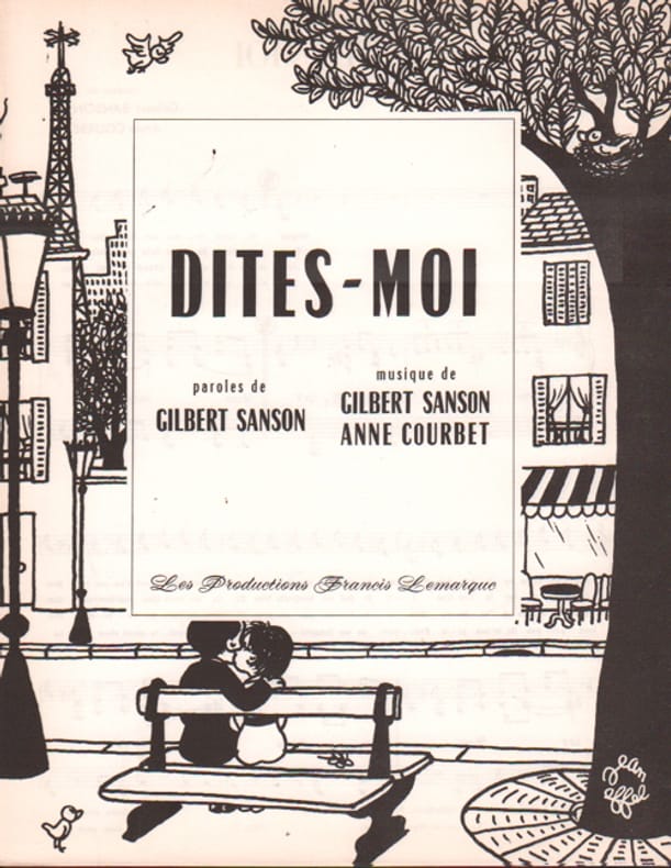
1962réf. 102757Lemarque Francis 1962
réf. 0364728167.Ghardcover. Good. Access codes and supplements are not guaranteed with used items. May be an ex-library book. hardcover
réf. 0353804282.Ghardcover. Good. Access codes and supplements are not guaranteed with used items. May be an ex-library book. hardcover