Samson, VictoriaBiblio.com

4 066 résultats
2010réf. x-0313353263Praeger Pub Text 2010. Hardcover. New. 224 pages. 9.30x6.40x1.20 inches. Praeger Pub Text hardcover
réf. 0313353263.Ghardcover. Good. Access codes and supplements are not guaranteed with used items. May be an ex-library book. hardcover
2010réf. DADAX0313353263Bloomsbury Academic 2010-03-23. hardcover. New. 6.15x0.62x9.21. Buy with confidence. Excellent Customer Service & Return policy. Bloomsbury Academic hardcover
réf. Bloomsbury-9780313353260Praeger. Hardback. New. 260 pages Praeger hardcover
réf. Bloomsbury-9780313353260Praeger. Hardback. New. 260 pages Praeger hardcover
réf. ria9780313353260_inpHardcover. New. New Book; Fast Shipping from UK; Not signed; Not First Edition; N/A hardcover
réf. A9780313353260Hardback. New. This hard-hitting analysis of the U.S. missile defense program explains the system's limitations and argues that it is not nearly as effective as Americans have been led to believe. hardcover
réf. B9780313353260Hardback. New. This hard-hitting analysis of the U.S. missile defense program explains the system's limitations and argues that it is not nearly as effective as Americans have been led to believe. hardcover
réf. 6707340ABC-Clio Incorporated . Hardback. New. pp. 258 ABC-Clio, Incorporated hardcover
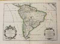
1698réf. M10786Paris 1698. Very Good. Notes: A charming large scale 17th century map of South America with two decorative cartouches and original outline colouring. Size : 460x648 mm 18.11x25.51 Inches Coloring: Original Outline Coloring Category: Maps South America Continent; unknown
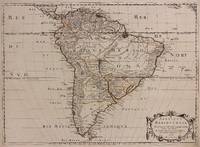
1650réf. 309461Paris: Pierre Mariette 1650. unbound. Abraham Peyrounin. Map. Engraving with original outline color. Image measures 15 3/4" x 21 3/4" This exceptionally fine map of South America covers the continent in fine detail. Coastlines are extensively labeled and mountains beautifully rendered in profile. The Orinoco and Amazon Rivers as well as Rio de la Plata are prominently rendered. Sanson refrains from drawing a southern coastline to Tierra del Fuego and the relatively unknown Amazon region is depicted in minimal detail. Sanson does however include the mythical lake "Lac de Parime" and the city of gold "Manoa del Dora" between the Orinoco and Amazon rivers. Nice dark impression. In very good condition. Minor dampstain to lower margin not affecting the image and some faint stains near the center of the map - otherwise clean and bright. Hard to find. Nicolas Sanson 1600-1667 is considered the founder of the French school of cartography. In reaction to the prevailing trend of Dutch lavishness Sanson favored minimal details focusing rather on accurate cartography than ornament. Pierre Mariette unknown
1691réf. M1345Paris 1691. Very Good. Size : 590x885 mm 23.25x34.875 Inches Coloring: Hand Colored in Outline Category: ; Maps South America Continent unknown
1650réf. 309461Paris: Pierre Mariette 1650. unbound. Abraham Peyrounin. Map. Engraving with original outline color. Image measures 15 3/4" x 21 3/4" This exceptionally fine map of South America covers the continent in fine detail. Coastlines are extensively labeled and mountains beautifully rendered in profile. The Orinoco and Amazon Rivers as well as Rio de la Plata are prominently rendered. Sanson refrains from drawing a southern coastline to Tierra del Fuego and the relatively unknown Amazon region is depicted in minimal detail. Sanson does however include the mythical lake "Lac de Parime" and the city of gold "Manoa del Dora" between the Orinoco and Amazon rivers. Nice dark impression. In very good condition. Minor dampstain to lower margin not affecting the image and some faint stains near the center of the map - otherwise clean and bright. Hard to find. Nicolas Sanson 1600-1667 is considered the founder of the French school of cartography. In reaction to the prevailing trend of Dutch lavishness Sanson favored minimal details focusing rather on accurate cartography than ornament. Pierre Mariette unknown books
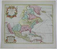
1792réf. M4892Amsterdam 1792. Excellent. Notes: North America revised from the Sanson/Jaillot maps. California is shown as a peninsula but named "isle de California" to the northwest is "Mer de Iesso" and beyond that a small stretch of coastline "Terre de Iesso ou Ieco." The Great Lakes are defined if not with great accuracy a number of settlements in Nouveau Mexico are identified and a R. del Norte flows southwest from a large lake near Taosii to the Gulf of California. Size : 480x580 mm 18.875x22.875 Inches Coloring: Original Hand Coloring Category: Maps North America; Maps Central America; Maps West Indies General unknown
réf. SLIVCN-9782844852021ALLIA EDITIONS
réf. 2090383240.Gpaperback. Good. Access codes and supplements are not guaranteed with used items. May be an ex-library book. paperback
réf. 2090354984.Gpaperback. Good. Access codes and supplements are not guaranteed with used items. May be an ex-library book. paperback
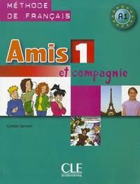
2009réf. 2-2090354968CLE International 2009. Paperback. New. amis et compagnie edition. 128 pages. French language. 11.10x8.50x0.31 inches. CLE International paperback
2002réf. 2-2090354909Cle 2002. Paperback. New. cle international edition. 127 pages. French language. 11.02x8.50x0.24 inches. Cle paperback
2004réf. DADAX2090354933Cle 2004-02-01. AMIS ET COMPAGNIE. paperback. New. 8.70x0.35x11.22. Buy with confidence. Excellent Customer Service & Return policy. Cle paperback
2008réf. 2-209035495XCle 2008. Paperback. New. 127 pages. French language. 11.10x8.50x0.32 inches. Cle paperback
2008réf. DADAX2090354917CLE INTERNAT 2008-01-24. AMIS ET COMPAGNIE. paperback. New. 8.70x0.24x11.26. Buy with confidence. Excellent Customer Service & Return policy. CLE INTERNAT paperback
réf. 209035495X.Gpaperback. Good. Access codes and supplements are not guaranteed with used items. May be an ex-library book. paperback
réf. 2090354925.Gpaperback. Good. Access codes and supplements are not guaranteed with used items. May be an ex-library book. paperback
2010réf. 2-2090383259Cle International 2010. Paperback. New. 112 pages. French language. 10.79x8.50x0.39 inches. Cle International paperback