934 résultats
1986réf. 2080302106809437Edited by the Nagasaki History Editorial Committee Yoshikawa Kobunkan 1986. Soft Cover. Fine. Size: A5 Number of books: 8 Edited by the Nagasaki History Editorial Committee, Yoshikawa Kobunkan paperback
1890réf. AMO-4520[Japon, Yokohama ?, vers 1890] Très beau spécimen en grand format (36 x 27 cm environ pour l'album et 26,5 x 20,5 cm pour les tirages). Complet. Très bel album très bien conservé malgré quelques chocs sur quelques bords et le dos de l'album manquant (bande de cuir), parfaitement solide et très décoratif. Très belle esthétique d'ensemble, superbe décor sur le premier plat (rare aussi beau et fin). Intérieur d'une grande fraîcheur. Beau coloris au pinceau à la main.
1986réf. 2080302106808310Yoshikawakobunkan 1986. Soft Cover. Fine. Number of books: 8 Yoshikawakobunkan paperback
1601In -8°, pp. 109, (b), cartonato, tagli rossi. Prima edizione. Francesco Pasio (1551-1612) fu il primo provinciale gesuita in Giappone, residente a Nagasaki; il libro comprende anche una lettera del vice-provinciale Pedro Gomez (1533-1600), autore del “Compendium”, ovvero un trattato di cosmologia e teologia che sarebbe diventata la prima opera a introdurre la cultura occidentale in Giappone; segue un testo di Nicolò Longobardi (1559-1654), gesuita siciliano che in Cina fu il successore di Matteo Ricci (nominato varie volte in questo testo); la quarta e ultima lettera è un resoconto di una missione presso i territori islamici del Mogol (India, Pakistan, Afghanistan). Marca dei gesuiti al frontespizio e capilettera figurati. First edition. Pasio (1551-1612) was the first Jesuit Provincial in Japan: he resided in Nagasaki; the book includes also a letter of his deputy Pedro Gomez (1533-1600), author of the “Compendium”, a cosmology and theology treaty that had to become the first work to introduce western knowledge in Japan; then a text by Nicolò Longoboardi (1559-1654), a sicilian jesuit who replace, in China, Matteo Ricci (mentioned many times in this text); the fourth and last letter is the chronicle of a mission in Islamic areas of Mughal (India, Pakistan, Afghanistan). A Jesuit mark on title page and figurative initials. Pasio (1551-1612) was the first Jesuit Provincial in Japan: he resided in Nagasaki; the book includes also a letter of his deputy Pedro Gomez (1533-1600), author of the “Compendium”, a cosmology and theology treaty that had to become the first work to introduce western knowledge in Japan; then a text by Nicolò Longoboardi (1559-1654), a sicilian jesuit who replace, in China, Matteo Ricci (mentioned many times in this text); the fourth and last letter is the chronicle of a mission in Islamic areas of Mughal (India, Pakistan, Afghanistan). A Jesuit mark on title page and figurative initials.
1973réf. 2080402107100635Not Available 1973. Soft Cover. Fine. The book is in fine condition. Not Available paperback
réf. 10960Scroll 385 x 8560 mm. with fine colored paintings using brush ink & various colors of wash of the route and major features along the way. Japan: mid-Edo. The route from Edo today’s Tokyo to Nagasaki and vice versa by land and by sea was one of the major thoroughfares and trade routes of Edo-period Japan. The Dutch and Chinese had been allowed to establish exclusive trading outposts in Nagasaki and Edo was the heart of domestic commerce and administration. Foreign goods especially silks other luxury items raw materials useful to the military and medicinal goods flowed through Nagasaki to Edo and the rest of Japan while Japanese goods including copper silver and porcelain were transported to Nagasaki for export. Most of the silver was sent to China to settle the trade balance. From the late 1670s to the 1740s Japan was the world’s largest copper producer and exporter. This route also carried the head of Nagasaki’s Dejima trading post to Edo for frequent mandatory ceremonial audiences with the shogun. The beginning of our scroll depicts the land route from Edo to Kyoto and then on to Osaka. The famous battleship Atake Maru is seen docked at the mouth of the Sumida River. Starting from Edo Castle in the great capital the scroll proceeds to Nagoya and Kyoto along the TÅkaidÅ road which was the most important highway of the Edo period. It depicts in great detail and with manuscript labels: stations on the route; bridges; major castles temples and shrines; the palace at Kyoto; other notable buildings; important geographical features including Mount Fuji partly shrouded in clouds; and towns and villages along the way. Distances are given and travellers are well-depicted showing their various clothing. Also shown are ships and skiffs in the nearby sea. We see more landmarks along the TÅkaidÅ road from Kyoto to the commercial hub and port city of Osaka an extension built in the 1620s. Arriving at Osaka we view the great castle the city’s canals and other sites. The rest of the scroll shows the hazardous passage from Osaka to Nagasaki through the 400 km. long Inland Sea Seto Naikai. The accomplished artist depicts the two main routes and alternate routes depending on the weather one for summertime in the open sea and the other hugging the coast for wintertime. Another route is shown that involved landing in the Bungo area of Kyūshū island and crossing overland to Nagasaki. Navigating through the Inland Sea with its 3000 plus islands and rocky outcroppings presented enormous problems in the era before modern navigation systems. Shown in very great detail are areas of turbulence including famous whirlpools numerous islands rock formations landscapes for orientation anchorages harbors along the way and fishing areas. The route then passes through the narrow Kanmon Strait the stretch of water separating the main island of Honshu and Kyūshū to the Sea of Japan finally arriving in Nagasaki. Dejima is prominently shown. A foreign ship is shown passing the GotÅ islands making its way to Nagasaki. Our scroll is finely drawn in black ink and heightened with wash in green blue gray pink and red. The routes are drawn from a partial “bird’s-eye” perspective with lovely vistas of mountains and islands and villages and towns. In fine condition preserved in an oldish wooden box which has the inscription on the outside of the lid 江戸長崎海陸é“ä¸çµµå›³ “From Edo to Nagasaki Travel by Land and by Sea Illustrated”. Inside this lid is the ownership inscription of RyÅra Gakuto. unknown
réf. 10960Scroll 385 x 8560 mm. with fine colored paintings using brush ink & various colors of wash of the route and major features along the way. Japan: mid-Edo. The route from Edo today’s Tokyo to Nagasaki and vice versa by land and by sea was one of the major thoroughfares and trade routes of Edo-period Japan. The Dutch and Chinese had been allowed to establish exclusive trading outposts in Nagasaki and Edo was the heart of domestic commerce and administration. Foreign goods especially silks other luxury items raw materials useful to the military and medicinal goods flowed through Nagasaki to Edo and the rest of Japan while Japanese goods including copper silver and porcelain were transported to Nagasaki for export. Most of the silver was sent to China to settle the trade balance. From the late 1670s to the 1740s Japan was the world’s largest copper producer and exporter. This route also carried the head of Nagasaki’s Dejima trading post to Edo for frequent mandatory ceremonial audiences with the shogun. The beginning of our scroll depicts the land route from Edo to Kyoto and then on to Osaka. The famous battleship Atake Maru is seen docked at the mouth of the Sumida River. Starting from Edo Castle in the great capital the scroll proceeds to Nagoya and Kyoto along the TÅkaidÅ road which was the most important highway of the Edo period. It depicts in great detail and with manuscript labels: stations on the route; bridges; major castles temples and shrines; the palace at Kyoto; other notable buildings; important geographical features including Mount Fuji partly shrouded in clouds; and towns and villages along the way. Distances are given and travellers are well-depicted showing their various clothing. Also shown are ships and skiffs in the nearby sea. We see more landmarks along the TÅkaidÅ road from Kyoto to the commercial hub and port city of Osaka an extension built in the 1620s. Arriving at Osaka we view the great castle the city’s canals and other sites. The rest of the scroll shows the hazardous passage from Osaka to Nagasaki through the 400 km. long Inland Sea Seto Naikai. The accomplished artist depicts the two main routes and alternate routes depending on the weather one for summertime in the open sea and the other hugging the coast for wintertime. Another route is shown that involved landing in the Bungo area of Kyūshū island and crossing overland to Nagasaki. Navigating through the Inland Sea with its 3000 plus islands and rocky outcroppings presented enormous problems in the era before modern navigation systems. Shown in very great detail are areas of turbulence including famous whirlpools numerous islands rock formations landscapes for orientation anchorages harbors along the way and fishing areas. The route then passes through the narrow Kanmon Strait the stretch of water separating the main island of Honshu and Kyūshū to the Sea of Japan finally arriving in Nagasaki. Dejima is prominently shown. A foreign ship is shown passing the GotÅ islands making its way to Nagasaki. Our scroll is finely drawn in black ink and heightened with wash in green blue gray pink and red. The routes are drawn from a partial “bird’s-eye” perspective with lovely vistas of mountains and islands and villages and towns. In fine condition preserved in an oldish wooden box which has the inscription on the outside of the lid 江戸長崎海陸é“ä¸çµµå›³ “From Edo to Nagasaki Travel by Land and by Sea Illustrated”. Inside this lid is the ownership inscription of RyÅra Gakuto. unknown books
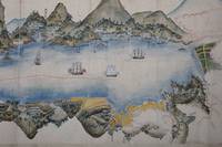
réf. 11453Scroll 535 x 2790 mm. pale brown silk on outer front endpaper inside covered with gold paper wooden core roller. Japan: late Edo 1855 or later. While Edo was the center of government and Osaka the national market hub Nagasaki was an extremely important center of commerce crafts and travel. It is no wonder that Nagasaki became the locus for trade with the rest of the world during the Tokugawa era: the port facing China and near Korea is at the end of a long and narrow entranceway - ideal for soldiers to observe from elevated positions the comings and goings of ships. The city itself at the eastern end of this long "neck" is shaped as an amphitheater by low mountains that enclose the bay to the north and west. Nagasaki was the only official port in Japan allowed to receive goods from around the world brought in initially by the Portuguese and Chinese and then by the Dutch. It served as the main port for export as well. The city also became the main conduit of "Dutch learning" and Chinese knowledge into the island nation. Artificial islands - Dejima for the Dutch and the dock island Shinchi 新地 for the Chinese connected to the Chinese quarter called TÅjin yashiki å”人屋敷 - were created for the myriad of goods and strange objects imported into Japan from the West and throughout Asia. Our scroll consists of one long highly detailed map of the city port areas and entrance to Nagasaki all surrounded by hills and low mountains. The map depicts cliffs beaches mountains and hills the many islands and dangerous rock outcroppings of the entrance outer observation stations etc. The beginning depicts the Urakami shinden 浦上新田 area of reclaimed land built in the 1730s used as fields for crops. As we proceed westward we see warehouses for saltpeter and rice storage and then the artificial islands of Dejima and the Chinese loading docks attached to the Chinese quarter by a bridge. The surrounding mountains and notable islands and points are labelled throughout as are the magistrates' offices of a number of domains. In the harbor we see Dutch two British American and Russian trading ships each with its national flag along with the ShÅhei Maru the first Western-style warship built in Japan 1853-54 constructed by the Satsuma fiefdom and presented to the Tokugawa shogunate in 1855. The scroll then shows the long narrow entranceway to Nagasaki with eight odaiba 御å°å ´ forts with cannons placed in strategic locations protecting the port from unwanted ships. Constructed in the early 19th century these were the first odaiba built in Japan as the government became increasingly anxious about possible attacks by foreign ships. Red lines depict the desired routes of entrance and exit for trading ships allowing the Japanese to easily observe the arriving Chinese and Dutch vessels. Distances from many points of the entrance to Nagasaki are given. The beginning of the outer GotÅ islands and the Nomozaki peninsula are shown at the end of the scroll. Fine condition; preserved in a modern wooden box. unknown
réf. 11453Scroll 535 x 2790 mm. pale brown silk on outer front endpaper inside covered with gold paper wooden core roller. Japan: late Edo 1855 or later. While Edo was the center of government and Osaka the national market hub Nagasaki was an extremely important center of commerce crafts and travel. It is no wonder that Nagasaki became the locus for trade with the rest of the world during the Tokugawa era: the port facing China and near Korea is at the end of a long and narrow entranceway - ideal for soldiers to observe from elevated positions the comings and goings of ships. The city itself at the eastern end of this long "neck" is shaped as an amphitheater by low mountains that enclose the bay to the north and west. Nagasaki was the only official port in Japan allowed to receive goods from around the world brought in initially by the Portuguese and Chinese and then by the Dutch. It served as the main port for export as well. The city also became the main conduit of "Dutch learning" and Chinese knowledge into the island nation. Artificial islands - Dejima for the Dutch and the dock island Shinchi 新地 for the Chinese connected to the Chinese quarter called TÅjin yashiki å”人屋敷 - were created for the myriad of goods and strange objects imported into Japan from the West and throughout Asia. Our scroll consists of one long highly detailed map of the city port areas and entrance to Nagasaki all surrounded by hills and low mountains. The map depicts cliffs beaches mountains and hills the many islands and dangerous rock outcroppings of the entrance outer observation stations etc. The beginning depicts the Urakami shinden 浦上新田 area of reclaimed land built in the 1730s used as fields for crops. As we proceed westward we see warehouses for saltpeter and rice storage and then the artificial islands of Dejima and the Chinese loading docks attached to the Chinese quarter by a bridge. The surrounding mountains and notable islands and points are labelled throughout as are the magistrates' offices of a number of domains. In the harbor we see Dutch two British American and Russian trading ships each with its national flag along with the ShÅhei Maru the first Western-style warship built in Japan 1853-54 constructed by the Satsuma fiefdom and presented to the Tokugawa shogunate in 1855. The scroll then shows the long narrow entranceway to Nagasaki with eight odaiba 御å°å ´ forts with cannons placed in strategic locations protecting the port from unwanted ships. Constructed in the early 19th century these were the first odaiba built in Japan as the government became increasingly anxious about possible attacks by foreign ships. Red lines depict the desired routes of entrance and exit for trading ships allowing the Japanese to easily observe the arriving Chinese and Dutch vessels. Distances from many points of the entrance to Nagasaki are given. The beginning of the outer GotÅ islands and the Nomozaki peninsula are shown at the end of the scroll. Fine condition; preserved in a modern wooden box. unknown books