Ptolemy DeanBiblio.com
346 risultati
rif. A9781848226838Hardback. New. hardcover
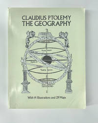
1991rif. 008371Dover Publications 1991 4to 31 cm XVI 288 pp. Laminated wrappers corners slightly bumped collector's stamps on half-title and title. Unabridged Dover republication of Geography of Claudius Ptolemy published in a limited edition of 250 copies by the New York Public Library in 1932. Dover Publications paperback
rif. DADAX150112918XSimon & Schuster 2016-02-16. hardcover. New. 5.75x1.00x9.00. Buy with confidence. Excellent Customer Service & Return policy. Simon & Schuster hardcover
1990rif. 43343New York: Harpercollins 1990. First Edition; First Printing. Hardcover. Very Good in a Very Good dust jacket. Stated First Edition.; 0.9 x 8.3 x 5.6 Inches; 192 pages. Harpercollins hardcover
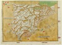
1486rif. 1271161486. Ulm: Johann Reger 1486. Original woodcut map hand-colored printed on a double-page sheet 570 x 407 mm with a central vertical fold verso blank. Upper margin closely trimmed with some loss of the printed border but no loss of the map central fold reinforced on verso a little inkwash and light soiling in the margins; a strong impression with bright contemporary coloring. Matted. § A "modern" map of the Iberian Peninsula Spain and Portugal by the 15th century German cartographer Nicolas Germanus who updated Ptolemy's Geography to show contemporary kingdoms and place names with towns marked by small circles and mountain ranges with brown ridges. The engraving was done by Johannes de Armsheim the first woodcut artist to sign his maps on this map his mark is the backwards "N" in the woodcut text. The map was first published by Lienhart Holle in his atlas of 1482 possibly a ruinous venture as Holle went bankrupt soon afterwards and the sheets and plates were bought by Johann Reger who reissued the atlas in 1486. The two issues can be distinguished by the coloring of the sea: a blue was in 1482 a tan wash in 1486. unknown
rif. GRP29051729Lund Humphries Publishers Limited. Used - Good. Former library copy. Pages intact with minimal writing/highlighting. The binding may be loose and creased. Dust jackets/supplements are not included. Includes library markings. Stock photo provided. Product includes identifying sticker. Better World Books: Buy Books. Do Good. Lund Humphries Publishers, Limited unknown
2014rif. mon0000002258Cambridge University Press 2014. Paperback. Very Good. Edges show some very very light shelf wear. Otherwise brand new. Cambridge University Press paperback
2014rif. mon0000015809Cambridge University Press 2014. Paperback. Very Good. Covers show some light flaring and shelf wear. Cambridge University Press paperback
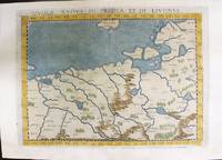
1574rif. M11141Venice: Ruscelli c. 1574. Very Good. Notes: Italian text on verso. Map of Prussia Poland Lithuania part of of Estonia and the Baltic Region. Girolamo Ruscelli 1518–1566 was an Italian mathematician and cartographer active in Venice during the early 16th century. Ruscelli is best known for his important revision of Ptolemy's Geographia published posthumously in 1574. Size : 190x263 mm 7.48x10.35 Inches Coloring: Hand Colored Category: Maps Europe Poland Lithuania; Ruscelli unknown
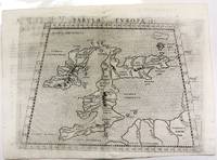
1574rif. M11040Venice c.1574. Very Good. Notes: Map of the British Isles United Kingdom based on Ptolemy's map. Girolamo Ruscelli 1518–1566 was an Italian mathematician and cartographer active in Venice during the early 16th century. Ruscelli is best known for his important revision of Ptolemy's Geographia published posthumously in 1574. Size : 190x262 mm 7.48x10.31 Inches Coloring: Black & White Category: Maps Europe United Kingdom; unknown
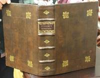
1621rif. B6798Padova: Paolo & Francesco Galignani. 1621. . Some toning interior otherwise clean and crisp. Edition: Second Italian edition. Binding: Recent full calf boards. Matching upper and lower with double blind panels gilt floral devices at corners of inner panel. Spine with 4 raised bands abbreviated title in gilt on maroon label in 2 remaining compartments with gilt devices and blind rules. Notes: Translated from Latin into Italian by Leonardo Cernoti Vinitiano. Text in Italian. A fine example of this monumental atlas and treatise on cartography considered to be the most influential cartographic and geographical account of the ancient world originally written by Ptolemy in Greek around 150 AD. Claudius Ptolemy c.100 – c.170 AD was a mathematician astronomer astrologer and geographer living in the city of Alexandria then the Roman province of Egypt under Roman rule who wrote a number of scientific treatises that greatly influenced Byzantine Islamic and Western European science. His Geografia written around 150 AD is a thorough discussion on maps and the geographic knowledge of the Greco-Roman world and also serves as a handbook on how to draw maps using geographic coordinates for parts of the Roman world known at the time. Geografia draws from an earlier work by Marinus of Tyre now lost to us as well as various Roman and Persian gazetteers. Geografia is divided into 8 books: book I is a treatise on cartography describing the methods used to assemble and arrange Ptolemy's data; from Book II through the beginning of Book VII a gazetteer provides longitude and latitude values for the world known to the ancient Romans; the rest of book VII provides details on three projections to be used for the construction of a map of the world varying in complexity and fidelity; book VIII constitutes an atlas of regional maps. The maps include a recapitulation of some of the values given earlier in the work which were intended to be used as captions to clarify the map's contents and maintain their accuracy during copying. Geografia was translated into Arabic in the 9th century and Latin around 1406 and was a highly influential resource on the cartographic traditions of the medieval Caliphate and Renaissance Europe. Size: Small Folio 301x 206 mm Illustration: Complete with 64 engraved maps 27 Ptolemaic 37 modern including the rare double-page world map “Orbis Terrae Compendiosa Descriptio” engraved by Girolamo Porro in addition to 14 in-text illustrations plus title vignette and chapter headpieces. Folio pagination. La Seconda Parte Della Geografia di Cl. Tolomeo…: title dated 1620; period marginalia in margins of 126v; 154 mispag. 174. Pg. 13 of Commentarii et Annotationi… unnumbered. Volume: 2 parts in 1 volume. References: Sabin 66506; Phillips Atlases 405; Adams M-118; Shirley 193-96 Pages: Blank 2. Title. 1597 dedication to Marco Cornaro from Gio. Battista & Giorgio Galignani. 1621 dedication to Marco Cornaro from Paolo & Francesco Galignani. Blank. Della Geografia di Claudio Tolomeo: p. 1-62. Commentarii et Annotationi dell’Eccell. Sig. Gio. Antonio Magini Padouano…: p. 1-21. Blank 2. Table of contents. Index 27. La Seconda Parte Della Geografia di Cl. Tolomeo…: p. 2-212. Blank. Index 59. Blank 3. Category: Book Atlas & Cartography; Paolo, & Francesco Galignani. hardcover
rif. 13518575-6Used - Good. Former library copy. Pages intact with minimal writing/highlighting. The binding may be loose and creased. Dust jackets/supplements are not included. Includes library markings. Stock photo provided. Product includes identifying sticker. Better World Books: Buy Books. Do Good. unknown
rif. 0691002606.Gpaperback. Good. Access codes and supplements are not guaranteed with used items. May be an ex-library book. paperback
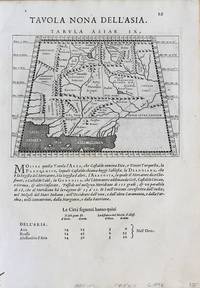
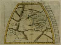
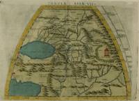
1598rif. M8430Venice.: G. Fratelli; G.A. Magini c. 1598. Very Good. Notes: Ptolemaic Map of Tabula Asiae IX Plate 9 from "Geografia cioe Descrittione Universale della Terra" published by Magini c.1598. Text in Italian. Size : 140x173 mm 5.50x6.80 Inches Coloring: Black & White Category: Maps Asia Central Afghanistan Pakistan; Maps Asia Central Turkmenistan Uzbekistan Tajikistan Kyrgyzstan Kazakhstan; Maps Asia Central India & Sri Lanka / Ceylon; G. Fratelli; G.A. Magini unknown
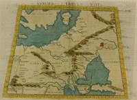
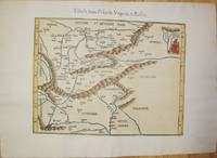
1574rif. M7264Venice: Ruscelli c. 1574. Very Good;. Notes: Italian text on verso. Girolamo Ruscelli 1518–1566 was an Italian mathematician and cartographer active in Venice during the early 16th century. Ruscelli is best known for his important revision of Ptolemy's Geographia published posthumously in 1574. Size : 190x265 mm 7.48x10.43 Inches Coloring: Hand Colored Category: Maps Russia; Maps Europe Ukraine; Maps Europe Poland Lithuania; Ruscelli unknown
1574rif. M7277Venice: Ruscelli c. 1574. Very Good;. Notes: Italian text on verso. Girolamo Ruscelli 1518–1566 was an Italian mathematician and cartographer active in Venice during the early 16th century. Ruscelli is best known for his important revision of Ptolemy's Geographia published posthumously in 1574. Size : 190x260 mm 7.48x10.24 Inches Coloring: Hand Colored Category: Maps Asia Central Tibet & Himalayas; Maps Asia Far East China; Ruscelli unknown
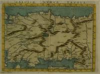
1574rif. M7280Venice: Ruscelli c. 1574. Very Good;. Notes: Italian text on verso. Girolamo Ruscelli 1518–1566 was an Italian mathematician and cartographer active in Venice during the early 16th century. Ruscelli is best known for his important revision of Ptolemy's Geographia published posthumously in 1574. Size : 189x260 mm 7.44x10.24 Inches Coloring: Hand Colored Category: Maps Asia Near East Turkey; Ruscelli unknown
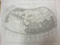
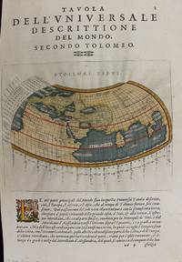
1597rif. M7073Venice 1597. Very Good; a tear in the lower margin not effecting the map. Notes: Ptolemaic map following the classical format. The Indian Ocean is landlocked with a continuous coastline joining Africa to South East Asia. Toprobana present day Sri Lanka is a very large island in the Indian Ocean and the Indian sub-continent is completely missing although the Ganges river is shown. The Mediterranean is well depicted but greatly exaggerated in length. In Africa the Nile is shown originating in mountains below the Equator. Finely engraved in the Italian style with a stippled sea by Girolamo Porro. The map is on a full sheet of Italian text. Italian text on verso. Size : 138x178 mm 5.43x7.01 Inches Coloring: Black & White Reference: Shirley #193. Category: Maps World; unknown
1541rif. M7225Lyon: Michael Servetus c. 1541. Very good minor wormholing on upper margin. Notes: StolenThe only text on verso is the number "33". The publisher Michael Villanovus or Servetus was tried by Calvin for heresy and burned at the stake with several of his books. Size : 307x363 mm 12.09x14.29 Inches Coloring: Hand Colored Category: Maps Europe Poland Lithuania; Maps Europe Hungary; Maps Europe Romania; Maps Europe Ukraine; Maps Europe Czech Republic Slovakia; Michael Servetus unknown
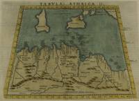
1574rif. M7259Venice: Ruscelli c. 1574. Very Good;. Notes: Italian text on verso. Girolamo Ruscelli 1518–1566 was an Italian mathematician and cartographer active in Venice during the early 16th century. Ruscelli is best known for his important revision of Ptolemy's Geographia published posthumously in 1574. Size : 190x253 mm 7.48x9.96 Inches Coloring: Hand Colored Category: Maps Africa North; Maps Mediterranean Islands; Ruscelli unknown
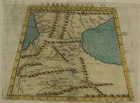
1574rif. M7273Venice: Ruscelli c. 1574. Very Good;. Notes: Italian text on verso. Girolamo Ruscelli 1518–1566 was an Italian mathematician and cartographer active in Venice during the early 16th century. Ruscelli is best known for his important revision of Ptolemy's Geographia published posthumously in 1574. Size : 192x264 mm 7.56x10.39 Inches Coloring: Hand Colored Category: Maps Asia Middle East Caucasus.; Ruscelli unknown
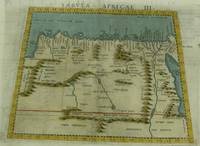
1574rif. M7260Venice: Ruscelli c. 1574. Very Good;. Notes: Italian text on verso. Girolamo Ruscelli 1518–1566 was an Italian mathematician and cartographer active in Venice during the early 16th century. Ruscelli is best known for his important revision of Ptolemy's Geographia published posthumously in 1574. Size : 189x261 mm 7.44x10.28 Inches Coloring: Hand Colored Category: Maps Africa North Egypt;Maps Africa North; Ruscelli unknown
1574rif. M7276Venice: Ruscelli c. 1574. Very Good;. Notes: Italian text on verso. Girolamo Ruscelli 1518–1566 was an Italian mathematician and cartographer active in Venice during the early 16th century. Ruscelli is best known for his important revision of Ptolemy's Geographia published posthumously in 1574. Size : 191x266 mm 7.52x10.47 Inches Coloring: Hand Colored Category: Maps Asia Central Turkmenistan Uzbekistan Tajikistan Kyrgyzstan Kazakhstan; Maps Asia Central Afghanistan Pakistan; Maps Asia Central India & Sri Lanka / Ceylon; Ruscelli unknown
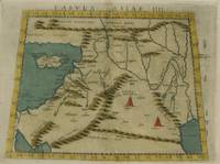
1574rif. M7274Venice: Ruscelli c. 1574. Very Good;. Notes: Italian text on verso. Girolamo Ruscelli 1518–1566 was an Italian mathematician and cartographer active in Venice during the early 16th century. Ruscelli is best known for his important revision of Ptolemy's Geographia published posthumously in 1574. Size : 192x266 mm 7.56x10.47 Inches Coloring: Hand Colored Category: Maps Asia Middle East Holy Land & Palestine;Maps Asia Middle East Jordan Syria Lebanon;Maps Asia Near East Turkey; Ruscelli unknown
1597rif. M7336Venice: Gio. Battista & Giorgio Galignani c. 1597. Very Good;. Notes: Text in Italian. From Magini's "Geografia cioe Descrittione Universale della Terra". The first edition of this map was printed with Latin text with the later issues printed in Italian. "This quarto edition of Ptolemy was edited by the distinguished Italian geographer Giovanni Magini who also published as part of the same work the first reduced-size version of Mercator's atlas. The four world maps -- one ancient and three modern engravings -- are all by Girolamo Porro neatly copying other earlier works." Shirley Size : 135x175 mm 5.31x6.89 Inches Coloring: Hand Colored Reference: Shirley 193; Phillips 405. Category: Maps World; Gio. Battista & Giorgio Galignani unknown