349 risultati
rif. 34705Leipzig B. G. Teubner 1963. Volume I: xxxi 461pp. ; Volume II: vi 446pp. Original cloth in dustwrapper worn on both volumes although the wrapper of volume I is significantly more worn than volume II. Numerous in-text diagrams and charts. The reverse endpaper of Volume I contains a loose constallations chart. A very good copy. German language text Leipzig, B. G. Teubner, 1963 hardcover
rif. 65014Brepols 2024. Hardback 479 pages Size:178 x 254 mm Illustrations:10 b/w 4 tables b/w. Languages:English Arabic. NEW ISBN 9782503607177. Summary Ptolemy's Almagest 2nd century AD is the most influential work of ancient and medieval astronomy. This work however does not tell us the full story about its author's views of the heavens. After completing the Almagest Ptolemy turned his attention to a physical investigation of celestial motions. The result is the Planetary Hypotheses a bold attempt to provide a celestial physics that coheres with the mathematical account of astronomical observations in his Almagest. This book provides the first complete critical edition and English translation of the Arabic version of the Planetary Hypotheses which is lost for the most part in its original Greek. It furthermore provides an extensive commentary on the whole work which situates the Planetary Hypotheses within the context of its time and investigates philosophical ideas central to the work. These include the epistemic value of mathematics relative to natural philosophy and the shape number and dynamics of the celestial bodies. The book also investigates the influence of the Planetary Hypotheses on a wide range of medieval Arabic astronomical and philosophical works from the 9th to the 13th century AD. The upshot is to establish the Planetary Hypotheses as a crucial text for understanding the history of philosophy and science from Greek antiquity to the Arabic Middle Ages TABLE OF CONTENTS I Introduction II Astronomy Natural Philosophy and the Physical Reality of the Celestial Bodies III The Dynamics of Celestial Motions IV Conclusion V The Arabic Version of the Planetary Hypotheses: Edition and Translation VI Commentary Glossary Bibliography Index Brepols 2024 hardcover
rif. 65272Brepols 2024. Hardback xii 245 pages Size:178 x 254 mm Illustrations:6 b/w 28 col. 10 tables b/w. Languages:English Arabic. ISBN 9782503602226. Summary This book deals with the Risla Dht al-kurs a 33-chapter Arabic treatise on the celestial globe with stand. The treatise is attributed to Ptolemy in some manuscripts to the Ottoman scholar Akhawayn in others but is anonymous in most. The book begins with a survey of references to Ptolemaic works in Greek and Arabic sources presenting various works attributed to Ptolemy either preserved in the original Greek or in translation or considered lost including both authentic works and pseudepigrapha. Next follows a critical edition of the treatise Dht al-kurs based on eight of the twenty-three manuscripts studied. The edition is accompanied by an English translation and an extensive mathematical commentary on each chapter enriched with explanatory figures. The comparison between this treatise and the Treatise on the Celestial Globe by Qus ibn Lq d. ca 912 AD presented in parallel with the commentary shows that the former is based on the latter; thus the treatise Dht al-kurs should be considered a Ptolemaic pseudepigraphon. A transcription of the Arabic text of the treatise by Qus ibn Lq based n three of the eighteen examined manuscripts is included so that the reader may compare the two texts. Furthermore in order to examine Akhawayn's association with the treatise a bibliographical and historical investigation is conducted which examines the full range of works attributed to Akhawayn. However the truth about the authorship was probably lost as the result of various rivalries in the late fifteenth century. TABLE OF CONTENTS Preface 1. Introduction 1.1 Ptolemy's authentic works and pseudepigrapha: Research on source materials 1.2 The treatise Dht al-kurs 1.3 The instrument dht al-kurs 1.4 Presentation of the manuscripts 1.5 Who was Akhawayn 2. The Arabic text and translation 3. Commentary on the treatise Dht al-kurs attributed to Ptolemy treatise P and comparison with the treatise on the celestial globe by Qus ibn Lq treatise Q 4. Conclusions 4.1 Comparison between the treatises P and Q 4.2 Possible sources 4.3 Possible date and place of compilation 4.4 The attribution of the treatise to Akhawayn 4.5 Possible relation to Ptolemy Appendix 1: The treatise on the use of the celestial globe with stand by Qus ibn Lq. The titles of the 65 chapters in English translation Appendix 2: Correspondence between the chapters of the various Arabic manuscripts of treatise Q the edition of its Latin translation by Lorch and Martínez Gázquez and treatise P Appendix 3: The Arabic text of the Treatise on the Use of the Celestial Globe with Stand by Qus ibn Lq Bibliography Manuscripts Brepols 2024 hardcover
rif. DADAX1436777291New unknown
rif. DADAX1436990858New unknown
1998rif. G0380790629I3N00HarperCollins Publishers 1998. Paperback. Good. Disclaimer:A copy that has been read but remains in clean condition. All pages are intact and the cover is intact. The spine may show signs of wear. Pages can include limited notes and highlighting and the copy can include previous owner inscriptions. At ThriftBooks our motto is: Read More Spend Less.Dust jacket quality is not guaranteed. HarperCollins Publishers paperback
1574rif. 18848Venetia Venice Giordano Ziletti 1574-73. 4to. Hcalf from ab 1820. Gilt back. Slight rubbing to spine. 78350 pp. and 65 double-page engraved maps with text on verso of plates 130 pp5665 pp. 6 textlvs. at end with brownspots in right margin sometimes a little browning to pages few brownspots and a few textlvs. with minor wormtracts. Complete with all 65 maps called for each measuring ab. 19 x 26 cm. A great part of the maps have some background shadowing from the printers ink mainly due to the fact that this is the third Ruscelli-edition where the plates have been used before. 3 printer's wood-cut devices and 20 smaller and larger woodcuts in the text. 2 woodcuts with Ptolemy shown observing. Third edition of Ruscelli's translation from Venice 1561. The maps are printed from the same plates with the exception of Ptolemy's map of the world for which Malomba had returned to the original conical projection of Ptolemy. Moreover one map is added: the map of "Territorio di Roma". In general the maps are enlarged copies of Gastaldi's maps from the edition of 1548 which came out in 8vo. The Ruscelli translation contains an important innovation namely the division of the world map into two parts one for the Old World and one for the New as seen on the plate "Tavola Universal" depicting the 2 hemispheres. The atlas contains 27 ptolemaic maps and 38 new. 1 World 1 Hemisphere 10 Europe 4 Africa 12 Asia and 38 others. 10 of the maps relate to America.Philipps I:380. Sabin 66505. Nordenskiöld Nr. 34 p.27. unknown
1901rif. 031228Paris: Editore Alfredo Firmin-Didot 1901. 1st Edition . Soft cover. Good. Ii Pp 571-1023. Original Printed Green Wrappers. 26.5 Cm Tall. Volume I Part 2 Only. Text In Greek And Latin Extensively Annotated In Latin. Wear With Minor Losses To Spine Edges Preliminary Pages Detached But Present. Editore Alfredo Firmin-Didot paperback
rif. DADAX0415100208New unknown
rif. 6820084Princeton University Press . Papeback. New. pp. 693 693 Indices Princeton University Press unknown
2008rif. 042267London: Dorling Kindersley 2008. 1st Edition. Hardcover. As New/No Dust Jacket. quarto. 1st printing. An unread book in an as new condition. Dorling Kindersley hardcover
1525rif. 56635Strasbourg. 1525. Originalt tresnitt. Arkets størrelse : 535 cm X 395 cm. Latin. Latinsk tekst. Bretten noe gulnet et par brunpletter.Med Kypros.Map of Palestine Mesopotamia and Babylonia in present day Middle East.Relief shown pictorially.Includes names of places and natural features.Descriptive text within ornamental borders on verso.Appears in the author's Geographia translated by Willibald Pirckheimer with annotations by Joannes Regiomontanus. Argentoragi i.e. Strasbourg : Iohannes Grieningerus communibus Iohannis Koberger impensis excudebat anno a Christi Natiuitate 1525 tertio Kalendas Apriles. Boston Public Library. unknown
1513rif. 54087Strasbourg. 1513. Originalt tresnitt. Arkets størrelse : 60 cm X 425 cm. Norsk. “Martin Waldseemüller a highly accomplished scholar of geography merged the science of mapmaking and the art of printing in his 1513 atlas one of the most groundbraking documents in the history of cartography. He intended this atlas as a new edition of Ptolemy’s Geographia but included the addition of 20 modern maps which were not based upon the tradition of Ptolemy. Waldseemüller’s use of a quadratic plane projection was also a noteworthy advance.”Martin Waldseemüller 1470-1520.Liten rift ved nedre marg. Et lite ormehull i venstre marg. Et par slitasjer i øvre marg. unknown
rif. 658618765Rowman & Littlefield Publishers Incorporated . Papeback. New. Rowman & Littlefield Publishers, Incorporated unknown
1991rif. DADAX0486268969Dover Publications 1991-11-19. paperback. New. 9.50x1.00x12.25. Buy with confidence. Excellent Customer Service & Return policy. Dover Publications paperback
rif. B9798985923780Paperback / softback. New. paperback
rif. A9781848226838Hardback. New. hardcover
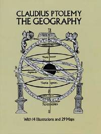
1991rif. 008371Dover Publications 1991 4to 31 cm XVI 288 pp. Laminated wrappers corners slightly bumped collector's stamps on half-title and title. Unabridged Dover republication of Geography of Claudius Ptolemy published in a limited edition of 250 copies by the New York Public Library in 1932. Dover Publications paperback
rif. DADAX150112918XSimon & Schuster 2016-02-16. hardcover. New. 5.75x1.00x9.00. Buy with confidence. Excellent Customer Service & Return policy. Simon & Schuster hardcover
1990rif. 43343New York: Harpercollins 1990. First Edition; First Printing. Hardcover. Very Good in a Very Good dust jacket. Stated First Edition.; 0.9 x 8.3 x 5.6 Inches; 192 pages. Harpercollins hardcover
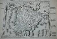
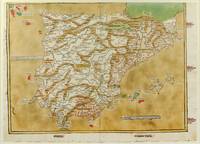
1486rif. 1271161486. Ulm: Johann Reger 1486. Original woodcut map hand-colored printed on a double-page sheet 570 x 407 mm with a central vertical fold verso blank. Upper margin closely trimmed with some loss of the printed border but no loss of the map central fold reinforced on verso a little inkwash and light soiling in the margins; a strong impression with bright contemporary coloring. Matted. § A "modern" map of the Iberian Peninsula Spain and Portugal by the 15th century German cartographer Nicolas Germanus who updated Ptolemy's Geography to show contemporary kingdoms and place names with towns marked by small circles and mountain ranges with brown ridges. The engraving was done by Johannes de Armsheim the first woodcut artist to sign his maps on this map his mark is the backwards "N" in the woodcut text. The map was first published by Lienhart Holle in his atlas of 1482 possibly a ruinous venture as Holle went bankrupt soon afterwards and the sheets and plates were bought by Johann Reger who reissued the atlas in 1486. The two issues can be distinguished by the coloring of the sea: a blue was in 1482 a tan wash in 1486. unknown
rif. GRP29051729Lund Humphries Publishers Limited. Used - Good. Former library copy. Pages intact with minimal writing/highlighting. The binding may be loose and creased. Dust jackets/supplements are not included. Includes library markings. Stock photo provided. Product includes identifying sticker. Better World Books: Buy Books. Do Good. Lund Humphries Publishers, Limited unknown
2014rif. mon0000002258Cambridge University Press 2014. Paperback. Very Good. Edges show some very very light shelf wear. Otherwise brand new. Cambridge University Press paperback
2014rif. mon0000015809Cambridge University Press 2014. Paperback. Very Good. Covers show some light flaring and shelf wear. Cambridge University Press paperback