PtolemyBiblio.com
296 résultats
réf. 0332683788.Ghardcover. Good. Access codes and supplements are not guaranteed with used items. May be an ex-library book. hardcover
réf. 0332286290.Ghardcover. Good. Access codes and supplements are not guaranteed with used items. May be an ex-library book. hardcover
1564réf. 265015Venice: Giordano Ziletti 1564. hardcover. very good. 3 parts in 1. Each part has a separate title page with large printer's device. Part 2: Espositioni et Introduttioni Universali di Girolamo Ruscelli sopra tutta la Geografia di Tolomeo. Part 3: Discorso Universale di M. Gioseppe Moleto mathematico. Illustrated with 63 of 64 fine double-leaf copper engraved maps including the rare "World in Hemispheres". Additional large in-text engravings and decorative initials throughout. 8 358 110 204 48 index 47 pages. Short thick 4to bound in old calf with gilt devices on covers neatly re-cased binding well-rubbed but very sound; very clean copy virtually free of foxing; one map ink stained; lacks the final world map "Carta Marina" a.e.g. Venetia: Appresso Giordano Ziletti 1564. Text in Italian. Bookplate of Otto Orren Fisher pasted on inside cover. Manuscript note in ink on title page reads: Ex Libris Stephan Tiapas. Second edition of Ruscelli's Italian translation very similar to the edition of 1561 and containing the same series of maps. The double- page maps are partly based on those of Jacopo Gastaldi in the edition of 1548 but on a larger scale. According to Nordenskiold two important innovations were introduced by the 1561 edition into cartographical literature. One: the division of the Map of the World in two hemispheres. Two: The re-issue of the Zeno Map of the Arctic Regions which had appeared first 3 years before. "If the remarkable map in this little work had not received extensive circulation under the sanction of Ptolemy's name it would probably have been forgotten. During nearly a whole century it exercised an influence on the mapping of the northern countries to which there are few parallels in the history of cartography". Girolamo Ruscelli c. 1504-1566 was a Venetian editor whose maps are primarily based on those by Jacopo Gastaldi 1548 but with many of his own additions and reproduced on a larger scale. Ruscelli introduces several important innovations in this volume through his 37 "modern" maps which cover Europe Africa Asia and the New World. Ruscelli includes a double hemisphere world map which was the first of its kind to be used in an atlas and "Carta Marina Nuova Tavola" a rare sea chart of the world. He includes a revised version of the Zeno map of the Arctic first published in 1558. The Zeno map describes the purported journey of the author's ancestors in the 1390s to Greenland Iceland the mythical islands of Frisland and Icaria and what is now thought to be Newfoundland and Labrador. While Zeno shows Greenland connected to Norway Ruscelli has updated the map by eliminating this land bridge. Despite its inaccuracies and inclusion of mythical lands the Zeno map persisted as the prevailing map of the Arctic and Greenland for many years. Six other New World maps include the South American continent Brazil Central America and the Baja Peninsula the eastern coast of North America Cuba and Hispaniola. Claudius Ptolemy 90-168 CE was a Roman geographer and mathematician living in Egypt who compiled his knowledge and theories about the world's geography into one seminal work. Although his maps did not survive his mathematical projections and location coordinates did. During the Renaissance revival of Greek and Roman works "Geographia" was rediscovered by monks and based upon Ptolemy's detailed instructions the maps were recreated. The first printed edition of "Geographia" with maps was published in Bologna in 1477. A rare and exciting edition for any collector. Sabin 66504 Giordano Ziletti unknown
1562réf. 220508Venice: Vincenzo Valgrisi 1562. hardcover. very good-. Venice: Vincenzo Valgrisi 1562. 2 parts with separate pagination. Short thick 4to bound in 19th century vellum with red edges. Features 64 double page maps: 27 Ptolemaic maps showing the ancient world as Ptolemy knew it including one world map 37 "modern" maps with two world maps and several woodcut diagrams illustrations and decorative initials. Text in Latin. Staining throughout affecting some of the maps. Title page cropped .5" at right margin. Bookplate of Otto Orren Fisher and ink inscription of Charles Singer. Giuseppe Moleto Josephus Moletius 1531-1588 was an Italian mathematician who based the text of this edition on the 1525 translation by Wilibald Pirckheimer. Moleto's draws upon Ruscelli's enlarged maps of his 1561 edition which in turn were based upon those by Jacopo Gastaldi. Moleto has also included some of Girolamo Ruscelli's innovations from his own edition: the double hemisphere world map and "Carta Marina Nuova Tavola" a rare sea chart of the world. Also from Ruscelli is a revised version of the Zeno map of the Arctic first published in 1558. The Zeno map describes the purported journey of the author's ancestors in the 1390s to Greenland Iceland the mythical islands of Frisland and Icaria and what is now thought to be Newfoundland and Labrador. While Zeno shows Greenland connected to Norway Ruscelli updated the map by eliminating this land bridge. Despite its inaccuracies and inclusion of mythical lands the Zeno map persisted as the prevailing map of the Arctic and Greenland for many years. Six other New World maps include the South American continent Brazil Central America and the Baja Peninsula the eastern coast of North America Cuba and Hispaniola. Moleto juxtaposes the Ptolemaic maps with the contemporary offering easy comparison between ancient and new. Claudius Ptolemy 90-168 CE was a Roman geographer and mathematician living in Egypt who compiled his knowledge and theories about the world's geography into one seminal work. Although his maps did not survive his mathematical projections and location coordinates did. During the Renaissance revival of Greek and Roman works "Geographia" was rediscovered by monks and based upon Ptolemy's detailed instructions the maps were recreated. The first printed edition of "Geographia" with maps was published in Bologna in 1477. A rare and exciting edition for any collector. Vincenzo Valgrisi unknown
1999réf. 3732943Ashgate Publishing Limited 1999. This is an ex-library book and may have the usual library/used-book markings inside.This book has hardback covers. In good all round condition. Dust jacket in good condition. Please note the Image in this listing is a stock photo and may not match the covers of the actual item1250grams ISBN:9781840142938 Ashgate Publishing Limited hardcover
1999réf. 3973784Ashgate 1999. This is an ex-library book and may have the usual library/used-book markings inside.This book has hardback covers. In good all round condition. No dust jacket. Please note the Image in this listing is a stock photo and may not match the covers of the actual item1200grams ISBN:1840142936 Ashgate hardcover
1985réf. 87932Franklin Center Pennsylvania: The Franklin Library 1985. Hardcover. Fine. 24 cm x 17 cm 1085 pp. Bound in full leather with AEG and ribbon insert. Moire end papers. This volume was published by The Franklin Library exclusively for subscribers as part of the 25th Anniversary Limited Edition of The Great Books of the Western World series. Includes Notes from the Editors pamphlet. The Franklin Library hardcover
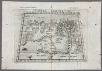
1574réf. 005867Venice: Vincenzo Valgrisi 1574. 1574 Edition. Engraving on Copper. Very Good. Double-page copperplate engraved map with letterpress text. Image: 26 x 19 cm. Sheet: 34 x 24 cm. A highly decorative and historically significant 16th-century map of North and Northeast Africa derived from Ptolemy’s 2nd-century geography. The map was published in the 1574 edition of Geographia edited by Girolamo Ruscelli and printed in Venice by Vincenzo Valgrisi. This is “Tabula Africae III” the third of Ptolemy’s Africa maps focusing on: Libya Egypt Cyrenaica Thebes and parts of Arabia Prominent classical sites including: Alexandria Cyrene Memphis Thebes Ptolemais Ammonis templum Mountain chains rivers and desert regions in stylized Renaissance form The map features Latin titling and classical toponyms while the verso contains the original Italian commentary explaining the geography cities and coordinates. CONDITION: Very good. Strong impression with clear platemark. Central fold as issued. Mild age toning and minor wear to margins. Backed at top center. Verso complete with full letterpress text Tavola Terza d’Africa Antica. Note: only this 1574 edition contains Vincenzo Valgrisi's elaborate printer's emblem showing: A lion leaping or attacking a smaller animal often interpreted as a fox and a large bird resembling an ostrich standing nearby. Vincenzo Valgrisi unknown
réf. 1024156877.Ghardcover. Good. Access codes and supplements are not guaranteed with used items. May be an ex-library book. hardcover
réf. 102483560X.Ghardcover. Good. Access codes and supplements are not guaranteed with used items. May be an ex-library book. hardcover
réf. 1108063640.Gpaperback. Good. Access codes and supplements are not guaranteed with used items. May be an ex-library book. paperback
réf. 0674994795.Ghardcover. Good. Access codes and supplements are not guaranteed with used items. May be an ex-library book. hardcover
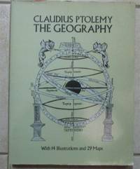
1991réf. Ancient World cptgAncient World cptg Claudius Ptolemy active 2nd century. The Geography. Translated and edited by Edward Luther Stevenson; with an introduction by Joseph Fischer. Mineola N.Y.: Dover; Toronto: General Pub. Company; London: Constable 1991 1 atlas xvi 167 ca. 121 p.: ill. maps; This The Dover reprint came from the library of a bibliophile who had a wonderful collection of printed books on the history of maps. The original paperback volume was rebound in a handsome blue library buckram with wrappers bound in gilt lettering on spine. Measures 9 ½" x 12 ½". Fine copy. $50.00 Box 5678 Notes Translation of the Geographia and dedication of the 1460 ms. ed. Codex Ebnerianus prepared by Donnus Nicholas Nicolaus Germanus. "Translation based upon . Latin and Greek texts" and later editions--P. xiii. At head of title: Claudius Ptolemy. Unabridged republication in reduced dimensions of the limited ed.: Geography of Claudius Ptolemy. New York: New York Public Library 1932. Includes reproductions of maps and some text from the Codex Ebnerianus and reproductions of two maps from 16th cent. printed eds. of the Geographia: the Ruysch world map from the 1508 ed. and the Lorenz Fries world map from the 1522 ed. Subjects Ptolemy active 2nd century. Geographia Manuscripts Latin -- Facsimiles Early maps -- Facsimiles Atlases -- Early works to 1800 Geography Ancient Geography Ancient -- Maps Author / Creator Nicolaus Germanus active 15th century. Stevenson Edward Luther 1858-1944. Fischer Joseph 1858-1944 New York Public Library Other title Claudius Ptolemy the Geography. Other title Codex Ebnerianus New York Public Library ISBN : 0486268969 pbk. : Dover; General Pub. Company; Constable hardcover
1936réf. 304164 pages in dark blue cloth with gilt titling on spine. Second printing of this edition. Appendix contains extracts from Ptolemy's Almagest the whole of his Centiloquy and a diagram of the Zodiacal Planisphere with an explanation by J.M. Ashmand. Several diagrams and tables throughout. Previous owner's inscription on front pastedown. Hinges shaken possibly glued. One front free end paper razored out. A few check marks in the margins. Else pages are clean and unmarked. Binding is firm spine is square. Good. The Aries Press hardcover
1970réf. 1970Liechtenstein: Klaus Reprint 1970. FacsimileFacsimile. Hardcover. Very Good/Very Good. Klaus Reprint Liechtenstein 1970 in - folio 20.5 x 14" 52x35cm of 141 pages 51 double-plate maps. New reprint edition of the standard work on the history of cartography by geologist explorer and collector of old maps Adolf Erik Nordenskjöld 1832-1901. Extensive iconography with numerous in-text map reproductions and 51 high-quality double-plate reproductions based on the famous atlases by Ptolemy Mercator Gastaldi and Apinius Ortelius; Published in Stockholm in 1889 entitled “Facsimile-Atlas to the Early History of Cartography with Reproductions of the Most Important Maps Printed in the XV and XVI Centuries”. This copy is from the second reprint edition of 1961 with a preface by Kraus. In very good condition. Klaus Reprint hardcover
réf. 146020Used. For more details please contact me unknown
1896réf. 000021169Glasgow: Hay Nisbet and Co. 1896. later edition. hardcover. Poor. Octavoapprox. 5 3/8" by 7 7/8" flexible brown leather covers xxvii 5 246 1 pages. Title page browned but the rest of the text is clean and unmarked. Repairs with linen tape at hinges as well as internally. Titling on paper spine label very faded. Mottling on covers damaged area at foot of spine and bottom of rear cover; no text is affected by the damage. 092717B Hay Nisbet and Co. hardcover
1541réf. 15881Vienna 1541. Very good condition. The second map to show just southern Africa; it is based on the Waldseemuller modern map of southern Africa and derived from Ptolemy. Decoratively illustrated with African kings serpents an elephant and a Christian soldier riding a sea monster towards Madagascar. Three large rivers arise from a mountain range labeled 'Fontes Nili' source of the Nile other mountain ranges and coastal towns named in Latin or Portuguese. With the figure of the King of Portugal riding a sea monster towards Madagascar. Based on the slightly larger map from 1513 published in "Ptolemy's Geographia". The atlas was reprinted in 1520 1522 1525 1535 and 1541. This wood block was cut in 1525 for the publisher J.Grünninger. This being the variant of 1541 now without the banner title but title in letter type and blank verso. From the last edition of Ptolemy's "Geography" with maps by Laurens Fries and the text edited by Michael Servetus. Servetus was accused of heresy and burnt at the stake. Calvin ordered that copies of the book should be burnt with him although this copy seems to have eluded the flames. Wood block map with early hand color. Blank on the verso with the number 39 at the lower right corner. Image size: 16 7/8 x 13". Paper size: 21 1/4 x 15". Strengthened on the verso very faint browning at middle of center fold otherwise very good. Betz p. 55-56. Tooley "Map Collectors' Circle No. 30 Printed Maps of the Continent of Africa Part II" p. 61-62. Karrow "Mapmakers of the Sixteenth Century" unknown
1973réf. 1602050041West of England Press 1973. Hardcover. Like New. Facsimile of the 1520 edition. Burgundy cloth with crimson spine label. 46 cm. Hardcover. No dust jacket. Good binding and cover. Spine cocked. Includes maps and original Latin text as well as essays on the history of the work. Clean unmarked pages. This is an over sized or heavy book that requires additional postage for international delivery outside the US. West of England Press hardcover
1742réf. 09570London: Printed for John and Paul Knapton at the Crown 1742 Book. Good. Hardcover. in the original full leather with five raised bands modestly worn both hinges cracked but holding no significant foxing all folding maps present and untorn very little wear inside. Printed for John and Paul Knapton at the Crown hardcover
1991réf. I5845New York: White Lotus 1991. Paperback. Good/no dj. 1.00. Claudius Ptolemy. Geography The White Lotus paperback