Ptolemy 2nd CentBiblio.com
346 résultats
réf. B9781017204117Hardback. New. hardcover
réf. 0332269779.Gpaperback. Good. Access codes and supplements are not guaranteed with used items. May be an ex-library book. paperback
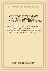
2026réf. LRB6021857Paris: Editions Recreasoft 2026 Langue : Latin. Environ 566 pages. Français : Réimpression à la demande. Édition originale : 1898. Édition savante consacrée à l'oeuvre conservée de Claude Ptolémée figure majeure de l'astronomie de la géographie et de la tradition scientifique antique. Ce volume présente un texte latin d'intérêt philologique et historique recherché pour l'étude de la transmission des savoirs antiques et des éditions critiques de la fin du XIXe siècle. Images du livre non contractuelles English : Print-on-demand reprint. Original edition : 1898. Scholarly edition devoted to the surviving works of Claudius Ptolemy a major figure in ancient astronomy geography and scientific tradition. This volume offers a Latin text of philological and historical interest valued for the study of the transmission of ancient knowledge and late nineteenth-century critical scholarship. Book images are non-contractual. Editions Recreasoft. Softcover. New. Editions Recreasoft paperback
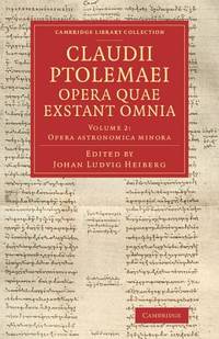
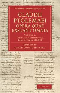
2014réf. mon0000002258Cambridge University Press 2014. Paperback. Very Good. Edges show some very very light shelf wear. Otherwise brand new. Cambridge University Press paperback
2014réf. mon0000015809Cambridge University Press 2014. Paperback. Very Good. Covers show some light flaring and shelf wear. Cambridge University Press paperback
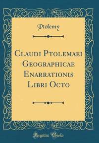
2026réf. LRB1012711Paris: Editions Recreasoft 2026 Langue : Latin. Environ 476 pages. Printed on premium paper. Français : Réimpression à la demande. Édition originale : 1525. Édition latine des huit livres de la Géographie de Claude Ptolémée accompagnée des cartes gravées qui ont fait la renommée de cet atlas fondamental de la cartographie de la Renaissance. L'ouvrage présente un texte en double colonne un titre dans un encadrement gravé et un ensemble de cartes dont la plupart sont numérotées avec un intérêt particulier pour les premières représentations de l'Amérique dans l'histoire de la cartographie. Ensemble recherché pour l'étude de la géographie antique de la transmission humaniste du texte ptoléméen et de l'illustration cartographique du XVIe siècle. Images du livre non contractuelles English : Print-on-demand reprint. Original edition : 1525. Latin edition of the eight books of Claudius Ptolemy's Geography accompanied by the engraved maps that made this Renaissance atlas a landmark in the history of cartography. The work features text in double columns a title within an engraved architectural border and a set of maps most of which are numbered with particular interest for the early depictions of America in the history of mapmaking. A desirable item for the study of ancient geography the humanist transmission of Ptolemaic texts and 16th-century cartographic illustration. Book images are non-contractual. Editions Recreasoft. Softcover. New. Editions Recreasoft paperback
réf. 0332011100.Ghardcover. Good. Access codes and supplements are not guaranteed with used items. May be an ex-library book. hardcover
réf. 0332010937.Gpaperback. Good. Access codes and supplements are not guaranteed with used items. May be an ex-library book. paperback
2026réf. LRB12001218Paris: Editions Recreasoft 2026 Langue : Latin. Environ 530 pages. Français : Réimpression à la demande. Édition originale : 1533. Texte latin de Claudius Ptolemaeus consacré aux significations des étoiles fixes et à leur interprétation dans la tradition astrologique antique. Ouvrage d'intérêt majeur pour l'histoire de l'astronomie de l'astrologie et de la transmission des textes gréco-latins à la Renaissance. Images du livre non contractuelles English : Print-on-demand reprint. Original edition : 1533. Latin text by Claudius Ptolemaeus on the significations of the fixed stars and their interpretation within the ancient astrological tradition. An important work for the history of astronomy astrology and the transmission of Greco-Latin texts in the Renaissance. Book images are non-contractual. Editions Recreasoft. Softcover. New. Editions Recreasoft paperback
1819réf. RO80255816Imprimerie de A. Bobée. 1819. In-4. Relié. Etat d'usage, Coins frottés, Dos fané, Quelques rousseurs. xliv + 88 + 54 + 20 + 183 + 18 + 37 pages. Quelques tables dépliantes hors texte. Titre doré au dos, pièce de titre verte. Trois photos disponibles.. . . . Classification Dewey : 904-Recueils de récits d'événements
1519réf. 045673Venice: Aldus & Andreas Torresano 1519. First Edition. Hardcover Full Leather. Very Good Condition. Contemporary calf worn paneled with a central Venetian device. Corners worn through rubbing to hinges old paper spine labels lacking ties but sound overall. Very light dampstain in top margin in latter sections scattered very minor foxing heavier to endpapers but generally bright and clean. 301 19 leaves. Ahmanson-Murphy 183 Adams P1860 The first Aldine edition of Pontano's commentary on the Ptolemaic Centiloquium and Pontano's De rebus coelestibus two of the central astrological texts of the Renaissance. This volume was meant to complement the two volume edition of Pontano's works published by Aldine the year previous. Size: Quarto 4to. Previous owner's signature in ink. Quantity Available: 1. Shipped Weight: Under 1 kilo. Category: Science & Technology; Astronomy; Philosophy. Inventory No: 045673. Aldus & Andreas Torresano hardcover
1996Celestial Matters is a startling novel of hard SF set in an alternative Ptolemaic universe . In this novel, the solar system and stars progress outward in concentric cirCles, and in this alternate universe known as the Ptolemaic Universe, the Greek empire of Alexander the Great has lasted for a thousand years. And now a starship journeys to the center of the universe to bring back the ultimate weapon: a fiery piece of sun matter. Book
1561réf. 7550Carte par Ptolémée. Produite sur cuivre pour la première fois par Ruscelli. Nomenclature latine "Tabula Asiae IIII". Descriptif au dos en italien.Venise, chez Valgrise 1561.Carte trapézoïdale sous chemise cartonnée, mais envoyée sans le support. Carte très primitive et rare. Très bon état. Format in-4° (25x19).
2008réf. 2-0789315912Universe Pub 2008. Hardcover. New. 304 pages. 14.00x9.00x1.25 inches. Universe Pub hardcover
1584réf. Map1002Cologne: Goldefridi Kempensis 1584. 2nd Edition . No Binding. Fine. Folio. AN ORIGINAL MAP. Original hand colouring. 47x40cms Folding double page.PLEASE EMAIL FOR PHOTOS. Goldefridi Kempensis unknown
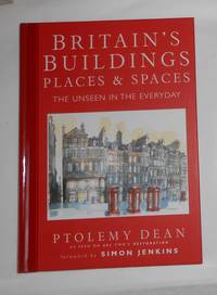
2008réf. 042267London: Dorling Kindersley 2008. 1st Edition. Hardcover. As New/No Dust Jacket. quarto. 1st printing. An unread book in an as new condition. Dorling Kindersley hardcover
2008réf. ABE-1712239321266Dorling Kindersley 2008 Superb copy of a stunning book. Award winning architect and historian Ptolemy Dean has packed so much into this heavy and large sized book. Clean and tight no owner marks looks new and unread. 1st Edition. Hardcover. As New. Dorling Kindersley hardcover
2008réf. TH241351Dorling Kindersley London 2008. 1st Edition. HARDCOVER. 1st printing. Tall large 4to. in colour printed boards 224pp illustrated in colour throughout __CONDITION : A well preserved AS NEW unmarked copy. . . . . . . . . . . . . . To see more of our Art Monographs etc type DbbARTIST in the Keywords search box __We always ship in PROTECTIVE CARD PARCELS Dorling Kindersley, London hardcover
réf. 1405329637.Ghardcover. Good. Access codes and supplements are not guaranteed with used items. May be an ex-library book. hardcover
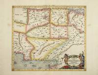
réf. 4023Utrecht: Francois Halma. 1578-c.1695. No binding. Very Good. 350 x 470 mm. a fine example in modern wash colour. From Gerard Mercator's edition of 'Claudii Ptolemaei Tabulae Geographicae Orbis Terrarum'. It was in 1578 that one of the world's greatest cartographers put out an edition of the earliest surviving geographical treatise. This map centres on India although there is not much of a peninsula. Its presence can be determined by the Indus and Ganges Rivers on the left and right respectively. Sri Lanka can be seen at the bottom of the map. Koeman Me 5; Nordenskiold 234; Phillips P.L. Atlases 384; Shirley BL T.Ptol-11a & 11k; Van der Krogt P. Atlantes 1:501. Francois Halma. 1578-[c.1695] unknown
réf. 6101Amsterdam: R & J Wetstenii & G Smith. 1578-1730. No binding. Very Good. 350 x 470 mm. a fine example in recent wash colour. Gerard Mercator's edition of Ptolemy's 'Geography' is highly acclaimed; he spent much of his life studying the work and even engraved the plates himself. The 'Geographia' is the earliest surviving geographical treatise. Much of Mercator's efforts were spent projecting Ptolemy's geography onto the projection which bears his name. Mercator is one of the world's greatest cartographers and the 'Claudii Ptolemaei Tabulae Geographicae Orbis Terrarum' was first published in 1578. This map centres on India although there is not much of a peninsula. Its presence can be determined by the Indus and Ganges Rivers on the left and right respectively. Sri Lanka can be seen at the bottom of the map. It is in the third state with the addition of a latitude and longitude grid illustrating the projection. Not in Gole; Koeman Me 5; Nordenskiold 234; Phillips P.L. Atlases 384; Shirley BL T.Ptol-11a & 11k; Van der Krogt P. Atlantes 1:501. R & J Wetstenii & G Smith. 1578-[1730] unknown
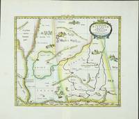
réf. 6099Amsterdam: R & J Wetstenii & G Smith. 1578-1730. No binding. Very Good. 350 x 410 mm. a fine example in recent wash colour. Gerard Mercator's edition of Ptolemy's 'Geography' is highly acclaimed; he spent much of his life studying the work and even engraved the plates himself. The 'Geographia' is the earliest surviving geographical treatise. Much of Mercator's efforts were spent projecting Ptolemy's geography onto the projection which bears his name. Mercator is one of the world's greatest cartographers and the 'Claudii Ptolemaei Tabulae Geographicae Orbis Terrarum' was first published in 1578. This map focuses on the region covering part of the silk route to China. Along this path rode much of Asia's spices to Europe. It is adorned with camels and camps of traders en route. It is in the third state with the addition of a latitude and longitude grid illustrating the projection. Koeman Me 5; Nordenskiold 234; Phillips P.L. Atlases 384; Shirley BL T.Ptol-11a & 11k; Van der Krogt P. Atlantes 1:501. R & J Wetstenii & G Smith. 1578-[1730] unknown
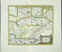
réf. 4022Utrecht: Francois Halma. 1578-c.1695. No binding. Very Good. 350 x 400 mm. a fine example in recent wash colour in good condition. From Gerard Mercator's edition of 'Claudii Ptolemaei Tabulae Geographicae Orbis Terrarum'. It was in 1578 that one of the world's greatest cartographers put out an edition of the earliest surviving geographical treatise. This map centres on present day Pakistan with the Indus River prominent. Upper right can be seen the Himalayan Mountains. Koeman Me 5; Nordenskiold 234; Phillips P.L. Atlases 384; Shirley BL T.Ptol-11a & 11k; Van der Krogt P. Atlantes 1:501. Francois Halma. 1578-[c.1695] unknown
réf. 6100Amsterdam: R & J Wetstenii & G Smith. 1578-1730. No binding. Very Good. 350 x 400 mm. a fine example in recent wash colour. Gerard Mercator's edition of Ptolemy's 'Geography' is highly acclaimed; he spent much of his life studying the work and even engraved the plates himself. The 'Geographia' is the earliest surviving geographical treatise. Much of Mercator's efforts were spent projecting Ptolemy's geography onto the projection which bears his name. Mercator is one of the world's greatest cartographers and the 'Claudii Ptolemaei Tabulae Geographicae Orbis Terrarum' was first published in 1578. This map centres on present day Pakistan with the Indus River prominent. Upper right can be seen the Himalayan Mountains. It is in the third state with the addition of a latitude and longitude grid illustrating the projection. Koeman Me 5; Nordenskiold 234; Phillips P.L. Atlases 384; Shirley BL T.Ptol-11a & 11k; Van der Krogt P. Atlantes 1:501. R & J Wetstenii & G Smith. 1578-[1730] unknown
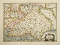
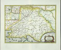
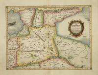
réf. 4017Utrecht: Francois Halma. 1578-c.1695. No binding. Very Good. 350 x 460 mm. a fine example in modern wash colour. From Gerard Mercator's edition of 'Claudii Ptolemaei Tabulae Geographicae Orbis Terrarum'. It was in 1578 that one of the world's greatest cartographers put out an edition of the earliest surviving geographical treatise. This map is centred on Armenia and shows the Black Sea and Caspian Sea to the west and east respectively. Koeman Me 5; Nordenskiold 234; Phillips P.L. Atlases 384; Shirley BL T.Ptol-11a & 11k; Van der Krogt P. Atlantes 1:501. Francois Halma. 1578-[c.1695] unknown