624 résultats
2005Travelling in Turkey, Greece, Bulgaria and the newly independent Former Yugoslav Republic of Macedonia, Myer encounters a bewildering array of political and cultural opinions-Orthodox Christians and Muslims, communists and nationalists, warlords and modernizers. His investigations take him to Orthodox weddings and Easter parades, political meetings and religious ceremonies. He encounters widows and witches, dervishes and mystics. Throughout he remains fascinated by the human dimension of Macedonia"s deep-seated identity crisis. More than a simple travelogue, People of the Storm God casts light on the troubled history of Macedonia and its unique melting pot of politics, religion and ethnicity. This book evocatively reveals both the extraordinary cultural diversity of the Balkans and the weight of history borne by its different peoples. Book
1825Mm 110x195 Volume rilegato in mezza tela con titolo in oro al dorso, 62-(2) pagine con una cartina dei luoghi applicata in chiusura del volume. Opera non comune di difficile reperibilità. Libro in ottime condizioni; spedizione in 24 ore dalla conferma dell'ordine.
1999As New English Paperback. Mint. Roy. 8vo. (24 x 17 cm). In English. 18 p., 1 color map. Macedonian minority in Greece. A human tragedy within the boundaries of the Eurpean Union.
1909Very Good Turkish, Ottoman (1500-1928) Extremely rare huge chromo-lithograph map in 24 sheets mounted on canvas, showing a large zone including Midyat (Mardin), Mosul, Mt. Cilo (Resko-Buzul) on the southeast; Kahta (Adiyaman), Munzur Mt., Divrigi (Sivas) on the west; the Black Sea on north and Turkish borders to Armenia, Azerbaijan on the east, and to Russia on the northeast. In addition shows in separate little portions, roads, mountains and hills, lakes, and telegraph and post ways and borders in that zone. Not in any libraries and any collection. An attractive map with its huge size and decorative surface. Several toponyms are underlined in red ink. Otherwise a very good example. Original folded map mounted on canvas. 118x112 cm. In Ottoman script (Turkish with Arabic letters). Scale: 1/630.000.
1916Very Good Turkish, Ottoman (1500-1928) Original color map. Folded. Oblong atlas folio. (50 x 60 cm). In Ottoman script. Shows Rhodes and Tilos Islands. Scale: 1/200.000. Hegira: 1332 = Gregorian: 1916. Not description on map-maker. This is one of the series of the Bonn projection maps which are the first map series in modern techniques in Turkey and the Ottoman Empire. This is one of the series of the Bonn projection maps which are the first map series in modern techniques in Turkey and the Ottoman Empire. In order to produce these maps covering Turkish territory, Reconnaissance Branch was incorporated into The Mapping Commission. The maps were produced in the datum based on the latitude and longitude of Ayasofya Mosque in an equal area Bonn Projection. The field works for the 123 sheets covering the country were conducted by 76 staff. The production was completed in 18 years starting from east-west. Fieldworks continued without stopping except in the years 1914 and 1920. This map series called also reconnaissance maps contributed a lot to producing 1:25.000 scale maps. A very detailed and attractive map of Rhodes Island showing its harbors and Ottoman place names.
réf. 26963Bruxelles, Musees Royaux d'Art et d'Histoire, 1980 Broche, couverture carton illustree en couleurs, 170 x 240mm., 62pp., illustration n/b et couleurs. .
2012réf. 060666National Bank of the Republic of Macedonia 2012. Paperback. Very Good. 0x0x0. Has some light general reading/shelfwear - otherwise this is a clean tight copy. Quick dispatch from the UK. National Bank of the Republic of Macedonia paperback
1996Articles by Priit Vesilind "Macedonia : Caught in the Middle" (pp 118-139) Book
1884réf. 28516Paris / Lyon, E. Plon, Nourrit et Cie / Librairie Briday, 1884. Un vol. au format in-12 (188 x 123 mm) de 1 f; bl., 2 ff. n.fol., 1 frontispice photographique n.fol., 246 p.;, 1 f. n.fol. et 1 f. bl. Reliure postérieure de demi-maroquin sable à coins, dos muet à nerfs, couvertures conservées.
1979Creasing to rear wrap. Large Tear (4 cm) to rear wrap, else VG. ; N. D. (c. 1978-1979). 110pp+62pp of plates, some in color. Exhibition catalog. ; 172 pages
1979Faint creasing. Tiny chip to base of front wrap. Scholar's name to ffep (Jenifer Neils). ; N. D. (c. 1978-1979). 110pp+62pp of plates, some in color. Exhibition catalog. ; 172 pages
1955Very Good Turkish Original manuscript map on cloth. Chipped margins, stains on cloth. Folded. Oblong folio. (32x35 cm) In modern Turkish. Sealed. It shows the exploration of an area of ??1487 hectares and some stone and brick mosques, fountains, buildings and geographic status of the region in the upper corner. Scale: 1:25.000. Extremely rare.
réf. DADAX1436663024New unknown
1898pp.309-320, extrait de "Mélanges Weil", br.orig., bel état
1898réf. R34754Paris, Fontemoing 1898 pp.309-320, extrait de "Mélanges Weil", br.orig., bel état
1926Edizione del 1926 di questo volume sull'imperialismo macedone e l'ellenizzazione dell'oriente scritto da Jouguet. Il testo è impreziosito da una mappa e 7 planches fotografiche. In mediocri condizioni. Copertina editoriale in mediocri condizioni generali con usure e parti mancanti ai margini e dorso. Nastro adesivo al dorso. Legatura quasi assente. All'interno le pagine si presentano in buone condizioni con fioriture. In 8. Dim. 20,5x14,5 cm. Pp. XVI+(6)+494+(10).
19648vo., First Edition, with 20 plates on 12, a double-page map in the text and a large folding panorama photograph; black cloth, gilt back, a very good, clean copy in dustwrapper, the latter lightly creased and frayed at edges. Scarce, especially in the dustwrapper. Enser, p.320.
1926In-8° (cm. 24 ca.), pp. 8 (da p. 49 a p. 56) + 4 RITRATTI in forma di monopodio o di erma in 3 TAVOLE su carta patinata in bianco e nero fuori testo, dal Museo Naz. di Napoli e da Ercolano. Uno è di Pirro, sugli altri, ipotesi identificatrive. Brossura provvisoria in carta decorta muta, segno a biro in cop.
1971This is a photocopied facsimile in soft cover wraps. 247p. bibliography footnotes, index leaves [31X21N2 cm] Book
2012Commemorative publication celebrating "One Hundred Years since the Liberation of Macedonia" 104p. illus maps [NO copies found in WorldCat] Book
2005Spring Fashion show 2005. Publlcation in support of the cultural activities of the Pan-Macedonian Association of Toronto. Directory of commercial sponsors. 54p. illus [NO copies in WorldCat] Book
1993Inscribed by the author to Christian Habicht, else unmarked. Some rubbing and wear to boards with a few scratches. Rear lower edge has edgewear with a bit of colour loss. ; 152pp, illustrated. ; 4to - over 9¾" - 12" tall; 152 pages; Signed by Author
1972Book shows very light wear to covers (in black cloth) only. Binding is solid and text/interior is clean and free of marking of any kind. 228 pages, map endpapers. Contents are composed of 22 lessons with three appendices and vocabulary. Text is in English. Author is head of department of Slavonic studies, U. of Nottingham
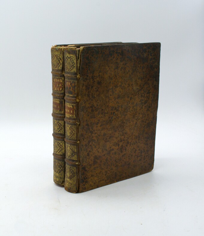
1731réf. PHO-1807Paris, F. G. Quillau, 1731. 2 volumes grand in-4 de [2]-VIII-XXIV-478-[4] et [2]-VI-524 pages, pleine basane brune, dos à nerfs, épidermures, manque aux coiffes, mouillure, rousseurs et brunissures, illustrée d'un frontispice de A. Humblot, 3 cartes gravées dressées par Buache sur les observations de Deslile et de 4 planches dépliantes gravées par Rigaud.
1969Mm 170x240 Volume nella sua brossura originale, dorso muto, 94 pagine. Opera in buone condizioni, presenta sottolineature a matita nel testo e segni d'uso in quarta di copertina. Spedizione in 24 ore dalla conferma dell'ordine.