979 resultados
2026ref. __0197609945Oxford University Press Inc 2026. Hardcover. New. 232 pages. 6.51x0.84x9.51 inches. Oxford University Press Inc hardcover
1834ref. 1415500Paris: J. B. Baillière Libraire 1834. First Edition. Softcover. Octavo 4 115 pages. In Very Good condition. Rebound in modern blue paper wraps. Moderate to heavy toning to covers with spine area nearly toned to white; a small vertical crease to rear cover. Text block has soiling to edges light penciling to half-title page a few scattered stains and age-toning and light foxing throughout. Text in French. Shelved in Room A octavo overflow. 1415500. Special Collections - Upstairs. J. B. Baillière, Libraire unknown
1834ref. 1415500Paris: J. B. Baillière Libraire 1834. First Edition. Softcover. Octavo 4 115 pages. In Very Good condition. Rebound in modern blue paper wraps. Moderate to heavy toning to covers with spine area nearly toned to white; a small vertical crease to rear cover. Text block has soiling to edges light penciling to half-title page a few scattered stains and age-toning and light foxing throughout. Text in French. Shelved in Room A octavo overflow. 1415500. Special Collections - Upstairs. J. B. Baillière, Libraire unknown books
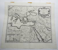
1707ref. 23156Amsterdam: Pierre Mortier. Very Good with No dust jacket as issued. c.1707. Map. 3 pieces of brown paper tape along upper blank margin.; No date c. 1707. We think this map is possibly from "Le Sainte Bible" edited by David Martin Amsterdam 1707. Dimensions of sheet: 508 x 451mm. Dimensions of printed area: 439 x 368mm. Uncoloured. Copperplate engraved map. Elaborate cartouche. Centrefold. With inset map at lower left "Campemens des Israelites dans le Desert". "The first Pieter Mortier was an 18th-century mapmaker and engraver who was born in Leiden the son of a political refugee from France. He travelled to Paris in 1681-1685 then returned to Amsterdam where he operated as a bookseller from 1685 until 1711. He won the privilege in 1690 of publishing maps and atlases by French publishers in Amsterdam for the Dutch market. He used this privilege to win a similar set of privileges for printing an "illustrated print bible" in 1700." - Wikipedia entry on Pieter or Pierre Mortier accessed October 2021. NB: This map will be posted rolled in a mailing tube. . Pierre Mortier unknown
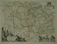
ref. 28798Paris: Pierre Mariette. c. 1658. 37.4 x 49.5 cm. Original outline colour. Double page map of Maine northern France. Title cartouche to lower left corner dedication cartouche to Christophe de Justel to upper right corner with the coat of arms of his family. Blank on verso. Small tears without loss to left and lower margins. Light stains to lower margin otherwise in good condition. Paris: Pierre Mariette. [c. 1658] unknown
ref. 106.869Bruxelles, Librairie médicale et scientifique, 1829. 14 x 23, 4 volumes, 116 + 417 + 569 + 390 pp. broché, état moyen (couvertures et dos fort abîmés, manque la couverture arrière du tome 4, intérieur frais, quasi pas de rousseurs).
1809ref. 017059Paris Jean Md d'Estampes 1809 Une carte repliée, format in-8°, aux frontières rehaussées sous chemise d'époque. Dimensions de la carte une fois dépliée: 75 cm x 53 cm. (chemise défraîchie, quelques rousseurs, brunissure aux plis).
1933ref. 564331 vol. in-12 br., Librairie Lipschutz, Paris, 1933, 64 pp.
ref. 3861957876.Gpaperback. Good. Access codes and supplements are not guaranteed with used items. May be an ex-library book. paperback
2014ref. x-0520283244Univ of California Pr 2014. Hardcover. New. 256 pages. 9.50x6.25x1.00 inches. Univ of California Pr hardcover
ref. 0786649941.Gpaperback. Good. Access codes and supplements are not guaranteed with used items. May be an ex-library book. paperback
ref. 45381745like new. unknown
1745ref. 18852Amsterdam Chatelain 1745 une carte ancienne gravée sur cuivre (Copper etching) en noir . Format : 17 x 39 cm, Échelle au1:200,000,000ème, plis centraux verticaux normaux venant d'un atlas ( verticals centerfold), avec note dans la marge en haut à droite : Tome I Page 10, pour "l'introduction à l'histoire générale et politique de l'univers, Ou l'on voit l'Origine, les Révolutions, l'Etat présent, & les Intérêts des Souverains" ; Commencée par Mr. le Baron de Pufendorff ; complétée et continuée jusqu'à 1745 par Mr. Bruzen de la Martinière, 8 volumes in-12, 1745 à Amsterdam chez Zacharie Chatelain Editeur,
1745ref. 18847Amsterdam Chatelain 1745 une carte ancienne gravée sur cuivre (Copper etching) en noir . Format : 16 x 19,1 cm, Échelle au1:200,000,000ème, pli central vertical normal venant d'un atlas( horizontal centerfold), avec note dans la marge en haut à droite : Tome I Page I, pour "l'introduction à l'histoire générale et politique de l'univers, Ou l'on voit l'Origine, les Révolutions, l'Etat présent, & les Intérêts des Souverains" ; Commencée par Mr. le Baron de Pufendorff ; complétée et continuée jusqu'à 1745 par Mr. Bruzen de la Martinière, 8 volumes in-12, 1745 à Amsterdam chez Zacharie Chatelain Editeur,
1745ref. 18848Amsterdam Chatelain 1745 une carte ancienne gravée sur cuivre (Copper etching) en noir . Format : 16 x 19,1 cm, Échelle au1:200,000,000ème, pli central vertical normal venant d'un atlas( horizontal centerfold), avec note dans la marge en haut à droite : Tome I Page I, pour "l'introduction à l'histoire générale et politique de l'univers, Ou l'on voit l'Origine, les Révolutions, l'Etat présent, & les Intérêts des Souverains" ; Commencée par Mr. le Baron de Pufendorff ; complétée et continuée jusqu'à 1745 par Mr. Bruzen de la Martinière, 8 volumes in-12, 1745 à Amsterdam chez Zacharie Chatelain Editeur,
ref. 86020Paris Pliure centrale. Format 43x58 cm marges comprises. Carte fraîche et sans accidents. Carte conservée roulée.
ref. 5400Utrecht: 1683. No binding. Very Good. 190 x 230 mm. in good condition. Engraved by Antoine de Winter and published in 1683 in the Dutch edition of Sanson's 'L'Asie'. Pastoureau Sanson IIIF no. 11. 1683 unknown
1944ref. ARC93931The Hogarth Press London 1944. Book. Very Good. Hardcover. 1st Edition. First Edition first printing of which 2000 copies were printed. 8vo. 163pp. Beige cloth lettered in blue at the spine. Corner tips gently rubbed. Small triangular inkstamp to the front free endpaper. A very good copy in the Keith Vaughan dust wrapper split into two parts at the spine panel-front panel fold and a little tanned rubbed and chipped with several tiny fractions of edge-loss and a small area of light staining. The author's scarce first book bar his anonymous 1941 'Fire Over London' pamphlet: twelve short stories drawing their inspiration from his experiences as a fireman during the Blitz. A super copy albeit somewhat disfigured by the state of the dust wrapper. The Hogarth Press, London Hardcover
1823ref. z07242Paris: De l'imprimerie de L.-T. Cellot 1823. First edition. Hardcover. Very Good. First edition 1823. xi1587 pp. Half title. In French. Later half brown morocco and marbled boards spine gilt raised bands. Corners bumped spine lightly scuffed. Contemporary ink ownership signature in upper margin of half title. Ex-lib. with institutional bookplate on front pastedown and inkstamp in rear free endpaper at gutter. Some residue from earlier bookplates in front endpapers. Mild foxing throughout and some faint dampstaining. Overall very good. Early 19th-century French lexicon termes used in the medical and natural sciences. De l'imprimerie de L.-T. Cellot hardcover
1831ref. 133460Paris, chez les marchands de nouveautés 1831 In-8 20 x 12 cm. Reliure demi-basane havane, dos lisse, LXVII-319 pp. Reliure sensiblement frottée.
ref. 71-2849Paris: Nicholas Sanson 1656. Hand colored engraving. 18.5 x 29.7 cm. plate. Very Good folded in center. Paris: Nicholas Sanson, 1656. unknown
1696ref. H40716Rome: Giovannie Giacomo de Rossi 1696. Very good. Sheet measures 27.5 x 20.5 inches map itself measures 20 x 16 inches. Very good some curving and bending from having been stored rolled up but no creases or tears light toning and mildest foxing. Period hand coloring and handsome cartouche. Italian edition of the French mapmaker's map of Germany and Bohemia. Giovannie Giacomo de Rossi unknown
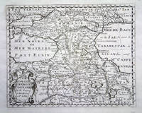
ref. 5391Paris: 1653. No binding. Good. 190 x 250 mm. early outline colour in good condition. A fine attractive map of the region of present day Georgia Armenia and Azerbaijan engraved for Nicolas Sanson's 'L'Asie'. Pastoureau Sanson IIIA no. 5. 1653 unknown
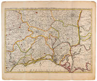
1710ref. 009141Amsterdam: Pierre Mortier 1710 Cooper engraving 44.5 x 59.5 cm on paper measuring 54.0 x 64.0 cm with original color in outline minor spotting and creasing remnants of centerfold. A good copy of a map of south-central France the Cévennes Vivarais Occitania published in Amsterdam by Pierre Mortier to illustrate events of the War of the Spanish Succession. Pierre Mortier unknown
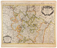
1710ref. 009140Amsterdam: Pierre Mortier 1710 Cooper engraving 46.5 x 61.5 cm on paper measuring 54.0 x 64.5 cm with original color in outline minor spotting and creasing remnants of centerfold. A good copy of a map of the Duchy of Lorraine and surrounding territories published in Amsterdam by Pierre Mortier to illustrate events of the War of the Spanish Succession. Pierre Mortier unknown