SANSON, NicolasBiblio.com

1 001 résultats
1700réf. 54030Nicolas Bion: L'Usage des Globes. Amsterdam: Francois Halma. 1700. Attractive map of Spain divided into its provinces. Maps by Sanson in original colour are rare. Nicolas Sanson was founder of the French school of mapmakers at a time when the leadership in European cartography passed from the Low Countries to France. This map was published in Brion's treatise on globes. Nicolas Brion was a famous French mathematical and scientific instrument maker. Copper engraving. Fine condition. Original colour. Size: 23.5 x 18 cm. 9½ x 7 inches. unknown
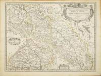
réf. 10820Paris: 1679. No binding. Good. 420 x 550 mm. early outline colour in good condition. This map of part of a portion of Eastern Europe includes Bohemia Silesia Moravia and Lusatia. It was published in Paris by Pierre Mariette in Nicolas Sanson's 'Les Cartes Generales' first published in 1658. This example is the second state dated 1679. It includes Frankfurt am oder in the upper left Glogow and Breslau Wroclaw. An inset of Moravia is centred on Olmutz present day Olomouc. Sanson was France's premier cartographer and helped to lift French work in this area to another level. His atlas is the first full world atlas to be produced in France. This work had been in development for several years as the dates on the various maps attest. Pastoureau M. Sanson V 59; Phillips P.L. Atlases 4260. 1679 unknown
1674réf. ag658Jaillot H. Carte 1674 Cartes en une partie, 42 par 56 cm ; frontières surlignées en couleur, mouillures marginales, n'atteignant pas la carte, bel exemplaire. Livraison a domicile (La Poste) ou en Mondial Relay sur simple demande.
1674réf. bb3404Jaillot H. Carte 1674 Carte de 43 x 57 cm en une partie : frontières colorées ; mouillure marginale sans gravité, bon exemplaire. Livraison a domicile (La Poste) ou en Mondial Relay sur simple demande.
1674réf. ag660Jaillot H. Carte 1674 Carte de 43 x 57 cm en une partie : frontières colorées ; mouillure marginale sans gravité, bon exemplaire. Livraison a domicile (La Poste) ou en Mondial Relay sur simple demande.
1674réf. bb3401Jaillot H. Carte 1674 Carte de 42 x 55 cm en une partie : frontières colorées ; très bon exemplaire. Livraison a domicile (La Poste) ou en Mondial Relay sur simple demande.
1828réf. 11433MADRID: Imprenta de Verges 1828. Primera edición.- 4º.- Plena pasta española doble tejuelo y dorados en el lomo.- 5 tomos.- I: VIII.- 479 páginas.- II: 392 páginas.- 1 hoja de Advertencia.- III: 402 páginas.- 1 hoja Erratas.- IV: 372 páginas.- V: 396 páginas.- 2 hojas Erratas. . Palau 271872 Imprenta de Verges hardcover
1661réf. 33640ABA Paris chez P. Mariette 1661. Blattgrösse: 43x53,5 cm. Grenzkolorierte Karte (30x33 cm) von Nicolas Sanson, gestochen von Lalleman und Somer.
1667réf. 33634AB(Paris, Nicolas Sanson). 1667. Blattgrösse: 46x61,5 cm. Grenzkolorierte Karte (36,7x55 cm) von Nicolas Sanson, gestochen von Robert Cordier.
réf. 41445142-nnew. unknown
1659réf. 122141659 Limites aquarellées. 1 carte gravée sur cuivre, 43 x 53 cms. P. Sanson 1659
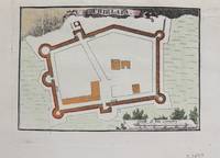
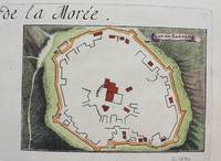
1690réf. M9479Paris c.1690. Very Good. Notes: Map of Chielafa Greece during the late 17th century. Size : 105x152 mm 4.13x5.98 Inches Coloring: Hand Colored Category: Maps Europe Greece Macedonia; unknown
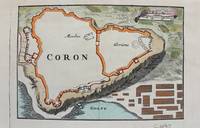
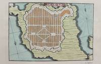
1690réf. M9480Paris c.1690. Very Good. Notes: Map of Coron Greece during the late 17th century. Size : 103x153 mm 4.06x6.02 Inches Coloring: Hand Colored Category: Maps Europe Greece Macedonia; unknown
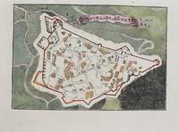
1690réf. M9473Paris c.1690. Very Good. Notes: A charming map of Fort D'Asso Greece during the late 17th century. Size : 104x153 mm 4.09x6.02 Inches Coloring: Hand Colored Category: Maps Europe Greece Macedonia; unknown
1690réf. M9475Paris c.1690. Very Good. Notes: A charming map of Forteresse de Zante Greece during the late 17th century. Size : 104x154 mm 4.09x6.06 Inches Coloring: Hand Colored Category: Maps Europe Greece Macedonia; unknown
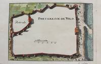
1690réf. M9474Paris c.1690. Very Good. Notes: A charming map of Forteresse de Volo Greece during the late 17th century. Size : 104x153 mm 4.09x6.02 Inches Coloring: Hand Colored Category: Maps Europe Greece Macedonia; unknown
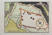
1690réf. M9481Paris c.1690. Very Good. Notes: Map of Passava Greece during the late 17th century. Size : 104x153 mm 4.09x6.02 Inches Coloring: Hand Colored Category: Maps Europe Greece Macedonia; unknown
1690réf. M9483Paris c.1690. Very Good. Notes: A charming map of Zarnata Greece during the late 17th century. Size : 103x152 mm 4.06x5.98 Inches Coloring: Hand Colored Category: Maps Europe Greece Macedonia; unknown
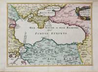
1656réf. M10647Paris c.1656. Very Good. Size : 182x246 mm 7.17x9.69 Inches Coloring: Hand Colored Category: Maps Russia; Maps Asia Near East Turkey; Maps Europe Ukraine; unknown
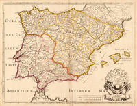
1704réf. 19604Paris: N. Sanson 1704. Other. In very good condition a slightly creasing in the lower part of the centrefold with minor tiny spots. 410 by 525mm 16¼ by 20¾ inches. 410 by 525mm 16¼ by 20¾ inches. Copper engraving hand colored in outline when published. Interesting and detailed map of Antique Spain with Portugal and the Balearic Islands by the French cartographer Nicolaus Sanson d´Abbeville. The map provides us a lot of information of the various place names of cities and small towns the rivers mountains and also engraved borders of the various Spanish provinces. The map impresses with the geographic exactness which is typical for the French cartographer Nicolaus Sanson. In the decorative cartouche which is in shape of a seashell we find the altered date 1704 which is a relatively late edition for maps by N. Sanson. The map is probably published in a French composit atlas around this date. N. Sanson unknown
réf. a92271Paris 1681. Chez H. I Aillot. first edition Color map 33 x 22 inches with 2 inch blank border on all 4 sides. "Dresse sur les Memoirs les plus Nouveaux par le S. Sanson Geographe Ordinaire du Roy." Fancy pictorial circle around map title and similar around map's key. Densely decorated map with lines of color in red pink orange green. No tears. Folded in half. One very light stain appears water-based at center fold about 8 inches by 1 inch. Very pretty map with bold black outlines and bright colors. Good plus condition. Map - ephemera. . unknown
réf. 85388Soit 9 années en 9 volumes in 8° reliés demi-chagrin brun, dos lisses ornés de filets dorés, initiales (A. de J.) frappées en queue du dos ; texte sur deux colonnes.
1690réf. 167791690 basane brune, dos à n. 2 tomes en un vol. in-12, (12ff.), 144pp. et titre, 178pp., (7ff.), 48pp., (catalogue des libraires), 4 planches dépliantes (la quatrième est incomplete de sa plus grande partie…) A Paris chez l'auteur, aux galleries du Louvres, vis-à-vis l'Eglise de St. Nicolas. 1690
réf. 3244Americas: Amsterdam Francois Halma 1705. Copper engraved map of Guatemala by N. Sanson from Halma's Algemeene Werelde Beschryving Vol. 3 Black and white; title in Dutch; verso blank; strapwork title cartouche. This map appeared in Algemeene Weereld-Beschryving nae de Rechte Verdeeling der Landschappen Plaetsen Zeeën Rivieren &c. Geographisch Politisch Historisch Chronologisch en Genealogisch a Dutch edition of A. Phérotée de la Croix's Nouvelle Methode Pour Apprendre Facilement la Geographie Universelle which first appeared in 1690. Dark impression. Nicolas Sanson d'Abbeville.1600-67 ' father of the French cartography' and founder of the Sanson firm. Atlas ' Cartes générales de toutes les parties du Monde' 1658-70 and a pocket atlas in 4 parts 1652-1705. Sanson's small maps from A. Phérotée de la Croix's Nouvelle Methode Pour Apprendre Facilement la Geographie Universelle. first published in 1652 and engraved by A. Peyrounin were copied several times by various map publishers. Johann David Zunners made copies of Sanson's maps for his German translation of Die Gantze Erd-Kugel in 1679. Johannes Ribbius and Simon de Vries published copies in 1682 and 1683 with new maps engraved by Antoine d'Winter. The plates were later sold to Francois Halma who used them in 1699 and then again in 1705 with the titles re-engraved in Dutch. François Halma 1653 - 1722 Dutch publisher/printer; dealer/auction house. Cartographer and publisher of maps active in Utrecht Amsterdam Franeker and Leeuwarden. Published 'Description de l'Univers' 1700; 'Algemene Wereldtbescrijving' 1705; 'Corpus Inscriptionum' 1707 and 'Lexicon Philosophicum' 1713. Keoman: Hal 1; Phillips 528; B Americas Central America Guatemala Amsterdam Francois Halma 1705 unknown
réf. 3243Americas: Amsterdam Francois Halma 1705. Copper engraved map of Mexico by N. Sanson from Halma's Algemeene Werelde Beschryving Vol. 3 Black and white; title in Dutch; verso blank; strapwork title cartouche. The map shows Mexico including the Yucatan peninsula part of present-day Guatemala and Honduras. This map appeared in Algemeene Weereld-Beschryving nae de Rechte Verdeeling der Landschappen Plaetsen Zeeën Rivieren &c. Geographisch Politisch Historisch Chronologisch en Genealogisch a Dutch edition of A. Phérotée de la Croix's Nouvelle Methode Pour Apprendre Facilement la Geographie Universelle which first appeared in 1690. Dark impression. Nicolas Sanson d'Abbeville.1600-67 ' father of the French cartography' and founder of the Sanson firm. Atlas ' Cartes générales de toutes les parties du Monde' 1658-70 and a pocket atlas in 4 parts 1652-1705. Sanson's small maps from A. Phérotée de la Croix's Nouvelle Methode Pour Apprendre Facilement la Geographie Universelle. first published in 1652 and engraved by A. Peyrounin were copied several times by various map publishers. Johann David Zunners made copies of Sanson's maps for his German translation of Die Gantze Erd-Kugel in 1679. Johannes Ribbius and Simon de Vries published copies in 1682 and 1683 with new maps engraved by Antoine d'Winter. The plates were later sold to Francois Halma who used them in 1699 and then again in 1705 with the titles re-engraved in Dutch. François Halma 1653 - 1722 Dutch publisher/printer; dealer/auction house. Cartographer and publisher of maps active in Utrecht Amsterdam Franeker and Leeuwarden. Published 'Description de l'Univers' 1700; 'Algemene Wereldtbescrijving' 1705; 'Corpus Inscriptionum' 1707 and 'Lexicon Philosophicum' 1713. Keoman: Hal 1; Phillips 528; B Americas Mexico Yucatan Guatemala Honduras Amsterdam Francois Halma 1705 unknown