Sanson, Nicolas [Antarctic & Arctic Map]Biblio.com
927 resultados
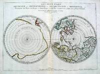
1657ref. 5033Paris 1657. Par N. Sanson d'Abbeville Geographe ordre du Roy. Spence 3017 lists a slightly different title but undoubtedly the same map. 53x38 cms. Period outline color central fold very good condition. A double hemisphere map to the North and South poles. The North pole is connected to Greenland and Spitzbergen but there is little other detailed coastline in the polar area. Europe Russia and Canada are delineated. The South pole is based on the great unknown Southland of Magellan. The tip of S. America is shown and a large land mass which encompasses the whole of the hemisphere but nothing else. unknown
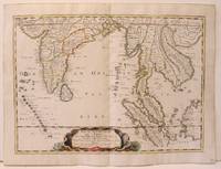
1654ref. M2656Paris 1654. Excellent. Size : 385x530 mm 15.125x20.875 Inches Coloring: Original Hand Coloring Reference: Nebenzahl 3.9C Category: Maps Asia South East; Maps Asia Central India & Sri Lanka / Ceylon; unknown
ref. 04086London: S.W. Fores 1801. Three of George Moutard Woodward's Hand-Colored Prints from "Symptoms of the Shop" WOODWARD George Moutard artist SANSON Francis printmaker. Symptoms of the Shop. London: S.W. Fores 1801. First edition. Quarto 10 1/8 x 8 1/16 inches; 257 x 265 mm. Three of twelve hand colored 'Satirical' stipple engravings on wove paper drawn by Woodward and etched by Sanson numbers 7 8 and 10. Each with the plate number at the top right margin and with lithographed text at the top of the image. On each of the lower margins is "Pub. June 1st 1801 by S.W. Fores No.50 Piccadilly Prints and Drawings lent on the plan of a Library Folio's of Caricature lent out for the Evening." / Symptoms of the Shop" / "Drawn by G. Woodward Etchd by F. Sansom". Some light marginal soiling otherwise near fine. Plate #7. "After all there is nothing like the true old orthodox principles." Plate #8. "I have brought your Honor home your new suit." Plate #10. "Madam - I was once a Minister and used to negotiations." Very rare. According to OCLC there are only two complete set in libraries and institutions worldwide The Lewis Walpole Library CT. has a complete colored set Princeton NJ also has a complete set but does not mention 'colored'. Yale university has nine of the twelve colored plates missing numbers 1 7 & 8. Harvard MA has one plate. These two artists previously collaborated on Every Body in Town BC-28 Every Body Out of Town BC-29 and Pigmy Revels: All Alive in Lilliput BC-62 all published by Fores. Each plate depicts two persons engaged in humorous wordplay relating to the characteristics of a trade or calling. William Gordon. A catalogue of the Books Drawings Prints and Periodicals forming the William A. Gordon Library of British Caricature. The three images present here include: Plate 7. A man sitting in a wooden chair lifts his hand for emphasis and declares: "After all there is nothing like the true old orthodox principles." An obese clergyman in a padded armchair on the right responds: "Orthodox principles - ah my dear friend you put me in mind of old times - when I was but a simple vicar. How I used to charm my congregation - slim as a Bedles wand - & delicate as a new wash'd surplice - but since I have been raised to higher dignities I do nothing but remain in my chair; bulky & unweildy as a Folio Church Service. - oh how elegantly I used to manage my discourses - fifteen minutes to a point by the clock under the gallery - never exceeded - short praye - text - and devision - one - two - three & away - that was my method." Plate 8. A man with a parcel under his arm bows slightly and says: "I have brought your Honor home your new suit." A stout bespectacled lawyer replies: "Suit - ah - Mr. Buckram you did not know me when I practiced in the Courts - I could have shewn you suits that would have puzzled Judge Blackstone himself - none of your simple matters - brim full of Law as a brief bag - intricate as the Temple avenues -& long as Westminster Hall - Shy Clients sometimes - but it would not do with Paul Parchment - sure to have them on way or other. - Once in never out that was my motto." Plate 10. A former Minister holding his hat wearing a bag-wig and with his pocket filled with scrolls addresses a woman: "Madam - I was once a Minister and used to Negotiations I shall therefore be happy to treat with you on Matrimonial Speculation - I have ample credentials ready to ratify my powers and if you please will enter into preliminaries immediately - but let me have a sight glance at your project and be assured I will deliver to you my contre projet as soon as the definitive treaty is concluded and duly guaranteed." The woman who is short and plump looks aghast at the proposition. London: S.W. Fores, 1801 unknown
ref. 04086London: S.W. Fores 1801. Three of George Moutard Woodward's Hand-Colored Prints from "Symptoms of the Shop" WOODWARD George Moutard artist SANSON Francis printmaker. Symptoms of the Shop. London: S.W. Fores 1801. First edition. Quarto 10 1/8 x 8 1/16 inches; 257 x 265 mm. Three of twelve hand colored 'Satirical' stipple engravings on wove paper drawn by Woodward and etched by Sanson numbers 7 8 and 10. Each with the plate number at the top right margin and with lithographed text at the top of the image. On each of the lower margins is "Pub. June 1st 1801 by S.W. Fores No.50 Piccadilly Prints and Drawings lent on the plan of a Library Folio's of Caricature lent out for the Evening." / Symptoms of the Shop" / "Drawn by G. Woodward Etchd by F. Sansom". Some light marginal soiling otherwise near fine. Plate #7. "After all there is nothing like the true old orthodox principles." Plate #8. "I have brought your Honor home your new suit." Plate #10. "Madam - I was once a Minister and used to negotiations." Very rare. According to OCLC there are only two complete set in libraries and institutions worldwide The Lewis Walpole Library CT. has a complete colored set Princeton NJ also has a complete set but does not mention 'colored'. Yale university has nine of the twelve colored plates missing numbers 1 7 & 8. Harvard MA has one plate. These two artists previously collaborated on Every Body in Town BC-28 Every Body Out of Town BC-29 and Pigmy Revels: All Alive in Lilliput BC-62 all published by Fores. Each plate depicts two persons engaged in humorous wordplay relating to the characteristics of a trade or calling. William Gordon. A catalogue of the Books Drawings Prints and Periodicals forming the William A. Gordon Library of British Caricature. The three images present here include: Plate 7. A man sitting in a wooden chair lifts his hand for emphasis and declares: "After all there is nothing like the true old orthodox principles." An obese clergyman in a padded armchair on the right responds: "Orthodox principles - ah my dear friend you put me in mind of old times - when I was but a simple vicar. How I used to charm my congregation - slim as a Bedles wand - & delicate as a new wash'd surplice - but since I have been raised to higher dignities I do nothing but remain in my chair; bulky & unweildy as a Folio Church Service. - oh how elegantly I used to manage my discourses - fifteen minutes to a point by the clock under the gallery - never exceeded - short praye - text - and devision - one - two - three & away - that was my method." Plate 8. A man with a parcel under his arm bows slightly and says: "I have brought your Honor home your new suit." A stout bespectacled lawyer replies: "Suit - ah - Mr. Buckram you did not know me when I practiced in the Courts - I could have shewn you suits that would have puzzled Judge Blackstone himself - none of your simple matters - brim full of Law as a brief bag - intricate as the Temple avenues -& long as Westminster Hall - Shy Clients sometimes - but it would not do with Paul Parchment - sure to have them on way or other. - Once in never out that was my motto." Plate 10. A former Minister holding his hat wearing a bag-wig and with his pocket filled with scrolls addresses a woman: "Madam - I was once a Minister and used to Negotiations I shall therefore be happy to treat with you on Matrimonial Speculation - I have ample credentials ready to ratify my powers and if you please will enter into preliminaries immediately - but let me have a sight glance at your project and be assured I will deliver to you my contre projet as soon as the definitive treaty is concluded and duly guaranteed." The woman who is short and plump looks aghast at the proposition. London: S.W. Fores, 1801 unknown books
ref. 140897aafA Amsterdam, chez P(ieter) Mortier et Compagnie: Avec Privilege, 1696-1708, Bildgröße - Karte 55 x 75 cm. (inkl. Wappen u. d. Titel über dem Rand 57x83 cm.), Carte géographique coloriée, français (1696-1708), publiée dans : Atlas Nouveau, Contenant toutes les Parties du Monde, ou sont exactement remarqués les Empires, Monarchies, Royaumes, Estats, Républiques & Peuples, entre 1696-1708. Unter Glas im Goldrahmen (92 x 66 cm).
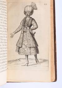
1694ref. 90853Paris: Veuve de Jacques LangloisVeuve de R. ChevillonJacques Langlois 1694. Fine. Veuve de Jacques Langlois Veuve de R. Chevillon Jacques Langlois Paris 1694 9.5 x 16.5 cm Relié Rare illustrated first edition with 5 copper-engraved plates hors-texte including 2 folding plates cf. Barbier II 302. Schwab 517. Hage Chahine 4320. Wilson 200. Absent from Blackmer and Atabey. Our copy lacks the two dedication leaves to Rouillié often missing with repairs to the joints and one corner and a manuscript ex-libris on the title-page. Contemporary full mottled fawn calf spine with five raised bands gilt and decorated with gilt compartments and floral tools tan calf title-label gilt fillets to the edges partly faded speckled edges. Sanson a zealous apostolic missionary tireless traveller and accomplished diplomat arrived in Persia in 1683 learning Armenian Turkish and Persian while travelling through the kingdom in order to ""consoler les chrétiens qui y habitent"". He took an interest in everything ""murs situation antiquités"" of the regions he crossed and eventually gained access to the Palace ""qui ne sont accordées qu'aux grands seigneurs de Perse"" attending all audiences and taking part in every banquet. He spent three years close to Soliman before returning to France bringing Louis XIV a personal message from the ""roi"" of Persia. Provenance: copy from the library of the literary critic Émile Faguet 18471916 with his vignette bookplate pasted to the inside board. Veuve de Jacques LangloisVeuve de R. ChevillonJacques Langlois hardcover
ref. 122122Paris 1692. . Double page engraved map with fine original hand-colour with two decorative cartouches surrounded by animals and foliage. Sheet size: 950 mm x 600 mm. Some minor offset and tiny worm holes otherwise very good. The map is dedicated to Jean-Baptiste Antoine Colbert Marquis de Seignelay the eldest son of the French minister of the same name who served Louis XIV. Alexis-Hubert Jaillot 1632-1712 was a French cartographer. He joined the Sanson heirs and redrew Nicolas Sanson's maps on a larger scale. 'Atlas Nouveau' 1674 sea-atlas ' Le Neptune François' 1693. Paris, 1692. unknown
1691ref. LBW-3673Paris, H. Jaillot, 1691. En deux feuilles jointes de 573 x 884 mm.
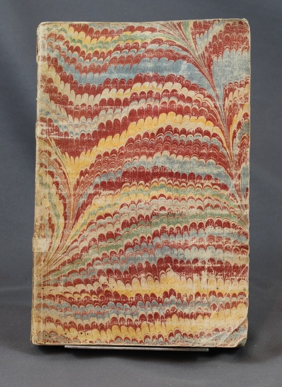
1698ref. 6703sans lieu [Amsterdam], sans nom [Pierre Mortier], sans date [circa 1698]. In-8 de [2]-30 pages, 25 cartes, 1 pl., 26 pages, couverture de papier marbré du temps (traces de plis au dos, coins un soupçon cornés).
1705ref. 3903Attractive original hand-color. Pin-head size stain just south of Mississippi delta please see image. An otherwise very nice clean copy. Paper size: 8 1/4 x 12 1/4 in 210 x 310 mm. Image size: 7 x 9.8 in 178 x 250 mm. ; All shipments through USPS insured Priority Mail.
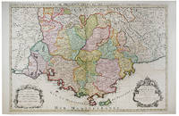
1696ref. 16269Paris: Alexis Hubert Jaillot 1696. Copper-engraved map with full original colour and gold embellishment in excellent condition. A stunning map of Normandy by Alexis Jaillot an exceptional example with gilt embellishments. One of the most important figures in French cartography Nicolas Sanson initiated the great school of French geographers. Born in Abbeville in 1600 Sanson established his first printing house in Paris in 1638. He soon became geographer to the king establishing himself as one of the most influential cartographers on the Continent. He was succeeded by his sons Adrien and Guillaume and by his son-in-law Pierre Duval who continued to publish a wealth of maps using Sanson's name. At the close of the seventeenth century Sanson's plates were purchased by the influential cartographer Alexis Hubert Jaillot who continued to publish his maps and atlases under Sanson's title. This stunning map of Normandy is based on Sanson's map published in 1650 but was redrawn and enlarged by Jaillot. It shows the provinces of Normandy as well as the northern tip of Brittany and part of the English Channel. Both Jersey and Guernsey are included as is Mont St. Michel off the coast of St. Malo. In keeping with all of Sanson's and Jaillot's superb maps forests rivers and towns are meticulously identified and named. The map includes an ornate cartouche in the upper section as well as a scale and key. Tooley Maps & Map-Makers pp. 40-41. Alexis Hubert Jaillot unknown
1696ref. 16269Paris: Alexis Hubert Jaillot 1696. Copper-engraved map with full original colour and gold embellishment in excellent condition. A stunning map of Normandy by Alexis Jaillot an exceptional example with gilt embellishments. One of the most important figures in French cartography Nicolas Sanson initiated the great school of French geographers. Born in Abbeville in 1600 Sanson established his first printing house in Paris in 1638. He soon became geographer to the king establishing himself as one of the most influential cartographers on the Continent. He was succeeded by his sons Adrien and Guillaume and by his son-in-law Pierre Duval who continued to publish a wealth of maps using Sanson's name. At the close of the seventeenth century Sanson's plates were purchased by the influential cartographer Alexis Hubert Jaillot who continued to publish his maps and atlases under Sanson's title. This stunning map of Normandy is based on Sanson's map published in 1650 but was redrawn and enlarged by Jaillot. It shows the provinces of Normandy as well as the northern tip of Brittany and part of the English Channel. Both Jersey and Guernsey are included as is Mont St. Michel off the coast of St. Malo. In keeping with all of Sanson's and Jaillot's superb maps forests rivers and towns are meticulously identified and named. The map includes an ornate cartouche in the upper section as well as a scale and key. Tooley Maps & Map-Makers pp. 40-41. Alexis Hubert Jaillot unknown books
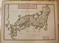
1656ref. M8114Paris c.1656. Very Good. Size : 375x521 mm 14.76x20.51 Inches Coloring: Original Hand Coloring Category: Maps Asia Far East Japan & Korea; unknown
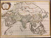
1667ref. M8921Paris: Pierre Mariette 1667. Very Good. Notes: An important map of Asia by Nicolas Sanson showing the boundaries of the major historic civilizations of this continent. Examples include Assyria Syria Asia Minor Armenia Arabia Felix Libya Sarmatia Thracia Graecia Persia India China Ethiopia Scythia and Gangem. Sanson 1600–1667 was a French cartographer termed by some as the "father of French cartography." His works are known for their incorporation of the most up to date information of the time and their clean modern style. Size : 402x470 mm 15.83x18.50 Inches Coloring: Original Hand Coloring Category: Maps Asia Continent; Pierre Mariette unknown
1704ref. 48770Amsterdam Franciscus Halma 1704. Folio. 455 x 29 cm. Contemp. full blindtooled Dutch vellum. Raised bands. Spine ends with tears some cracking along fronthinge but not loose. Vellum at frontcover a bit soiled. Egraved titlepage Coxis del. ianen fecit. Printed titlepage in red/black with an engraved vignette. 15119511 pp. 1 engraved plate with portrait and coat of arms. 4 large folded engraved maps. Light yellowing to margins of textleaves but maps and text fine and clean. 3 of the maps engraved by F. Halma. The maps are the Francois Halma reissues of Sanson's maps from 1683. hardcover
1704ref. 48770Amsterdam, Franciscus Halma, 1704. Folio. (45,5 x 29 cm.). Contemp. full blindtooled Dutch vellum. Raised bands. Spine ends with tears, some cracking along fronthinge, but not loose. Vellum at frontcover a bit soiled. Egraved titlepage (Coxis del., ianen fecit). Printed titlepage in red/black with an engraved vignette. 15,(119),51,(1) pp., 1 engraved plate with portrait and coat of arms. 4 large folded engraved maps. Light yellowing to margins of textleaves, but maps and text fine and clean. (3 of the maps engraved by F. Halma).
1698ref. 6697Amsterdam, Pierre Mortier, sans date [circa 1698]. In-8 broché de [titre gravé]-[2]-23-[1]p., 35 cartes, 1 pl., 40-8p. couverture de papier marbré du temps, étiquette manuscrite au dos. Coins légèrement arrondis, petits manque de papier au second mors.
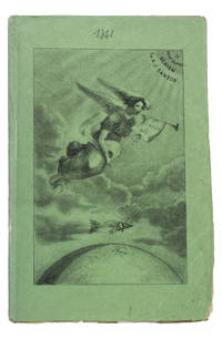
1841ref. 93KAS1RPK7OLParis 1841. 8vo. De Boulé et Comp. for Ledoyen Original green wrappers in a protective plastic wrapper with a large lithographed plate on the front showing a dirigible flying over the globe underneath a floating angel who is blowing a trumpet with the motto "Conquête de l'aire". With a large folding lithographed plate 40 x 235 cm of the dirigible and a smaller woodcut of the same dirigible on p. 5. 31 1 blank pp. First edition of this very rare early and remarkable brochure on navigation in the air and the dirigible manoeuvrable balloon. The brochure introduces a new project to build a dirigible in the shape of a fish. The cost was estimated at 30.000 francs and was to be financed by the issue of 300 shares of 100 francs. The work explains the expected profits and the workings of the dirigible in order to entice patrons. It is an early example of such a project as the first powered and steerable airship that was able to take flight was invented in 1852 eleven years after the publication of the present work. This curious brochure therefore offers a fascinating insight into the history of aviation.The fish dirigible is shown in detail on the large folding plate. It was proposed to ascend the balloon being in equilibrium by means of wings to obtain propulsion by four small paddle-wheels and to steer by means of a large triangular rudder. It was approximately 25 meters long and 12 meters high and operated from a basket hanging underneath like in a hot air balloon. It was invented by bookseller and author Alexandre-Jacques Sanson 1789-1862 and his father. The dirigible was never built but the Sansons nevertheless published a number of other works elaborating on the same subject in the following years: Navigation atmosphérique. Explications complémentaires sur le système 1845; Explication du système de navigation aérienne 1848 and Solution du problème de la navigation aérienne principes preuves et moyens 1850. The present work ends with a letter by the aeronaut Jules-François Dupuis-Delcourt 1802-1864 giving permission to use some of his data in the brochure and offering his blessing to the project.The wrappers are somewhat creased with tears at the head and foot of the spine. The folding plate has browned. Otherwise in good condition.l Tissandier p. 34; WorldCat 457418223 907812680 1141280150 13 copies. EUROPE HORSES HUNTING SPORTS & GAMES SCIENCE & TECHNOLOGY France Games & Sports Technology unknown
2012ref. 105280Somogy Editions D'Art. New. Paperback. FREE UPGRADE to Courier/Priority Shipping Upon Request - IN STOCK AND IMMEDIATELY AVAILABLE FOR SHIPMENT - Flawless copy brand new pristine never opened -- Text in French. 176 pages. -- with a bonus offer-- . 2012. 2757205617 . Somogy Editions D'Art paperback
1692ref. M7546Paris: H. Jaillot c. 1692. Very Good;. Notes: The title cartouche in the lower left corner is encased in a floral wreath at the bottom of which sits a winged lion wielding a sword and standing at a pulpit. At the top of the wreath sits a coat of arms held by two winged putti. Encircling the wreath are little diagrams of various fortifications around Greece. Size : 565x845 mm 22.24x33.27 Inches Coloring: Original Outline Coloring Category: Maps Europe Greece Macedonia; H. Jaillot unknown
1696ref. LBW-6394Paris, H. Jaillot, 1696. En deux feuilles jointes formant une carte de 565 x 868 mm.
1696ref. 9749Scarce original hand-colored engraving by Sanson published in Pierre Mortier's Atlas Nouveau or Atlas Novum ad usum serenissimi. Image size is approximately 23 x 18.75 in 58.5 x 47.5 cm; page size is 24.75 x 21 in 63 x 53.5 cm. Some minor staining and toning to edges not affecting the image.
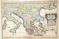
1720ref. M8856Amsterdam: Pierre Mortier 1720. Very Good. Notes: A fine large scale map of Mediterranean Sea Italy Greece Eastern Europe Turkey. The map depicts the Ottoman Empire in the mid to late seventeenth century. Size : 530x864 mm 20.87x34.02 Inches Coloring: Original Hand Coloring Category: Maps Europe Balkans; Maps Mediterranean Sea; Maps Europe Italy; Maps Europe Greece Macedonia; Maps Asia Near East Turkey; Pierre Mortier unknown
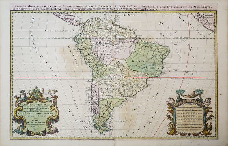
1691ref. M1345Paris 1691. Very Good. Size : 590x885 mm 23.25x34.875 Inches Coloring: Hand Colored in Outline Category: ; Maps South America Continent unknown
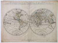
1652ref. 010748twParis: Sanson. Very Good. 1652. A very rare map from Nicolas Sanson. Imprint bears the date of 1652 although it is possible that this copy came from an atlas in the later 1600s. Light toning and edgewear with one corner slightly chipped. Light soil on lower margin. Hand-colored boundaries. Map borders measure 14" x 20 3/4". California is shown as an island and Terre Australe is a vague line encircling the Antarctic. Terre de Iesso is the name given to the land mass northwest of North America. Sanson 1600-1667 published many map versions of the world and is known as "the father of French cartography." ; 16 1/2" x 22 1/4" . Sanson unknown