SANSON, NicolasABAA

979 résultats
réf. 215370Amsterdam: Pierre Mortier. unbound. very good. Map. Engraving with hand outline. Image measures 13 3/4" x 22 1/2". Rare map of Galatia an ancient region of northern Anatolia present-day Turkey along the southern coast of the Black Sea. Published circa 1705 this map is centered on Ankara and shows provinces inhabited by Trocmi Tectosages and Tolistobogi - three Celtic tribes who inhabited the region from the 3rd century BC. Neighboring historical regions of Paphlagonia Pontus Phyrgia Cappadocia and Lycaonia are labeled. Mountains and cities are depicted pictorially. The map shows major roads connecting cities throughout the region. A decorative cartouche features lively figures celebrating with percussion and wind instruments. Full original margins minor offsetting. Based on earlier plates by Sanson. This map appeared in "Atlas Antiquus Sacer Ecclesiasticus et Profanus" published in Amsterdam by Pieter Mortier. Nicolas Sanson 1600-1667 who is considered the founder of the French school of cartography. In reaction to the prevailing trend of Dutch lavishness Sanson favored minimal details focusing rather on accurate cartography than ornament. Pierre Mortier 1661-1711 was a Dutch cartographer engraver and printseller who worked in Amsterdam. He used advanced Dutch printing methods to produce high quality editions of contemporary French maps by cartographers such as De L'Isle Sanson Jaillot de Fer and De Wit. This map is a lovely example of his work. Pierre Mortier unknown books
1713réf. 215454Amsterdam: Mortier Pieter 1713. unbound. very good. Map. Engraving with original hand outline. Image measures 14.5" x 18.75". Rare map of Paphlagonia an ancient region of northern Anatolia present-day Turkey along the southern coast of the Black Sea. Highlighting the capital city of Sinope this map depicts the region as defined by Strabo: bound by the Parthenius River in the west extending to the Hays river in the east. Sanson depicts the region comprising the Kingdom of Pontus during the rule of Mithridates IV. Neighboring historical regions of Gallatia and Bithynia et Pontus are labeled. Full original margins light scattered foxing. Based on earlier plates by Sanson. This map appeared in "Atlas Antiquus Sacer Ecclesiasticus et Profanus" published in Amsterdam by Pieter Mortier. Nicolas Sanson 1600-1667 who is considered the founder of the French school of cartography. In reaction to the prevailing trend of Dutch lavishness Sanson favored minimal details focusing rather on accurate cartography than ornament. Pierre Mortier 1661-1711 was a Dutch cartographer engraver and printseller who worked in Amsterdam. He used advanced Dutch printing methods to produce high quality editions of contemporary French maps by cartographers such as De L'Isle Sanson Jaillot de Fer and De Wit. His greatest feat was the nautical atlas "Le Neptune Francois" or "Suite de Neptune Francois" considered to contain the most beautiful examples of cartographic art. After his death his widow Amelia continued publishing in partnership with her brother-in-law David until her death in 1719. This map was published during Amelia's tenure at the firm. Mortier, Pieter unknown books
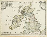
réf. 10523Paris: 1640-c.48. No binding. Good. 405 x 530 mm. early outline colour small lower margin centrefold split repaired otherwise in good condition. A rare map in this second produced by Nicolas Sanson 1600-67 and published by Melchoir Tavernier 1594-1665 and Pierre Mariette c.1602-58. Separately published the map displays a shortened Scotland and exaggerated south west north east slant to Ireland. In later states it would be published in Pierre Mariette's 'Les Cartes Generales de Toutes les Parties du Monde' from 1658. Sanson was France's premier cartographer and helped to lift the field onto another level during his career. With an attractive cartouche upper left and right and an inset map of the Shetland Islands. This second state is determined by the addition of Mariette's imprint to the cartouche upper right. Provenance: private English collection since 2006. Pastoureau 1984 Tavernier IIE 106; Shirley R.W. BI to 1650 506 pl. 80 st. 1. 1640-[c.48] unknown
1650réf. 011592Paris 1650. No Binding. Very Good/No Jacket. R Cordier. 1650 Normanie. Engraved by R Cordier. A fine and detailed province map with the english coast included. All important place names are shown. Original outline colour. very slight discoloration. otherwise good condition. 385 x 515 mm framed and glazed unknown
réf. 230537Paris, MARIETTE Pierre, (vers 1662) à vue : 32 x 43,5 cm - cadre : 43 x 52.5 cm , Cadre du XXe siècle. Déchirures dont une au coin inférieur gauche et une au niveau inférieur de la pliure centrale. Taches.
réf. 3249Americas: Amsterdam Francois Halma 1705. Copper engraved map of Brazil by N. Sanson from Halma's Algemeene Werelde Beschryving Vol. 3 Black and white; title in Dutch; verso blank; Attractive small map of Brazil; title cartouche surrounded by garland of leaves in centre of country. This map appeared in Algemeene Weereld-Beschryving nae de Rechte Verdeeling der Landschappen Plaetsen Zeeën Rivieren &c. Geographisch Politisch Historisch Chronologisch en Genealogisch a Dutch edition of A. Phérotée de la Croix's Nouvelle Methode Pour Apprendre Facilement la Geographie Universelle which first appeared in 1690. Dark impression; minor dampstain at top of centre fold. Nicolas Sanson d'Abbeville.1600-67 ' father of the French cartography' and founder of the Sanson firm. Atlas ' Cartes générales de toutes les parties du Monde' 1658-70 and a pocket atlas in 4 parts 1652-1705. Sanson's small maps from A. Phérotée de la Croix's Nouvelle Methode Pour Apprendre Facilement la Geographie Universelle. first published in 1652 and engraved by A. Peyrounin were copied several times by various map publishers. Johann David Zunners made copies of Sanson's maps for his German translation of Die Gantze Erd-Kugel in 1679. Johannes Ribbius and Simon de Vries published copies in 1682 and 1683 with new maps engraved by Antoine d'Winter. The plates were later sold to Francois Halma who used them in 1699 and then again in 1705 with the titles re-engraved in Dutch. François Halma 1653 - 1722 Dutch publisher/printer; dealer/auction house. Cartographer and publisher of maps active in Utrecht Amsterdam Franeker and Leeuwarden. Published 'Description de l'Univers' 1700; 'Algemene Wereldtbescrijving' 1705; 'Corpus Inscriptionum' 1707 and 'Lexicon Philosophicum' 1713. Keoman: Hal 1; Phillips 528. Americas South America Brazil Amsterdam Francois Halma 1705 unknown
réf. 3245Americas: Amsterdam Francois Halma 1705. Copper engraved map of Caribbean by N. Sanson from Halma's Algemeene Werelde Beschryving Vol. 3 Black and white; title in Dutch; verso blank; strapwork title cartouche. The map shows the islands of the Caribbean with the tip of Florida to the North and the coast line of Honduras and Venezuela to the South This map appeared in Algemeene Weereld-Beschryving nae de Rechte Verdeeling der Landschappen Plaetsen Zeeën Rivieren &c. Geographisch Politisch Historisch Chronologisch en Genealogisch a Dutch edition of A. Phérotée de la Croix's Nouvelle Methode Pour Apprendre Facilement la Geographie Universelle which first appeared in 1690. Dark impression. Upper margin short cut to plate mark ; extra folds to fit in binding; light dampstaining to lower margin just entering plate. Nicolas Sanson d'Abbeville.1600-67 ' father of the French cartography' and founder of the Sanson firm. Atlas ' Cartes générales de toutes les parties du Monde' 1658-70 and a pocket atlas in 4 parts 1652-1705. Sanson's small maps from A. Phérotée de la Croix's Nouvelle Methode Pour Apprendre Facilement la Geographie Universelle. first published in 1652 and engraved by A. Peyrounin were copied several times by various map publishers. Johann David Zunners made copies of Sanson's maps for his German translation of Die Gantze Erd-Kugel in 1679. Johannes Ribbius and Simon de Vries published copies in 1682 and 1683 with new maps engraved by Antoine d'Winter. The plates were later sold to Francois Halma who used them in 1699 and then again in 1705 with the titles re-engraved in Dutch. François Halma 1653 - 1722 Dutch publisher/printer; dealer/auction house. Cartographer and publisher of maps active in Utrecht Amsterdam Franeker and Leeuwarden. Published 'Description de l'Univers' 1700; 'Algemene Wereldtbescrijving' 1705; 'Corpus Inscriptionum' 1707 and 'Lexicon Philosophicum' 1713. Keoman: Hal 1; Phillips 528. Americas Caribbean Antilles Bahamas Cuba Amsterdam Francois Halma 1705 unknown
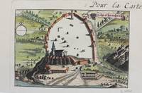
1690réf. M9477Paris c.1690. Very Good. Notes: A charming map of Athens Greece during the late 17th century. Size : 103x154 mm 4.06x6.06 Inches Coloring: Hand Colored Category: Maps City Maps; Maps Europe Greece Macedonia; unknown
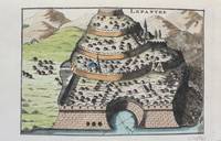
1690réf. M9478Paris c.1690. Very Good. Notes: A charming map of Lepanto Greece during the late 17th century. Size : 105x153 mm 4.13x6.02 Inches Coloring: Hand Colored Category: Maps Europe Greece Macedonia; unknown
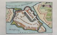
1690réf. M9472Paris c.1690. Very Good. Notes: A charming map of Santa Maura on the island of Lefkada Greece during the late 17th century. Size : 104x153 mm 4.09x6.02 Inches Coloring: Hand Colored Category: Maps Europe Greece Macedonia; unknown
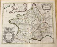
1710réf. M10329Amsterdam: Jean Covens & Corneille Mortier c.1710. Very Good. Size : 378x486 mm 14.88x19.13 Inches Coloring: Original Outline Coloring Category: Maps Europe France; Jean Covens & Corneille Mortier unknown
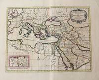
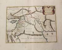
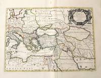
1710réf. M10321Amsterdam: Jean Covens & Corneille Mortier c.1710. Very Good. Size : 402x520 mm 15.83x20.47 Inches Coloring: Original Hand Coloring Category: Maps Mediterranean Sea; Maps Asia Middle East; Jean Covens & Corneille Mortier unknown
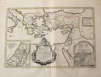
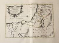
1710réf. M10319Amsterdam: Jean Covens & Corneille Mortier c.1710. Very Good. Notes: With 2 inset maps showing the Holy Land and Hierusalem. Size : 375x550 mm 14.76x21.65 Inches Coloring: Original Hand Coloring Category: Maps Asia Near East Turkey; Maps Asia Middle East Holy Land & Palestine; Maps Mediterranean Sea; Jean Covens & Corneille Mortier unknown
1710réf. M10250Amsterdam: Jean Covens & Corneille Mortier c.1710. Very Good. Size : 370x493 mm 14.57x19.41 Inches Coloring: Original Hand Coloring Category: Maps Asia Middle East Holy Land & Palestine; Maps Asia Middle East Iran Iraq; Jean Covens & Corneille Mortier unknown
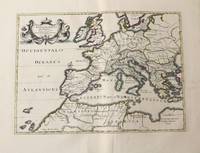
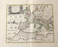
1710réf. M10326Amsterdam: Jean Covens & Corneille Mortier c.1710. Very Good. Size : 375x525 mm 14.76x20.67 Inches Coloring: Original Hand Coloring Category: Maps Africa North; Maps Europe Continent; Maps Mediterranean Sea; Jean Covens & Corneille Mortier unknown
1710réf. M10331Amsterdam: Jean Covens & Corneille Mortier c.1710. Very Good. Size : 410x508 mm 16.14x20.00 Inches Coloring: Original Outline Coloring Category: Maps Africa North; Maps Europe Continent; Maps Mediterranean Sea; Jean Covens & Corneille Mortier unknown
1710réf. M10332Amsterdam: Jean Covens & Corneille Mortier c.1710. Very Good. Size : 403x555 mm 15.87x21.85 Inches Coloring: Original Outline Coloring Category: Maps Mediterranean Sea; Maps Asia Middle East; Jean Covens & Corneille Mortier unknown
1710réf. M10330Amsterdam: Jean Covens & Corneille Mortier c.1710. Very Good. Size : 368x495 mm 14.49x19.49 Inches Coloring: Original Outline Coloring Category: Maps Asia Middle East Holy Land & Palestine; Maps Africa North; Maps Africa North Egypt; Jean Covens & Corneille Mortier unknown
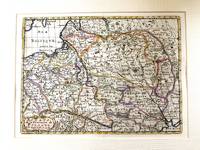
1683réf. M11172Paris c.1683. Very Good. Notes: French map showing Poland and the surrounding region. Nicolas Sanson 1600–1667 was a renowned French cartographer termed by some as the "father of French cartography." His works are known for their incorporation of the most up to date information of the time and their clean modern style. Size : 188x256 mm 7.40x10.08 Inches Coloring: Hand Colored Category: Maps Europe Poland Lithuania; unknown
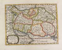
1652réf. M4655Paris 1652. Very Good. Notes: This is an important 17th-century map of Iran published in Paris by Nicolas Sanson the greatest 17th-century French cartographer. The map depicts Iran at the time of Shah Abbas II of the Safavid dynasty. It is interesting to note that present-day Afghanistan and Pakistan and even part of India sit within Iran's borders all of which were lost in due course by the kings of the Qajar dynasty. Also as Sufism was the religion of Iran at the time of the Safavid dynasty the title of the map refers to the "Empire of the Sufi of the Persians". Size : 192x247 mm 7.56x9.72 Inches Coloring: Hand Colored Reference: Ala'i E. 107. Category: Maps Asia Middle East Iran Iraq; unknown
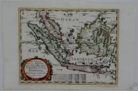
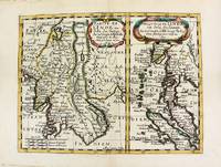
1660réf. M5006Paris 1660. Excellent. Notes: French map of South East Asia. Size : 195x250 mm 7.625x9.875 Inches Coloring: Hand Colored Category: ; Maps Asia South East Malaysia & Singapore; Maps Asia South East Indonesia & Papua New Guinea unknown
1652réf. M8177Paris. 1652. Very Good. Notes: Fine 17th century map of Thailand Burma and Malaysia. Size : 191x249 mm 7.50x9.80 Inches Coloring: Original Hand Coloring Category: Maps Asia South East Thailand Laos Vietnam Cambodia & Burma / Myanmar; Maps Asia South East Malaysia & Singapore; unknown
1648réf. 251162Paris 1648. unbound. Map. Engraving with hand outline color. Image measures 14.5 x 21.5 inches. This map of Switzerland centers on Lucerne covering approximately the area from Lake Constance south to Lake Como in Italy. Published in 1648 the map dates to the period of the Old Swiss Confederacy. Furthermore it predates by only a few years the Swiss Peasant War of 1653 a siege of Lucerne and Bern that demonstrated the significance of the rural population to the confederacy's stability. Hand-colored outlines on the map indicate the various independent states that made up the confederacy. A title cartouche with elaborate scrollwork adorns the lower right corner of the map. The map is in good condition with full margins and no chips or tears. Wear to lower margin. Nicolas Sanson 1600-1667 is considered the founder of the French school of cartography. In reaction to the prevailing trend of Dutch lavishness Sanson favored minimal details focusing rather on accurate cartography than ornament. This map demonstrates the skill that made him such a valuable asset to the French monarchy. unknown
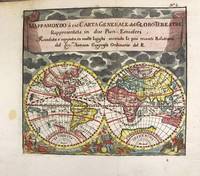
1697réf. M11198Antwerp Belgium: Jan Duren c.1697. Very Good. Notes: Rare miniature World map. California is depicted as an island. There are symbols for the four continents: dangerous America strong Europe exotic Asia and wild Africa. Size : 140x160 mm 5.51x6.30 Inches Coloring: Hand Colored Reference: Shirley #553. Category: Maps World; Jan Duren unknown
1648réf. 251162Paris 1648. unbound. Map. Engraving with hand outline color. Image measures 14.5 x 21.5 inches. This map of Switzerland centers on Lucerne covering approximately the area from Lake Constance south to Lake Como in Italy. Published in 1648 the map dates to the period of the Old Swiss Confederacy. Furthermore it predates by only a few years the Swiss Peasant War of 1653 a siege of Lucerne and Bern that demonstrated the significance of the rural population to the confederacy's stability. Hand-colored outlines on the map indicate the various independent states that made up the confederacy. A title cartouche with elaborate scrollwork adorns the lower right corner of the map. The map is in good condition with full margins and no chips or tears. Wear to lower margin. Nicolas Sanson 1600-1667 is considered the founder of the French school of cartography. In reaction to the prevailing trend of Dutch lavishness Sanson favored minimal details focusing rather on accurate cartography than ornament. This map demonstrates the skill that made him such a valuable asset to the French monarchy. unknown books