979 resultados
1650ref. 24869London 1650. 1 vols. 13" x 8 3/4. Contemporary. hand-coloring. Fine condition. 1 vols. 13" x 8 3/4 ". unknown
ref. 83285Berlin : Hasselberg’sche Verlagshandlung ohne Jahr. demi-percaline. SANSON H.Geheimnisse des Schaffots. Memoiren der Scharsricher-Familie Sanson 1685-1847. 1. 2.und 3. Bd. in 1 Band. Berlin Hasselberg’sche Verlagshandlung ohne Jahr 190x130mm 199 190 191 Seiten Halbperkalin. No hidden customs fees for orders shipped to the U.S.A with a value of up to 800 USD PDDP shipping we pay the VAT in advance Hasselberg’sche Verlagshandlung unknown
1862ref. 1862SansonEXECUTIONS IN FRANCE Sept Générations d'Exécuteurs 1688-1847: Mémoires des Sanson mis en ordre rédigés et publiés par H. Sanson. Paris: Dupray de la Mahérie 1862-1863. Six volumes each complete with half-title and probably large-paper copies but IV 67/68 with partial loss in lower blank. Tall 8vo unusually clean with hardly any spotting; gilt-stamped leather spines with matching black boards. First edition of this apocryphal memoir of the Sanson family based on family diaries and correspondence by the journalist D'Olbreuse detailing all the major executions from the late 17th century thru middle 19th century. The most famous member of the family is Charles-Henri Sanson 1739–1806 who served as the chief executioner of Paris during the French Revolution. He executed thousands of people—including King Louis XVI Marie Antoinette Danton and Robespierre. He was also closely involved in testing and adopting the guillotine as a more humane method of execution. The family's tenure ended in 1847 when Charles-Henri's grandson Henri-Clément Sanson was dismissed from office and arrested after pawning the family's official guillotine to cover mounting debts and gambling losses. Tulard 1316 - Fierro 1315. Dupray de la Mahérie hardcover
2011ref. G0197264832I4N00British Academy 2011. Hardcover. Very Good. May have limited writing in cover pages. Pages are unmarked. ~ ThriftBooks: Read More Spend Less.Dust jacket quality is not guaranteed. British Academy hardcover
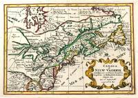
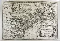
1705ref. M11241Amsterdam c.1705. Very Good. Notes: A reduced version of the most influential 17th century maps of the French and English colonies in North America. The map not only shows details of the Great Lakes but also it is a great source for Indian tribal names and locations. Two names Aouentsiouaeron and Attiouandarons appear here for the first time. Lake Superior and Michigan Lac du Puans are left open-end to the west. It is engraved by Anthony d'Winter. Size : 207x300 mm 8.15x11.81 Inches Coloring: Hand Colored Reference: Burden #575; Kershaw #138. Category: Maps Canada East; Maps North America Great Lakes; unknown
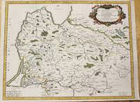
ref. 1916-25Paris H. Jaillot 1692. Alt grenzkolorierte Kupferstichkarte von 2 Platten. 64 5 x 99 cm Blattgr. Breitrandiges Exemplar. Äußere Ränder etwas gebräunt kleiner Randeiniß sonst gut erhalten. Großformatige Karte von Guillaume Sanson 1633-1703 die das Gebiet von Deggendorf bis Wagram und von Kromeríz/Kremsier bis Veszprém/Weissbrünn mit dem Neusiedler See Newsidler See zeigt. Aus dem Verlag von Alexis-Hubert Jaillot um 1632-1712 der eng mit Sanson zusammenarbeitete. Paris, H. Jaillot 1692. unknown
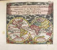
1697ref. M11198Antwerp Belgium: Jan Duren c.1697. Very Good. Notes: Rare miniature World map. California is depicted as an island. There are symbols for the four continents: dangerous America strong Europe exotic Asia and wild Africa. Size : 140x160 mm 5.51x6.30 Inches Coloring: Hand Colored Reference: Shirley #553. Category: Maps World; Jan Duren unknown
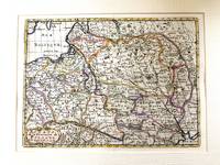
1683ref. M11172Paris c.1683. Very Good. Notes: French map showing Poland and the surrounding region. Nicolas Sanson 1600–1667 was a renowned French cartographer termed by some as the "father of French cartography." His works are known for their incorporation of the most up to date information of the time and their clean modern style. Size : 188x256 mm 7.40x10.08 Inches Coloring: Hand Colored Category: Maps Europe Poland Lithuania; unknown
1700ref. M11077Paris 1700. Excellent. Notes: Second state. Published in Description De Tout L'Universe-Halma. An excellent example of Nicolas Sanson's map of Canada and the Great Lakes Lake Superior and Lake Michigan Lac du Puans are shown open-ended. Engraved in the bottom-right corner outside the neat-line is "A.d.Winter Schulp". Additions include a latitude and longitude grid; mountains and trees filling in the blank areas east of James Bay and in northern Labrador; and the three latitude and longitude values that were previously missing in three of the corners on the border. Size : 207x308 mm 8.15x12.13 Inches Coloring: Black & White Reference: Burden #575; Kershaw #137 Plate 85 Category: Maps Canada East; Maps North America Great Lakes; unknown
1659ref. M4916Paris 1659. Very Good. Notes: Map of Baltic region of Estonia Latvia including Riga to Vilnius Wilna and parts of Lithuania. Nicolas Sanson 1600–1667 was a renowned French cartographer termed by some as the "father of French cartography." His works are known for their incorporation of the most up to date information of the time and their clean modern style. Size : 410x535 mm 16.125x21 Inches Coloring: Original Outline Coloring Reference: Category: Maps Europe Estonia Latvia unknown
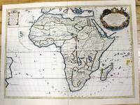
1700ref. M11022Paris c.1700. Very Good. Notes: French map of Africa as a continent. Size : 462x645 mm 18.19x25.39 Inches Coloring: Hand Colored Category: Maps Africa Continent; unknown
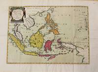
1654ref. M10780Paris 1654. Very Good. Notes: Detailed map of Southeast Asia by Nicholas Sanson 1600-1667 renowned French cartographer. Size : 402x560 mm 15.83x22.05 Inches Coloring: Original Hand Coloring Category: Maps Asia South East Indonesia & Papua New Guinea; Maps Asia South East Thailand Laos Vietnam Cambodia & Burma / Myanmar; Maps Asia South East Philippines; unknown
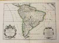
1698ref. M10786Paris 1698. Very Good. Notes: A charming large scale 17th century map of South America with two decorative cartouches and original outline colouring. Size : 460x648 mm 18.11x25.51 Inches Coloring: Original Outline Coloring Category: Maps South America Continent; unknown
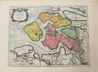
1693ref. M10774Paris 1693. Very Good. Notes: Map of the county of Zeeland. Size : 440x575 mm 17.32x22.64 Inches Coloring: Original Hand Coloring Category: Maps Europe Benelux; unknown
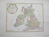
1754ref. M3766Paris 1754. Excellent. Size : 410x540 mm 16.125x21.25 Inches Coloring: Hand Colored Category: ; Maps Europe Ireland;; Maps Europe United Kingdom unknown
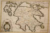
1692ref. M7546Paris: H. Jaillot c. 1692. Very Good;. Notes: The title cartouche in the lower left corner is encased in a floral wreath at the bottom of which sits a winged lion wielding a sword and standing at a pulpit. At the top of the wreath sits a coat of arms held by two winged putti. Encircling the wreath are little diagrams of various fortifications around Greece. Size : 565x845 mm 22.24x33.27 Inches Coloring: Original Outline Coloring Category: Maps Europe Greece Macedonia; H. Jaillot unknown
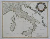
1665ref. M5118Paris 1665. Very Good central fold reinfrced. Notes: There is a water mark on the right hand portion of the map. Size : 435x540 mm 17.125x21.25 Inches Coloring: Original Outline Coloring Category: ; Maps Europe Italy unknown
1666ref. M1204Paris: Mariette Pierre 1666. Very Good. Size : 410x555 mm 16.125x21.875 Inches Coloring: Hand Colored Reference: Mojski Piotr Maria "Cartographia Rappersviliana Polonorum" page 388 number 32; Category: ; Maps Europe Poland Lithuania Mariette, Pierre unknown
1760ref. M7988Paris: Sr. Delamarche c.1760. Very Good. Notes: Engraved by Delahaye. Large scale attractive map of France. Size : 493x668 mm 19.41x26.30 Inches Coloring: Original Hand Coloring Category: Maps Europe France; Sr. Delamarche unknown
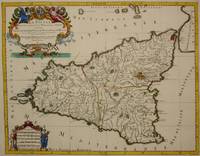
1692ref. M7516Paris: Hubert Jaillot c. 1692. Very Good. Notes: Title cartouche in upper left features Sicilian coat of arms winged angels and merpeople while the scale in the lower left is held on each side by allegorical figures of labour and harvest. Mount Etna is represented pictorially. Size : 418x530 mm 16.46x20.87 Inches Coloring: Hand Colored in Outline Category: Maps Mediterranean Islands; Hubert Jaillot unknown
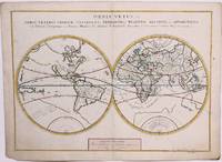
1657ref. M8883Paris 1657 . Very Good. Notes: A handsome 17th century map of the known world typifying Sanson's scientific style of cartography. Embodying the most up to date information of the period Sanson's map depicts California as an island with Antarctica and Australia still largely unknown. A land bridge connects Asia to North America and touches Japan. A very accurate map for the period. Nicolas Sanson 1600–1667 was a French cartographer termed by some the creator of French geography in which he's been called the "father of French cartography." Size : 380x537 mm 14.96x21.14 Inches Coloring: Original Hand Coloring Reference: Shirley R.W. World 400; Pastoureau M. Sanson V A 98. Category: Maps World; unknown
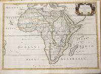
1650ref. M6678Paris: Pierre Mariette c. 1650. Very Good;. Notes: Title cartouche bordered by two outward-facing birds of prey. Norwich writes: "This is an early Sanson map. An odd feature is the name Barditus Mons given to a long chain of mountains running continuously from somewhere in Angolato Algoa Bay. No place names appear even on the coast of the southern part of the continent which is labelled 'Agi Symba' a name usually referring to the northern African region and inhabitants are 'Anthropophagi Aethiopes' or cannibals." Size : 396x553 mm 15.59x21.77 Inches Coloring: Hand Colored Reference: Norwich's Map 35. Category: Maps Africa Continent; Pierre Mariette unknown
1656ref. B2984Paris: Nicolas Sanson c. 1656. Lower right corner of the first eight leaves strengthened otherwise a very good copy maps and text are clean and crisp. In protective cloth slipcase. Edition: First edition. Binding: Full contemporary calf expertly rebacked with spine in six compartments of raised bands and finely-gilt motifs morocco label on two edges speckled red. Notes: This atlas was dedicated to the Superintendent of Finances at the time Nicolas Fouquet. Regarding a map of South and Central Africa published the year before which bears resemblance to this map of South Africa--‘Pays et Costes des Caffres’--in particular Norwich writes: “This map although a fine example of cartography is based on very little information; for example the desert-like coast of South West Africa is presented as a land rich in rivers. The fictitious states are given fictitious boundaries and the interior is marked with large cities such as Vigiti Magna and Monomotapa. This information led to subsequent exploration in search of these fabulous cities. Although the map is dated three years after the foundation of a settlement at the Cape by Jan van Riebeeck no mention is made of any European settlement anywhere in the south.” Size: 4to Illustration: Recent stencilled title. Complete with 18 maps of Africa and its territories in original outline colour. References: Tooley IV:103; Tooley Africa 100 Peyrounin edition; Norwich 37 & 158. Pages: P. 1-96. Category: Book Africa General; Book Atlas & Cartography Nicolas Sanson hardcover
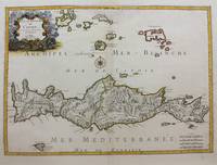
1658ref. M9417Paris: Nicolas Sanson c.1658. Very Good upper fold area expertly repaired. Notes: A fine map of Crete from the mid 17th century. The map also shows nearby islands such as Santorini Stampalia and Milo. The map has a decorative cartouche and details cities borders and geographical features. Size : 394x553 mm 15.51x21.77 Inches Coloring: Hand Colored Category: Maps Europe Greece Macedonia; Nicolas Sanson unknown
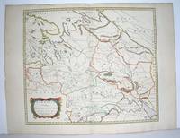
1654ref. M2853Paris 1654. Excellent. Size : 415x483 mm 16.375x19 Inches Coloring: Original Outline Coloring Category: Maps Russia unknown