Nicolas Sanson (1600-1667)Biblio.com
997 résultats
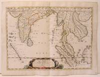
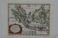
1660réf. M5006Paris 1660. Excellent. Notes: French map of South East Asia. Size : 195x250 mm 7.625x9.875 Inches Coloring: Hand Colored Category: ; Maps Asia South East Malaysia & Singapore; Maps Asia South East Indonesia & Papua New Guinea unknown
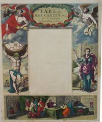
1650réf. M2494Paris 1650. Very Good; light age toning; some browning on lower half of the map. Size : 547x433 mm 21.5x17 Inches Coloring: Original Hand Coloring Category: ; Maps Misc Curiosities Title Pages Games etc. unknown
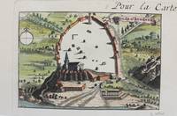
1690réf. M9477Paris c.1690. Very Good. Notes: A charming map of Athens Greece during the late 17th century. Size : 103x154 mm 4.06x6.06 Inches Coloring: Hand Colored Category: Maps City Maps; Maps Europe Greece Macedonia; unknown
1654réf. M2656Paris 1654. Excellent. Size : 385x530 mm 15.125x20.875 Inches Coloring: Original Hand Coloring Reference: Nebenzahl 3.9C Category: Maps Asia South East; Maps Asia Central India & Sri Lanka / Ceylon; unknown
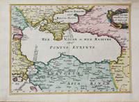
1656réf. M10647Paris c.1656. Very Good. Size : 182x246 mm 7.17x9.69 Inches Coloring: Hand Colored Category: Maps Russia; Maps Asia Near East Turkey; Maps Europe Ukraine; unknown
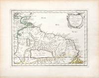
1657réf. 66689Paris. c. 1657. A very attractive and finely engraved map of the north eastern South American country of Guiana. The map is highlighted by numerous rivers tributaries mountains villages inlets bays and a very large inland equatorial lake that was thought to exist. Published in "Cartes Generales de toutes les parties du monde." Size: 285 x 360 mm. Copperplate engraving with original outline colouring. Fine condition. unknown
2017réf. x-0520295439Univ of California Pr 2017. Paperback. New. 273 pages. 6.00x9.00x0.50 inches. Univ of California Pr paperback
2016réf. x-0520290852Univ of California Pr 2016. Paperback. New. 324 pages. 9.00x6.00x0.75 inches. Univ of California Pr paperback
2014réf. x-0520283252Univ of California Pr 2014. Paperback. New. 256 pages. 9.25x6.25x0.50 inches. Univ of California Pr paperback
réf. #[63428]Map of North Holland with Tessel island. Large cartouche on the left with title dedication and explanation concerning the scales adopted for this map. The title is printed from a different plate. Titled: 'PARTIE SEPTENTIONALE DU COMTÉ DE / HOLLANDE. / Dressée sur les Memoires les plus Nouveaux. / Par le S.r SANSON Geographe ordinaire du Roy.' // 'Presenté A MONSEIGNEUR LE DAUPHIN / Par son tres-humple tres-Obeissant et tres fidele Serviteur / Alexis Hubert Iaillot.' On the bottom of the scales: 'A Paris chez H. Iallot joignant kes grands Augustins aux deux Globes. / Avec Privilege du Roy pour Vingt Ans. / 1699' last number '9'in pen and brown ink. In fact the original plate does not show the last number which was supposed to be added in a second moment. l Etching and engraving on paper trimmed to plate mark partially hand coloured; total: 431 x 564 mm; pasted on thick paper some losses of paper some stains corners with pinholes and further damages. Folding line in the middle top part of the folding damaged. unknown
1844réf. 274131J.-b. baillière 1844. Etat Passable couverture défraîchie bords abimés texte frais qq rousseurs en marge le prix tient compte de l'état absence page titre tome V. in8. 1844. Relié. 715750 pages. J.-b. baillière unknown
1957réf. 79200MAUGARD 1957. Broché. Etat moyen. in-8. . MAUGARD unknown
2011réf. DADAX0197264832British Academy 2011-11-07. 1. hardcover. New. 9.20x1.30x6.20. Buy with confidence. Excellent Customer Service & Return policy. British Academy hardcover
1700réf. 54030Nicolas Bion: L'Usage des Globes. Amsterdam: Francois Halma. 1700. Attractive map of Spain divided into its provinces. Maps by Sanson in original colour are rare. Nicolas Sanson was founder of the French school of mapmakers at a time when the leadership in European cartography passed from the Low Countries to France. This map was published in Brion's treatise on globes. Nicolas Brion was a famous French mathematical and scientific instrument maker. Copper engraving. Fine condition. Original colour. Size: 23.5 x 18 cm. 9½ x 7 inches. unknown
1700réf. 54035Amsterdam: 1700. Map of Germany divided into regions which at the time extended over much of the Low Countries. Maps by Sanson in original colour are rare. Nicolas Sanson was founder of the French school of mapmakers at a time when the leadership in European cartography passed from the Low Countries to France. This map was published in Brion's treatise on globes. Nicolas Brion was a famous French mathematical and scientific instrument maker. L'Usage des Globes. Copper engraving. Fine condition. Original colour. Size: 23.5 x 18.5 cm. unknown
1700réf. 58299Description de tout l'Univers 1700 published by F.Halma Amsterdam. Nicolas Sanson was founder of the French school of mapmakers at a time when the leadership in European cartography passed from the Low Countries to France. Copper engraving. Fine condition. Original colour with gold leaf highlights. Size: 17 x 18.5 cm. unknown
1700réf. 54023Nicolas Bion: L'Usage des Globes. Amsterdam: Francois Halma. 1700. Attractive map of Morocco the Saharan hinterland and the Canary Islands. Handsome title cartouche at top left. Much of the charm of early maps of Africa lies in how they show the interior of the continent which was not explored until the 19th century. Maps by Sanson in original colour are rare. Nicolas Sanson was founder of the French school of mapmakers at a time when the leadership in European cartography passed from the Low Countries to France. This map was published in Brion's treatise on globes. Nicolas Brion was a famous French mathematical and scientific instrument maker. Copper engraving. Very good condition. Faint library stamp right margin. Original colour. Size: 28 x 17 cm. 11 x 6½ inches. unknown
1657réf. 56721Histoire et Geographie de l'Amerique. 1657. Attractive map of Paraguay. Title cartouche at top right. Maps by Sanson in original colour are rare. Nicolas Sanson was founder of the French school of mapmakers at a time when the leadership in European cartography passed from the Low Countries to France. Copper engraving. Fine condition; very light offsetting. Original outline colour. Size: 28.5 x 21.5 cm. 11 x 8½ inches unknown
1689réf. 52354Paris. 1689. The map covers the area from the Moselle in NW to Worms in SE. ornamental cartouche at lower left. Copper engraving. Good condition though map is slightly discolured and stained. Original colour. Size: 56 x 43 cm. unknown
1655réf. 56109Paris. 1655. Attractive map of Morocco and parts of Algeria. Maps by Sanson in original colour are rare. Nicolas Sanson was founder of the French school of mapmakers at a time when the leadership in European cartography passed from the Low Countries to France. Copper engraving. Very good condition. Some light browning to the centre fold. Attractive water mark. Original colour. Size: 53 x 40 cm. 21 x 15½ inches unknown
1700réf. 54377Nicolas Bion: L'Usage des Globes. Amsterdam: Francois Halma. 1700. An armillary sphere perused by three scholars at a table. Nicolas Sanson was founder of the French school of mapmakers at a time when the leadership in European cartography passed from the Low Countries to France. This map was published in Bion's treatise on globes. Nicolas Bion was a famous French mathematical and scientific instrument maker. Size: 125 x 175 mm. Copper engraving. Original colour. Mounted size: 295 x 360 mm. Fine condition. unknown
1700réf. 54043Nicolas Bion: L'Usage des Globes. Amsterdam: Francois Halma. 1700. Map showing north-east South America from Trindad to the mouth of the Amazon - modern day Guyana and Surinam. Several large fictitious lakes make up much of the unexplored interior. Maps by Sanson in original colour are rare. Nicolas Sanson was founder of the French school of mapmakers at a time when the leadership in European cartography passed from the Low Countries to France. This map was published in Bion's treatise on globes. Nicolas Bion was a famous French mathematical and scientific instrument maker. Copper engraving. Very good condition. Small 1cm. very faint library stamp on border not affecting map. Original colour. Size: 27.5 x 20 cm. 11 x 8 inches. unknown
1700réf. 54022Nicolas Bion: L'Usage des Globes. Amsterdam: Francois Halma. 1700. Attractive map of north eastern Africa including Egypt and northern Libya. Much of the charm of early maps of Africa lies in how they show the interior of the continent which was not explored until the 19th century. Maps by Sanson in original colour are rare. Nicolas Sanson was founder of the French school of mapmakers at a time when the leadership in European cartography passed from the Low Countries to France. This map was published in Brion's treatise on globes. Nicolas Brion was a famous French mathematical and scientific instrument maker. Copper engraving. Very good condition. Darkened edges to margins. Faint inkstamp on right margin not affecting map. Original colour. Size: 27 x 17 cm. 10½ x 6½ inches. unknown
1953réf. ZB691256Paris: Presses Universitaires de France 1953. 366 pp. rebound in buckram hardcover ex library else text and binding clean and tight. - If you are reading this this item is actually physically in our stock and ready for shipment once ordered. We are not bookjackers. Buyer is responsible for any additional duties taxes or fees required by recipient's country. Paris: Presses Universitaires de France hardcover
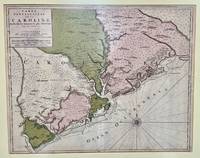
1696réf. 48399Amsterdam: Pierre Mortier 1696. Engraved broadside map 19 x 23 5/8 inches plate mark dimensions with extensive pink and green wash. Some light browning but an attractive copy. Matted glazed and framed. One of two issues of this map this one being a bit larger based on the Thornton-Morden map of circa 1685. Pictures the colony from the Santee River to the South Edisto River and well inland up the Cooper River. Physical features and names of plantation and land owners are given in English "Nouveau Londre" on the Edistow sic River being exceptions; soundings are given at river mouths in Charleston Harbor and in the ocean along some beaches. Cumming Southeast in Early Maps 121. Kendall Early Maps of Carolina 17c: "This map has a wealth of names of owners of land in Carolina. Pierre Mortier unknown