977 résultats
1780réf. M5125Paris 1780. Excellent. Size : 490x690 mm 19.25x27.125 Inches Coloring: Hand Colored in Outline Category: ; Maps Asia Middle East Holy Land & Palestine unknown
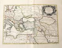
1710réf. M10332Amsterdam: Jean Covens & Corneille Mortier c.1710. Very Good. Size : 403x555 mm 15.87x21.85 Inches Coloring: Original Outline Coloring Category: Maps Mediterranean Sea; Maps Asia Middle East; Jean Covens & Corneille Mortier unknown
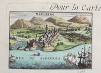
1690réf. M9579Paris c. 1690. Very Good. Notes: A charming map of Pylos Navarino Greece during the late 17th century. Size : 104x154 mm 4.09x6.06 Inches Coloring: Hand Colored Category: Maps Europe Greece Macedonia; unknown
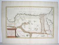
1655réf. M2801Paris: Mariette Pierre 1655. Excellent. Size : 345x523 mm 13.625x20.625 Inches Coloring: Original Outline Coloring Category: Maps Africa North Egypt Mariette, Pierre unknown
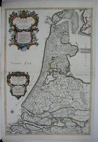
1674réf. M1744Paris: Jaillot Hubert 1674. Very Good to Excellent. Size : 572x840 mm 22.5x33 Inches Coloring: Original Outline Coloring Category: ; Maps Europe Benelux Jaillot, Hubert unknown
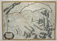
1663réf. M645Paris: Mariette Pierre 1663. Excellent. Size : 420x575 mm 16.5x22.625 Inches Coloring: Hand Colored Category: ; Maps Europe Switzerland Mariette, Pierre unknown
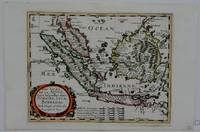
1660réf. M5006Paris 1660. Excellent. Notes: French map of South East Asia. Size : 195x250 mm 7.625x9.875 Inches Coloring: Hand Colored Category: ; Maps Asia South East Malaysia & Singapore; Maps Asia South East Indonesia & Papua New Guinea unknown
1650réf. M2494Paris 1650. Very Good; light age toning; some browning on lower half of the map. Size : 547x433 mm 21.5x17 Inches Coloring: Original Hand Coloring Category: ; Maps Misc Curiosities Title Pages Games etc. unknown
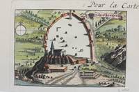
1690réf. M9477Paris c.1690. Very Good. Notes: A charming map of Athens Greece during the late 17th century. Size : 103x154 mm 4.06x6.06 Inches Coloring: Hand Colored Category: Maps City Maps; Maps Europe Greece Macedonia; unknown
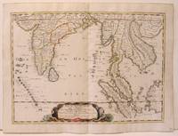
1654réf. M2656Paris 1654. Excellent. Size : 385x530 mm 15.125x20.875 Inches Coloring: Original Hand Coloring Reference: Nebenzahl 3.9C Category: Maps Asia South East; Maps Asia Central India & Sri Lanka / Ceylon; unknown
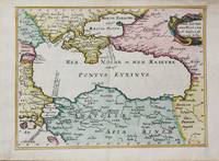
1656réf. M10647Paris c.1656. Very Good. Size : 182x246 mm 7.17x9.69 Inches Coloring: Hand Colored Category: Maps Russia; Maps Asia Near East Turkey; Maps Europe Ukraine; unknown
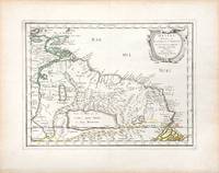
1657réf. 66689Paris. c. 1657. A very attractive and finely engraved map of the north eastern South American country of Guiana. The map is highlighted by numerous rivers tributaries mountains villages inlets bays and a very large inland equatorial lake that was thought to exist. Published in "Cartes Generales de toutes les parties du monde." Size: 285 x 360 mm. Copperplate engraving with original outline colouring. Fine condition. unknown
1700réf. 54030Nicolas Bion: L'Usage des Globes. Amsterdam: Francois Halma. 1700. Attractive map of Spain divided into its provinces. Maps by Sanson in original colour are rare. Nicolas Sanson was founder of the French school of mapmakers at a time when the leadership in European cartography passed from the Low Countries to France. This map was published in Brion's treatise on globes. Nicolas Brion was a famous French mathematical and scientific instrument maker. Copper engraving. Fine condition. Original colour. Size: 23.5 x 18 cm. 9½ x 7 inches. unknown
1700réf. 54035Amsterdam: 1700. Map of Germany divided into regions which at the time extended over much of the Low Countries. Maps by Sanson in original colour are rare. Nicolas Sanson was founder of the French school of mapmakers at a time when the leadership in European cartography passed from the Low Countries to France. This map was published in Brion's treatise on globes. Nicolas Brion was a famous French mathematical and scientific instrument maker. L'Usage des Globes. Copper engraving. Fine condition. Original colour. Size: 23.5 x 18.5 cm. unknown
1700réf. 58299Description de tout l'Univers 1700 published by F.Halma Amsterdam. Nicolas Sanson was founder of the French school of mapmakers at a time when the leadership in European cartography passed from the Low Countries to France. Copper engraving. Fine condition. Original colour with gold leaf highlights. Size: 17 x 18.5 cm. unknown
1700réf. 54023Nicolas Bion: L'Usage des Globes. Amsterdam: Francois Halma. 1700. Attractive map of Morocco the Saharan hinterland and the Canary Islands. Handsome title cartouche at top left. Much of the charm of early maps of Africa lies in how they show the interior of the continent which was not explored until the 19th century. Maps by Sanson in original colour are rare. Nicolas Sanson was founder of the French school of mapmakers at a time when the leadership in European cartography passed from the Low Countries to France. This map was published in Brion's treatise on globes. Nicolas Brion was a famous French mathematical and scientific instrument maker. Copper engraving. Very good condition. Faint library stamp right margin. Original colour. Size: 28 x 17 cm. 11 x 6½ inches. unknown
1657réf. 56721Histoire et Geographie de l'Amerique. 1657. Attractive map of Paraguay. Title cartouche at top right. Maps by Sanson in original colour are rare. Nicolas Sanson was founder of the French school of mapmakers at a time when the leadership in European cartography passed from the Low Countries to France. Copper engraving. Fine condition; very light offsetting. Original outline colour. Size: 28.5 x 21.5 cm. 11 x 8½ inches unknown
1689réf. 52354Paris. 1689. The map covers the area from the Moselle in NW to Worms in SE. ornamental cartouche at lower left. Copper engraving. Good condition though map is slightly discolured and stained. Original colour. Size: 56 x 43 cm. unknown
1700réf. 54377Nicolas Bion: L'Usage des Globes. Amsterdam: Francois Halma. 1700. An armillary sphere perused by three scholars at a table. Nicolas Sanson was founder of the French school of mapmakers at a time when the leadership in European cartography passed from the Low Countries to France. This map was published in Bion's treatise on globes. Nicolas Bion was a famous French mathematical and scientific instrument maker. Size: 125 x 175 mm. Copper engraving. Original colour. Mounted size: 295 x 360 mm. Fine condition. unknown
1700réf. 54043Nicolas Bion: L'Usage des Globes. Amsterdam: Francois Halma. 1700. Map showing north-east South America from Trindad to the mouth of the Amazon - modern day Guyana and Surinam. Several large fictitious lakes make up much of the unexplored interior. Maps by Sanson in original colour are rare. Nicolas Sanson was founder of the French school of mapmakers at a time when the leadership in European cartography passed from the Low Countries to France. This map was published in Bion's treatise on globes. Nicolas Bion was a famous French mathematical and scientific instrument maker. Copper engraving. Very good condition. Small 1cm. very faint library stamp on border not affecting map. Original colour. Size: 27.5 x 20 cm. 11 x 8 inches. unknown
1700réf. 54022Nicolas Bion: L'Usage des Globes. Amsterdam: Francois Halma. 1700. Attractive map of north eastern Africa including Egypt and northern Libya. Much of the charm of early maps of Africa lies in how they show the interior of the continent which was not explored until the 19th century. Maps by Sanson in original colour are rare. Nicolas Sanson was founder of the French school of mapmakers at a time when the leadership in European cartography passed from the Low Countries to France. This map was published in Brion's treatise on globes. Nicolas Brion was a famous French mathematical and scientific instrument maker. Copper engraving. Very good condition. Darkened edges to margins. Faint inkstamp on right margin not affecting map. Original colour. Size: 27 x 17 cm. 10½ x 6½ inches. unknown
1953réf. ZB691256Paris: Presses Universitaires de France 1953. Price HAS BEEN REDUCED by 10% until Monday Oct. 26 weekend SALE item 366 pp. rebound in buckram hardcover ex library else text and binding clean and tight. - If you are reading this this item is actually physically in our stock and ready for shipment once ordered. We are not bookjackers. Buyer is responsible for any additional duties taxes or fees required by recipient's country. Paris: Presses Universitaires de France hardcover
réf. 122122Paris 1692. . Double page engraved map with fine original hand-colour with two decorative cartouches surrounded by animals and foliage. Sheet size: 950 mm x 600 mm. Some minor offset and tiny worm holes otherwise very good. The map is dedicated to Jean-Baptiste Antoine Colbert Marquis de Seignelay the eldest son of the French minister of the same name who served Louis XIV. Alexis-Hubert Jaillot 1632-1712 was a French cartographer. He joined the Sanson heirs and redrew Nicolas Sanson's maps on a larger scale. 'Atlas Nouveau' 1674 sea-atlas ' Le Neptune François' 1693. Paris, 1692. unknown
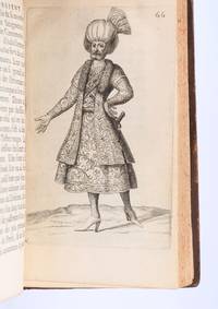
1694réf. 90853Paris: Veuve de Jacques LangloisVeuve de R. ChevillonJacques Langlois 1694. Fine. Veuve de Jacques Langlois Veuve de R. Chevillon Jacques Langlois Paris 1694 9.5 x 16.5 cm Relié Rare illustrated first edition with 5 copper-engraved plates hors-texte including 2 folding plates cf. Barbier II 302. Schwab 517. Hage Chahine 4320. Wilson 200. Absent from Blackmer and Atabey. Our copy lacks the two dedication leaves to Rouillié often missing with repairs to the joints and one corner and a manuscript ex-libris on the title-page. Contemporary full mottled fawn calf spine with five raised bands gilt and decorated with gilt compartments and floral tools tan calf title-label gilt fillets to the edges partly faded speckled edges. Sanson a zealous apostolic missionary tireless traveller and accomplished diplomat arrived in Persia in 1683 learning Armenian Turkish and Persian while travelling through the kingdom in order to ""consoler les chrétiens qui y habitent"". He took an interest in everything ""murs situation antiquités"" of the regions he crossed and eventually gained access to the Palace ""qui ne sont accordées qu'aux grands seigneurs de Perse"" attending all audiences and taking part in every banquet. He spent three years close to Soliman before returning to France bringing Louis XIV a personal message from the ""roi"" of Persia. Provenance: copy from the library of the literary critic Émile Faguet 18471916 with his vignette bookplate pasted to the inside board. Veuve de Jacques LangloisVeuve de R. ChevillonJacques Langlois hardcover
réf. 117739Paris H. Jaillot 1692 but 1696. . Large two-sheet engraved map of Ireland with extremely fine original hand colouring heightened with gold; sheet size: 945 x 628 mm.; left margin cropped into the scale some minor offset and reinforcement to fold on verso; framed & glazed: 1000 x 710 mm. One of the best large format maps of Ireland issued in the late 17th early 18th century. The map shows towns counties mountains islands and a host of other fine details. The title cartouche is impressive with the coat of arms all in stunning full original colour delicately heightened in gold. Based upon the geographical compilations and work of Nicolas Sanson which remained unpublished at the time of his death. In 1674 Jaillot conceived of the re-issue of Sanson's major work published and unpublished in an enlarged format. The maps were issued as early as 1674 and were later jointly issued by Sanson and Mortier in Amsterdam. Paris, H. Jaillot, 1692 [but 1696]. unknown