SANSON NicolasABAA

888 Ergebnisse
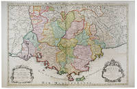
1652Best.-Nr. 251161Paris 1652. unbound. Map. Engraving with hand outline color. Image measures 14 x 16.5%u201D. This map of southeastern France includes the erstwhile provinces of Dauphiné corresponding roughly to the present departments of Isère Drôme and Hautes-Alpes as well as parts of Savoye and Bresse. At the time of the map%u2019s publication in 1652 Dauphiné was under the absolutist rule of King Louis XIV. The cartographer Nicolas Sanson as Royal Geographer to Louis XIV as well as Louis III likely understood the importance of this region to French interests of the time. The map thusly provides ample detail about the area including cities rivers mountains and significant forts. Hand-colored outlines indicate political boundaries. An elegant cartouche in the upper right corner of the map displays the title amidst scrollwork topped with the crown of the French monarchy. The map is in very good condition with full margins and no chips or tears. Nicolas Sanson 1600-1667 is considered the founder of the French school of cartography. In reaction to the prevailing trend of Dutch lavishness Sanson favored minimal details focusing rather on accurate cartography than ornament. This map points to his significant role within the French monarchy. unknown books
1648Best.-Nr. 251162Paris 1648. unbound. Map. Engraving with hand outline color. Image measures 14.5 x 21.5 inches. This map of Switzerland centers on Lucerne covering approximately the area from Lake Constance south to Lake Como in Italy. Published in 1648 the map dates to the period of the Old Swiss Confederacy. Furthermore it predates by only a few years the Swiss Peasant War of 1653 a siege of Lucerne and Bern that demonstrated the significance of the rural population to the confederacy%u2019s stability. Hand-colored outlines on the map indicate the various independent states that made up the confederacy. A title cartouche with elaborate scrollwork adorns the lower right corner of the map. The map is in good condition with full margins and no chips or tears. Wear to lower margin. Nicolas Sanson 1600-1667 is considered the founder of the French school of cartography. In reaction to the prevailing trend of Dutch lavishness Sanson favored minimal details focusing rather on accurate cartography than ornament. This map demonstrates the skill that made him such a valuable asset to the French monarchy. unknown books
1680Best.-Nr. 264415Paris 1680. unbound. Map. Uncolored copper plate engraving. Image measures 7.5" x 10". 1680. This map of southeast Asia and the East Indies is essentially two maps on a single sheet. The map on the left depicts the northern portion of the India Ganges region representing Burma Myanmar Thailand Cambodia Vietnam and Laos while the map of the right depicts the southern portion and includes the Malay Peninsula Singapore Sumatra. The most interesting feature is the Lacus Chimay Chimay Lake the mythical lake located in northern Burma which was believed to be the source of the river system in Southeast Asia. Important towns and cities are identified with beautifully rendered topography depicted in profile. Map is in very good condition with some toning along original centerfold which shows repairs on verso. Minimal foxing. Nicolas Sanson 1600-1667 is considered the founder of the French school of cartography. In reaction to the prevailing trend of Dutch lavishness Sanson favored minimal details focusing rather on accurate cartography than ornament. This map is a fine example of his work. unknown books
1696Best.-Nr. 16269Paris: Alexis Hubert Jaillot 1696. Copper-engraved map with full original colour and gold embellishment in excellent condition. A stunning map of Normandy by Alexis Jaillot an exceptional example with gilt embellishments. One of the most important figures in French cartography Nicolas Sanson initiated the great school of French geographers. Born in Abbeville in 1600 Sanson established his first printing house in Paris in 1638. He soon became geographer to the king establishing himself as one of the most influential cartographers on the Continent. He was succeeded by his sons Adrien and Guillaume and by his son-in-law Pierre Duval who continued to publish a wealth of maps using Sanson's name. At the close of the seventeenth century Sanson's plates were purchased by the influential cartographer Alexis Hubert Jaillot who continued to publish his maps and atlases under Sanson's title. This stunning map of Normandy is based on Sanson's map published in 1650 but was redrawn and enlarged by Jaillot. It shows the provinces of Normandy as well as the northern tip of Brittany and part of the English Channel. Both Jersey and Guernsey are included as is Mont St. Michel off the coast of St. Malo. In keeping with all of Sanson's and Jaillot's superb maps forests rivers and towns are meticulously identified and named. The map includes an ornate cartouche in the upper section as well as a scale and key. Tooley Maps & Map-Makers pp. 40-41. Alexis Hubert Jaillot unknown books
1696Best.-Nr. 48399Amsterdam: Pierre Mortier 1696. Engraved broadside map 19 x 23 5/8 inches plate mark dimensions with extensive pink and green wash. Some light browning but an attractive copy. Matted glazed and framed. One of two issues of this map this one being a bit larger based on the Thornton-Morden map of circa 1685. Pictures the colony from the Santee River to the South Edisto River and well inland up the Cooper River. Physical features and names of plantation and land owners are given in English "Nouveau Londre" on the Edistow sic River being exceptions; soundings are given at river mouths in Charleston Harbor and in the ocean along some beaches. Cumming Southeast in Early Maps 121. Kendall Early Maps of Carolina 17c: "This map has a wealth of names of owners of land in Carolina." Pierre Mortier unknown books
2010Best.-Nr. 29856Paris: Somogy 2010. First edition. Paperback. Fine. Thick paperbound volume in photo-illustrated glossy wrappers with French flaps. 103 pp. Illustrated with numerous illustrations and color photographs. Text in French by Pierre Berge and others. A fine copy. Book describes and analyzes the life and career of author and artist Jean Cocteau in his home in France. Somogy paperback books
1667Best.-Nr. 10027Paris 1667. No Binding. Near Fine. 12 ½ x 17 inches. Original outline color; excellent. Earliest map of Martinique listed in Phillips featuring attractive original color and an elegant cartouche. This map depicts the situation on the island before 1660 when it was still largely inhabited by natives and only about half of it had been claimed by colonists for sugar cane farming. The map goes so far as to mark with a printed line the partition dividing the "demeure des François" and the "demeure des savages." However by 1660 the entirety of the native population was either dead expelled or in slavery and Martinique was a full-fledged sugar cane-farming European colony. Phillips Maps P. 389. unknown books
1949Best.-Nr. 014154Cambridge MA: University Press Inc. 1949. Book. Very good condition. Hardcover. First Edition. Octavo 8vo. xxx 474 pages of text. Hardcover binding with minimal shelfwear. Unclipped dustjacket with several chips including a large one at the base of the spine and numerous small tears and creases; protected in archival mylar. Contains 26 black & white illustrations. First edition. Text is in Spanish. Includes a typed letter signed by Alejandro Orfila on Organization of American States letterhead. University Press, Inc. Hardcover books
1647Best.-Nr. WB16371Lutetiae Parisiorum: Sumptibus & Impensis Autoris 1647. Hardcover. Good. 16mo. Old leather; quite worn. pp 16 246 2. Liber primus only. Sumptibus & Impensis Autoris hardcover books
1700Best.-Nr. 104160Copper engraved map double page 24" x 20" hand colored and large uncolored title cartouches. Some minor soiling a little wear along centerfold with old verso repair normal aging; very good. Samson 1600-1667 is often referred to as the father of French cartography. Louis XIII was impressed with his work and appointed him "Geographe Ordinaire du Roi". During his career Sanson would produce about 300 maps and his major atlas "Cartes Generales de Toutes les Parties du Monde" would represent an important part of his body of work. While two of his sons continued publication of his maps after his death Pieter Schenk 1655-1718 an important publisher and engraver in his own right published this map. The map is attractively colored and gives a detailed view of the provinces of France. The map is also decorated with a large title cartouche. Bagrow p. 185. map hist website. books
Best.-Nr. 3861957884.Gpaperback. Good. Access codes and supplements are not guaranteed with used items. May be an ex-library book. paperback
Best.-Nr. 122122Paris 1692. . Double page engraved map with fine original hand-colour with two decorative cartouches surrounded by animals and foliage. Sheet size: 950 mm x 600 mm. Some minor offset and tiny worm holes otherwise very good. The map is dedicated to Jean-Baptiste Antoine Colbert Marquis de Seignelay the eldest son of the French minister of the same name who served Louis XIV. Alexis-Hubert Jaillot 1632-1712 was a French cartographer. He joined the Sanson heirs and redrew Nicolas Sanson's maps on a larger scale. 'Atlas Nouveau' 1674 sea-atlas ' Le Neptune François' 1693. Paris, 1692. unknown
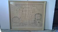
Best.-Nr. 6m5023H. Jaillot Paris 1696. Grenzkolorierte Kupferkarte gerahmt ca. 56 : 65 cm gebräunt. unknown
2026Best.-Nr. x-0197609945Oxford University Press Inc 2026. Hardcover. New. 232 pages. 6.51x0.84x9.51 inches. Oxford University Press Inc hardcover
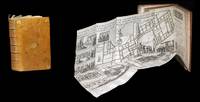
1643Best.-Nr. 309321643. S.l. chez l'Autheur sic 1643 - A Paris de l'Imprimerie de Robert Mansion 1636 - A Paris chez Antoine de Sommaville 1655 - A Paris s.. 1604 pour le troisiÂme texte ; divis en trois parties pagination spare. 3 ouvrages le dernier compos de 3 parties relis en un fort vol. au format in-12 173 x 112 mm de 1 f. bl. 3 ff. n.fol. et 106 pp. ; 1 f. bl. ; 4 ff. n.fol. et 111 pp. ; 3 ff. n.fol. et 50 pp. ; 3 ff. n.fol. et 63 pp. ; 72 pp. et 2 ff. n.fol. de PrivilÂge in fine. Reliure de l'poque de plein veau glac blond larges fleurons angulaires et fleuron central dors ports sur chacun des plats dos nerfs orn de filets gras froid roulette dore sur les nerfs caissons d'encadrement dors filets verticaux dors filets en pointills dors larges fleurons dors semis de pointills dors piÂce de titre de maroquin fauve titre dor palette dore en tÂte et queue roulette dore sur les coupes tranches mouchetes. Le prsent exemplaire renferme trois textes ; relis en un volume. Le Crmonial de l'lection des Papes closant le prsent volume est ici bien complet de ses 3 parties ainsi que de ses deux grandes planches dpliantes graves. Les deux premiers ouvrages sont l'oeuvre de Nicolas Sanson d'Abbeville clÂbre cartographe s'il en est. Coiffe infrieure arase. Quelques tches brunes sur les plats. Contre-gardes absentes. Quelques feuillets lgÂrement oxyds et rousseurs dans les corps d'ouvrages. Restauration ancienne au revers de chacun des planches. Du reste belle condition. Rare. b42961 unknown
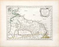
1657Best.-Nr. 66689Paris. c. 1657. A very attractive and finely engraved map of the north eastern South American country of Guiana. The map is highlighted by numerous rivers tributaries mountains villages inlets bays and a very large inland equatorial lake that was thought to exist. Published in "Cartes Generales de toutes les parties du monde." Size: 285 x 360 mm. Copperplate engraving with original outline colouring. Fine condition. unknown
2017Best.-Nr. x-0520295439Univ of California Pr 2017. Paperback. New. 273 pages. 6.00x9.00x0.50 inches. Univ of California Pr paperback
2016Best.-Nr. x-0520290852Univ of California Pr 2016. Paperback. New. 324 pages. 9.00x6.00x0.75 inches. Univ of California Pr paperback
2014Best.-Nr. x-0520283252Univ of California Pr 2014. Paperback. New. 256 pages. 9.25x6.25x0.50 inches. Univ of California Pr paperback
1690Best.-Nr. 192941690. S.l. Alexis Hubert Jaillot 1680. Une grande carte 892 x 592 mm compose de deux feuillets contrecolls sous cadre moderne. Attractive 892 x 592 mm carte de la fin du XVIIÂme avec rehauts aquarells du temps. Elle s'orne d'un important cartouche aux armes du Grand Dauphin Louis de France et s'agrmente en marge gauche de la figuration de vaisseaux ayant pris part un combat naval. Kupcik Cartes gographiques anciennes p. 159. Papier trÂs lgÂrement oxyd. Prsence de rares et claires rousseurs ou petites tches. Deux plissures et une infime perforation en marge suprieure droite. Du reste belle condition. b42961 unknown
Best.-Nr. 04086London: S.W. Fores 1801. Three of George Moutard Woodward's Hand-Colored Prints from "Symptoms of the Shop" WOODWARD George Moutard artist SANSON Francis printmaker. Symptoms of the Shop. London: S.W. Fores 1801. First edition. Quarto 10 1/8 x 8 1/16 inches; 257 x 265 mm. Three of twelve hand colored 'Satirical' stipple engravings on wove paper drawn by Woodward and etched by Sanson numbers 7 8 and 10. Each with the plate number at the top right margin and with lithographed text at the top of the image. On each of the lower margins is "Pub. June 1st 1801 by S.W. Fores No.50 Piccadilly Prints and Drawings lent on the plan of a Library Folio's of Caricature lent out for the Evening." / Symptoms of the Shop" / "Drawn by G. Woodward Etchd by F. Sansom". Some light marginal soiling otherwise near fine. Plate #7. "After all there is nothing like the true old orthodox principles." Plate #8. "I have brought your Honor home your new suit." Plate #10. "Madam - I was once a Minister and used to negotiations." Very rare. According to OCLC there are only two complete set in libraries and institutions worldwide The Lewis Walpole Library CT. has a complete colored set Princeton NJ also has a complete set but does not mention 'colored'. Yale university has nine of the twelve colored plates missing numbers 1 7 & 8. Harvard MA has one plate. These two artists previously collaborated on Every Body in Town BC-28 Every Body Out of Town BC-29 and Pigmy Revels: All Alive in Lilliput BC-62 all published by Fores. Each plate depicts two persons engaged in humorous wordplay relating to the characteristics of a trade or calling. William Gordon. A catalogue of the Books Drawings Prints and Periodicals forming the William A. Gordon Library of British Caricature. The three images present here include: Plate 7. A man sitting in a wooden chair lifts his hand for emphasis and declares: "After all there is nothing like the true old orthodox principles." An obese clergyman in a padded armchair on the right responds: "Orthodox principles - ah my dear friend you put me in mind of old times - when I was but a simple vicar. How I used to charm my congregation - slim as a Bedles wand - & delicate as a new wash'd surplice - but since I have been raised to higher dignities I do nothing but remain in my chair; bulky & unweildy as a Folio Church Service. - oh how elegantly I used to manage my discourses - fifteen minutes to a point by the clock under the gallery - never exceeded - short praye - text - and devision - one - two - three & away - that was my method." Plate 8. A man with a parcel under his arm bows slightly and says: "I have brought your Honor home your new suit." A stout bespectacled lawyer replies: "Suit - ah - Mr. Buckram you did not know me when I practiced in the Courts - I could have shewn you suits that would have puzzled Judge Blackstone himself - none of your simple matters - brim full of Law as a brief bag - intricate as the Temple avenues -& long as Westminster Hall - Shy Clients sometimes - but it would not do with Paul Parchment - sure to have them on way or other. - Once in never out that was my motto." Plate 10. A former Minister holding his hat wearing a bag-wig and with his pocket filled with scrolls addresses a woman: "Madam - I was once a Minister and used to Negotiations I shall therefore be happy to treat with you on Matrimonial Speculation - I have ample credentials ready to ratify my powers and if you please will enter into preliminaries immediately - but let me have a sight glance at your project and be assured I will deliver to you my contre projet as soon as the definitive treaty is concluded and duly guaranteed." The woman who is short and plump looks aghast at the proposition. London: S.W. Fores, 1801 unknown
2000Best.-Nr. DADAX0967763908Brand: Quailmark Books 2000-01-01. First Edition. hardcover. New. 11.25x0.75x12.25. Buy with confidence. Excellent Customer Service & Return policy. Brand: Quailmark Books hardcover
2003Best.-Nr. DADAX0972123342Brand: MCD Century Publications 2003-06-01. paperback. New. 1.00x10.00x9.00. Buy with confidence. Excellent Customer Service & Return policy. Brand: MCD Century Publications paperback
2011Best.-Nr. DADAX0197264832British Academy 2011-11-07. 1. hardcover. New. 9.20x1.30x6.20. Buy with confidence. Excellent Customer Service & Return policy. British Academy hardcover
1700Best.-Nr. 54030Nicolas Bion: L'Usage des Globes. Amsterdam: Francois Halma. 1700. Attractive map of Spain divided into its provinces. Maps by Sanson in original colour are rare. Nicolas Sanson was founder of the French school of mapmakers at a time when the leadership in European cartography passed from the Low Countries to France. This map was published in Brion's treatise on globes. Nicolas Brion was a famous French mathematical and scientific instrument maker. Copper engraving. Fine condition. Original colour. Size: 23.5 x 18 cm. 9½ x 7 inches. unknown