917 Ergebnisse
2021Best.-Nr. Gyan-9789333378413Facsimile Publisher 2021. Hardcover. New. 22.59 x 14.34 x 3.46 cm. English Facsimile Publisher hardcover
Best.-Nr. 2-24828Bruxelles Librairie Médicale de J.-B. Tircher 1834 due volumi in-8vo cartonato coevo pp. VIII-562 556 due frontespizi con incisione zilografica con motto ciascno con timbretto in ceralacca con le iniziali V.C. Piccolo strappo al dorso del primo volume. unknown
2004Best.-Nr. H-405-5902004. Paperback. Good. Former library book. Different cover. Different publisher. Ammareal gives back up to 15% of this item's net price to charity organizations. paperback
2005Best.-Nr. X-343-635STE ECRIVAINS 2005. Paperback. Good. Former library book. Different cover. Ammareal gives back up to 15% of this item's net price to charity organizations. STE ECRIVAINS paperback
2003Best.-Nr. 2-2868478255PU Rennes 2003. Paperback. New. 562 pages. French language. 9.37x6.30x1.42 inches. PU Rennes paperback
Best.-Nr. 17757London: J. Hooke at the Flower-de-Luce in Fleet Street & 2 others 1720. title continued: Being a Collection of Letters That passed between an English Lady and an English Gentleman in France who took an affection to each other by reading accidentally one another's Occasional Compositions both in Prose and Verse.First edtion First Issue. Engraved head and tail pieces. 8vo 7 3/4 x 4 3/4 inches pages: xxiv Dedication to Sir Richard Steele:xxv-lxviii A Critical Essay.by way of Letter from Mr. John Porter.:131 contemporary full panelled tan calf 20th Century very neat reback in tan calf with lettering piece. Contemporary signature 'Nichs Marshall' on front fly. Anon. Rare. Clio was Fowke's "literary" name for herself while Strephon was the poet and journalist William Bond. The work is an exchange of letters in verse and prose. Fowke's poetry sometimes expresses her frustration with the conventional expectations of a woman's place in 18th Century society; her former friend and fellow-writer Eliza Haywood attacked Fowke in a scandalous account of her relationships which affected the poet's reputation badly. London: J. Hooke, at the Flower-de-Luce, in Fleet Street [& 2 others], 1720. unknown
1678Best.-Nr. 200041AG1678. Paris Sanson d'Abbeville 1678. Original hand-coloured engraving. Plate Size: 53.6 cm x 41.7 cm. Sheet Size: 61.8 cm x 46.5 cm. Original map. In very good condition. Faint signs of browning to map. Minor paper imperfections to the outer margins. Small stain to map near centre-fold. A richly detailed map showing the northern part of Portugal. Relief on map depicted pictorially and border inlaid with longitudinal and latitudinal details The map is dominated by three rivers: the Tajo Tagus in the south the Douro and the Minho further north. The Spanish kingdom and regions such as Leon are included and the great city of Salamanca can be seen. The lower part of the map runs out before the Tagus estuary empties into the Atlantic at Lisbon. The ornamental title cartouche is in the lower right corner of the map. Off the coast is a large warship flying the coat-of-arms Kingdom of Portugal and the Algarves. The sails of the boat carry Latin text commemorates the commercial and maritime exploits of King John IV in Africa Arabia Ethiopia Persia India and Brazil. Nicolas Sanson 20 December 1600 7 July 1667 was a French cartographer termed by some the creator of French geography in which he's been called the "father of French cartography." The French school of Geography was unprecedented in its attention to precision and scientific detail and discarded much of the decorative embellishments of previous maps as irrelevant. From Sanson's time in the second half of the seventeenth century until the latter part of the eighteenth century French geographical conceptions were more influential than those put forward by any other nation. He was tutor to Louis XIII and Louis XIV. Sanson published over 300 maps. In 1692 Hubert Jaillot collected Sanson's maps in an Atlas nouveau. Wikipedia unknown
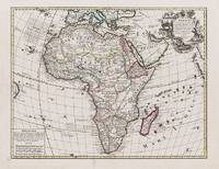
1595Best.-Nr. 100047AG1595. Paris / London / Antwerp and other places of print c.1595 - 1851. Some stunning examples of hand-coloured copper-engravings plus one manuscript map Tuckey / Congo - Zaire. All of these maps in very good / excellent condition. This collection presents itself for becoming an amazing a meaningful starting-point for an Africana-Collection decoration for a Safari-Lodge interior-design for an Africana-themed library etc. etc. The price includes worldwide free shipping per DHL Express-Courier 2-3 day-delivery. Ask for complete list and images and please also inquire about our amazing book-collection of Africana which would be a great match for this collection of vintage maps. unknown
Best.-Nr. 14357382like new. unknown
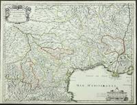
Best.-Nr. 3863Paris: P. Mariette. 1651. No binding. Good. 420 x 550 mm. early outline colour. One small paper crease upper margin otherwise a superb example. Engraved by R. Cordier this fine map displays the region of Languedoc in south western France extending from the Pyranees to the Rhone valley. Inland to the north west the cities of Toulouse and Cahors are displayed. From the 'Cartes Generales de Toutes les Parties du Monde'. Pastoureau Sanson V A no. 44. P. Mariette. 1651 unknown
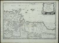
Best.-Nr. 3952Paris: 1655. No binding. Very Good. 370 x 530 mm. in early outline colour in very good condition. Engraved by Joannes Somer and published in Paris by Pierre Mariette this attractive map of central north Africa bears an ornate title cartouche top right. It is centred on Tunisia and Libya and includes the island of Malta in the Mediterranean. It comes from Sanson's 'Cartes Generales de Toutes les Parties du Monde'. Pastoureau Sanson V A no. 16. 1655 unknown
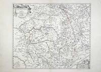
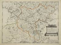
Best.-Nr. 5579Paris: 1658-79. No binding. Very Good. 370 x 440 mm. early outline colour in good condition. This map of the Champagne and Brie region of France was published in Paris by Pierre Mariette. It appears in the first edition of Nicolas Sanson's ""Les Cartes Generales"" in 1658. Sanson was France's premier cartographer and helped to lift French work in this area to another level. His atlas is the first full world atlas to be produced in France. This work had been in development for several years as the dates on the various maps attest. Pastoureau 1984 Sanson Va no. 11; Phillips P.L. 1909- 4260 no. 11. 1658-[79] unknown
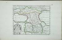
Best.-Nr. 5400Utrecht: 1683. No binding. Very Good. 190 x 230 mm. in good condition. Engraved by Antoine de Winter and published in 1683 in the Dutch edition of Sanson's 'L'Asie'. Pastoureau Sanson IIIF no. 11. 1683 unknown
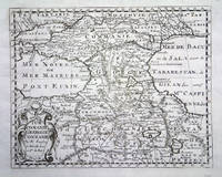
Best.-Nr. 5391Paris: 1653. No binding. Good. 190 x 250 mm. early outline colour in good condition. A fine attractive map of the region of present day Georgia Armenia and Azerbaijan engraved for Nicolas Sanson's 'L'Asie'. Pastoureau Sanson IIIA no. 5. 1653 unknown
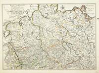
Best.-Nr. 3402Paris: 1652. No binding. Fair. 375 x 530 mm. very detailed map in original outline colour two wax marks otherwise in good condition. Beautifully engraved map of Germany from Sanson's folio atlas entitled 'Cartes Generales de Toutes les Parties du Monde'. Shirley 'Atlases in the BL' T.San-2a; Pastoureau Sanson VB no. 133. 1652 unknown
Best.-Nr. 3135Paris: 1651. No binding. Very Good. 390 x 525 mm. early outline colour good condition. Beautifully engraved by Jean Sommer this map is of the region around Paris. Pastoureau Sanson V B no. 127. 1651 unknown
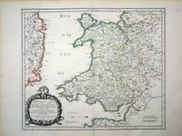
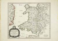
Best.-Nr. 6460Paris: 1658. No binding. Very Good. 370 x 435 mm. in fine early outline colour good condition. An attractive map of the whole of Wales first published in Nicolas Sanson's 'Les Cartes Generales de Toutes les Parties du Monde' in 1658. Sanson was France's premier cartographer and helped to lift the field onto another level during his career. With an attractive title cartouche lower left in a nice dark impression. The cartography is derived from that of John Speed and includes the neighbouring English counties including Herefordshire Shropshire Worcestershire Cheshire parts of Gloucestershire and Staffordshire. To the west the proximity of the Irish coast is depicted. Not in Booth; Pastoureau M. Sanson V 27; Roberts Iolo & Menai 'Printed Maps of the whole of Wales 1573-1837' Part 1 in 'The Map Collector' no. 68 pp. 34-9; Shirley 2004 T.San 2a no. 13. 1658 unknown
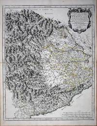
Best.-Nr. 8636Paris: 1658-65. No binding. Very Good. 550 x 435 mm. early outline colour in good condition. This map of the Piedmont region of Italy was published in Paris by Pierre Mariette. It centres on Turin and extends from Antibe on the French coast to Savona. Nicolas Sanson's 'Les Cartes Generales' was first published in 1658. This map was introduced in 1665 this example is a later state with the imprint altered to 'Chez l'Autheur'. Sanson was France's premier cartographer and helped to lift French work in this area to another level. His atlas is the first full world atlas to be produced in France. This work had been in development for several years as the dates on the various maps attest. Pastoureau Sanson Vb no. 147. 1658-[65] unknown
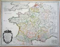
Best.-Nr. 6420Paris: 1693. No binding. Good. 440 x 570 mm. early outline colour in good condition. A particularly attractive map of France or ancient Gaul. It famously depicts the country before Louis XIV lost a third of his territory to mapmakers who concluded that the longitudinal width of the country was not as great as was depicted! Not in Pastoureau 1984. 1693 unknown
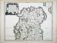
Best.-Nr. 6991Paris: 1665. No binding. Very Good. 400 x 490 mm. in fine early outline colour in very good condition. This map of northern Ireland was published in Paris by Pierre Mariette. It was first introduced in to a later edition of Nicolas Sanson's ""Les Cartes Generales"" in 1665. Nicolas Sanson was to bring about the rise of French cartography although the fierce competition of the Dutch would last until the end of the century. This shift in cartographic centres shadowed the relative fortunes of the two countries; France under Louis XIV was a growing power in Europe. Born in Abbeville in the Picardy region of France 1600 Sanson studied history and turned to cartography as a means of recording it. In 1630 he was made Géographe Ordinaire du Roi and was to become one of the tutors to Louis XIV. However his future success was partly owing to the partnership he made with the publisher Pierre Mariette. In 1644 the latter had purchased the business of Melchoir Tavernier and helped Sanson with financial support in producing the maps for the planned atlas. His atlas is the first full world atlas to be produced in France. This work had been in development for several years as the dates on the various maps attest. A fine example of the first state. Bonar-Law 1997 no. 11 st. 1; Pastoureau 1984 Sanson Vb no. 124. 1665 unknown
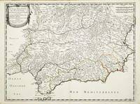
Best.-Nr. 10313Paris: Pierre Mariette. 1652. No binding. Good. 410 x 540 mm. early outline colour in excellent condition. An attractive map of the south of Spain the Costa del Sol. First published in Nicolas Sanson's 'Les Cartes Generales' in 1658. Sanson was France's premier cartographer and helped to lift the field onto another plain during his career. The map extends from Faro in Portugal in the west eastwards to Valencia. Pastoureau Sanson Va no. 69; Phillips P.L. Atlases 4260-67. Pierre Mariette. 1652 unknown
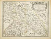
Best.-Nr. 10820Paris: 1679. No binding. Good. 420 x 550 mm. early outline colour in good condition. This map of part of a portion of Eastern Europe includes Bohemia Silesia Moravia and Lusatia. It was published in Paris by Pierre Mariette in Nicolas Sanson's 'Les Cartes Generales' first published in 1658. This example is the second state dated 1679. It includes Frankfurt am oder in the upper left Glogow and Breslau Wroclaw. An inset of Moravia is centred on Olmutz present day Olomouc. Sanson was France's premier cartographer and helped to lift French work in this area to another level. His atlas is the first full world atlas to be produced in France. This work had been in development for several years as the dates on the various maps attest. Pastoureau M. Sanson V 59; Phillips P.L. Atlases 4260. 1679 unknown
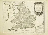
Best.-Nr. 10525Paris: 1665. No binding. Very Good. 400 x 510 mm. superb early outline colour very good condition. A FIRST STATE example of an ornate map of England and Wales first published in Nicolas Sanson's 'Les Cartes Generales de Toutes les Parties du Monde' in 1665. Sanson 1600-67 was France's premier cartographer and helped to lift the field onto another level during his career. In 1665 two folio maps were issued one of the British Isles and this of England and Wales. The map outlines the modern counties along with the traditional Anglo-Saxon heptarchy which are here outlined in colour. With an attractive cartouche upper right. The cartography is derived from that of John Speed Willem Blaeu and Johannes Jansson. This is an example of the first state dated 1665 according to Shirley however since then two further states dated similarly have been identified. This example remains the first state. Provenance Doreen Green 2003. Pastoureau M. Sanson V B 117; Shirley R.W. Sanson 3.1. 1665 unknown
Best.-Nr. 10634Paris: 1658. No binding. Very Good. 370 x 435 mm. in fine early outline colour good condition. An attractive map of the whole of Wales first published in Nicolas Sanson's 'Les Cartes Generales de Toutes les Parties du Monde' in 1658. Sanson was France's premier cartographer and helped to lift the field onto another level during his career. With an attractive title cartouche lower left in a nice dark impression. The cartography is derived from that of John Speed and includes the neighbouring English counties including Herefordshire Shropshire Worcestershire Cheshire parts of Gloucestershire and Staffordshire. To the west the proximity of the Irish coast is depicted. Provenance: Doreen Green 1996; private collection. Not in Booth 1977; Pastoureau 1980 Sanson V 27; Roberts 1994 14; Shirley 2004 T.San 2a no. 13. 1658 unknown
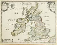
Best.-Nr. 10523Paris: 1640-c.48. No binding. Good. 405 x 530 mm. early outline colour small lower margin centrefold split repaired otherwise in good condition. A rare map in this second produced by Nicolas Sanson 1600-67 and published by Melchoir Tavernier 1594-1665 and Pierre Mariette c.1602-58. Separately published the map displays a shortened Scotland and exaggerated south west north east slant to Ireland. In later states it would be published in Pierre Mariette's 'Les Cartes Generales de Toutes les Parties du Monde' from 1658. Sanson was France's premier cartographer and helped to lift the field onto another level during his career. With an attractive cartouche upper left and right and an inset map of the Shetland Islands. This second state is determined by the addition of Mariette's imprint to the cartouche upper right. Provenance: private English collection since 2006. Pastoureau 1984 Tavernier IIE 106; Shirley R.W. BI to 1650 506 pl. 80 st. 1. 1640-[c.48] unknown