SANSON, NicolasBiblio.com

979 risultati
rif. 215370Amsterdam: Pierre Mortier. unbound. very good. Map. Engraving with hand outline. Image measures 13 3/4" x 22 1/2". Rare map of Galatia an ancient region of northern Anatolia present-day Turkey along the southern coast of the Black Sea. Published circa 1705 this map is centered on Ankara and shows provinces inhabited by Trocmi Tectosages and Tolistobogi - three Celtic tribes who inhabited the region from the 3rd century BC. Neighboring historical regions of Paphlagonia Pontus Phyrgia Cappadocia and Lycaonia are labeled. Mountains and cities are depicted pictorially. The map shows major roads connecting cities throughout the region. A decorative cartouche features lively figures celebrating with percussion and wind instruments. Full original margins minor offsetting. Based on earlier plates by Sanson. This map appeared in "Atlas Antiquus Sacer Ecclesiasticus et Profanus" published in Amsterdam by Pieter Mortier. Nicolas Sanson 1600-1667 who is considered the founder of the French school of cartography. In reaction to the prevailing trend of Dutch lavishness Sanson favored minimal details focusing rather on accurate cartography than ornament. Pierre Mortier 1661-1711 was a Dutch cartographer engraver and printseller who worked in Amsterdam. He used advanced Dutch printing methods to produce high quality editions of contemporary French maps by cartographers such as De L'Isle Sanson Jaillot de Fer and De Wit. This map is a lovely example of his work. Pierre Mortier unknown
1696rif. 206066Amsterdam: Alexis-Hubert Jaillot 1696. unbound. very good. Map. Engraving with hand outline. Image measures 23" x 35". Stunning map showing the vast extent of the German Empire including parts of Poland Bohemia Hungary Austria Croatia Italy France and the Netherlands. Exquisite and subtle coloring beautifully detailed. Based on a plate by Nicolas Sanson reworked and published in "Atlas Nouveau" by Jaillot. Severe toning due to early acid backing chipping to edges and corners and some tears. Priced as is. Alexis-Hubert Jaillot 1632--1712 was a French sculptor engraver publisher and cartographer. He served as official geographer to King Louis XIV and worked with other prominent mapmakers of the period such as Nicolas Sanson He is best known for his Atlas Nouveau of 1674. Alexis-Hubert Jaillot unknown
1723rif. 209708Amsterdam: Mortier Pieter 1723. unbound. very good. Map. Engraving with hand outline. Image measures 14" x 18.75". Beautifully detailed map showing the area between the the Black and Caspian Seas including modern day Russia Georgia Azerbaijan Armenia and Turkey. Full original margins have minor stains. Based on the plates by Nicolas Sanson 1600-1667 who is considered the founder of the French school of cartography. In reaction to the prevailing trend of Dutch lavishness Sanson favored minimal details focusing rather on accurate cartography than ornament. Mortier, Pieter unknown
1723rif. 202384Amsterdam: Mortier Pieter II 1723. unbound. very good. Map. Engraving with hand coloring. Image measures 14.5" x 19.25". Includes parts of modern day Morocco Algeria Tunisia and Libya. Nicolas Sanson 1600-1667 is considered the founder of the French school of cartography. In reaction to the prevailing trend of Dutch lavishness Sanson favored minimal details focusing rather on accurate cartography than ornament. Large decorative title cartouche. Map is in good condition with ample margins. Staining along centerfold. Chipped near edges along centerfold. Mortier, Pieter II unknown
rif. 0259030171.Gpaperback. Good. Access codes and supplements are not guaranteed with used items. May be an ex-library book. paperback
rif. 2329234465.Gpaperback. Good. Access codes and supplements are not guaranteed with used items. May be an ex-library book. paperback
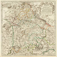
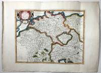
1703rif. 32775Paris 1703. Tadelloses Exemplar. 420 by 420mm 16½ by 16½ inches. Original antiker Kupferstich in zeitgenössischem Grenzkolrit. Dargestellt wird der bayrische Kreis um 1650 im Norden von Eger bis nach dem benachbarten Insbruck im Süden. Im Westen noch mit Ulm a.d. Donau und im Osten bis Linz. Die einzelnen Bezirksämter u. Bistümer deutlich durch das schöne Grenzkolorit herausgearbeitet. Zeigt Ober- u. Niederbayern sowie die Oberpfalz. Rechts oben große dekorative Rollwerkstitelkartusche links oben kleiner Meilenzeiger. Gestochen von R. Cordier. Nicolas Sanson der Ältere 20. Dezember 1600 in Abbeville Frankreich; 7. Juli 1667 in Paris war ein französischer Kartograph. Seine Vorfahren stammten aus Schottland. In den Jahren 1618 bis 1667 schuf Sanson etwa 300 einzelne Karten sowie Atlanten und illustrierte Texte. Seine Arbeit wurde von seinen Söhnen Nicolas Sanson 1626 Schottland; 27. August 1648 in Paris Adrien Sanson 1708 und Guillaume Sanson 1703 seinem Neffen Pierre Duval 1619; 1683 seinem Enkel Pierre Moulard Sanson 1730 und Gilles Robert de Vaugondy 1688; 1766 fortgeführt. Wikipedia Speculum Orbis/Loeb San.VA53 unknown
2025rif. __1382052901OUP Oxford 2025. Paperback. New. 5.12x0.59x7.28 inches. OUP Oxford paperback
rif. 0428884288.Ghardcover. Good. Access codes and supplements are not guaranteed with used items. May be an ex-library book. hardcover
rif. 2012465773.Gpaperback. Good. Access codes and supplements are not guaranteed with used items. May be an ex-library book. paperback
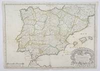
1658rif. 356952Paris.: Tavernier. 1658. Dampstain cover mot of the image also some coffee spots otherwise good. 42.5x57.2x.01 cm. Image size 41x55.5 to neatline. An uncommon map of Spain and Portugal with outline color. weight: 0.1 lb. Engraved by Melchior Tavernier. Tavernier. unknown
rif. 028257557X.Gpaperback. Good. Access codes and supplements are not guaranteed with used items. May be an ex-library book. paperback
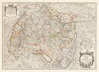
1710rif. 37419Paris: Hubert Jaillot 1710. In ausgezeichnetem Zustand. 803 by 560mm 31½ by 22 inches. Kupferstichkarte in zeitgenössischem Grenzkolorit. Mit großer prächtiger allegorischer Kartusche sowie Meilenzeiger mit Legende. Erschienen im großen AtlasAtlas Nouveau contenant. von Nicolaus Sanson u. Hubert Jaillot. Dargestellt wird der schwäbische Kreis im Norden mit dem benachbarten Franken u. im Süden bis zum Bodensee. Im Osten noch mit Teilen von Bayern der Westen mit dem angrenzenden Frankreich. Das Kartenbild sorgfältig u. übersichtlich ausgearbeitet. Der Atlas Nouveau. entstand als Auftragsarbeitet für Ludwig XIV. und nahm einen Zeitraum von über 10 Jahren in Anspruch. Die Karten gelten bis heute noch als eine Meisterleistung der französischen Kartographie des 17.Jahrhunderts. Als Geburtsjahr Jaillots wird das Jahr 1632 angenommen da in seiner Sterbeurkunde sein Alter mit 80 Jahren angegeben war. Der Geburtsort war Avignon-lès-Saint-Claude damals ein kleiner Weiler in der Exklave der Freigrafschaft Burgund die dazu gehörte Spanisches Königreich. Jaillot hatte seit seiner Kindheit ein großes Talent für Kunst und Design. Bildhauerei lernte er bei seinem Bruder Pierre-Simón. Als Folge der französisch-spanischen Konflikte wurde ihre Heimatstadt verwüstet und so gingen die beiden Brüder 1657 nach Paris. Dort erlangten sie bald einen gewissen Ruf und den Titel „Sculpteur du Roy. 1665 heiratete Jaillot in die Kartenverlegerfamilie Berey ein. Nach dem Tod seines Schwagers Nikolaus II. Berey 16401667 kaufte er die Berey-Kartensammlung von seiner Schwägerin. Dadurch erhielt er eine wertvolle Grundlage die er sofort vermarkten konnte ohne jemals selbst eine Karte erstellt zu haben. Jaillot stieg zu einem günstigen Zeitpunkt in das Kartengeschäft ein. Anfang 1668 gewann Ludwig XIV. den ersten seiner Réunionskriege und es begann eine Zeit in der Frankreich sein Territorium kontinuierlich erweiterte. Es entwickelte sich eine große Nachfrage nach Karten die die französischen Triumphe und die neuen Grenzen sowie bevorstehende Expansionspläne darstellten.Zu Jaillots Kartensammlung gehörten auch Druckplatten die von Pierre Duval 16191683 Neffe von Nicolas Sanson erstellt und ursprünglich an Nicolas Berey verkauft wurden. Doch Duval der auch seine eigenen Karten veröffentlichte weigerte sich seine alten Karten nachzudrucken. Auf dem Höhepunkt des Streits mit Duval rekrutierte Jaillot Ende 1670 Nicolas Sansons Söhne Guillaume und Adrien als Kartenmacher und Geschäftspartner. Mit ihnen konnte er neue Karten mit dem prestigeträchtigen Namen Sansons vermarkten. Sein erster Atlas aus dem Jahr 1681 Atlas Nouveau wurde ein so großer kommerzieller Erfolg dass andere Verlage begannen plagiierte Kopien zu verbreiten.Jaillot bemühte sich um königliche Schirmherrschaft und widmete viele seiner Kartenausgaben dem König. Schließlich wurde er am 20. Juli 1686 zum Géographe du Roy ernannt und erhielt eine jährliche Rente von 600 Livres. Dieser Titel sowie die protektionistische und kontrollierende Gesetzgebung ermöglichten es ihm sich erfolgreich gegen seine Plagiatoren zu wehren.Seit dem frühen 18. Jahrhundert gab Jaillot immer weniger Karten aus. Die Nachfrage nach zeitnah aktualisierten Karten nahm zu und er war immer weniger in der Lage auf die Anforderungen des Marktes zu reagieren. Jüngere Konkurrenten waren gut ausgebildete Geographen wie Guillaume Delisle die die Kartierung selbst durchführen konnten. Im Laufe der Zeit übergab Jaillot das Geschäft an seinen Sohn Bernard Jean-Hyacinthe.Alexis Hubert Jaillot starb am 2. November 1712 im Alter von 80 Jahren in Paris. Er wurde im Convent des Grands-Augustins beigesetzt. WikipediaNicolas Sanson der Ältere 20. Dezember 1600 in Abbeville Frankreich; 7. Juli 1667 in Paris war ein französischer Kartograph. Seine Vorfahren stammten aus Schottland. Zwischen 1618 und 1667 schuf Sanson rund 300 Einzelkarten sowie Atlanten und illustrierte Texte.Seine Arbeit wurde von seinen Söhnen Nicolas Sanson 1626 Schottland; 27. August 1648 in Paris Adrien Sanson 1708 und Guillaume Sanson 1703 seinem Neffen Pierre Duval 1619; 1683 ausgeführt. sein Enkel Pierre Moulard Sanson 1730 und Gilles Robert de Vaugondy 1688; 1766 führten weiter. Wikipedia Hubert Jaillot unknown
1696rif. 23767Amsterdam: Covens 1696 -1700. Other. In very good to excellent condition. A small tear at the left side. 392 by 517mm 15½ by 20¼ inches. 392 by 517mm 15½ by 20¼ inches. Copper engraving uncolored as published. Covens unknown
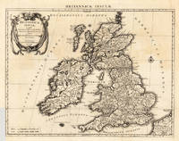
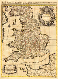
1693rif. 17484Paris: H. Jaillot 1693. Other. In very good condition. 757 by 582mm 29¾ by 23 inches. 757 by 582mm 29¾ by 23 inches. Copper-engraving handcolored in outline when published. Minor offsetting of the old outline colors to the paper. Printed around 1693 by Hubert Jaillot in Paris printed from two plates and published in his great atlas the Atlas Noveau.. Large and decorative map of England by the French cartographer Nicolaus Sanson and Hubert Jaillot. Published in the 'Atlas Noveau.' this atlas was a masterpiece in the French cartography in the 17th century. The atlas was specially designed for Louis XIV and due of the very large size of the plates most maps were printed from two plates it took Hubert Jaillot over 12 years to complete the 'Atlas Noveau.'. England is very detailled shown on the map as well the various counties are shown in engraved territory borders. The maps are rich in detail with many cities and place names rivers mountains castles etc. The map is ornated with a very large fine allegoric title cartouche with coat of arms in the upper right corner as well a decorative cartouche with a milage scale in the lower left corner. H. Jaillot unknown
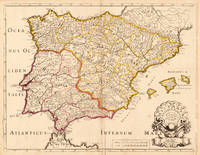
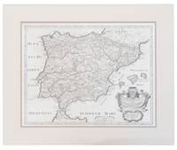
1704rif. 19604Paris: N. Sanson 1704. Other. In very good condition a slightly creasing in the lower part of the centrefold with minor tiny spots. 410 by 525mm 16¼ by 20¾ inches. 410 by 525mm 16¼ by 20¾ inches. Copper engraving hand colored in outline when published. Interesting and detailed map of Antique Spain with Portugal and the Balearic Islands by the French cartographer Nicolaus Sanson d´Abbeville. The map provides us a lot of information of the various place names of cities and small towns the rivers mountains and also engraved borders of the various Spanish provinces. The map impresses with the geographic exactness which is typical for the French cartographer Nicolaus Sanson. In the decorative cartouche which is in shape of a seashell we find the altered date 1704 which is a relatively late edition for maps by N. Sanson. The map is probably published in a French composit atlas around this date. N. Sanson unknown
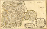
1654rif. 17463Paris: N. Sanson 1654. Other. In very good condition. 365 by 580mm 14¼ by 22¾ inches. 365 by 580mm 14¼ by 22¾ inches. Copper-engraving handcolored in outline when published. Fine and strong impression of this early decorative mid-seventeenth century map of this English regional map covering the area Chester Darbing Nottingham. by the famous French cartographer Nicolaus Sanson. Very detailled and naming many cities and villages as well many places along the coastline. Showing prominently the eastern part of central England. In the lower right corner with a large floral title cartouche and milage scale. N. Sanson unknown
rif. 1332514030.Gpaperback. Good. Access codes and supplements are not guaranteed with used items. May be an ex-library book. paperback
1954rif. 1440Aerovoz revista mensual organo oficial de la federacion aerea nacional de cuba director calixto sanchez white 4 anos desde enero de 1954 hasta junio de 1957 director macario fernandez coleccion en 2 volumenes.en muy buen estadorevista ilustrada.es una revista muy rara sobre la aviacion cubana de la republica.con interesantes articulos y resenas historicas y de la actualidad. Talleres editorial puga,guanabacoa hardcover
rif. 1331792908.Gpaperback. Good. Access codes and supplements are not guaranteed with used items. May be an ex-library book. paperback
1710rif. 13749441710. A map of Spain by French cartographer Nicolas Sanson 1600-1667 in a later Italian edition dated 1710. In Excellent condition with even age toning. Double matted. Mat: w 28.25 in. x h 23.5; Map: w 24.25 in. x h 19 in. Shelved at DuPont. 1374944. Arts & Antiques. unknown
1662rif. 16493Paris: chez l’Autheur 1662. SECOND EDITION. Complete with 17 double-page engraved maps hand-colored in outline. Contemporary mottled calf corner edges neatly repaired interior has some minor dampstaining mainly on text and on blank verso of maps last blank leaf torn on lower fore-edge. A contemporary signature on first blank leaf. Similar to L’Amerique this atlas of the continent of Asia was first printed in 1652 and reprinted here with a new title page. The maps are all dated 1652 with only one dated 1653 and do not include the address of Mariette. The atlas features maps of India Persia China Japan the Maldives Arabia and the Philippines among others. Just prior to publication of this series of works which also included atlases of Europe and Africa Sanson formed a partnership with Pierre Mariette an engraver and printseller. Pursuant to their contract Sanson drew the maps and Mariette engraved and printed them. Each maintained possession of half of the plates and they were allowed to exchange and/or buy from one another. Some bore the address of Sanson others Mariette. But Sanson allowed Mariette to store his plates and Mariette without prior agreement started placing his address on Sanson’s plates. In time a lawsuit which had been prosecuted was settled when both died and their respective sons took over the business. This atlas is a fine examples of French mapping by the foremost French cartographer of the seventeenth century. Sanson 1600-1667 “Geographe Ordinaire du Roi” to Louis XIII is considered the founder of French cartography and is generally acknowledged as the originator of the great age of French cartography. chez l’Autheur unknown
2019rif. 2-169190225XIndependently published 2019. Paperback. New. 244 pages. 9.00x6.00x0.58 inches. Independently published paperback
1696rif. H40716Rome: Giovannie Giacomo de Rossi 1696. Very good. Sheet measures 27.5 x 20.5 inches map itself measures 20 x 16 inches. Very good some curving and bending from having been stored rolled up but no creases or tears light toning and mildest foxing. Period hand coloring and handsome cartouche. Italian edition of the French mapmaker's map of Germany and Bohemia. Giovannie Giacomo de Rossi unknown
rif. 0520399005.Gpaperback. Good. Access codes and supplements are not guaranteed with used items. May be an ex-library book. paperback