982 results
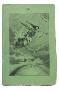
1841ref. 93KAS1RPK7OLParis 1841. 8vo. De Boulé et Comp. for Ledoyen Original green wrappers in a protective plastic wrapper with a large lithographed plate on the front showing a dirigible flying over the globe underneath a floating angel who is blowing a trumpet with the motto "Conquête de l'aire". With a large folding lithographed plate 40 x 235 cm of the dirigible and a smaller woodcut of the same dirigible on p. 5. 31 1 blank pp. First edition of this very rare early and remarkable brochure on navigation in the air and the dirigible manoeuvrable balloon. The brochure introduces a new project to build a dirigible in the shape of a fish. The cost was estimated at 30.000 francs and was to be financed by the issue of 300 shares of 100 francs. The work explains the expected profits and the workings of the dirigible in order to entice patrons. It is an early example of such a project as the first powered and steerable airship that was able to take flight was invented in 1852 eleven years after the publication of the present work. This curious brochure therefore offers a fascinating insight into the history of aviation.The fish dirigible is shown in detail on the large folding plate. It was proposed to ascend the balloon being in equilibrium by means of wings to obtain propulsion by four small paddle-wheels and to steer by means of a large triangular rudder. It was approximately 25 meters long and 12 meters high and operated from a basket hanging underneath like in a hot air balloon. It was invented by bookseller and author Alexandre-Jacques Sanson 1789-1862 and his father. The dirigible was never built but the Sansons nevertheless published a number of other works elaborating on the same subject in the following years: Navigation atmosphérique. Explications complémentaires sur le système 1845; Explication du système de navigation aérienne 1848 and Solution du problème de la navigation aérienne principes preuves et moyens 1850. The present work ends with a letter by the aeronaut Jules-François Dupuis-Delcourt 1802-1864 giving permission to use some of his data in the brochure and offering his blessing to the project.The wrappers are somewhat creased with tears at the head and foot of the spine. The folding plate has browned. Otherwise in good condition.l Tissandier p. 34; WorldCat 457418223 907812680 1141280150 13 copies. unknown
ref. HIST1567Brünn Karafiat o.J. 1862 - 1864. Zus. 1.550 Seiten Lnbde. d. Zeit mit goldgepr. Rückentit. etwas schief gelesen u. gebräunt im Ganzen gut erhalten. Brünn, Karafiat o.J. [1862 - 1864]. unknown
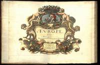
1647ref. 75287Paris Uten år. 1647-1665. 4to. Samtidig helskinnbind med opphøyde ryggbånd og ryggforgylling. Ryggen rebacked med bruk av den gamle ryggstripen. Håndkolorert gravert dobbeltsidig tittelblad og dedikasjonsblad. Upaginert. 30 bl. Med 12 dobbeltsidige håndkolorerte kart. 4to. Contemporary full calf with raised bands spine gilt. Spine rebacked by using of the old spine. Handcoloured doublepage title and handcoloured doublepage dedication. Not paginated. 30 leaves. With 12 doublepage handcoloured copper engraved maps. Chez Pierre Mariette. Fransk. “Nicolas Sanson le fils 1625 - 1648. Son of Nicolas and his intended heir prevented by his premature death from gunshot wounds. Only three known works. L’Europe 12 maps ca. 1648 compiled by N. Sanson fils engraved by A. Peyrounin theoretically published by Nicolas fils himself but may have been published posthumously by his father republished by Mariette 1660 1665. Tooley’s Dictionary of mapmakers. Revised edition. hardcover
1752ref. 54049Amsterdam. Uten år. 1752. Originalt kobberstikk. Arkets størrelse : 175 cm X 164 cm. Fransk. Med en brett.Fra 'La Science des Personnes de Cour d'Epee et de Robe' by Z. Chatelain. unknown
2014ref. __3838178408Presses Académiques Francophones 2014. Paperback. New. 212 pages. French language. 8.66x5.91x0.48 inches. Presses Académiques Francophones paperback
2014ref. 1-3838178408Presses Académiques Francophones 2014. Paperback. New. 212 pages. French language. 8.66x5.91x0.48 inches. Presses Académiques Francophones paperback
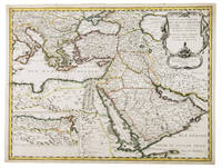
1654ref. G1ADV7RKD7B6Paris 1654. Engraved map 42 x 56 cm coloured in outline. Map of the Turkish Empire showing Ottoman possessions in the Balkans Eastern Mediterranean Egypt and Arabia - marking topography and settlements.l Al Ankary 59; Al-Qasimi 60; Tibbetts 99. unknown
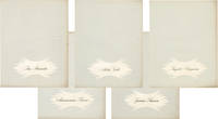
1950ref. 158225Rome: Unitalia Film / IFE 1950. Collection of 14 vintage oversize promotional brochures for Italian and international actresses. Each brochure features a one-page biography in Italian and a full-page black-and-white photograph of each actress. Actresses represented are Sylvana Mangano Isa Miranda Annamaria Gerrero Yvonne Sanson Alida Valli Delia Scala Ingrid Bergman Silvana Pampanini Lea Padovani Lucia Bose Eleanora Rossi Gina Lollobrigida Carla Del Poggio and Anna Magnani. 11 x 14.25 inches folded once vertically as issued with a company statement on the verso. Very Good plus overall some with light toning and foxing and a few with short tears. Unitalia Film / IFE unknown
1700ref. 17404CB1700. Amsterdam Mortier about 1700. Octav. 56 pages; 16 pages index. With 12 maps. 10 detailled maps and 2 overview maps all with contemporary coloured frontier lines and an engraved mileage scale. Contemporary marbled cardboard. A bit waterstained. The spine has been restored professionally. Private stamp on title otherwise fine and complete. Rare pocket atlas ! Published by Mortier 1661-1711 who published major atlases and maps mostly of French cartographers. This atlas was important for the French troops / Bourbone regime who attacked Northern Italy after 1700. unknown
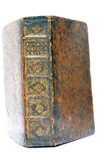
ref. 48297Paris Lutetiae Parisiorum Sumptibus et Impensis Autoris 1647. 3 ouvrages en 1 volume. 1. 2 feuillets blancs. 8 feuillets. 246 pages. 2. 13 feuillets. 283 pages. 3. 2 feuillets blancs. Page de titre. Carte gravée. 11 feuillets. 2 feuillets blancs. 15x9 Cm. Plein veau de l'époque. Dos à nerfs orné et doré un peu frotté. Pièce de titre doré. Charnières fendues. Petits accidents aux coiffes. Rousseurs et quelques taches. Les deux premiers ouvrages sont des critiques très rares du "Pharum Gallia Antiquae" de Philippe Labbé que Sanson rectifie sur plusieurs points. À la suite on trouve une courte description de la Judée accompagnée d'une belle carte dépliante. Bon exemplaire comportant l'exlibris gravé d'Henri Liébaux. Paris, Lutetiae Parisiorum Sumptibus et Impensis Autoris, 1647. unknown
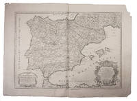
1708ref. E7GCJJB1RUYXParis 1708. Hubert Jaillot Engraved map on 2 assembled sheets 55.5 x 78 cm engraved by Cordier. With title in decorated cartouche on the bottom right corner scales and privilege in decorated cartouche on the bottom left corner and a few lines coloured in green. Large map of Spain and Portugal this state with a privilege for 20 years granted in 1708. Engraved by Cordier after the map by Nicolas Sanson.Strengthened fold damaged corners but map in very good condition.l Cf. Pastoureau Jail. II A map 91. unknown
ref. 87163Paris Chez N. Berey anlumineur De la Reine Au bout du pont Neuf proche les Augustins aux deux globes 1646. . Double-page engraved map. Rare map of the British Isles. Berey has closely copied Sanson separately issued map of 1640. Berey's imprint in the right-hand cartouche replaces that of Tavernier. Nicolas Berey 1608-1665 map publisher colourist and father-in-law of Jaillot. Although his original oeuvre is small he did copy numerous maps by the leading cartographers of the day including Blaeu Hondius and Sanson. Shirley 584. Paris, Chez N. Berey anlumineur De la Reine, Au bout du pont Neuf proche les Augustins aux deux globes, 1646. unknown
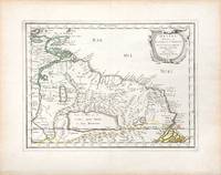
1657ref. 66689Paris. c. 1657. A very attractive and finely engraved map of the north eastern South American country of Guiana. The map is highlighted by numerous rivers tributaries mountains villages inlets bays and a very large inland equatorial lake that was thought to exist. Published in "Cartes Generales de toutes les parties du monde." Size: 285 x 360 mm. Copperplate engraving with original outline colouring. Fine condition. unknown
ref. 73602Paris Pierrr Mariette 1656/ca. 1950. 13 x 17.5 cm 26 x 30 cm Rahmen vergoldet unter Passepartout Min. gebrauchspurig sonst tadell. Handkolorierte Faksimile. - Nicolas Sanson der Ältere auch: Nicolas Sanson d’Abbeville 1600 in Abbeville Frankreich- 1667 in Paris französischer Kartograph. Er gilt als der Vater der Geographie in Frankreich.In den Jahren 1618 bis 1667 schuf Sanson etwa 300 einzelne Karten sowie Atlanten und illustrierte Texte. Er wurde zum Geographe Ordinaire du Roy königlicher Kartenmacher ernannt und unterrichtete die Könige Ludwig XIII. und Ludwig XIV. in Geographie. 010 Paris, Pierrr Mariette, 1656/ca. 1950 unknown
1690ref. 192941690. S.l. Alexis Hubert Jaillot 1680. Une grande carte 892 x 592 mm compose de deux feuillets contrecolls sous cadre moderne. Attractive 892 x 592 mm carte de la fin du XVIIÂme avec rehauts aquarells du temps. Elle s'orne d'un important cartouche aux armes du Grand Dauphin Louis de France et s'agrmente en marge gauche de la figuration de vaisseaux ayant pris part un combat naval. Kupcik Cartes gographiques anciennes p. 159. Papier trÂs lgÂrement oxyd. Prsence de rares et claires rousseurs ou petites tches. Deux plissures et une infime perforation en marge suprieure droite. Du reste belle condition. b42961 unknown
1719ref. E7CG2ENMSWHRParis: Hubert Jaillot 1719. Engraved map on 2 assembled sheets 54.5 x 88 cm. With title in decorated cartouche signed F.C. in upper right corner and scalebars in decorated cartouche in the lower left corner. Coloured in outline. Large map of the Pyrenees a mountain range on the border between France and Spain after Nicolas Sanson 1600-1675. Apparently printed from the original plates differing from the map issued in Mortier's "Jaillot-Atlas".Very good copy slightly browned.l Pastoureau Jail. II C map 166. Hubert Jaillot, unknown
1700ref. 54030Nicolas Bion: L'Usage des Globes. Amsterdam: Francois Halma. 1700. Attractive map of Spain divided into its provinces. Maps by Sanson in original colour are rare. Nicolas Sanson was founder of the French school of mapmakers at a time when the leadership in European cartography passed from the Low Countries to France. This map was published in Brion's treatise on globes. Nicolas Brion was a famous French mathematical and scientific instrument maker. Copper engraving. Fine condition. Original colour. Size: 23.5 x 18 cm. 9½ x 7 inches. unknown
1700ref. 54035Amsterdam: 1700. Map of Germany divided into regions which at the time extended over much of the Low Countries. Maps by Sanson in original colour are rare. Nicolas Sanson was founder of the French school of mapmakers at a time when the leadership in European cartography passed from the Low Countries to France. This map was published in Brion's treatise on globes. Nicolas Brion was a famous French mathematical and scientific instrument maker. L'Usage des Globes. Copper engraving. Fine condition. Original colour. Size: 23.5 x 18.5 cm. unknown
1700ref. 58299Description de tout l'Univers 1700 published by F.Halma Amsterdam. Nicolas Sanson was founder of the French school of mapmakers at a time when the leadership in European cartography passed from the Low Countries to France. Copper engraving. Fine condition. Original colour with gold leaf highlights. Size: 17 x 18.5 cm. unknown
1657ref. 56721Histoire et Geographie de l'Amerique. 1657. Attractive map of Paraguay. Title cartouche at top right. Maps by Sanson in original colour are rare. Nicolas Sanson was founder of the French school of mapmakers at a time when the leadership in European cartography passed from the Low Countries to France. Copper engraving. Fine condition; very light offsetting. Original outline colour. Size: 28.5 x 21.5 cm. 11 x 8½ inches unknown
1689ref. 52354Paris. 1689. The map covers the area from the Moselle in NW to Worms in SE. ornamental cartouche at lower left. Copper engraving. Good condition though map is slightly discolured and stained. Original colour. Size: 56 x 43 cm. unknown
1700ref. 54377Nicolas Bion: L'Usage des Globes. Amsterdam: Francois Halma. 1700. An armillary sphere perused by three scholars at a table. Nicolas Sanson was founder of the French school of mapmakers at a time when the leadership in European cartography passed from the Low Countries to France. This map was published in Bion's treatise on globes. Nicolas Bion was a famous French mathematical and scientific instrument maker. Size: 125 x 175 mm. Copper engraving. Original colour. Mounted size: 295 x 360 mm. Fine condition. unknown
1700ref. 54043Nicolas Bion: L'Usage des Globes. Amsterdam: Francois Halma. 1700. Map showing north-east South America from Trindad to the mouth of the Amazon - modern day Guyana and Surinam. Several large fictitious lakes make up much of the unexplored interior. Maps by Sanson in original colour are rare. Nicolas Sanson was founder of the French school of mapmakers at a time when the leadership in European cartography passed from the Low Countries to France. This map was published in Bion's treatise on globes. Nicolas Bion was a famous French mathematical and scientific instrument maker. Copper engraving. Very good condition. Small 1cm. very faint library stamp on border not affecting map. Original colour. Size: 27.5 x 20 cm. 11 x 8 inches. unknown
1700ref. 54022Nicolas Bion: L'Usage des Globes. Amsterdam: Francois Halma. 1700. Attractive map of north eastern Africa including Egypt and northern Libya. Much of the charm of early maps of Africa lies in how they show the interior of the continent which was not explored until the 19th century. Maps by Sanson in original colour are rare. Nicolas Sanson was founder of the French school of mapmakers at a time when the leadership in European cartography passed from the Low Countries to France. This map was published in Brion's treatise on globes. Nicolas Brion was a famous French mathematical and scientific instrument maker. Copper engraving. Very good condition. Darkened edges to margins. Faint inkstamp on right margin not affecting map. Original colour. Size: 27 x 17 cm. 10½ x 6½ inches. unknown
1680ref. 024707London: William Berry 1680. .Kingdoms and States which are found there at present/Described by Sanson/Corrected and amended By William Berry =Kopftitel; Text der figürlich reich verzierten Kartusche oben rechts: Asia Divided into its Principall Regions in which may be seen the extent of the Empires Monarchies Kingdoms and States which at present divide Asia/To the Most serene and Most Sacred Majesty of Charles II./By the Grace of God King of Great Britain France and Ireland/This Map of Asia is humbly Dedicated and Presented By Your Majesties Loyal Subject and Servand William Berry; Text der reich verzierten Kartusche links oben: Scale es folgen Maßstäbe verschiedener Länder/London/Sold by William Berry at the Sign of the Globe between Charing-Cross and White-Hall/1680; SW-Kupferstich-Landkarte nach Nicolas Sanson d'Abbeville gestochen von William Berry; ca. 51 x 39 cm; Falzspuren einige Tintenflecken hauptsächlich ausserhalb des Druckbildes mässige Lichtverfärbung; professionell hinter Glas gerahmt in schwarzem Holzrahmen; äußerst selten; for description in other languages of this extremely rare map please don't hesitate to contact me. . Gut. Landkarte. William Berry unknown