Nicolas Sanson (1600-1667)Biblio.com
927 résultats
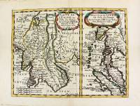
1652réf. M8177Paris. 1652. Very Good. Notes: Fine 17th century map of Thailand Burma and Malaysia. Size : 191x249 mm 7.50x9.80 Inches Coloring: Original Hand Coloring Category: Maps Asia South East Thailand Laos Vietnam Cambodia & Burma / Myanmar; Maps Asia South East Malaysia & Singapore; unknown
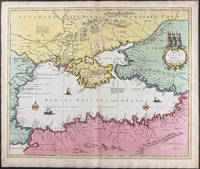
1696réf. 9749Scarce original hand-colored engraving by Sanson published in Pierre Mortier's Atlas Nouveau or Atlas Novum ad usum serenissimi. Image size is approximately 23 x 18.75 in 58.5 x 47.5 cm; page size is 24.75 x 21 in 63 x 53.5 cm. Some minor staining and toning to edges not affecting the image.
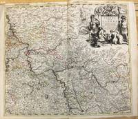
1708réf. M10193Amsterdam: Pierre Mortier c.1708. Very Good. Notes: "Theatre de la Guerre" Theater of War maps covering the battles raging in Europe and the Americas during the Spanish War of Succession 1701-1713 and the Northern War 1700-1721. The atlas maps are large folio size with most maps made of two sheets and many maps combining 4 or 6 sheets those also issued as wall maps separately. The atlas is most impressive for its large size and number of maps as well as being up to date for its time. Size : 517x585 mm 20.35x23.03 Inches Coloring: Original Outline Coloring Category: Maps Europe Germany; Pierre Mortier unknown
réf. 0666787816.Ghardcover. Good. Access codes and supplements are not guaranteed with used items. May be an ex-library book. hardcover
1818Ritratto del personaggio distintosi nelle vittorie e conquiste militari francesi tra il 1792 e 1815. L'incisione, antica ed originale, è accompagnata da pagina con testo descrittivo del personaggio. Foxing
1935réf. 1133011935 Librairie Plon, Paris - 1935 - Petit in-8, broché - XIII pages (préface) + 264 pages - Envoi de l'autrice (dédicace) en page de garde
1957réf. 79200MAUGARD 1957. Broché. Etat moyen. in-8. . MAUGARD unknown
1910réf. 5891910 1 Paris, Garnier, 1910, in-8 relié demi-percaline vieux rose.
réf. 21267P., Imprimerie Dubuisson, sans date pour les deux ouvrages, soit deux ouvrages reliés en un volume petit in 12, demi-percaline verte amateur, 188 et 192pp. ; qq. rousseurs ; reliure modeste.
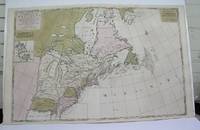
1698réf. M3704Paris 1698. Excellent. Notes: Rather rare original coloured version of this map an important 17th century map of the Great Lakes and East coast with an inset map of Boston. Cumming qtd in Arkway: "in spite of its scope and size it has a good deal of information for the Carolina Coast". This map by Sanson first appeared in Mortier's sea atlas "Le Neptune Francois"; interestingly it is not generally found in Sanson or Jaillot atlases. Size : 650x924 mm 25.625x36.375 Inches Coloring: Original Hand Coloring Reference: Arkway 58:23 Category: Maps Canada East; Maps United States New England unknown
1926réf. 10471Éditions SPES 1926 256 pages in8. 1926. broché. 256 pages. L'Inquiétude Humaine est un livre de conférences données par le R.P. Pierre Sanson pendant le Carême de 1926 à Notre-Dame de Paris. L'ouvrage explore le thème de l'inquiétude humaine à travers le message du christianisme et du judaïsme en s'appuyant sur la Bible
1925réf. 3813373011Rousseurs sur les 1ère et 4ème de couverture, GLN-7, Spes 1925
1926réf. 3813761811Exemplaire non relié, GLN-7, Spes 1926
1926réf. 3836865415GLN-7, Spes 1926
1926réf. 3836865420GLN-7, Spes 1926
1926réf. 3836865425GLN-7, Spes 1926
1926réf. 3836865585GLN-7, Spes 1926
1926réf. 3836865621GLN-7, Spes 1926
1926réf. 3836865622GLN-7 Spes 1926
1927réf. 3813768152Exemplaire non relié, GLN-7, Spes 1927
1927réf. 3836863432GLN-7, Spes 1927
1927réf. 3836863552GLN-7, Spes 1927
1927réf. 3836863669GLN-7, Spes 1927
1927réf. 3836863897GLN-7, Spes 1927
1927réf. 3836863267GLN-7, Spes 1927