979 résultats
réf. lc_86098Parole et Silence
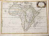
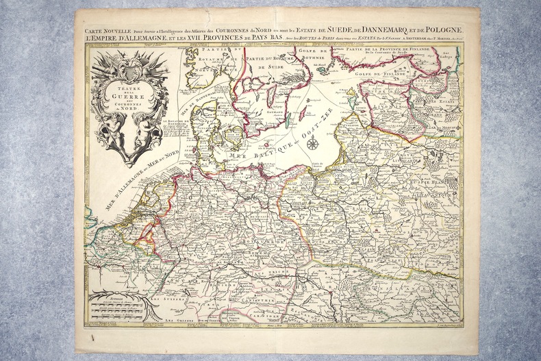
1696réf. 2308A AMSTERDAM. CHEZ P. MORTIER. SANS DATE (VERS 1696). GRANDE CARTE GEOGRAPHIQUE, GRAVEE PAR JOAN VAN LUGTENBURG, LIMITES COLORIEES A LA MAIN D'EPOQUE (46,5 X 58 CENTIMETRES ENVIRON, 53 X 61,5 CENTIMETRES ENVIRON AVEC LES MARGES), AVEC UN CARTOUCHE DECORATIF AUX ATTRIBUTS MILITAIRES DONNANT LE TITRE. BON ETAT.
réf. 126765aafChez l’Autheur, 1660, 41x52 cm, 1 Blatt 43x57 cm. Auf Lwd aufgezogen.
1888réf. RO80029762LA MAISON RUSTIQUE. 3ème édition. 1888. In-12. Broché. Bon état, Couv. légèrement passée, Dos satisfaisant, Quelques rousseurs. 382 pages. Quelques illustrations en noir et blanc dans le texte.. . . . Classification Dewey : 590-Zoologie
1882réf. RO80026312MAISON RUSTIQUE. 3ème édition. 1882. In-12. Broché. Bon état, Couv. convenable, Dos satisfaisant, Rousseurs. 448 pages. Quelques illustrations en noir et blanc dans le texte. Pages non coupées.. . . . Classification Dewey : 590-Zoologie
1888réf. RO30064548LIBRAIRIE AGRICOLE DE LA MAISON RUSTIQUE - 3° EDITION. 1888. In-16. Broché. Etat d'usage, Couv. légèrement passée, Dos satisfaisant, Quelques rousseurs. 363 pages. Quelques gravures en noir et blanc dans le texte. Petites rousseurs sur la couverture.. . . . Classification Dewey : 590-Zoologie
1893réf. RO30139274LIBRAIRIE AGRICOLE DE LA MAISON RUSTIQUE. 1893. In-8. Relié. Etat d'usage, Coins frottés, Dos satisfaisant, Intérieur frais. XVII + 401 pages augmentées de nombreuses figures en noir et blanc dans le texte - auteur, titre, tomaison et filets dorés sur le dos - plats et contre plats jaspés. . . . Classification Dewey : 590-Zoologie
réf. 5102Paris, Librairie agricole de la maison rustique, 1877-82. 4 vol. in-12, demi-reliure.
réf. 62034P., Librairie Agricole de la Maison Rustique (Bibliothèque Agricole), 1896, in 12 broché, VII-382 pages ; 20 figures ; index in-fine ; quelques rousseurs ; couverture fanée.
2008réf. R200082302DE NOYELLES. 2008. In-8. Broché. Bon état, Couv. convenable, Dos satisfaisant, Intérieur frais. 505 pages.. . . . Classification Dewey : 820-Littératures anglaise et anglo-saxonne
1989réf. R109655Paris, Cerf 1989 xvi + 708gr., 24cm., br.orig., Thèse de doctorat, cachet au verso de la p.d.t., texte frais, poids: 1.1kg., R109655
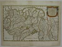
1661réf. 33640ABA Paris chez P. Mariette 1661. Blattgrösse: 43x53,5 cm. Grenzkolorierte Karte (30x33 cm) von Nicolas Sanson, gestochen von Lalleman und Somer.
1695réf. 862121695 Paris, Mabre Cramoisy, 1695, in 12 relié plein veau de l'époque, dos à nerfs orné, 5 feuillets non chiffrés (titre et avertissement) - 264 pages et 12 feuillets de table ; exemplaire de travail, légèrement dérelié, reliure frottée.
1650réf. M6678Paris: Pierre Mariette c. 1650. Very Good;. Notes: Title cartouche bordered by two outward-facing birds of prey. Norwich writes: "This is an early Sanson map. An odd feature is the name Barditus Mons given to a long chain of mountains running continuously from somewhere in Angolato Algoa Bay. No place names appear even on the coast of the southern part of the continent which is labelled 'Agi Symba' a name usually referring to the northern African region and inhabitants are 'Anthropophagi Aethiopes' or cannibals." Size : 396x553 mm 15.59x21.77 Inches Coloring: Hand Colored Reference: Norwich's Map 35. Category: Maps Africa Continent; Pierre Mariette unknown
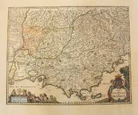
1656réf. M6320Paris 1656. Very Good. Notes: This map shows the southern coast of France. Size : 425x535 mm 16.75x21 Inches Coloring: Original Hand Coloring Category: Maps Europe France unknown
1676réf. 38217Paris: Sanson 1676. AN ATTRACTIVE MAP OF SPAIN AND PORTUGAL. 18 x 25 cm plate 23.5 x 32 cm sheet. FULLY COLORED by a later hand. Printed on fine laid paper. Reverse blank. A fine impression. A PRISTINE EXAMPLE with the paper FINE AND BRIGHT. Very scarce in such fine condition. Sanson unknown
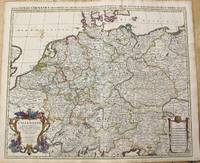
1696réf. M10211Amsterdam: Covens & Mortier c.1696. Very Good. Size : 510x605 mm 20.08x23.82 Inches Coloring: Original Outline Coloring Category: Maps Europe Germany; Covens & Mortier unknown
1652réf. 14178Paris: Sanson 1652. Double hemisphere world map showing the rivers and water bodies of the world. Original outline color. 20 3/4 x 15 3/4". Depicts Australia prior to Tasman's discoveries and labels North Australia "Beach" according to Marco Polo and California as an island. References: Shirley R.W. World 394. Sanson unknown
1654réf. M5952Paris 1654. Very Good some mild discoloration along the margins. Size : 350x555 mm 13.75x21.875 Inches Coloring: Original Outline Coloring Reference: Gole 16; Nebenzahl 3.9B Category: Maps Asia South East Thailand Laos Vietnam Cambodia & Burma / Myanmar; Maps Asia Central India & Sri Lanka / Ceylon; unknown
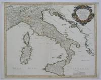
1665réf. M5118Paris 1665. Very Good central fold reinfrced. Notes: There is a water mark on the right hand portion of the map. Size : 435x540 mm 17.125x21.25 Inches Coloring: Original Outline Coloring Category: ; Maps Europe Italy unknown
réf. 6m5023H. Jaillot Paris 1696. Grenzkolorierte Kupferkarte gerahmt ca. 56 : 65 cm gebräunt. unknown
1690réf. M10380Paris: H. Jaillot c.1690. Very Good backed on acid free tissue paper for long term preservation. Notes: Large and detailed map of France with a large decorative cartouche in the lower left two sheets joined. Size : 565x896 mm 22.24x35.28 Inches Coloring: Original Outline Coloring Category: Maps Europe France; H. Jaillot unknown
réf. a8664Le Cercle de Westphalie. 25x38 inches. A double panel map profesionally joined together at seam. Colored in outline. Highly detailed. VG. . unknown
1655réf. M5583Paris 1655. Very Good. Size : 385x535 mm 15.125x21 Inches Coloring: Hand Colored Category: Maps Africa North unknown
1666réf. M1204Paris: Mariette Pierre 1666. Very Good. Size : 410x555 mm 16.125x21.875 Inches Coloring: Hand Colored Reference: Mojski Piotr Maria "Cartographia Rappersviliana Polonorum" page 388 number 32; Category: ; Maps Europe Poland Lithuania Mariette, Pierre unknown