SANSON, S:Biblio.com
979 resultados
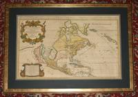
ref. 89167Amsterdam Hubert Jaillot Chez Pierre Mortimer et Company. 1692. Copper-engraved map. Engraved surface 34 x 22 inches. Framed with glass and double dark-green and blue mounts. Overall 44 x 33 inches. In very good condition. Stunning large early map of America. Beautifully coloured states and islands with both cartouches and border also coloured. With vertical centre fold/crease. The map lines up in the middle but is slightly offset at top and bottom. A couple of very light minor spots around the main cartouche else map surface is lovely and bright and clean. No offsetting or darkening. A stunning map. With two decorative cartouches with scale. With later hand-colouring. Jaillot's oversized map of North America notable for the large island of California poised off the West Coast first published in 1674. Tooley notes rather critically: “Jaillot who succeeded to Sanson's business makes a rehash of his maps. California is copied from Sanson's map of 1656. The remainder of the map is based on that of 1669. Jaillot retains the 5 lakes with two open at their western ends. He shows New Sweden and New Amsterdam. Curiously he omits Montreal but does insert a few French Missions round the Great Lakes. Large handsome titlepiece with arms of the Dauphin natives and indigenous fauna.” The map was reissued many times and its “long life was to in part to the expense of production for it continued in use long after its geographical information became out of date.” Tooley 37 Plate 44; McLaughlin 55. Amsterdam, Hubert Jaillot, Chez Pierre Mortimer et Company. 1692 unknown
ref. 0974948101.Gpaperback. Good. Access codes and supplements are not guaranteed with used items. May be an ex-library book. paperback
1992ref. I8181Singapore: White Lotus Press 1992. Paperback. Good/no dj. 0.24. Gardens and Parks of Singapore White Lotus Press paperback
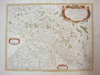
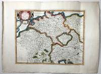
1689ref. 52354Paris. 1689. The map covers the area from the Moselle in NW to Worms in SE. ornamental cartouche at lower left. Copper engraving. Good condition though map is slightly discolured and stained. Original colour. Size: 56 x 43 cm. unknown
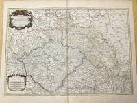
1778ref. M4133Paris: Fortin 1778. Very Good. Notes: Map showing Bohemia Silesia Moravia and Lusatia. Size : 420x545 mm 16.5x21.5 Inches Coloring: Hand Colored Category: Maps Europe Poland Lithuania Fortin unknown
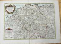
1785ref. M10224Paris: Chez Brion 1785. Very Good. Notes: Detailed large map of Germany with large decorative cartouches. Size : 465x652 mm 18.31x25.67 Inches Coloring: Original Hand Coloring Category: Maps Europe Germany; Chez Brion unknown
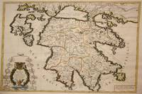
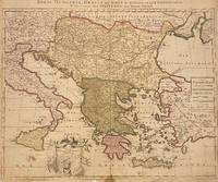
1692ref. M7546Paris: H. Jaillot c. 1692. Very Good;. Notes: The title cartouche in the lower left corner is encased in a floral wreath at the bottom of which sits a winged lion wielding a sword and standing at a pulpit. At the top of the wreath sits a coat of arms held by two winged putti. Encircling the wreath are little diagrams of various fortifications around Greece. Size : 565x845 mm 22.24x33.27 Inches Coloring: Original Outline Coloring Category: Maps Europe Greece Macedonia; H. Jaillot unknown
1785ref. M10271Paris c.1785. Very Good. Size : 470x658 mm 18.50x25.91 Inches Coloring: Original Outline Coloring Category: Maps Europe Czech Republic Slovakia; Maps Europe Germany; unknown
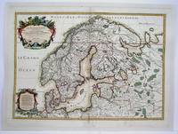
1708ref. M4264Paris 1708. Very Good central fold reinforced mounted on acid free canvas. Size : 474x655 mm 18.625x25.75 Inches Coloring: Hand Colored in Outline Category: ; Maps Europe Scandinavia unknown
1696ref. H40716Rome: Giovannie Giacomo de Rossi 1696. Very good. Sheet measures 27.5 x 20.5 inches map itself measures 20 x 16 inches. Very good some curving and bending from having been stored rolled up but no creases or tears light toning and mildest foxing. Period hand coloring and handsome cartouche. Italian edition of the French mapmaker's map of Germany and Bohemia. Giovannie Giacomo de Rossi unknown
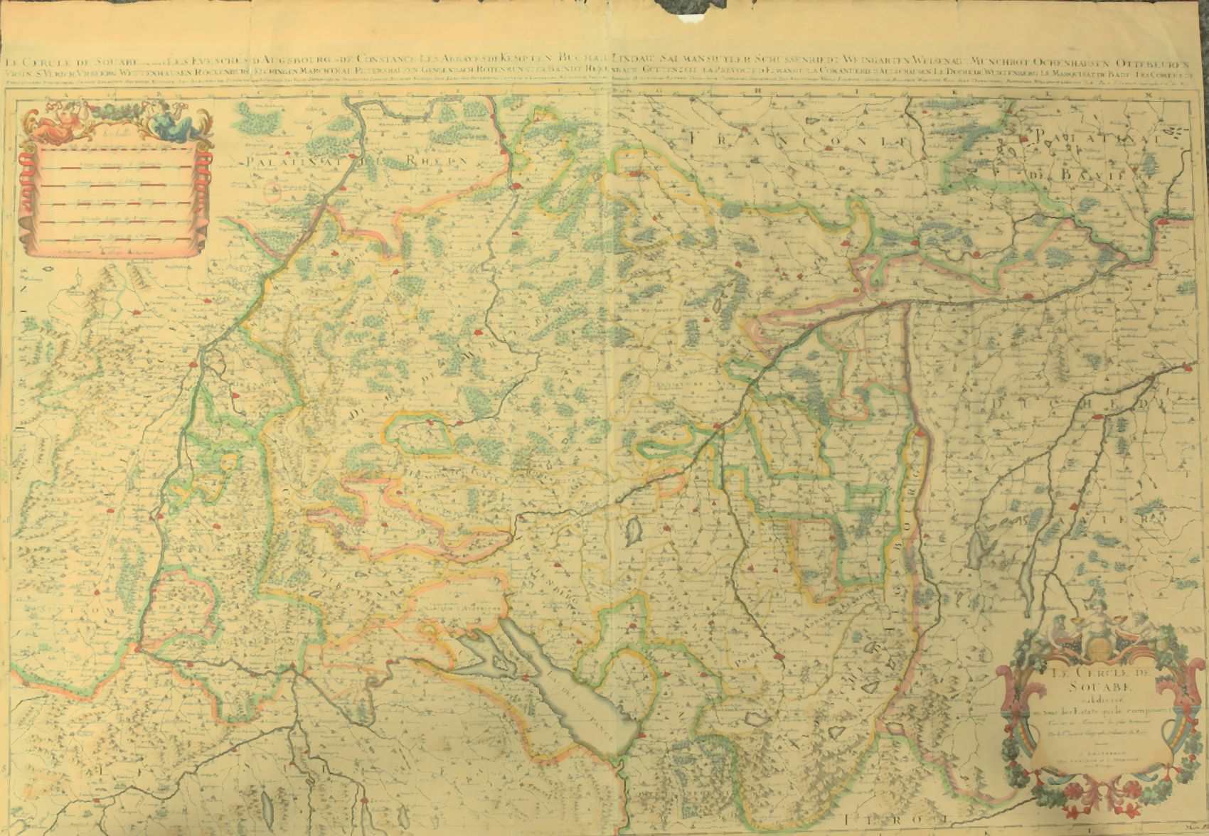
1730ref. 910097CGAmsterdam:, Covens u. Mortier, um 1730. Teilkolorierter Kupferstich, 54 x 87 cm, Blattgröße 61 x 87 cm.
1705ref. 311838Amsterdam: Petrus Schenk 1705. unbound. Map. Engraving with original hand outline. Image measures 18 7/8" x 22 3/4" Beautiful map of southeastern Europe extending from Italy to Turkey and from Hungary to Cyprus. Published circa 1705 this map depicts the region during the Ottoman-Habsburg wars. In fair condition. Wear to original centerfold with tape repair and stain at bottom edge. Lower margin worn and frayed not affecting the image. Minor cracking and small loss near center due to oxidization of original viridian green coloring. Some foxing. Publisher's crease to upper right corner. Sold as-is. Petrus Schenk c.1660--1711 was a German engraver and cartographer. He began his training in Amsterdam in the art of mezzotint and soon began working closely with Gerard Valck. The two took advantage of the bustling cartographic trade in the city and quickly expanded their business from portraits and prints into maps and globes. In 1700 Schenk grew the business further by moving to Leipzig Germany and opening a shop. As his sons and grandson returned to the Netherlands to become active engravers as well the Schenk firm developed into one of the best-known publishing houses in 18th-century Amsterdam. This map attests to Schenk's prolific production and skill in both cartographic artistry and business. Petrus Schenk unknown
1705ref. 311838Amsterdam: Petrus Schenk 1705. unbound. Map. Engraving with original hand outline. Image measures 18 7/8" x 22 3/4" Beautiful map of southeastern Europe extending from Italy to Turkey and from Hungary to Cyprus. Published circa 1705 this map depicts the region during the Ottoman-Habsburg wars. In fair condition. Wear to original centerfold with tape repair and stain at bottom edge. Lower margin worn and frayed not affecting the image. Minor cracking and small loss near center due to oxidization of original viridian green coloring. Some foxing. Publisher's crease to upper right corner. Sold as-is. Petrus Schenk c.1660--1711 was a German engraver and cartographer. He began his training in Amsterdam in the art of mezzotint and soon began working closely with Gerard Valck. The two took advantage of the bustling cartographic trade in the city and quickly expanded their business from portraits and prints into maps and globes. In 1700 Schenk grew the business further by moving to Leipzig Germany and opening a shop. As his sons and grandson returned to the Netherlands to become active engravers as well the Schenk firm developed into one of the best-known publishing houses in 18th-century Amsterdam. This map attests to Schenk's prolific production and skill in both cartographic artistry and business. Petrus Schenk unknown books
2026ref. LRB27034454Paris: Editions Recreasoft 2026 Reliure rigide hardcover. Langue : Français. Environ 822 pages. Tome 8 d'un ouvrage en plusieurs volumes. / Volume 8 of a multi-volume work. Français : Réimpression à la demande. Édition originale : 1838. Ouvrage en français. Ce traité d'anatomie comparée traduit en français est une oeuvre majeure de référence dans le domaine scientifique du XIXe siècle. Il aborde les principes fondamentaux de l'anatomie comparée offrant une analyse détaillée des structures anatomiques chez divers organismes. Destiné aux chercheurs et aux étudiants en médecine cet ouvrage reste une ressource précieuse pour l'étude de la biologie et de la médecine comparée. Images du livre non contractuelles English: Print-on-demand reprint. Original edition : 1838. Text in French. This treatise on comparative anatomy translated into French is a major reference work in the scientific field of the 19th century. It addresses the fundamental principles of comparative anatomy providing a detailed analysis of anatomical structures in various organisms. Aimed at researchers and medical students this work remains a valuable resource for the study of biology and comparative medicine. Book images are non-contractual. Editions Recreasoft. Softcover. New. Editions Recreasoft paperback
2026ref. LRB27034451Paris: Editions Recreasoft 2026 Langue : Français. Environ 528 pages. Tome 6 d'un ouvrage en plusieurs volumes. / Volume 6 of a multi-volume work. Français : Réimpression à la demande. Édition originale : 1838. Ouvrage en français. Ce traité d'anatomie comparée initialement publié en 1838 est une oeuvre majeure de référence dans le domaine de l'anatomie. Il présente une analyse détaillée des structures anatomiques chez divers organismes offrant une perspective comparative essentielle pour les chercheurs et les étudiants en sciences biologiques. L'ouvrage est le résultat d'une collaboration entre plusieurs éminents anatomistes de l'époque dont Theodor Schuster et Johann Friedrich Meckel. Images du livre non contractuelles English: Print-on-demand reprint. Original edition : 1838. Text in French. This comparative anatomy treatise originally published in 1838 is a seminal work in the field of anatomy. It provides a detailed analysis of anatomical structures across different organisms offering a crucial comparative perspective for researchers and students in biological sciences. The work is the result of a collaboration between several prominent anatomists of the time including Theodor Schuster and Johann Friedrich Meckel. Book images are non-contractual. Editions Recreasoft. Softcover. New. Editions Recreasoft paperback
2026ref. LRB27034455Paris: Editions Recreasoft 2026 Langue : Français. Environ 678 pages. Tome 10 d'un ouvrage en plusieurs volumes. / Volume 10 of a multi-volume work. Français : Réimpression à la demande. Édition originale : 1838. Ouvrage en français. Ce traité d'anatomie comparée traduit et complété par des auteurs éminents constitue une référence majeure pour l'étude des structures anatomiques chez les différents organismes. Il couvre des aspects fondamentaux de la morphologie et de la physiologie comparées offrant une perspective scientifique rigoureuse. Images du livre non contractuelles English: Print-on-demand reprint. Original edition : 1838. Text in French. This comparative anatomy treatise translated and expanded by renowned authors is a key reference for studying anatomical structures across various organisms. It covers fundamental aspects of comparative morphology and physiology providing a rigorous scientific perspective. Book images are non-contractual. Editions Recreasoft. Softcover. New. Editions Recreasoft paperback
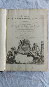
ref. 007346Paris Book. Good. Full-Leather. Elephant Folio - over 15 - 23" tall. 106 geographical tables. This copy has tables from various editions with printing dates from 1663 to 1741. The majority of tables date from 1663-1698. Most are in French but many also in Latin. The plates show different versions of the geographical tables. Please inquire for more details. The majority of tables are 20 inches some tables are 16 inches and are pasted on blank pages. The leather binding is worn at the top and bottom of spine and on corners and edges. Hardcover
1950ref. 158225Rome: Unitalia Film / IFE 1950. Collection of 14 vintage oversize promotional brochures for Italian and international actresses. Each brochure features a one-page biography in Italian and a full-page black-and-white photograph of each actress. Actresses represented are Sylvana Mangano Isa Miranda Annamaria Gerrero Yvonne Sanson Alida Valli Delia Scala Ingrid Bergman Silvana Pampanini Lea Padovani Lucia Bose Eleanora Rossi Gina Lollobrigida Carla Del Poggio and Anna Magnani. 11 x 14.25 inches folded once vertically as issued with a company statement on the verso. Very Good plus overall some with light toning and foxing and a few with short tears. Unitalia Film / IFE unknown
1950ref. 158225Rome: Unitalia Film / IFE 1950. Collection of 14 vintage oversize promotional brochures for Italian and international actresses. Each brochure features a one-page biography in Italian and a full-page black-and-white photograph of each actress. Actresses represented are Sylvana Mangano Isa Miranda Annamaria Gerrero Yvonne Sanson Alida Valli Delia Scala Ingrid Bergman Silvana Pampanini Lea Padovani Lucia Bose Eleanora Rossi Gina Lollobrigida Carla Del Poggio and Anna Magnani. 11 x 14.25 inches folded once vertically as issued with a company statement on the verso. Very Good plus overall some with light toning and foxing and a few with short tears. Unitalia Film / IFE unknown books
1691ref. 43500Amsterdam, Huguetan & Mortier, 1691. 56x85 cm. Large engraved map of Terra Sancta with original colours in outline. With two large engraved cartouches. Small repairs to lower part of centerfold.
1691ref. 43500Amsterdam Huguetan & Mortier 1691. 56x85 cm. Large engraved map of Terra Sancta with original colours in outline. With two large engraved cartouches. Small repairs to lower part of centerfold. This is Jaillot's large version of Sanson's map of Palaestine divided into tribes. unknown
1780ref. M5125Paris 1780. Excellent. Size : 490x690 mm 19.25x27.125 Inches Coloring: Hand Colored in Outline Category: ; Maps Asia Middle East Holy Land & Palestine unknown
1979ref. R130003979WEA. 1979. In-12. Broché. Bon état, Couv. convenable, Dos satisfaisant, Intérieur frais. Paroles des chansons dans la pochette. Photos de Véronique SANSON sur la couverture, le dos et dans la pochette Jim SCHEA.. . . . Classification : 410-33 Tours
1977ref. R130001804WEA. 1977. In-12. Broché. Bon état, Couv. convenable, Dos satisfaisant, Intérieur frais. Pochette décollée. Photo de Véronique SANSON sur la couverture, le dos et dans la pochette par A. KRATOCHVIL et K. OTTER.. . . . Classification : 410-33 Tours
1979ref. R130001791WEA. 1979. In-12. Broché. Bon état, Couv. convenable, Dos satisfaisant, Intérieur frais. Paroles dans la pochette. Photos de la pochette par Jim SHEA.. . . . Classification : 410-33 Tours