Sanson, Nicolas d'AbbevilleBiblio.com
979 risultati
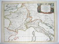
1667rif. M2849Paris 1667. Excellent. Size : 424x563 mm 16.625x22.125 Inches Coloring: Original Outline Coloring Category: ; Maps Europe France; Maps Europe Italy unknown
1704rif. 48770Amsterdam Franciscus Halma 1704. Folio. 455 x 29 cm. Contemp. full blindtooled Dutch vellum. Raised bands. Spine ends with tears some cracking along fronthinge but not loose. Vellum at frontcover a bit soiled. Egraved titlepage Coxis del. ianen fecit. Printed titlepage in red/black with an engraved vignette. 15119511 pp. 1 engraved plate with portrait and coat of arms. 4 large folded engraved maps. Light yellowing to margins of textleaves but maps and text fine and clean. 3 of the maps engraved by F. Halma. The maps are the Francois Halma reissues of Sanson's maps from 1683. hardcover
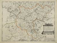
rif. 3135Paris: 1651. No binding. Very Good. 390 x 525 mm. early outline colour good condition. Beautifully engraved by Jean Sommer this map is of the region around Paris. Pastoureau Sanson V B no. 127. 1651 unknown
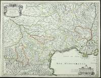
rif. 3863Paris: P. Mariette. 1651. No binding. Good. 420 x 550 mm. early outline colour. One small paper crease upper margin otherwise a superb example. Engraved by R. Cordier this fine map displays the region of Languedoc in south western France extending from the Pyranees to the Rhone valley. Inland to the north west the cities of Toulouse and Cahors are displayed. From the 'Cartes Generales de Toutes les Parties du Monde'. Pastoureau Sanson V A no. 44. P. Mariette. 1651 unknown
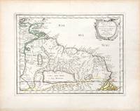
1657rif. 66689Paris. c. 1657. A very attractive and finely engraved map of the north eastern South American country of Guiana. The map is highlighted by numerous rivers tributaries mountains villages inlets bays and a very large inland equatorial lake that was thought to exist. Published in "Cartes Generales de toutes les parties du monde." Size: 285 x 360 mm. Copperplate engraving with original outline colouring. Fine condition. unknown
1700rif. 54043Nicolas Bion: L'Usage des Globes. Amsterdam: Francois Halma. 1700. Map showing north-east South America from Trindad to the mouth of the Amazon - modern day Guyana and Surinam. Several large fictitious lakes make up much of the unexplored interior. Maps by Sanson in original colour are rare. Nicolas Sanson was founder of the French school of mapmakers at a time when the leadership in European cartography passed from the Low Countries to France. This map was published in Bion's treatise on globes. Nicolas Bion was a famous French mathematical and scientific instrument maker. Copper engraving. Very good condition. Small 1cm. very faint library stamp on border not affecting map. Original colour. Size: 27.5 x 20 cm. 11 x 8 inches. unknown
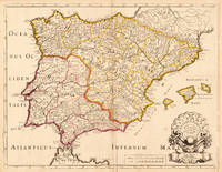
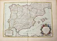
1704rif. 19604Paris: N. Sanson 1704. Other. In very good condition a slightly creasing in the lower part of the centrefold with minor tiny spots. 410 by 525mm 16¼ by 20¾ inches. 410 by 525mm 16¼ by 20¾ inches. Copper engraving hand colored in outline when published. Interesting and detailed map of Antique Spain with Portugal and the Balearic Islands by the French cartographer Nicolaus Sanson d´Abbeville. The map provides us a lot of information of the various place names of cities and small towns the rivers mountains and also engraved borders of the various Spanish provinces. The map impresses with the geographic exactness which is typical for the French cartographer Nicolaus Sanson. In the decorative cartouche which is in shape of a seashell we find the altered date 1704 which is a relatively late edition for maps by N. Sanson. The map is probably published in a French composit atlas around this date. N. Sanson unknown
rif. 1104771187.Gpaperback. Good. Access codes and supplements are not guaranteed with used items. May be an ex-library book. paperback
rif. 1166040631.Gpaperback. Good. Access codes and supplements are not guaranteed with used items. May be an ex-library book. paperback
1647rif. WB16371Lutetiae Parisiorum: Sumptibus & Impensis Autoris 1647. Hardcover. Good. 16mo. Old leather; quite worn. pp 16 246 2. Liber primus only. Sumptibus & Impensis Autoris hardcover
1663rif. 283501Paris 1663. unbound. very good. Map. Hand-colored engraving. 15" x 23". This map of Sicily from the 17th century shows the entire island as well as the southwesternmost tip of the Italian peninsula. The names of the surrounding bodies of water are named in Latin and rivers mountains lakes and towns are noted on the map. Nicolas Sanson 1600-1667 is considered the founder of the French school of cartography. In reaction to the prevailing trend of Dutch lavishness Sanson favored minimal details focusing rather on accurate cartography than ornament. This map is a fine example of his work. unknown
1656rif. 006682Paris: Chez l'Autheur 1656. First Edition. Full Calf. Very Good. 4to. 23.5 by 17.5 cm. Unpaginated 100 pages of text plus 2 pp. of ads. With 18 copper engraved maps all two page plates each with hand-colored of boundaries. Maps include one of the entire continent then of its various regions as then known plus the islands off the continent. Also a map of Malta. Bound in contemporary calf. Condition: calf dry and rubbed on spine and joints and edges rubbed. Light to moderate soiling in the margins of the pages. Two bookplates -- one of the Marquis of Lothian the other the Newbattle Abbey Library. Chez l'Autheur unknown
1652rif. 006683Paris: Chez l'Autheur 1652. First Edition. Full Calf. Very Good. 4to. 23.5 by 17.5 cm. Unpaginated 102 pages of text plus 2 pp. of ads 1 Royal privilege page. With 17 copper engraved maps all two page plates each with hand-colored of boundaries. Maps include one of the entire continent then of its various regions as then known plus island groups. Separate maps for China and Japan. Bound in contemporary calf. Condition: Rebacked with joints making this obvious. The original spine was re-mounted with some losses. Its blindstamped decoration of fans is discernible but somewhat vague. We think it is possible this decoration had some gilding or color originally but none survives. Still an interesting and unusual feature in our view. Calf dry and rubbed on spine and joints and edges rubbed. Light to moderate soiling in the margins of many pages and on a few pages the soiling invades inward beyond the margins and also in a few instances the marginal soiling is on the heavier side. There are a few archival tape repairs of small chips three on the title leaf one on the following leaf and after that wormhole edge damage was left untouched. That said the defect and repair isn't as glaring as it might sound. The edges elsewhere can have short spans of a chewed appearance. As a book generally we would consider this copy at best Good. As far as the maps go independent of the book we would regard them as Very Good. A few of the maps might individually fall short of such grading; on the other hand all the maps of this copy one can easily imagine someone enthusiastically framing even without an attempt to clean them up. Two bookplates -- one of the Marquis of Lothian the other the Newbattle Abbey Library. Chez l'Autheur unknown
2026rif. LRB2006053Paris: Editions Recreasoft 2026 Langue : Français. Environ 608 pages. Français : Réimpression à la demande. Édition originale : 1658. Ensemble cartographique réunissant quatre atlas en un volume consacré à l'Asie à l'Afrique à l'Europe et à l'Amérique. L'exemplaire présente une pagination manuscrite ainsi qu'un index manuscrit des volumes chapitres et cartes. Les atlas de l'Asie de l'Afrique et de l'Amérique sont dédiés à Nicolas Fouquet tandis que celui de l'Europe est dédié à Michel Le Tellier. Intérêt bibliographique notable pour l'étude de l'oeuvre cartographique de Nicolas Sanson et des éditions signalées par la littérature spécialisée. Images du livre non contractuelles English : Print-on-demand reprint. Original edition : 1658. Cartographic set bringing together four atlases in one volume devoted to Asia Africa Europe and America. The copy shows manuscript pagination and a handwritten index of volumes chapters and maps. The atlases of Asia Africa and America are dedicated to Nicolas Fouquet while the Europe atlas is dedicated to Michel Le Tellier. Of notable bibliographic interest for the study of Nicolas Sanson's cartographic work and the editions recorded in specialist reference literature. Book images are non-contractual. Editions Recreasoft. Softcover. New. Editions Recreasoft paperback
1710rif. M10278Paris: H. Jaillot c.1710. Very Good. Size : 465x655 mm 18.31x25.79 Inches Coloring: Original Hand Coloring Category: Maps Europe Portugal; Maps Europe Spain; H. Jaillot unknown
rif. 16-6522Paris: Pierre Mariette 1665. 4to 24.8 x 17.6cm contemporary mottled calf engraved title-page and dedication leaf 12 engraved folding maps hand-colored in outline all folding each map with 2 leaves of descriptive text trimmed and inset except Hungary no text-leaves present and the Black Sea map followed by 6 leaves of text headed ‘Rivières plus fameuses de l’Europe' title-page lightly damp-stained in margins.The title-page and maps are undated but the imprint on the final page of text is dated 1665. The maps comprise Europe Great Britain Scandinavia Russia France Germany Hungary Poland Spain Italy Greece and the Black Sea.Bookplate of David Smythe Lord Methven FRSE LLD 1746–1806 who was a Scottish lawyer and judge who rose to be a Senator of the College of Justice. Paris: Pierre Mariette, 1665. unknown
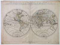
1652rif. 010748twParis: Sanson. Very Good. 1652. A very rare map from Nicolas Sanson. Imprint bears the date of 1652 although it is possible that this copy came from an atlas in the later 1600s. Light toning and edgewear with one corner slightly chipped. Light soil on lower margin. Hand-colored boundaries. Map borders measure 14" x 20 3/4". California is shown as an island and Terre Australe is a vague line encircling the Antarctic. Terre de Iesso is the name given to the land mass northwest of North America. Sanson 1600-1667 published many map versions of the world and is known as "the father of French cartography." ; 16 1/2" x 22 1/4" . Sanson unknown
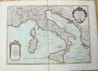
1783rif. M10279Paris: H. Jaillot c.1783. Very Good. Size : 469x655 mm 18.46x25.79 Inches Coloring: Original Hand Coloring Category: Maps Europe Italy; Maps Mediterranean Islands; H. Jaillot unknown
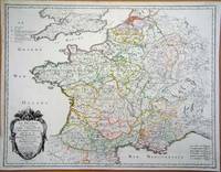
rif. 6420Paris: 1693. No binding. Good. 440 x 570 mm. early outline colour in good condition. A particularly attractive map of France or ancient Gaul. It famously depicts the country before Louis XIV lost a third of his territory to mapmakers who concluded that the longitudinal width of the country was not as great as was depicted! Not in Pastoureau 1984. 1693 unknown
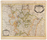
1710rif. 009140Amsterdam: Pierre Mortier 1710 Cooper engraving 46.5 x 61.5 cm on paper measuring 54.0 x 64.5 cm with original color in outline minor spotting and creasing remnants of centerfold. A good copy of a map of the Duchy of Lorraine and surrounding territories published in Amsterdam by Pierre Mortier to illustrate events of the War of the Spanish Succession. Pierre Mortier unknown
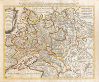
1710rif. 009147Amsterdam: Petrus Schenck 1710 Cooper engraving 46.5 x 58.0 cm on paper measuring 51.0 x 63.5 cm with original outline coloring flattened expertly restored and backed with archival tissue paper. The Latin title in the top border reads: "Russiae Albae sive Moscoviae delineatio Geographica accurata et nova…". A good copy of a Moscovie map published in Amsterdam by Petrus Schenck. Petrus Schenck unknown
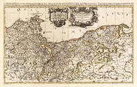
1696rif. 25836Paris: Hubert Jaillot 1696. Other. In excellent condition. 545 by 874mm 21 by 34 inches. 545 by 874mm 21 by 34 inches. Hand-Colored Original Copperplate Engraving by Nicolas d Abbeville Sanson depicting Le Duche de Pomeranie divis en ses Principales Parties Dress sur les Memoires les plus Nouveaux. Par le Sr. Sanson. Geographe Ordinaire du Roy. A Paris Chez H Iaillot. joignant les grands Augustins aux deux Globes Avec Privilege du Roy Pourvingt Ans 1696. Published Paris Hubert Jaillot 1696. Sheet: 545 by 874mm 21 by 34 inches. A fine and original hand-colored example of Sanson's celebrated cartographic work documenting this region of Germany with the precision and decorative artistry characteristic of the 16900s. Nicolas d Abbeville Sanson was a cartographer active in the 1600s working in the tradition of European copper-engraved cartography. Their maps are valued by collectors for their historical accuracy and decorative quality.This original copperplate engraving with original hand coloring depicts the region of Le Duche de Pomeranie divis en ses Principales Parties Dress sur les Memoires les plus Nouveaux. Par le Sr. Sanson. Geographe Ordinaire du Roy. A Paris Chez H Iaillot. joignant les grands Augustins aux deux Globes Avec Privilege du Roy Pourvingt Ans 1696. published in Paris Hubert Jaillot 1696. The map records the political and geographic boundaries of the region as understood in 1696 offering a fascinating window into the history of German territorial organization. Sheet measures 545 by 874mm 21 by 34 inches. In good condition overall with minor signs of age appropriate for a 17th-century engraving. Ready to frame. Hubert Jaillot unknown
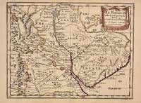
1657rif. 326341Paris 1657. unbound. Map. Original outline coloring. Sheet measures 8 3/4" x 12 1/8". Image measures 8" x 10 5/8". Paris: Nicolas Sanson 1657. This rare 17th century map by Nicolas Sanson with original color depicts the region showing present day Paraguay Uruguay with parts of Brazil and Argentina. Mountains are rendered pictorially and cities rivers and notations describing indigenous populations are labeled. In very good condition. Nicolas Sanson 1600-1667 is considered the founder of the French school of cartography. In reaction to the prevailing trend of Dutch lavishness Sanson favored minimal details focusing rather on accurate cartography than ornament. unknown
1657rif. 56721Histoire et Geographie de l'Amerique. 1657. Attractive map of Paraguay. Title cartouche at top right. Maps by Sanson in original colour are rare. Nicolas Sanson was founder of the French school of mapmakers at a time when the leadership in European cartography passed from the Low Countries to France. Copper engraving. Fine condition; very light offsetting. Original outline colour. Size: 28.5 x 21.5 cm. 11 x 8½ inches unknown
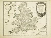
rif. 10525Paris: 1665. No binding. Very Good. 400 x 510 mm. superb early outline colour very good condition. A FIRST STATE example of an ornate map of England and Wales first published in Nicolas Sanson's 'Les Cartes Generales de Toutes les Parties du Monde' in 1665. Sanson 1600-67 was France's premier cartographer and helped to lift the field onto another level during his career. In 1665 two folio maps were issued one of the British Isles and this of England and Wales. The map outlines the modern counties along with the traditional Anglo-Saxon heptarchy which are here outlined in colour. With an attractive cartouche upper right. The cartography is derived from that of John Speed Willem Blaeu and Johannes Jansson. This is an example of the first state dated 1665 according to Shirley however since then two further states dated similarly have been identified. This example remains the first state. Provenance Doreen Green 2003. Pastoureau M. Sanson V B 117; Shirley R.W. Sanson 3.1. 1665 unknown