Sanson, Nicolas d'AbbevilleBiblio.com
1 001 résultats
1663réf. M1708Paris: Mariette Pierre 1663. Excellent. Size : 425x575 mm 16.75x22.625 Inches Coloring: Hand Colored Category: ; Maps Europe France Mariette, Pierre unknown
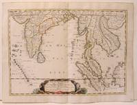
1654réf. M2656Paris 1654. Excellent. Size : 385x530 mm 15.125x20.875 Inches Coloring: Original Hand Coloring Reference: Nebenzahl 3.9C Category: Maps Asia South East; Maps Asia Central India & Sri Lanka / Ceylon; unknown
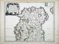
réf. 6991Paris: 1665. No binding. Very Good. 400 x 490 mm. in fine early outline colour in very good condition. This map of northern Ireland was published in Paris by Pierre Mariette. It was first introduced in to a later edition of Nicolas Sanson's ""Les Cartes Generales"" in 1665. Nicolas Sanson was to bring about the rise of French cartography although the fierce competition of the Dutch would last until the end of the century. This shift in cartographic centres shadowed the relative fortunes of the two countries; France under Louis XIV was a growing power in Europe. Born in Abbeville in the Picardy region of France 1600 Sanson studied history and turned to cartography as a means of recording it. In 1630 he was made Géographe Ordinaire du Roi and was to become one of the tutors to Louis XIV. However his future success was partly owing to the partnership he made with the publisher Pierre Mariette. In 1644 the latter had purchased the business of Melchoir Tavernier and helped Sanson with financial support in producing the maps for the planned atlas. His atlas is the first full world atlas to be produced in France. This work had been in development for several years as the dates on the various maps attest. A fine example of the first state. Bonar-Law 1997 no. 11 st. 1; Pastoureau 1984 Sanson Vb no. 124. 1665 unknown
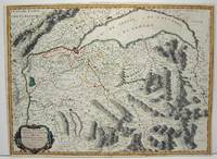
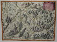
1663réf. M645Paris: Mariette Pierre 1663. Excellent. Size : 420x575 mm 16.5x22.625 Inches Coloring: Hand Colored Category: ; Maps Europe Switzerland Mariette, Pierre unknown
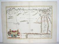
1640réf. M2804Paris: Mariette Pierre 1640. Very Good. Size : 372x510 mm 14.625x20.125 Inches Coloring: Original Outline Coloring Category: Maps Africa North Egypt Mariette, Pierre unknown
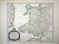
réf. 6460Paris: 1658. No binding. Very Good. 370 x 435 mm. in fine early outline colour good condition. An attractive map of the whole of Wales first published in Nicolas Sanson's 'Les Cartes Generales de Toutes les Parties du Monde' in 1658. Sanson was France's premier cartographer and helped to lift the field onto another level during his career. With an attractive title cartouche lower left in a nice dark impression. The cartography is derived from that of John Speed and includes the neighbouring English counties including Herefordshire Shropshire Worcestershire Cheshire parts of Gloucestershire and Staffordshire. To the west the proximity of the Irish coast is depicted. Not in Booth; Pastoureau M. Sanson V 27; Roberts Iolo & Menai 'Printed Maps of the whole of Wales 1573-1837' Part 1 in 'The Map Collector' no. 68 pp. 34-9; Shirley 2004 T.San 2a no. 13. 1658 unknown
réf. 10634Paris: 1658. No binding. Very Good. 370 x 435 mm. in fine early outline colour good condition. An attractive map of the whole of Wales first published in Nicolas Sanson's 'Les Cartes Generales de Toutes les Parties du Monde' in 1658. Sanson was France's premier cartographer and helped to lift the field onto another level during his career. With an attractive title cartouche lower left in a nice dark impression. The cartography is derived from that of John Speed and includes the neighbouring English counties including Herefordshire Shropshire Worcestershire Cheshire parts of Gloucestershire and Staffordshire. To the west the proximity of the Irish coast is depicted. Provenance: Doreen Green 1996; private collection. Not in Booth 1977; Pastoureau 1980 Sanson V 27; Roberts 1994 14; Shirley 2004 T.San 2a no. 13. 1658 unknown
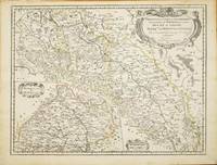
réf. 10820Paris: 1679. No binding. Good. 420 x 550 mm. early outline colour in good condition. This map of part of a portion of Eastern Europe includes Bohemia Silesia Moravia and Lusatia. It was published in Paris by Pierre Mariette in Nicolas Sanson's 'Les Cartes Generales' first published in 1658. This example is the second state dated 1679. It includes Frankfurt am oder in the upper left Glogow and Breslau Wroclaw. An inset of Moravia is centred on Olmutz present day Olomouc. Sanson was France's premier cartographer and helped to lift French work in this area to another level. His atlas is the first full world atlas to be produced in France. This work had been in development for several years as the dates on the various maps attest. Pastoureau M. Sanson V 59; Phillips P.L. Atlases 4260. 1679 unknown
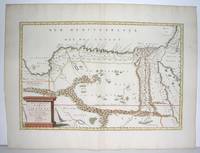
1700réf. 54022Nicolas Bion: L'Usage des Globes. Amsterdam: Francois Halma. 1700. Attractive map of north eastern Africa including Egypt and northern Libya. Much of the charm of early maps of Africa lies in how they show the interior of the continent which was not explored until the 19th century. Maps by Sanson in original colour are rare. Nicolas Sanson was founder of the French school of mapmakers at a time when the leadership in European cartography passed from the Low Countries to France. This map was published in Brion's treatise on globes. Nicolas Brion was a famous French mathematical and scientific instrument maker. Copper engraving. Very good condition. Darkened edges to margins. Faint inkstamp on right margin not affecting map. Original colour. Size: 27 x 17 cm. 10½ x 6½ inches. unknown
1655réf. M2801Paris: Mariette Pierre 1655. Excellent. Size : 345x523 mm 13.625x20.625 Inches Coloring: Original Outline Coloring Category: Maps Africa North Egypt Mariette, Pierre unknown
1654réf. M2853Paris 1654. Excellent. Size : 415x483 mm 16.375x19 Inches Coloring: Original Outline Coloring Category: Maps Russia unknown
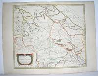
1654réf. 8874Paris: Pierre Mariette 1654. Copper engraving 41.5 x 47.5 cm original hand-colour in outline trivial spotting blank verso. Showing parts of European Russia and Ukraine in antiquity. For Greco-Roman geographers and ethnographers Sarmatia was in western Scythia bordering the Roman Empire. Nicolas Sanson 1600-1667 founder of the Sanson dynasty of map-makers is considered by many to be the father of the French school of cartography. He was a prolific and original map-maker admired for the clarity and scientific accuracy of his maps. Map Pierre Mariette unknown
1700réf. 54377Nicolas Bion: L'Usage des Globes. Amsterdam: Francois Halma. 1700. An armillary sphere perused by three scholars at a table. Nicolas Sanson was founder of the French school of mapmakers at a time when the leadership in European cartography passed from the Low Countries to France. This map was published in Bion's treatise on globes. Nicolas Bion was a famous French mathematical and scientific instrument maker. Size: 125 x 175 mm. Copper engraving. Original colour. Mounted size: 295 x 360 mm. Fine condition. unknown
réf. 2570Americas: Paris Par N Sanson . Chez Pierre Mariette. 1656-8. Copper engraved map of the Caribbean by Nichols sanson from his"Cartes Generales De Toutes Les Parties Du Monde". Original outline colour; verso blank. The map shows all the islands of the Caribbean with the southern tip of Florida and the coasts to the south. Decorative title cartouche . Good impression; slight dampstaining to edges far from plate ; small stain just below cartouche. Nicolas Sanson 1600-1667 is generally acknowledged as the founder of the great French school of geographers and cartographers that supplanted the Dutch as the leading European map-makers. His work was acclaimed for its geographical accuracy and high standard of engraving. As a consequence his many maps received a wide diffusion. His career marks the start of the process by which Paris superseded Amsterdam as the centre of European map production. Nicolas studied Ancient History as a young man and this awoke in him an interest in classical geography. His first map of ancient Gaul was made in 1618 when he was only 18. Sanson had three sons Nicolas 1626-1648 Guillaume d.1703 and Adrien d.1708 and a grandson Pierre Moullard-Sanson d.1730 all of whom were involved in the family's map-making activities. After Sanson settled in Paris his work came to the attention of King Louis XIII who eventually appointed Sanson Geographe Ordinaire du Roi one of whose duties was to tutor the King in geography. Sanson published some 300 maps in his career though his first most famous atlas the folio "Cartes Generales De Toutes Les Parties Du Monde" was not published until 1658. He would go into partnership with Pierre Mariette a publisher of prints. Sanson also prepared a series of quarto atlases of the different continents. These scarce atlases are more frequently encountered in the Dutch piracy engraved by Anthony d'Winter first published in 1683. The Sanson atlases are rarely found with a standard set of maps; the practice seems to have been that additional or revised plates would be inserted as available. After Sanson's death the business was continued by his two surviving sons and grandson in partnership with and later superseded by Alexis Hubert Jaillot. Credit must go Jaillot and Pierre Duval for re-engraving his maps many still unprinted at his death and re-publishing them in face of strong competition from the Dutch who continued to dominate the market until the end of the century. Americas Caribbean Antilles Lucayan Archipelago Paris Par N Sanson ... Chez Pierre Mariette. 1656-8 unknown
1700réf. 58299Description de tout l'Univers 1700 published by F.Halma Amsterdam. Nicolas Sanson was founder of the French school of mapmakers at a time when the leadership in European cartography passed from the Low Countries to France. Copper engraving. Fine condition. Original colour with gold leaf highlights. Size: 17 x 18.5 cm. unknown
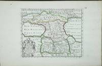
réf. 5400Utrecht: 1683. No binding. Very Good. 190 x 230 mm. in good condition. Engraved by Antoine de Winter and published in 1683 in the Dutch edition of Sanson's 'L'Asie'. Pastoureau Sanson IIIF no. 11. 1683 unknown
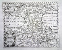
réf. 5391Paris: 1653. No binding. Good. 190 x 250 mm. early outline colour in good condition. A fine attractive map of the region of present day Georgia Armenia and Azerbaijan engraved for Nicolas Sanson's 'L'Asie'. Pastoureau Sanson IIIA no. 5. 1653 unknown
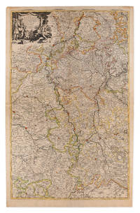
1710réf. 009148Amsterdam: Pierre Mortier 1710 Cooper engraving on two joined sheets measuring 59.5 x 95.5 cm with original outline coloring expertly cleaned and flattened. A good copy of a map of western Germany published in Amsterdam by Pierre Mortier to illustrate events of the War of the Spanish Succession. The first state with "2. Carte de la Meuse" added in manuscript. Pierre Mortier unknown
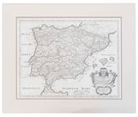
1710réf. 13749441710. A map of Spain by French cartographer Nicolas Sanson 1600-1667 in a later Italian edition dated 1710. In Excellent condition with even age toning. Double matted. Mat: w 28.25 in. x h 23.5; Map: w 24.25 in. x h 19 in. Shelved at DuPont. 1374944. Arts & Antiques. unknown
2000réf. Q-0967763908Quailmark Books Llc 2000-01-01. hardcover. New. In shrink wrap. Looks like an interesting title! Quailmark Books Llc hardcover
1667réf. 10027Paris 1667. No Binding. Near Fine. 12 ½ x 17 inches. Original outline color; excellent. Earliest map of Martinique listed in Phillips featuring attractive original color and an elegant cartouche. This map depicts the situation on the island before 1660 when it was still largely inhabited by natives and only about half of it had been claimed by colonists for sugar cane farming. The map goes so far as to mark with a printed line the partition dividing the "demeure des François" and the "demeure des savages." However by 1660 the entirety of the native population was either dead expelled or in slavery and Martinique was a full-fledged sugar cane-farming European colony. Phillips Maps P. 389. unknown
1667réf. 10027Paris 1667. No Binding. Near Fine. 12 ½ x 17 inches. Original outline color; excellent. Earliest map of Martinique listed in Phillips featuring attractive original color and an elegant cartouche. This map depicts the situation on the island before 1660 when it was still largely inhabited by natives and only about half of it had been claimed by colonists for sugar cane farming. The map goes so far as to mark with a printed line the partition dividing the "demeure des François" and the "demeure des savages." However by 1660 the entirety of the native population was either dead expelled or in slavery and Martinique was a full-fledged sugar cane-farming European colony. Phillips Maps P. 389. unknown books
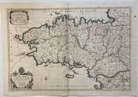
1693réf. 324404Paris: Alexis-Hubert Jaillot 1693. Map. Engraving with hand colored outline. Image measures 21" x 31" This large 17th century double-page map features the Brittany region of France. Cities towns abbeys government buildings rivers ports and harbors are labeled. Mountains forests and wetlands are depicted pictorially. The attention to detail in topography and population centers hints at the abundance of the region known for its production of Muscadet wine cheese boar seafood and other agricultural products. Executed by Nicolas Sanson in dedication to his son this map was published by Alexis-Hubert Jaillot in Paris and later reproduced in Amsterdam by Jaillot and Pierre Mortier. This early edition is scarce and hard to find. In very good condition with some offsetting to left side and a spot in the right margin. Nicolas Sanson 1600-1667 is considered the founder of the French school of cartography. In reaction to the prevailing trend of Dutch lavishness Sanson favored minimal details focusing rather on accurate cartography than ornament. Alexis-Hubert Jaillot unknown
1693réf. 324404Paris: Alexis-Hubert Jaillot 1693. Map. Engraving with hand colored outline. Image measures 21" x 31" This large 17th century double-page map features the Brittany region of France. Cities towns abbeys government buildings rivers ports and harbors are labeled. Mountains forests and wetlands are depicted pictorially. The attention to detail in topography and population centers hints at the abundance of the region known for its production of Muscadet wine cheese boar seafood and other agricultural products. Executed by Nicolas Sanson in dedication to his son this map was published by Alexis-Hubert Jaillot in Paris and later reproduced in Amsterdam by Jaillot and Pierre Mortier. This early edition is scarce and hard to find. In very good condition with some offsetting to left side and a spot in the right margin. Nicolas Sanson 1600-1667 is considered the founder of the French school of cartography. In reaction to the prevailing trend of Dutch lavishness Sanson favored minimal details focusing rather on accurate cartography than ornament. Alexis-Hubert Jaillot unknown books
2012réf. 105280Somogy Editions D'Art. New. Paperback. FREE UPGRADE to Courier/Priority Shipping Upon Request - IN STOCK AND IMMEDIATELY AVAILABLE FOR SHIPMENT - Flawless copy brand new pristine never opened -- Text in French. 176 pages. -- with a bonus offer-- . 2012. 2757205617 . Somogy Editions D'Art paperback