Sanson, Nicolas; Jaillot, Alexis-HubertBiblio.com
997 résultats
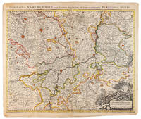
1710réf. 009138Amsterdam: Pierre Mortier 1710 Cooper engraving 50.5 x 60.5 cm on paper measuring 54.0 x 63.0 cm with original color in outline minor spotting and creasing remnants of centerfold paper slightly frayed at edges. A good copy of an uncommon map of the province of Namur a region of the Spanish Netherlands published in Amsterdam by Pierre Mortier to illustrate events of the War of the Spanish Succession. Pierre Mortier unknown
2026réf. LRB40027834Paris: Editions Recreasoft 2026 Gebundene Ausgabe Hardcover. Sprache: Deutsch. Ca. 811 Seiten. Deutsch : Nachdruck auf Anfrage. Originalausgabe : 1679. Werk auf Deutsch. Diese seltene und umfassende geographische Abhandlung von Nicolas Sanson behandelt die vier Kontinente der Welt - Europa Asien Afrika und Amerika. Das Werk enthält detaillierte Beschreibungen der Kaiserreiche und ist mit präzisen Landkarten illustriert die den Stand des geografischen Wissens im 17. Jahrhundert widerspiegeln. Eine wertvolle Quelle für Historiker und Kartographie-Enthusiasten. Buchbilder sind unverbindlich English: Print-on-demand reprint. Original edition : 1679. Text in German. This rare and comprehensive geographical treatise by Nicolas Sanson covers the four continents of the world - Europe Asia Africa and America. The work includes detailed descriptions of the empires and is illustrated with accurate maps reflecting the state of geographical knowledge in the 17th century. A valuable resource for historians and cartography enthusiasts. Book images are non-contractual. Editions Recreasoft. Softcover. New. Editions Recreasoft paperback
1650réf. 011592Paris 1650. No Binding. Very Good/No Jacket. R Cordier. 1650 Normanie. Engraved by R Cordier. A fine and detailed province map with the english coast included. All important place names are shown. Original outline colour. very slight discoloration. otherwise good condition. 385 x 515 mm framed and glazed unknown
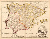
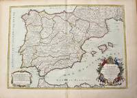
1700réf. 54030Nicolas Bion: L'Usage des Globes. Amsterdam: Francois Halma. 1700. Attractive map of Spain divided into its provinces. Maps by Sanson in original colour are rare. Nicolas Sanson was founder of the French school of mapmakers at a time when the leadership in European cartography passed from the Low Countries to France. This map was published in Brion's treatise on globes. Nicolas Brion was a famous French mathematical and scientific instrument maker. Copper engraving. Fine condition. Original colour. Size: 23.5 x 18 cm. 9½ x 7 inches. unknown
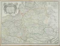
réf. 11195Paris: 1655-1703. No binding. Good. 435 x 580 mm. early outline colour in good condition. A fine detailed map of Poland Lithuania Latvia present day Belarus and Ukraine published by Nicolas Sanson 1600-67. The map was first published in 1655 with at least one later state dated 1663. Here it is dated 1703 upper right. Sanson was to bring about the rise of French cartography although the fierce competition of the Dutch would last until the end of the century. This shift in cartographic centres shadowed the relative fortunes of the two countries; France under Louis XIV was a growing power in Europe. Born in Abbeville in the Picardy region of France 1600 Sanson studied history and turned to cartography as a means of recording it. In 1630 he was made Géographe Ordinaire du Roi and was to become one of the tutors to Louis XIV. However his future success was partly owing to the partnership he made with the publisher Pierre Mariette. In 1644 the latter had purchased the business of Melchoir Tavernier and helped Sanson with financial support in producing the maps for the planned atlas. In 1657 Pierre Mariette died which delayed publication of Sanson's atlas. However his son also named Pierre co-published Les Cartes Générales de toutes les parties du Monde the following year. It was the first folio French produced world atlas. Pastoureau 1984 Sanson V A 65. 1655-1703 unknown
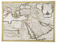
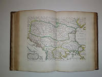
1654réf. G1ADV7RKD7B6Paris 1654. Engraved map 42 x 56 cm coloured in outline. Map of the Turkish Empire showing Ottoman possessions in the Balkans Eastern Mediterranean Egypt and Arabia - marking topography and settlements.l Al Ankary 59; Al-Qasimi 60; Tibbetts 99. AFRICA CARTOGRAPHY GEOGRAPHY & TOPOGRAPHY EUROPE MIDDLE EAST & ISLAMIC WORLD Balkan & Greece Charts & Maps Eastern Mediterranean & Cyprus Egypt North Africa Turkey & Ottoman Empire unknown
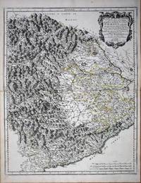
réf. 8636Paris: 1658-65. No binding. Very Good. 550 x 435 mm. early outline colour in good condition. This map of the Piedmont region of Italy was published in Paris by Pierre Mariette. It centres on Turin and extends from Antibe on the French coast to Savona. Nicolas Sanson's 'Les Cartes Generales' was first published in 1658. This map was introduced in 1665 this example is a later state with the imprint altered to 'Chez l'Autheur'. Sanson was France's premier cartographer and helped to lift French work in this area to another level. His atlas is the first full world atlas to be produced in France. This work had been in development for several years as the dates on the various maps attest. Pastoureau Sanson Vb no. 147. 1658-[65] unknown
1655réf. 56109Paris. 1655. Attractive map of Morocco and parts of Algeria. Maps by Sanson in original colour are rare. Nicolas Sanson was founder of the French school of mapmakers at a time when the leadership in European cartography passed from the Low Countries to France. Copper engraving. Very good condition. Some light browning to the centre fold. Attractive water mark. Original colour. Size: 53 x 40 cm. 21 x 15½ inches unknown
réf. 215370Amsterdam: Pierre Mortier. unbound. very good. Map. Engraving with hand outline. Image measures 13 3/4" x 22 1/2". Rare map of Galatia an ancient region of northern Anatolia present-day Turkey along the southern coast of the Black Sea. Published circa 1705 this map is centered on Ankara and shows provinces inhabited by Trocmi Tectosages and Tolistobogi - three Celtic tribes who inhabited the region from the 3rd century BC. Neighboring historical regions of Paphlagonia Pontus Phyrgia Cappadocia and Lycaonia are labeled. Mountains and cities are depicted pictorially. The map shows major roads connecting cities throughout the region. A decorative cartouche features lively figures celebrating with percussion and wind instruments. Full original margins minor offsetting. Based on earlier plates by Sanson. This map appeared in "Atlas Antiquus Sacer Ecclesiasticus et Profanus" published in Amsterdam by Pieter Mortier. Nicolas Sanson 1600-1667 who is considered the founder of the French school of cartography. In reaction to the prevailing trend of Dutch lavishness Sanson favored minimal details focusing rather on accurate cartography than ornament. Pierre Mortier 1661-1711 was a Dutch cartographer engraver and printseller who worked in Amsterdam. He used advanced Dutch printing methods to produce high quality editions of contemporary French maps by cartographers such as De L'Isle Sanson Jaillot de Fer and De Wit. This map is a lovely example of his work. Pierre Mortier unknown
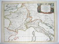
1667réf. M2849Paris 1667. Excellent. Size : 424x563 mm 16.625x22.125 Inches Coloring: Original Outline Coloring Category: ; Maps Europe France; Maps Europe Italy unknown
1704réf. 48770Amsterdam Franciscus Halma 1704. Folio. 455 x 29 cm. Contemp. full blindtooled Dutch vellum. Raised bands. Spine ends with tears some cracking along fronthinge but not loose. Vellum at frontcover a bit soiled. Egraved titlepage Coxis del. ianen fecit. Printed titlepage in red/black with an engraved vignette. 15119511 pp. 1 engraved plate with portrait and coat of arms. 4 large folded engraved maps. Light yellowing to margins of textleaves but maps and text fine and clean. 3 of the maps engraved by F. Halma. The maps are the Francois Halma reissues of Sanson's maps from 1683. hardcover
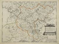
réf. 3135Paris: 1651. No binding. Very Good. 390 x 525 mm. early outline colour good condition. Beautifully engraved by Jean Sommer this map is of the region around Paris. Pastoureau Sanson V B no. 127. 1651 unknown
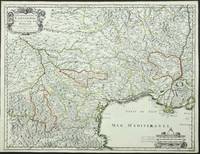
réf. 3863Paris: P. Mariette. 1651. No binding. Good. 420 x 550 mm. early outline colour. One small paper crease upper margin otherwise a superb example. Engraved by R. Cordier this fine map displays the region of Languedoc in south western France extending from the Pyranees to the Rhone valley. Inland to the north west the cities of Toulouse and Cahors are displayed. From the 'Cartes Generales de Toutes les Parties du Monde'. Pastoureau Sanson V A no. 44. P. Mariette. 1651 unknown
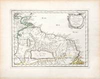
1657réf. 66689Paris. c. 1657. A very attractive and finely engraved map of the north eastern South American country of Guiana. The map is highlighted by numerous rivers tributaries mountains villages inlets bays and a very large inland equatorial lake that was thought to exist. Published in "Cartes Generales de toutes les parties du monde." Size: 285 x 360 mm. Copperplate engraving with original outline colouring. Fine condition. unknown
1700réf. 54043Nicolas Bion: L'Usage des Globes. Amsterdam: Francois Halma. 1700. Map showing north-east South America from Trindad to the mouth of the Amazon - modern day Guyana and Surinam. Several large fictitious lakes make up much of the unexplored interior. Maps by Sanson in original colour are rare. Nicolas Sanson was founder of the French school of mapmakers at a time when the leadership in European cartography passed from the Low Countries to France. This map was published in Bion's treatise on globes. Nicolas Bion was a famous French mathematical and scientific instrument maker. Copper engraving. Very good condition. Small 1cm. very faint library stamp on border not affecting map. Original colour. Size: 27.5 x 20 cm. 11 x 8 inches. unknown
1704réf. 19604Paris: N. Sanson 1704. Other. In very good condition a slightly creasing in the lower part of the centrefold with minor tiny spots. 410 by 525mm 16¼ by 20¾ inches. 410 by 525mm 16¼ by 20¾ inches. Copper engraving hand colored in outline when published. Interesting and detailed map of Antique Spain with Portugal and the Balearic Islands by the French cartographer Nicolaus Sanson d´Abbeville. The map provides us a lot of information of the various place names of cities and small towns the rivers mountains and also engraved borders of the various Spanish provinces. The map impresses with the geographic exactness which is typical for the French cartographer Nicolaus Sanson. In the decorative cartouche which is in shape of a seashell we find the altered date 1704 which is a relatively late edition for maps by N. Sanson. The map is probably published in a French composit atlas around this date. N. Sanson unknown
réf. 1104771187.Gpaperback. Good. Access codes and supplements are not guaranteed with used items. May be an ex-library book. paperback
réf. 1166040631.Gpaperback. Good. Access codes and supplements are not guaranteed with used items. May be an ex-library book. paperback
1647réf. WB16371Lutetiae Parisiorum: Sumptibus & Impensis Autoris 1647. Hardcover. Good. 16mo. Old leather; quite worn. pp 16 246 2. Liber primus only. Sumptibus & Impensis Autoris hardcover
1663réf. 283501Paris 1663. unbound. very good. Map. Hand-colored engraving. 15" x 23". This map of Sicily from the 17th century shows the entire island as well as the southwesternmost tip of the Italian peninsula. The names of the surrounding bodies of water are named in Latin and rivers mountains lakes and towns are noted on the map. Nicolas Sanson 1600-1667 is considered the founder of the French school of cartography. In reaction to the prevailing trend of Dutch lavishness Sanson favored minimal details focusing rather on accurate cartography than ornament. This map is a fine example of his work. unknown
1656réf. 006682Paris: Chez l'Autheur 1656. First Edition. Full Calf. Very Good. 4to. 23.5 by 17.5 cm. Unpaginated 100 pages of text plus 2 pp. of ads. With 18 copper engraved maps all two page plates each with hand-colored of boundaries. Maps include one of the entire continent then of its various regions as then known plus the islands off the continent. Also a map of Malta. Bound in contemporary calf. Condition: calf dry and rubbed on spine and joints and edges rubbed. Light to moderate soiling in the margins of the pages. Two bookplates -- one of the Marquis of Lothian the other the Newbattle Abbey Library. Chez l'Autheur unknown
1652réf. 006683Paris: Chez l'Autheur 1652. First Edition. Full Calf. Very Good. 4to. 23.5 by 17.5 cm. Unpaginated 102 pages of text plus 2 pp. of ads 1 Royal privilege page. With 17 copper engraved maps all two page plates each with hand-colored of boundaries. Maps include one of the entire continent then of its various regions as then known plus island groups. Separate maps for China and Japan. Bound in contemporary calf. Condition: Rebacked with joints making this obvious. The original spine was re-mounted with some losses. Its blindstamped decoration of fans is discernible but somewhat vague. We think it is possible this decoration had some gilding or color originally but none survives. Still an interesting and unusual feature in our view. Calf dry and rubbed on spine and joints and edges rubbed. Light to moderate soiling in the margins of many pages and on a few pages the soiling invades inward beyond the margins and also in a few instances the marginal soiling is on the heavier side. There are a few archival tape repairs of small chips three on the title leaf one on the following leaf and after that wormhole edge damage was left untouched. That said the defect and repair isn't as glaring as it might sound. The edges elsewhere can have short spans of a chewed appearance. As a book generally we would consider this copy at best Good. As far as the maps go independent of the book we would regard them as Very Good. A few of the maps might individually fall short of such grading; on the other hand all the maps of this copy one can easily imagine someone enthusiastically framing even without an attempt to clean them up. Two bookplates -- one of the Marquis of Lothian the other the Newbattle Abbey Library. Chez l'Autheur unknown
2026réf. LRB2006053Paris: Editions Recreasoft 2026 Langue : Français. Environ 608 pages. Français : Réimpression à la demande. Édition originale : 1658. Ensemble cartographique réunissant quatre atlas en un volume consacré à l'Asie à l'Afrique à l'Europe et à l'Amérique. L'exemplaire présente une pagination manuscrite ainsi qu'un index manuscrit des volumes chapitres et cartes. Les atlas de l'Asie de l'Afrique et de l'Amérique sont dédiés à Nicolas Fouquet tandis que celui de l'Europe est dédié à Michel Le Tellier. Intérêt bibliographique notable pour l'étude de l'oeuvre cartographique de Nicolas Sanson et des éditions signalées par la littérature spécialisée. Images du livre non contractuelles English : Print-on-demand reprint. Original edition : 1658. Cartographic set bringing together four atlases in one volume devoted to Asia Africa Europe and America. The copy shows manuscript pagination and a handwritten index of volumes chapters and maps. The atlases of Asia Africa and America are dedicated to Nicolas Fouquet while the Europe atlas is dedicated to Michel Le Tellier. Of notable bibliographic interest for the study of Nicolas Sanson's cartographic work and the editions recorded in specialist reference literature. Book images are non-contractual. Editions Recreasoft. Softcover. New. Editions Recreasoft paperback
1710réf. M10278Paris: H. Jaillot c.1710. Very Good. Size : 465x655 mm 18.31x25.79 Inches Coloring: Original Hand Coloring Category: Maps Europe Portugal; Maps Europe Spain; H. Jaillot unknown
réf. 16-6522Paris: Pierre Mariette 1665. 4to 24.8 x 17.6cm contemporary mottled calf engraved title-page and dedication leaf 12 engraved folding maps hand-colored in outline all folding each map with 2 leaves of descriptive text trimmed and inset except Hungary no text-leaves present and the Black Sea map followed by 6 leaves of text headed ‘Rivières plus fameuses de l’Europe' title-page lightly damp-stained in margins.The title-page and maps are undated but the imprint on the final page of text is dated 1665. The maps comprise Europe Great Britain Scandinavia Russia France Germany Hungary Poland Spain Italy Greece and the Black Sea.Bookplate of David Smythe Lord Methven FRSE LLD 1746–1806 who was a Scottish lawyer and judge who rose to be a Senator of the College of Justice. Paris: Pierre Mariette, 1665. unknown