927 résultats
1990réf. R240077928A COMPTE D'AUTEUR. 1990. In-8. Broché. Etat d'usage, Couv. convenable, Agraffes rouillées, Intérieur frais. Catalogue d'environ 12 pages - petite annotation au stylo bleu sur la page de titre - illustration en couleurs sur le 1er plat.. . . . Classification Dewey : 708-Galeries, musées, collections d'art
réf. 5579Paris: 1658-79. No binding. Very Good. 370 x 440 mm. early outline colour in good condition. This map of the Champagne and Brie region of France was published in Paris by Pierre Mariette. It appears in the first edition of Nicolas Sanson's ""Les Cartes Generales"" in 1658. Sanson was France's premier cartographer and helped to lift French work in this area to another level. His atlas is the first full world atlas to be produced in France. This work had been in development for several years as the dates on the various maps attest. Pastoureau 1984 Sanson Va no. 11; Phillips P.L. 1909- 4260 no. 11. 1658-[79] unknown
2004réf. R240004050EDITIONS PAROLE ET SILENCE. 2004. In-12. Broché. Parfait état, Couv. fraîche, Dos satisfaisant, Intérieur frais. 90 pages. Nombreuses annotations au crayons a papier.. . . . Classification Dewey : 200-RELIGION
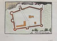
1690réf. M9479Paris c.1690. Very Good. Notes: Map of Chielafa Greece during the late 17th century. Size : 105x152 mm 4.13x5.98 Inches Coloring: Hand Colored Category: Maps Europe Greece Macedonia; unknown
réf. 3251Americas: Amsterdam Francois Halma 1705. Copper engraved map of Chili by N. Sanson from Halma's Algemeene Werelde Beschryving Vol. 3 Black and white; title in Dutch; verso blank; strapwork title cartouche. Small version of Sanson's important map of Chili showing the Cuyo provinces. The map is based on the descriptions of Alfonso de Ovalle. This map appeared in Algemeene Weereld-Beschryving nae de Rechte Verdeeling der Landschappen Plaetsen Zeeën Rivieren &c. Geographisch Politisch Historisch Chronologisch en Genealogisch a Dutch edition of A. Phérotée de la Croix's Nouvelle Methode Pour Apprendre Facilement la Geographie Universelle which first appeared in 1690. Dark impression. Nicolas Sanson d'Abbeville.1600-67 ' father of the French cartography' and founder of the Sanson firm. Atlas ' Cartes générales de toutes les parties du Monde' 1658-70 and a pocket atlas in 4 parts 1652-1705. Sanson's small maps from A. Phérotée de la Croix's Nouvelle Methode Pour Apprendre Facilement la Geographie Universelle. first published in 1652 and engraved by A. Peyrounin were copied several times by various map publishers. Johann David Zunners made copies of Sanson's maps for his German translation of Die Gantze Erd-Kugel in 1679. Johannes Ribbius and Simon de Vries published copies in 1682 and 1683 with new maps engraved by Antoine d'Winter. The plates were later sold to Francois Halma who used them in 1699 and then again in 1705 with the titles re-engraved in Dutch. François Halma 1653 - 1722 Dutch publisher/printer; dealer/auction house. Cartographer and publisher of maps active in Utrecht Amsterdam Franeker and Leeuwarden. Published 'Description de l'Univers' 1700; 'Algemene Wereldtbescrijving' 1705; 'Corpus Inscriptionum' 1707 and 'Lexicon Philosophicum' 1713. Keoman: Hal 1; Phillips 528. Americas South America Chili Amsterdam Francois Halma 1705 unknown
1995réf. ABE-1655801755460196 PAGES-19 CM X 27 CM-DOSSIER VERONIQUE SANSON-PANTHEON: FRANCIS LEMARQUE-(EM622)
1993réf. ABE-1655803362898196 PAGES-19 CM X 27 CM-DOSSIER ROMAIN DIDIER-(EM622)
1723réf. 209708Amsterdam: Mortier Pieter 1723. unbound. very good. Map. Engraving with hand outline. Image measures 14" x 18.75". Beautifully detailed map showing the area between the the Black and Caspian Seas including modern day Russia Georgia Azerbaijan Armenia and Turkey. Full original margins have minor stains. Based on the plates by Nicolas Sanson 1600-1667 who is considered the founder of the French school of cartography. In reaction to the prevailing trend of Dutch lavishness Sanson favored minimal details focusing rather on accurate cartography than ornament. Mortier, Pieter unknown
1723réf. 209708Amsterdam: Mortier Pieter 1723. unbound. very good. Map. Engraving with hand outline. Image measures 14" x 18.75". Beautifully detailed map showing the area between the the Black and Caspian Seas including modern day Russia Georgia Azerbaijan Armenia and Turkey. Full original margins have minor stains. Based on the plates by Nicolas Sanson 1600-1667 who is considered the founder of the French school of cartography. In reaction to the prevailing trend of Dutch lavishness Sanson favored minimal details focusing rather on accurate cartography than ornament. Mortier, Pieter unknown books
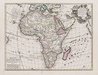
1595réf. 100047AG1595. Paris / London / Antwerp and other places of print c.1595 - 1851. Some stunning examples of hand-coloured copper-engravings plus one manuscript map Tuckey / Congo - Zaire. All of these maps in very good / excellent condition. This collection presents itself for becoming an amazing a meaningful starting-point for an Africana-Collection decoration for a Safari-Lodge interior-design for an Africana-themed library etc. etc. The price includes worldwide free shipping per DHL Express-Courier 2-3 day-delivery. Ask for complete list and images and please also inquire about our amazing book-collection of Africana which would be a great match for this collection of vintage maps. unknown
1950réf. 158225Rome: Unitalia Film / IFE 1950. Collection of 14 vintage oversize promotional brochures for Italian and international actresses. Each brochure features a one-page biography in Italian and a full-page black-and-white photograph of each actress. Actresses represented are Sylvana Mangano Isa Miranda Annamaria Gerrero Yvonne Sanson Alida Valli Delia Scala Ingrid Bergman Silvana Pampanini Lea Padovani Lucia Bose Eleanora Rossi Gina Lollobrigida Carla Del Poggio and Anna Magnani. 11 x 14.25 inches folded once vertically as issued with a company statement on the verso. Very Good plus overall some with light toning and foxing and a few with short tears. Unitalia Film / IFE unknown books
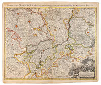
1710réf. 009138Amsterdam: Pierre Mortier 1710 Cooper engraving 50.5 x 60.5 cm on paper measuring 54.0 x 63.0 cm with original color in outline minor spotting and creasing remnants of centerfold paper slightly frayed at edges. A good copy of an uncommon map of the province of Namur a region of the Spanish Netherlands published in Amsterdam by Pierre Mortier to illustrate events of the War of the Spanish Succession. Pierre Mortier unknown
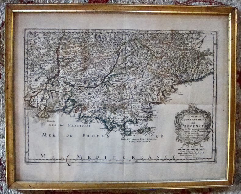
1656réf. M6320Paris 1656. Very Good. Notes: This map shows the southern coast of France. Size : 425x535 mm 16.75x21 Inches Coloring: Original Hand Coloring Category: Maps Europe France unknown
1669réf. 7613À Paris chez l'autheur. Encadré Très bon Paris 1669 1669 44 x 55 cm avec son cadre ancien.
1833réf. 29648Paris Imprimerie d'Hippolyte Tilliard 1833 in-4 cartonnage Bradel moderne de papier bordeaux, pièce de titre en long
réf. 22266Editions SPES 1927 livre conférences 18,5*11,5 pages
1926réf. RO30138410editions spes. 1926. In-8. Broché. Etat d'usage, Couv. légèrement passée, Dos satisfaisant, Intérieur frais. 24 pages. . . . Classification Dewey : 230-Christianisme. Théologie chrétienne
1927réf. R260219815EDITIONS SPES. 1927. In-12. Broché. Etat d'usage, Couv. défraîchie, Agraffes rouillées, Non coupé. 51 pages - Papier jauni. . . . Classification Dewey : 260-Théologie sociale chrétienne
1926réf. RO20164583SPES. 1926. In-8. Broché. Etat d'usage, Couv. défraîchie, Agraffes rouillées, Intérieur frais. 51 pages.. . . . Classification Dewey : 200-RELIGION
réf. 41090Editions Spes 1925 livre essai 18,5*11,5 276 pages
1926réf. RO40088965Spes. 1926. In-8. Broché. Etat d'usage, Tâchée, Dos satisfaisant, Intérieur bon état. 256 pages. Couverture se détachant légèrement. Tampon en page de garde.. . . . Classification Dewey : 240-Théologie morale et spirituelle
1925réf. 240525SPES 1925 env. 25p par livret pages in12. 1925. Broché. env. 25p par livret pages. I Notre doctrine II Un point de départ III La cause de l'inquiétude et le problème qu'elle pose IV la solution du problème par une fin de non-recevoir V la solution par une organisation sociale terrestre et temporelle VI La solution par la science et la philosophie
1926réf. R300296450Spes. 1926. In-12. Relié demi-cuir. Etat d'usage, Couv. convenable, Dos satisfaisant, Papier jauni. Environ 200 pages par volume. Plats jaspés. Dos cuir à titre, année et motifs dorés.. . . . Classification Dewey : 248-Vie chrétienne et méditations