917 resultados
1830ref. 35931830 Paris: chez les principaux libraires, 1830. In-8: 13.5 x 21 cm, ii-379 pp. Reliure de l'époque en demi-basane. Dos lisse orné de bandes dorées. Titre sur pièce de couleur verte. Bas du mors supérieur légèrement fendu et quelques rares rousseurs pâles sans gravité, sinon ouvrage solide et en très bon état. Une curiosité.
1911ref. 2499PARIS. ALBIN MICHEL, EDITEUR. SANS DATE (1911). IN-8 (14,5 X 21,5 X 3,5 CENTIMETRES ENVIRON) DE (4) + 390 PAGES, RELIURE D’EPOQUE 1/2 CHAGRIN VERT, DOS A QUATRE NERFS ORNE D’UN DECOR A FROID AVEC FILETS ET FLEURONS DORES, TITRE ET TETE DORES, COUVERTURE ILLUSTREE CONSERVEE. BEL EXEMPLAIRE.
ref. B9781015798434Hardback. New. hardcover
ref. 45381745-nnew. unknown
ref. 45381745like new. unknown
ref. ria9781015563797_inpHardcover. New. New Book; Fast Shipping from UK; Not signed; Not First Edition; This work has been selected by scholars as being culturally important and is part of the knowledge base of civilization as we know it.This work is in the "public domain in the United States of America and possibly other nations. Withi hardcover
ref. B9781015590250Hardback. New. hardcover
ref. 1528461029.Ghardcover. Good. Access codes and supplements are not guaranteed with used items. May be an ex-library book. hardcover
ref. 1528365852.Ghardcover. Good. Access codes and supplements are not guaranteed with used items. May be an ex-library book. hardcover
2021ref. Gyan-9789333378413Facsimile Publisher 2021. Hardcover. New. 22.59 x 14.34 x 3.46 cm. English Facsimile Publisher hardcover
ref. 45001475like new. unknown
ref. 45001475-nnew. unknown
ref. 45381529-nnew. unknown
ref. 45381529like new. unknown
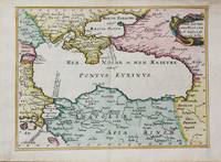
1656ref. M10647Paris c.1656. Very Good. Size : 182x246 mm 7.17x9.69 Inches Coloring: Hand Colored Category: Maps Russia; Maps Asia Near East Turkey; Maps Europe Ukraine; unknown
ref. 3243Americas: Amsterdam Francois Halma 1705. Copper engraved map of Mexico by N. Sanson from Halma's Algemeene Werelde Beschryving Vol. 3 Black and white; title in Dutch; verso blank; strapwork title cartouche. The map shows Mexico including the Yucatan peninsula part of present-day Guatemala and Honduras. This map appeared in Algemeene Weereld-Beschryving nae de Rechte Verdeeling der Landschappen Plaetsen Zeeën Rivieren &c. Geographisch Politisch Historisch Chronologisch en Genealogisch a Dutch edition of A. Phérotée de la Croix's Nouvelle Methode Pour Apprendre Facilement la Geographie Universelle which first appeared in 1690. Dark impression. Nicolas Sanson d'Abbeville.1600-67 ' father of the French cartography' and founder of the Sanson firm. Atlas ' Cartes générales de toutes les parties du Monde' 1658-70 and a pocket atlas in 4 parts 1652-1705. Sanson's small maps from A. Phérotée de la Croix's Nouvelle Methode Pour Apprendre Facilement la Geographie Universelle. first published in 1652 and engraved by A. Peyrounin were copied several times by various map publishers. Johann David Zunners made copies of Sanson's maps for his German translation of Die Gantze Erd-Kugel in 1679. Johannes Ribbius and Simon de Vries published copies in 1682 and 1683 with new maps engraved by Antoine d'Winter. The plates were later sold to Francois Halma who used them in 1699 and then again in 1705 with the titles re-engraved in Dutch. François Halma 1653 - 1722 Dutch publisher/printer; dealer/auction house. Cartographer and publisher of maps active in Utrecht Amsterdam Franeker and Leeuwarden. Published 'Description de l'Univers' 1700; 'Algemene Wereldtbescrijving' 1705; 'Corpus Inscriptionum' 1707 and 'Lexicon Philosophicum' 1713. Keoman: Hal 1; Phillips 528; B Americas Mexico Yucatan Guatemala Honduras Amsterdam Francois Halma 1705 unknown
ref. 46662661-nnew. unknown
2024ref. x-0520399005University of California Press 2024. Paperback. New. 228 pages. 8.00x5.50x0.50 inches. University of California Press paperback
ref. 0520399005.Gpaperback. Good. Access codes and supplements are not guaranteed with used items. May be an ex-library book. paperback
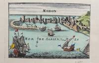
1690ref. M9578Paris c. 1690. Very Good. Notes: A charming map of Modon Greece during the late 17th century. Size : 104x152 mm 4.09x5.98 Inches Coloring: Hand Colored Category: Maps Europe Greece Macedonia; unknown
ref. SLIVCN-9782745325976CHAMPION
ref. 1024372820.Ghardcover. Good. Access codes and supplements are not guaranteed with used items. May be an ex-library book. hardcover
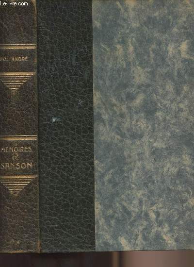
ref. 5381Paris Albin Michel éditeur sans date relié Demi Basane dos à 5 nerfs couvertures et dos conservés 390 pages - reliure fragile aux mors
ref. R240148985Albin Michel. Non daté. In-12. Relié. Etat d'usage, Couv. convenable, Coiffe en tête abîmée, Papier jauni. 390 pages augmentées de nombreuses illustrations en noir et blanc hors texte. Dos cuir, titre, auteur et filets argentés.. . . . Classification Dewey : 848-Ecrits divers, citations, journaux intimes, souvenirs, mémoires