980 risultati
1832rif. 104565Imprenta De Repulles. Very Good. 1832. Second Edition. Hardcover. Leatherbound. 1832. Some wear to the bindings. 5 volume set complete. Spanish language. Madrid Imprenta de Repulles. Marbled endpapers. Second Edition. ; 8vo 8" - 9" tall . Imprenta De Repulles hardcover
2026rif. LRB13004382Paris: Editions Recreasoft 2026 Lingua: Italiano. Circa 750 pagine. Volume 2 di un'opera in più volumi. / Volume 2 of a multi-volume work. Italiano : Ristampa su richiesta. Edizione originale : 1834. Trattato medico-chirurgico di patologia che presenta in forma teorico-pratica i principali elementi della medicina e della chirurgia nella prima metà dell'Ottocento. Opera di interesse storico per lo studio dell'evoluzione della nosologia della semeiotica e dei metodi terapeutici dell'epoca. Immagini del libro non contrattuali English : Print-on-demand reprint. Original edition : 1834. Medical-surgical treatise on pathology presented in a theoretical and practical form offering the principal elements of medicine and surgery as understood in the first half of the nineteenth century. Of historical interest for the study of the evolution of nosology semiotics and therapeutic methods of the period. Book images are non-contractual. Editions Recreasoft. Softcover. New. Editions Recreasoft paperback
2026rif. LRB25015873Paris: Editions Recreasoft 2026 Lingua: Italiano. Circa 724 pagine. Italiano : Ristampa su richiesta. Edizione originale : 1834. Questa riproduzione moderna di Nuovi elementi di patologia medico-chirurgica o sia trattato teorico-pratico di medicina e chirurgia di Roche L. Ch. Louis Charles 1790-1875; Sanson L. J. Louis Joseph 1790-1841 rende accessibile un testo antico o raro per la consultazione la ricerca bibliografica e le collezioni specializzate. Immagini del libro non contrattuali English : Print-on-demand reprint. Original edition : 1834. Treatise on medico-surgical pathology presented as a theoretical and practical manual of medicine and surgery reflecting early nineteenth-century medical teaching and the systematization of clinical knowledge. The work is of interest for its discussion of disease diagnosis semiology and the close relationship between medicine and surgery in the period. Book images are non-contractual. Editions Recreasoft. Softcover. New. Editions Recreasoft paperback
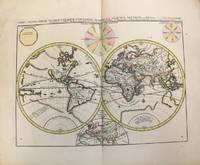
1696rif. M10191Amsterdam: Covens & Mortier c.1696. Very Good. Size : 393x540 mm 15.47x21.26 Inches Coloring: Original Hand Coloring Category: Maps World; Covens & Mortier unknown
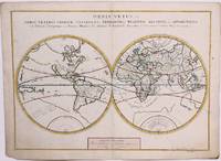
1657rif. M8883Paris 1657 . Very Good. Notes: A handsome 17th century map of the known world typifying Sanson's scientific style of cartography. Embodying the most up to date information of the period Sanson's map depicts California as an island with Antarctica and Australia still largely unknown. A land bridge connects Asia to North America and touches Japan. A very accurate map for the period. Nicolas Sanson 1600–1667 was a French cartographer termed by some the creator of French geography in which he's been called the "father of French cartography." Size : 380x537 mm 14.96x21.14 Inches Coloring: Original Hand Coloring Reference: Shirley R.W. World 400; Pastoureau M. Sanson V A 98. Category: Maps World; unknown
rif. 90474PARIS Chez l’Auteur 1654. Title cartouche to lower right corner. Blank on verso. In good condition. Some light tanning on edges with a few faint foxing marks. A few small nicks lower margin edge. With original outline hand colouring. Engraved Size 17.5 x 23 inches Nicolas Sanson 1600-1667 sometimes called Nicolas Sanson d'Abbeville or Sanson d'Abbeville was the most important French cartographer of the 17th century. Tooley called Sanson "the founder of the French school of cartography." He began making maps in the late 1620s and in the 1630s he was working with Melchior Tavernier. Later Sanson worked in concert with the print publisher Pierre Mariette with whom he published his great atlas: Cartes générales de toutes les parties du monde 1658. After Sanson's death in 1667 his son Guillaume carried on the business in partnership with Alexis Hubert Jaillot. Guillaume established himself as a very important French mapmaker in his own right. PARIS Chez l’Auteur 1654. unknown
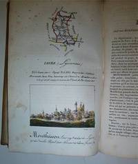
rif. 16-4577Paris : Palais-Royal Librairie d'Education de A. J. Sanson 1825. . This copy with the maps and town views all with contemporary handcoloring. OCLC Number: 642902888.Notes: Engravings by S. Hosse and Duchâtel.Title vignette.Publisher's advertisements: p. 2 and p. 179-180.Description: 180 pages 87 unnumbered leaves of plates : illustrations 87 maps with birds eye views all handcolored. ; 21 cm.In-8 12 x 20cm. cartonnage de l'époque plats illustrés. Ouvrage illustré d'une carte générale de France lithographiée avec contours colorié et de 86 planches lithographiées et coloriées. Les quatre-vingt-six départements ont chacun un feuillet de description accompagné d'une planche ornée d'une carte et d'une vue de la ville principale. Elles sont toutes lithographiées par Duchâtel d'après S. Hoffe. Parmi les villes représentées se trouvent La Rochelle Ajaccio Dijon Bordeaux Rennes Nantes Angers Vannes Lyon ou Paris. Bon exemplaire. Défauts aux coins et aux mors.Expertise by M. Christian GASCHBoite Postale 405F-58004 NEVERS Cedex. Paris : Palais-Royal, Librairie d'Education de A. J. Sanson, 1825. unknown
1678rif. M3434Paris: Mariette Pierre 1678. Excellent. Size : 390x522 mm 15.375x20.5 Inches Coloring: Original Outline with later cartouche coloring Category: ; Maps Asia Near East Turkey Mariette, Pierre unknown
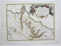
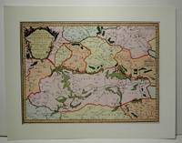
1713rif. 215454Amsterdam: Mortier Pieter 1713. unbound. very good. Map. Engraving with original hand outline. Image measures 14.5" x 18.75". Rare map of Paphlagonia an ancient region of northern Anatolia present-day Turkey along the southern coast of the Black Sea. Highlighting the capital city of Sinope this map depicts the region as defined by Strabo: bound by the Parthenius River in the west extending to the Hays river in the east. Sanson depicts the region comprising the Kingdom of Pontus during the rule of Mithridates IV. Neighboring historical regions of Gallatia and Bithynia et Pontus are labeled. Full original margins light scattered foxing. Based on earlier plates by Sanson. This map appeared in "Atlas Antiquus Sacer Ecclesiasticus et Profanus" published in Amsterdam by Pieter Mortier. Nicolas Sanson 1600-1667 who is considered the founder of the French school of cartography. In reaction to the prevailing trend of Dutch lavishness Sanson favored minimal details focusing rather on accurate cartography than ornament. Pierre Mortier 1661-1711 was a Dutch cartographer engraver and printseller who worked in Amsterdam. He used advanced Dutch printing methods to produce high quality editions of contemporary French maps by cartographers such as De L'Isle Sanson Jaillot de Fer and De Wit. His greatest feat was the nautical atlas "Le Neptune Francois" or "Suite de Neptune Francois" considered to contain the most beautiful examples of cartographic art. After his death his widow Amelia continued publishing in partnership with her brother-in-law David until her death in 1719. This map was published during Amelia's tenure at the firm. Mortier, Pieter unknown
1713rif. 215454Amsterdam: Mortier Pieter 1713. unbound. very good. Map. Engraving with original hand outline. Image measures 14.5" x 18.75". Rare map of Paphlagonia an ancient region of northern Anatolia present-day Turkey along the southern coast of the Black Sea. Highlighting the capital city of Sinope this map depicts the region as defined by Strabo: bound by the Parthenius River in the west extending to the Hays river in the east. Sanson depicts the region comprising the Kingdom of Pontus during the rule of Mithridates IV. Neighboring historical regions of Gallatia and Bithynia et Pontus are labeled. Full original margins light scattered foxing. Based on earlier plates by Sanson. This map appeared in "Atlas Antiquus Sacer Ecclesiasticus et Profanus" published in Amsterdam by Pieter Mortier. Nicolas Sanson 1600-1667 who is considered the founder of the French school of cartography. In reaction to the prevailing trend of Dutch lavishness Sanson favored minimal details focusing rather on accurate cartography than ornament. Pierre Mortier 1661-1711 was a Dutch cartographer engraver and printseller who worked in Amsterdam. He used advanced Dutch printing methods to produce high quality editions of contemporary French maps by cartographers such as De L'Isle Sanson Jaillot de Fer and De Wit. His greatest feat was the nautical atlas "Le Neptune Francois" or "Suite de Neptune Francois" considered to contain the most beautiful examples of cartographic art. After his death his widow Amelia continued publishing in partnership with her brother-in-law David until her death in 1719. This map was published during Amelia's tenure at the firm. Mortier, Pieter unknown books
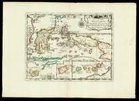
1652rif. 17601Paris: chez l'autheur 1652. 265 by 370mm. 10.5 by 14.5 inches. Maps""Les Isles Molucques; Celebes Gilolo &c. Sanson's Moluccas Engraved chart with contemporary hand-colour in outline. Detailed map of the island east of Borneo in Southeast Asia with an inset of Banda and the Moluccas. Published in Sanson's 'L'Asie en Plusieurs Cartes.' 1652. Nicolas Sanson 1600-1667 began to make maps to supplement his study of history and a map of Ancient Gaul made early in his career brought him to the attention of Cardinal Richelieu. This foothold in the French court allowed him to rise to the position of geographe du roi teaching both Louis XIII and Louis XIV. Louis XIII even made him a counsellor of state. Sanson produced an atlas 'Cartes Generales de Toutes les Parties du Monde' which contained important maps of the post roads and waterways of France. He also produced two major maps of North America: 'Amerique Septentrionale' 1650 was the first map to show the Great Lakes in a recognisable form aided by Sanson's access to The Jesuit Relations a collection of accounts by French missionaries to the area. The map was drawn on a sinusoidal projection which Sanson was the first to use. In 1656 he made 'Le Canada ou Nouvelle France' which showed the Great Lakes in greater detail and included accurate representations of the Hudson Bay area the Delaware and the Gulf of Saint Lawrence. chez l'autheur, unknown
rif. 3250Americas: Amsterdam Francois Halma 1705. Copper engraved map of Paraguayby N. Sanson from Halma's Algemeene Werelde Beschryving Vol. 3 Black and white; title in Dutch; verso blank; strapwork title cartouche. The map shows the region of present day Paraguay Uruguay northern Argentina and southern Brazil. The Rio de la Plata is the main feature of the map along with the mountains and volcanoes of the Cordillera de los Andes. Engraved by Antoine de Winter. This map appeared in Algemeene Weereld-Beschryving nae de Rechte Verdeeling der Landschappen Plaetsen Zeeën Rivieren &c. Geographisch Politisch Historisch Chronologisch en Genealogisch a Dutch edition of A. Phérotée de la Croix's Nouvelle Methode Pour Apprendre Facilement la Geographie Universelle which first appeared in 1690. Dark impression; minor dampstain at top of centre fold. Nicolas Sanson d'Abbeville.1600-67 ' father of the French cartography' and founder of the Sanson firm. Atlas ' Cartes générales de toutes les parties du Monde' 1658-70 and a pocket atlas in 4 parts 1652-1705. Sanson's small maps from A. Phérotée de la Croix's Nouvelle Methode Pour Apprendre Facilement la Geographie Universelle. first published in 1652 and engraved by A. Peyrounin were copied several times by various map publishers. Johann David Zunners made copies of Sanson's maps for his German translation of Die Gantze Erd-Kugel in 1679. Johannes Ribbius and Simon de Vries published copies in 1682 and 1683 with new maps engraved by Antoine d'Winter. The plates were later sold to Francois Halma who used them in 1699 and then again in 1705 with the titles re-engraved in Dutch. François Halma 1653 - 1722 Dutch publisher/printer; dealer/auction house. Cartographer and publisher of maps active in Utrecht Amsterdam Franeker and Leeuwarden. Published 'Description de l'Univers' 1700; 'Algemene Wereldtbescrijving' 1705; 'Corpus Inscriptionum' 1707 and 'Lexicon Philosophicum' 1713. Keoman: Hal 1; Phillips 528. Americas South America Paraguay Uraguay Amsterdam Francois Halma 1705 unknown
1655rif. M5583Paris 1655. Very Good. Size : 385x535 mm 15.125x21 Inches Coloring: Hand Colored Category: Maps Africa North unknown
2005rif. ABE-1549275249101116 PAGES-EN COUVERTURE "VERONIQUE SANSON L'AMOUR M'A SAUVEE DE L'ALCOOL"-JOUEURS DE RUGBY POUR PUBLICITE "EDEN PARK"-VICTOIRE DE CASTELLANE, 3P-OBISPO LE PARRAIN, 1P, PHOTO-TERESA BERGANZA DIVA ASSOLUTA, 1P, PHOTO-LE CARDINAL LUSTIGER AU NOM DE LA FOI, 4P-VERONIQUE SANSON AMOUREUSE, 8P-ALLEGRA VERSACE L'ANOREXIE EN HERITAGE, 4P-BRUNO SOLO, YVAN LE BOLLOC'H L'AMITIE PLUS FORTE QUE LE SUCCES, 4P-LE JOUR OU JE ME SUIS CRUE DEFIGUREE, 1P PAR ARIANE MASSENET
1678rif. 200041AG1678. Paris Sanson d'Abbeville 1678. Original hand-coloured engraving. Plate Size: 53.6 cm x 41.7 cm. Sheet Size: 61.8 cm x 46.5 cm. Original map. In very good condition. Faint signs of browning to map. Minor paper imperfections to the outer margins. Small stain to map near centre-fold. A richly detailed map showing the northern part of Portugal. Relief on map depicted pictorially and border inlaid with longitudinal and latitudinal details The map is dominated by three rivers: the Tajo Tagus in the south the Douro and the Minho further north. The Spanish kingdom and regions such as Leon are included and the great city of Salamanca can be seen. The lower part of the map runs out before the Tagus estuary empties into the Atlantic at Lisbon. The ornamental title cartouche is in the lower right corner of the map. Off the coast is a large warship flying the coat-of-arms Kingdom of Portugal and the Algarves. The sails of the boat carry Latin text commemorates the commercial and maritime exploits of King John IV in Africa Arabia Ethiopia Persia India and Brazil. Nicolas Sanson 20 December 1600 7 July 1667 was a French cartographer termed by some the creator of French geography in which he's been called the "father of French cartography." The French school of Geography was unprecedented in its attention to precision and scientific detail and discarded much of the decorative embellishments of previous maps as irrelevant. From Sanson's time in the second half of the seventeenth century until the latter part of the eighteenth century French geographical conceptions were more influential than those put forward by any other nation. He was tutor to Louis XIII and Louis XIV. Sanson published over 300 maps. In 1692 Hubert Jaillot collected Sanson's maps in an Atlas nouveau. Wikipedia unknown
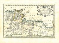
1656rif. 78507Uten sted. Paris 1656. Tverr4to. Arkets størrelse : 335 cm X 245 cm. Med samtidig grensekolorering. Fransk. Nicolas Sanson 1600-1667 blir regnet for å være grunnleggeren av fransk kartografi. Kommer fra atlaset “L’Afrique” med flere senere utgivelser. unknown
1656rif. 78505Uten sted. Paris 1656. Tverr4to. Arkets størrelse : 335 cm X 245 cm. Med samtidig grensekolorering. Fransk. Nicolas Sanson 1600-1667 blir regnet for å være grunnleggeren av fransk kartografi. Kommer fra atlaset “L’Afrique” med flere senere utgivelser. unknown
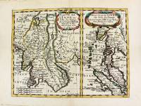
1652rif. M8177Paris. 1652. Very Good. Notes: Fine 17th century map of Thailand Burma and Malaysia. Size : 191x249 mm 7.50x9.80 Inches Coloring: Original Hand Coloring Category: Maps Asia South East Thailand Laos Vietnam Cambodia & Burma / Myanmar; Maps Asia South East Malaysia & Singapore; unknown
1666rif. M1204Paris: Mariette Pierre 1666. Very Good. Size : 410x555 mm 16.125x21.875 Inches Coloring: Hand Colored Reference: Mojski Piotr Maria "Cartographia Rappersviliana Polonorum" page 388 number 32; Category: ; Maps Europe Poland Lithuania Mariette, Pierre unknown
1665rif. M589Paris: Mariette Pierre 1665. Excellent. Size : 410x560 mm 16.125x22 Inches Coloring: Hand Colored Reference: Mojski Piotr Maria "Cartographia Rappersviliana Polonorum" page 387 number 31; Category: ; Maps Europe Poland Lithuania Mariette, Pierre unknown
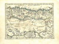
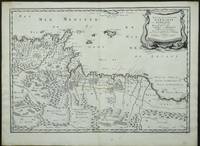
rif. 3952Paris: 1655. No binding. Very Good. 370 x 530 mm. in early outline colour in very good condition. Engraved by Joannes Somer and published in Paris by Pierre Mariette this attractive map of central north Africa bears an ornate title cartouche top right. It is centred on Tunisia and Libya and includes the island of Malta in the Mediterranean. It comes from Sanson's 'Cartes Generales de Toutes les Parties du Monde'. Pastoureau Sanson V A no. 16. 1655 unknown
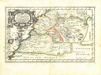
1683rif. 297468Paris 1683. unbound. Map. Copper engraving with hand coloring. Image measures 7 5/8 x 11 1/4 inches. This map published in Paris in Afrique en plusieurs cartes is one of Sanson's small atlas maps of depicting various African regions. This map offers extensive detail on the cities of North Africa as well as topographical and geographical features with mountains beautifully rendered in profile. Nicolas Sanson 1600-1667 is considered the founder of the French school of cartography. In reaction to the prevailing trend of Dutch lavishness Sanson favored minimal details focusing rather on accurate cartography than ornament. This map is a fine example of his work. unknown
1683rif. 297468Paris 1683. unbound. Map. Copper engraving with hand coloring. Image measures 7 5/8 x 11 1/4 inches. This map published in Paris in Afrique en plusieurs cartes is one of Sanson's small atlas maps of depicting various African regions. This map offers extensive detail on the cities of North Africa as well as topographical and geographical features with mountains beautifully rendered in profile. Nicolas Sanson 1600-1667 is considered the founder of the French school of cartography. In reaction to the prevailing trend of Dutch lavishness Sanson favored minimal details focusing rather on accurate cartography than ornament. This map is a fine example of his work. unknown books
1652rif. LBW041961652. 188 x 251 mm.
1656rif. 78506Uten sted. Paris 1656. Tverr4to. Arkets størrelse : 335 cm X 245 cm. Med samtidig grensekolorering. Fransk. Nicolas Sanson 1600-1667 blir regnet for å være grunnleggeren av fransk kartografi. Kommer fra atlaset “L’Afrique” med flere senere utgivelser. unknown