SansonBiblio.com
1 001 résultats
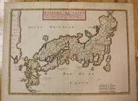
1656réf. M8114Paris c.1656. Very Good. Size : 375x521 mm 14.76x20.51 Inches Coloring: Original Hand Coloring Category: Maps Asia Far East Japan & Korea; unknown
1656réf. 78503Uten sted. Paris 1656. Tverr4to. Arkets størrelse : 335 cm X 245 cm. Med samtidig grensekolorering. Fransk. Nicolas Sanson 1600-1667 blir regnet for å være grunnleggeren av fransk kartografi. Kommer fra atalset “L’Afrique” med flere senere utgivelser. unknown
réf. H32ca. 1750. 30 mal 21 cm. Gefalt. Karte. unknown
1663réf. LBW-9481663 417 x 378 mm.
1720réf. LBW-464Amsterdam, J. Covens et C. Mortier, [circa 1720]. 400 x 501 mm.
1710réf. M10331Amsterdam: Jean Covens & Corneille Mortier c.1710. Very Good. Size : 410x508 mm 16.14x20.00 Inches Coloring: Original Outline Coloring Category: Maps Africa North; Maps Europe Continent; Maps Mediterranean Sea; Jean Covens & Corneille Mortier unknown
1710réf. M10332Amsterdam: Jean Covens & Corneille Mortier c.1710. Very Good. Size : 403x555 mm 15.87x21.85 Inches Coloring: Original Outline Coloring Category: Maps Mediterranean Sea; Maps Asia Middle East; Jean Covens & Corneille Mortier unknown
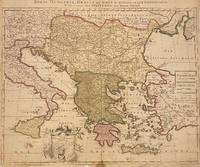
1705réf. 311838Amsterdam: Petrus Schenk 1705. unbound. Map. Engraving with original hand outline. Image measures 18 7/8" x 22 3/4" Beautiful map of southeastern Europe extending from Italy to Turkey and from Hungary to Cyprus. Published circa 1705 this map depicts the region during the Ottoman-Habsburg wars. In fair condition. Wear to original centerfold with tape repair and stain at bottom edge. Lower margin worn and frayed not affecting the image. Minor cracking and small loss near center due to oxidization of original viridian green coloring. Some foxing. Publisher's crease to upper right corner. Sold as-is. Petrus Schenk c.1660--1711 was a German engraver and cartographer. He began his training in Amsterdam in the art of mezzotint and soon began working closely with Gerard Valck. The two took advantage of the bustling cartographic trade in the city and quickly expanded their business from portraits and prints into maps and globes. In 1700 Schenk grew the business further by moving to Leipzig Germany and opening a shop. As his sons and grandson returned to the Netherlands to become active engravers as well the Schenk firm developed into one of the best-known publishing houses in 18th-century Amsterdam. This map attests to Schenk's prolific production and skill in both cartographic artistry and business. Petrus Schenk unknown books
1705réf. 311838Amsterdam: Petrus Schenk 1705. unbound. Map. Engraving with original hand outline. Image measures 18 7/8" x 22 3/4" Beautiful map of southeastern Europe extending from Italy to Turkey and from Hungary to Cyprus. Published circa 1705 this map depicts the region during the Ottoman-Habsburg wars. In fair condition. Wear to original centerfold with tape repair and stain at bottom edge. Lower margin worn and frayed not affecting the image. Minor cracking and small loss near center due to oxidization of original viridian green coloring. Some foxing. Publisher's crease to upper right corner. Sold as-is. Petrus Schenk c.1660--1711 was a German engraver and cartographer. He began his training in Amsterdam in the art of mezzotint and soon began working closely with Gerard Valck. The two took advantage of the bustling cartographic trade in the city and quickly expanded their business from portraits and prints into maps and globes. In 1700 Schenk grew the business further by moving to Leipzig Germany and opening a shop. As his sons and grandson returned to the Netherlands to become active engravers as well the Schenk firm developed into one of the best-known publishing houses in 18th-century Amsterdam. This map attests to Schenk's prolific production and skill in both cartographic artistry and business. Petrus Schenk unknown
1943réf. 38552D. Appleton -Century. Good with no dust jacket. 1943. Revised Edition. Hardcover. Spine is straight binding is tight name sticker inside the book reading pages have some underlining some wear. Map is in very good condition and comes with the book.; 9x6x1.5; 554 pages . D. Appleton -Century hardcover
réf. ria9782343199894_inpPaperback. New. New Book; Fast Shipping from UK; Not signed; Not First Edition; Véritable making of baigné de la folie permanente des tournages Quelques années de lumière offre le point de vue rare d'un personnage clé du plateau le chef électricien. Avec enthousiasme et toujours à juste distance Philippe Sanson paperback
réf. 2343199892.Gpaperback. Good. Access codes and supplements are not guaranteed with used items. May be an ex-library book. paperback
réf. 0428634230.Ghardcover. Good. Access codes and supplements are not guaranteed with used items. May be an ex-library book. hardcover
réf. 0282047352.Gpaperback. Good. Access codes and supplements are not guaranteed with used items. May be an ex-library book. paperback
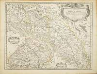
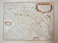
réf. 10820Paris: 1679. No binding. Good. 420 x 550 mm. early outline colour in good condition. This map of part of a portion of Eastern Europe includes Bohemia Silesia Moravia and Lusatia. It was published in Paris by Pierre Mariette in Nicolas Sanson's 'Les Cartes Generales' first published in 1658. This example is the second state dated 1679. It includes Frankfurt am oder in the upper left Glogow and Breslau Wroclaw. An inset of Moravia is centred on Olmutz present day Olomouc. Sanson was France's premier cartographer and helped to lift French work in this area to another level. His atlas is the first full world atlas to be produced in France. This work had been in development for several years as the dates on the various maps attest. Pastoureau M. Sanson V 59; Phillips P.L. Atlases 4260. 1679 unknown
1778réf. M4133Paris: Fortin 1778. Very Good. Notes: Map showing Bohemia Silesia Moravia and Lusatia. Size : 420x545 mm 16.5x21.5 Inches Coloring: Hand Colored Category: Maps Europe Poland Lithuania Fortin unknown
réf. 90477PARIS Chez l’Auteur 1658. Title cartouche to lower left corner. Blank on verso. In good condition. Some light tanning on edges with a few faint foxing marks. With original outline hand colouring. Engraved Size 17.5 x 23 inches Nicolas Sanson 1600-1667 sometimes called Nicolas Sanson d'Abbeville or Sanson d'Abbeville was the most important French cartographer of the 17th century. Tooley called Sanson "the founder of the French school of cartography." He began making maps in the late 1620s and in the 1630s he was working with Melchior Tavernier. Later Sanson worked in concert with the print publisher Pierre Mariette with whom he published his great atlas: Cartes générales de toutes les parties du monde 1658. After Sanson's death in 1667 his son Guillaume carried on the business in partnership with Alexis Hubert Jaillot. Guillaume established himself as a very important French mapmaker in his own right. PARIS Chez l’Auteur 1658 unknown
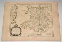
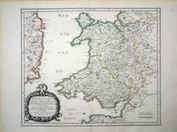
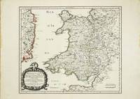
réf. 6460Paris: 1658. No binding. Very Good. 370 x 435 mm. in fine early outline colour good condition. An attractive map of the whole of Wales first published in Nicolas Sanson's 'Les Cartes Generales de Toutes les Parties du Monde' in 1658. Sanson was France's premier cartographer and helped to lift the field onto another level during his career. With an attractive title cartouche lower left in a nice dark impression. The cartography is derived from that of John Speed and includes the neighbouring English counties including Herefordshire Shropshire Worcestershire Cheshire parts of Gloucestershire and Staffordshire. To the west the proximity of the Irish coast is depicted. Not in Booth; Pastoureau M. Sanson V 27; Roberts Iolo & Menai 'Printed Maps of the whole of Wales 1573-1837' Part 1 in 'The Map Collector' no. 68 pp. 34-9; Shirley 2004 T.San 2a no. 13. 1658 unknown
réf. 10634Paris: 1658. No binding. Very Good. 370 x 435 mm. in fine early outline colour good condition. An attractive map of the whole of Wales first published in Nicolas Sanson's 'Les Cartes Generales de Toutes les Parties du Monde' in 1658. Sanson was France's premier cartographer and helped to lift the field onto another level during his career. With an attractive title cartouche lower left in a nice dark impression. The cartography is derived from that of John Speed and includes the neighbouring English counties including Herefordshire Shropshire Worcestershire Cheshire parts of Gloucestershire and Staffordshire. To the west the proximity of the Irish coast is depicted. Provenance: Doreen Green 1996; private collection. Not in Booth 1977; Pastoureau 1980 Sanson V 27; Roberts 1994 14; Shirley 2004 T.San 2a no. 13. 1658 unknown
1643réf. 30932S.l., chez l'Autheur [sic], 1643 - A Paris, de l'Imprimerie de Robert Mansion, 1636 - A Paris, chez Antoine de Sommaville, 1655 - A Paris, s.é., 1604 (pour le troisième texte ; divisé en trois parties à pagination séparée). 3 ouvrages (le dernier composé de 3 parties) reliés en un fort vol. au format in-12 (173 x 112 mm) de 1 f. bl., 3 ff. n.fol. et 106 pp. ; 1 f. bl., ; 4 ff. n.fol. et 111 pp. ; 3 ff. n.fol. et 50 pp. ; 3 ff. n.fol. et 63 pp. ; 72 pp. et 2 ff. n.fol. de Privilège in fine. Reliure de l'époque de plein veau glacé blond, larges fleurons angulaires et fleuron central dorés portés sur chacun des plats, dos à nerfs orné de filets gras à froid, roulette dorée sur les nerfs, caissons d'encadrement dorés, filets verticaux dorés, filets en pointillés dorés, larges fleurons dorés, semis de pointillés dorés, pièce de titre de maroquin fauve, titre doré, palette dorée en tête et queue, roulette dorée sur les coupes, tranches mouchetées.
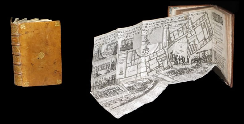
1643réf. 309321643. S.l. chez l'Autheur sic 1643 - A Paris de l'Imprimerie de Robert Mansion 1636 - A Paris chez Antoine de Sommaville 1655 - A Paris s.. 1604 pour le troisiÂme texte ; divis en trois parties pagination spare. 3 ouvrages le dernier compos de 3 parties relis en un fort vol. au format in-12 173 x 112 mm de 1 f. bl. 3 ff. n.fol. et 106 pp. ; 1 f. bl. ; 4 ff. n.fol. et 111 pp. ; 3 ff. n.fol. et 50 pp. ; 3 ff. n.fol. et 63 pp. ; 72 pp. et 2 ff. n.fol. de PrivilÂge in fine. Reliure de l'poque de plein veau glac blond larges fleurons angulaires et fleuron central dors ports sur chacun des plats dos nerfs orn de filets gras froid roulette dore sur les nerfs caissons d'encadrement dors filets verticaux dors filets en pointills dors larges fleurons dors semis de pointills dors piÂce de titre de maroquin fauve titre dor palette dore en tÂte et queue roulette dore sur les coupes tranches mouchetes. Le prsent exemplaire renferme trois textes ; relis en un volume. Le Crmonial de l'lection des Papes closant le prsent volume est ici bien complet de ses 3 parties ainsi que de ses deux grandes planches dpliantes graves. Les deux premiers ouvrages sont l'oeuvre de Nicolas Sanson d'Abbeville clÂbre cartographe s'il en est. Coiffe infrieure arase. Quelques tches brunes sur les plats. Contre-gardes absentes. Quelques feuillets lgÂrement oxyds et rousseurs dans les corps d'ouvrages. Restauration ancienne au revers de chacun des planches. Du reste belle condition. Rare. b42961 unknown
1652réf. LBW041971652 192 x 243 mm.
réf. 25075089-nnew. unknown
2016réf. x-0520290852Univ of California Pr 2016. Paperback. New. 324 pages. 9.00x6.00x0.75 inches. Univ of California Pr paperback
réf. 0520290852.Gpaperback. Good. Access codes and supplements are not guaranteed with used items. May be an ex-library book. paperback