Mortier, Pierre - SansonBiblio.com
977 resultados
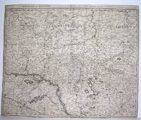
1690ref. M2919Amsterdam 1690. Good; fold reinforced. Size : 480x596 mm 18.875x23.5 Inches Coloring: Black & White Category: ; Maps Europe Hungary; Maps Europe Poland Lithuania unknown
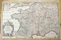
1690ref. M10380Paris: H. Jaillot c.1690. Very Good backed on acid free tissue paper for long term preservation. Notes: Large and detailed map of France with a large decorative cartouche in the lower left two sheets joined. Size : 565x896 mm 22.24x35.28 Inches Coloring: Original Outline Coloring Category: Maps Europe France; H. Jaillot unknown
ref. 117739Paris H. Jaillot 1692 but 1696. . Large two-sheet engraved map of Ireland with extremely fine original hand colouring heightened with gold; sheet size: 945 x 628 mm.; left margin cropped into the scale some minor offset and reinforcement to fold on verso; framed & glazed: 1000 x 710 mm. One of the best large format maps of Ireland issued in the late 17th early 18th century. The map shows towns counties mountains islands and a host of other fine details. The title cartouche is impressive with the coat of arms all in stunning full original colour delicately heightened in gold. Based upon the geographical compilations and work of Nicolas Sanson which remained unpublished at the time of his death. In 1674 Jaillot conceived of the re-issue of Sanson's major work published and unpublished in an enlarged format. The maps were issued as early as 1674 and were later jointly issued by Sanson and Mortier in Amsterdam. Paris, H. Jaillot, 1692 [but 1696]. unknown
ref. 117736Paris H. Jaillot 1693 but 1696. . Large two-sheet engraved map of Scotland with extremely fine original hand colouring heightened with gold; sheet size: 945 x 628 mm some minor offset; framed & glazed: 1000 x 710 mm. One of the best large format maps of Scotland issued in the late 17th early 18th century. The map shows towns counties mountains islands and a host of other fine details. The title cartouche is impressive with the coat of arms all in stunning full original colour delicately heightened in gold. Based upon the geographical compilations and work of Nicolas Sanson which remained unpublished at the time of his death. In 1674 Jaillot conceived of the re-issue of Sanson's major work published and unpublished in an enlarged format. The maps were issued as early as 1674 and were later jointly issued by Sanson and Mortier in Amsterdam. Paris, H. Jaillot, 1693 [but 1696]. unknown
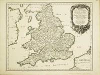
ref. 10525Paris: 1665. No binding. Very Good. 400 x 510 mm. superb early outline colour very good condition. A FIRST STATE example of an ornate map of England and Wales first published in Nicolas Sanson's 'Les Cartes Generales de Toutes les Parties du Monde' in 1665. Sanson 1600-67 was France's premier cartographer and helped to lift the field onto another level during his career. In 1665 two folio maps were issued one of the British Isles and this of England and Wales. The map outlines the modern counties along with the traditional Anglo-Saxon heptarchy which are here outlined in colour. With an attractive cartouche upper right. The cartography is derived from that of John Speed Willem Blaeu and Johannes Jansson. This is an example of the first state dated 1665 according to Shirley however since then two further states dated similarly have been identified. This example remains the first state. Provenance Doreen Green 2003. Pastoureau M. Sanson V B 117; Shirley R.W. Sanson 3.1. 1665 unknown
1665ref. M1736Paris: Mariette Pierre 1665. Excellent; some light browning on upper margin. Size : 410x535 mm 16.125x21 Inches Coloring: Original Hand Coloring Category: ; Maps Europe France Mariette, Pierre unknown
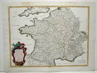
1700ref. 104160Copper engraved map double page 24" x 20" hand colored and large uncolored title cartouches. Some minor soiling a little wear along centerfold with old verso repair normal aging; very good. Samson 1600-1667 is often referred to as the father of French cartography. Louis XIII was impressed with his work and appointed him "Geographe Ordinaire du Roi". During his career Sanson would produce about 300 maps and his major atlas "Cartes Generales de Toutes les Parties du Monde" would represent an important part of his body of work. While two of his sons continued publication of his maps after his death Pieter Schenk 1655-1718 an important publisher and engraver in his own right published this map. The map is attractively colored and gives a detailed view of the provinces of France. The map is also decorated with a large title cartouche. Bagrow p. 185. map hist website.
2003ref. BN528626JMG Editions 2003. 2003. Le Plaisir De Tuer Le Plaisir De Tuer Sanson Charly und Richard Bessière JMG Editions unknown
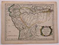
1657ref. W2347Paris: Chez Sanson 1657. Image is 8 1/8 inches by 11 inches on a folded sheet measuring 9 inches by 12 13/16 inches. Original hand-colored copper-engraved map from Sanson's atlas of maps of the Americas: L'Amerique en Plusieurs Cartes. It is a map of the Viceroyalty of Peru that displays the Amazon River and its many tributaries. Nicolas Sanson 1600-1667 was the official geographer for the king of France. His map of Peru and the Amazon became the standard that was copied by almost all geographers/cartographers--even reproduced by Bion for his 1700 treatise on globes. Cintra and Oliveira argue that Sanson's map was a scientific one that holds up well even when compared to 21st century maps of the region. The map is in about very good condition: clean with bright original outline color; minimal foxing ; some edgewear and soiling in the margins. . First Edition. Single Sheet. Very Good-. 8 1/8 inches by 11 Inches. Map. Chez Sanson
2013ref. 154364L'Harmattan L'Harmattan, 2013. Grand in-8 broché de 367 pages. Rares passages soulignés au crayon de papier. Très bon état
ref. RO20240356A compte d'auteur. Non daté. In-8. Broché. Bon état, Couv. convenable, Dos fané, Intérieur frais. 52 pages. Quelques illustrations en noir et blanc hors texte. Texte tapuscrit.. . . . Classification Dewey : 646.72-Soins de beauté
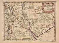
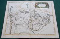
1657ref. 326341Paris 1657. unbound. Map. Original outline coloring. Sheet measures 8 3/4" x 12 1/8". Image measures 8" x 10 5/8". Paris: Nicolas Sanson 1657. This rare 17th century map by Nicolas Sanson with original color depicts the region showing present day Paraguay Uruguay with parts of Brazil and Argentina. Mountains are rendered pictorially and cities rivers and notations describing indigenous populations are labeled. In very good condition. Nicolas Sanson 1600-1667 is considered the founder of the French school of cartography. In reaction to the prevailing trend of Dutch lavishness Sanson favored minimal details focusing rather on accurate cartography than ornament. unknown books
1668ref. 014632Paris: Cartes Generales de Toutes les Parties du Monde. 1668. Hand coloured. Map measures 55x40.cm plus margin. Some light surface wear or dust marking. Map in good condition. Boldly engraved map of the region of present day Paraguay Uruguay northern Argentina and parts of Chile and Brazil. The Rio de la Plata is the main feature of the map which extends north to the mythical Lago de los Xarayes. The mountains and volcanoes of the Cordillera de los Andes are also prominently shown. There is good detail of topography missions and villages. The decorative title cartouche is adorned with two female figures fruit and flowers. Very Good. Cartes Generales de Toutes les Parties du Monde.. unknown
1657ref. 326341Paris 1657. unbound. Map. Original outline coloring. Sheet measures 8 3/4" x 12 1/8". Image measures 8" x 10 5/8". Paris: Nicolas Sanson 1657. This rare 17th century map by Nicolas Sanson with original color depicts the region showing present day Paraguay Uruguay with parts of Brazil and Argentina. Mountains are rendered pictorially and cities rivers and notations describing indigenous populations are labeled. In very good condition. Nicolas Sanson 1600-1667 is considered the founder of the French school of cartography. In reaction to the prevailing trend of Dutch lavishness Sanson favored minimal details focusing rather on accurate cartography than ornament. unknown
1657ref. 56721Histoire et Geographie de l'Amerique. 1657. Attractive map of Paraguay. Title cartouche at top right. Maps by Sanson in original colour are rare. Nicolas Sanson was founder of the French school of mapmakers at a time when the leadership in European cartography passed from the Low Countries to France. Copper engraving. Fine condition; very light offsetting. Original outline colour. Size: 28.5 x 21.5 cm. 11 x 8½ inches unknown
1843ref. R100686Paris, Gustave Martin 1843 vi + 480pp., 18cm., reliure cart. (dos en cuir avec titre et décorations dorées, plats marbrés), feuilles de garde marbrées, rousseurs (mais le texte est toujours bien lisible), R100686
1855ref. 015717Jacques Lecoffre et Cie, Editeurs reliure Rigide Décorative Paris 1855 460 pages en format 12 - 18 cm - cachet - reliure rigide en cuir repoussé avec dos et titre en dorure - BE
1867ref. 011859Lecoffre Fils et Cie reliure Rigide Décorative Paris Lyon 1867 460 pages en format 11 - 18 cm - reliure rigide en plein cuir avec dos en dorure et plats marbrés - TBE
1867ref. RO30145676LECOFFRE FILS ET CIE. 1867. In-12. Broché. Etat d'usage, Couv. convenable, Mors fendus, Quelques rousseurs. 460 pages -. . . . Classification Dewey : 200-RELIGION
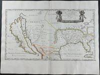
1656ref. 9429Engraving outlined in original color in the third state with Chez l'Autheur to the cartouche. Sanson's first large format regional map of North America depicting California as an island. The map measures approximately 21.5 x 12.5 in 54.5 x 32 cm with the paper size being 23.5 x 17.75 in 60 x 45 cm. Scarce.
1976ref. ABE-154004066633336 PAGES-35 CM X 50 CM-LIBRES OPINIONS: LES CHRETIENS ET LE COMMUNISME, PAR GILBERT CESBRON-LA TRAGEDIE DE TROYES DESAVOUER OU SANCTIONNER, PATRICK HENRY-LE MEURTRE DE BRIGITTE DEWEVRE LA COUR D'APPEL DE PARIS CONFIME LA RELAXE DE JEAN-PIERRE-XAVIER GRALL UN POETE DE PLEIN VENT-LOUISE MICHEL LA PETROLEUSE AU COEUR DE MYOSOTIS-L'ACADEMIE FRANCAISE A RECU LE PERE CARRE, 4P, LE DISCOURS DU RECIPIENDAIRE, DESSIN DE MARCK RUDNICKI, LA REPONSE DE M. JEAN GUITTON, DESSIN DE MARCK RUDNICKI-JEAN MALAURIE LE CHERCHEUR DES MERS FROIDES, DESSIN DE JEAN-PIERRE CAGNAT-VARIETES PAR CLAUDE FLEOUTER: VERONIQUE SANSON-MALGRE LA PROCEDURE ACCELEREE LE PROCES DE PATRICK HENRY N'AURAIT PAS LIEU AVANT QUATRE MOIS-ANNOTATIONS 2 LIGNES EN MARGE SUP DE UNE
1975ref. ABE-161157805968332 PAGES-"DROLE DE CRISE" EN ANGLETERRE, PAR NICOLE BERNHEIM, DEMI PAGE-RELIGION: A RENNES DES FAMILLES CREENT UNE ASSOCIATION POUR DEFENDRE LEURS ENFANTS CONTRE UNE SECTE SUD COREENNE-LES MATERNELLES VICTIMES DE LEUR SUCCES II APPRENDRE LE PLAISIR DE PARLER, PAR CATHERINE ARDITTI-VARIETES, PAR CLAUDE FLEOUTER: VERONIQUE SANSON A L'OLYMPIA-COMPLET-QUELQUES ROUSSEURS EN MARGE G DE UNE
1978ref. ABE-1586234314944 PAGES FORMAT 34 CM X 50 CM-ENTRETIEN AVEC MIKEL DUFRENNE II POUR UN ART POPULAIRE AUTOGERE, PROPOS RECUEILLIS PAR LUCIEN MALSON-LA CRISE DU ZAIRE ET LES CONFLITS EN AFRIQUE LES ROUGES ET LES NOIRS, PAR ANDRE FONTAINE-MAI MAIS. MAIS MAI I MAI SPHINX, PAR EDGAR MORIN-ON A ENCORE VU MESRINE.-LE MUNDIAL, DOUBLE ENJEU POUR LE REGIME ARGENTIN, PAR GERARD ALBOUY-M. BERNARD-HENRI LEVY ASSIGNE A RESIDENCE-LE XXXIe FESTIVAL DE CANNES RETOUR AU CINEMA-SPECTACLE, PAR JACQUES SICLIER-VERONIQUE SANSON AU PALAIS DES SPORTS-APRES LE LICENCIEMENT DU DIRECTEUR-REGISSEUR LE GRAND HOTEL DE CABOURG SUR LA SELLETTE-DES MERCENAIRES DIRIGES PAR BOB DENARD AURAIENT PARTICIPE AU COUP D'ETAT AUX COMORES
1925ref. 3836865362GLN-7, Spes 1925