Sanson, Nicolas dAbbevilleBiblio.com
1001 resultados
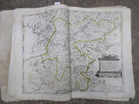
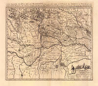
1693ref. 19103Amsterdam: Pierre Mortier 1693-1700. Other. A strong impression in excellent condition. 490 by 580mm 19 by 22 inches. 490 by 580mm 19 by 22 inches. Original antique copper engraving uncolored from the 'Atlas Nouveau' published in Paris 1693. Depicting Mantua this map is a fine example of 1690s European cartography. Image: 490 by 580mm 19 by 22 inches. An attractive and historically significant 17th-century map for the discerning collector. Nicolas Sanson d'Abbeville 16001667 was the founder of the French school of cartography and arguably the most important French cartographer of the 17th century. Appointed Géographe Ordinaire du Roi to Louis XIII in 1630 he produced hundreds of maps that set a new standard for geographic accuracy and systematic coverage. His work was continued and expanded by Alexis-Hubert Jaillot and later by Pierre Mortier in Amsterdam ensuring that Sanson's surveys remained in use well into the 18th century. Maps bearing the Sanson name are prized for their scholarly precision large format and the elaborate cartouches that reflect the grandeur of the Sun King's court.Large detailed and interesting map by the famous French cartographer Nicolaus Sanson published in the famous sea atlas Le Neptune francois. in Amsterdam at Pierre Mortier. This interesting and large map was originally first published in the Atlas Noveau. by Alexis Hubert Jaillot & N. Sanson in Paris 1683-89. Alexis Hubert Jaillot & Nicolaus Jaillot worked as a royal cartographers for the French royal house for king Louis XIV. His maps published for the Atlas Nouveau. can be regarded as masterpieces of cartography in France in the ending 18th century. Also the maps impress by their accuracy and are providing an enormous amount of place names monasteries rivers trails fortifications etc. Shown is the duchy of Mantua Mantova in Northern Italy. Mantua is shown prominently in the center of the map. The map provides many place names detailed information on the river system also in the lower right corner a cartouche with a mileage scale and a table of explanations.A fine example from Atlas Nouveau Paris / Amsterdam sought after by collectors of antique maps of Italy antique maps of Mantua and antique copper engraving uncoloreds for sale. In good condition consistent with age. Shown is the duchy of Mantua Mantova in Northern Italy. Mantua is shown prominently in the center of the map. The map provides many place names detailed information on the river system also in the lower right corner a cartouche with a mileage scale and a table of explanations. Pierre Mortier unknown
1812ref. 006820Paris: Chez Jean Md d'Estampes 1812 Engraving 59 x 90 cm old color. The first edition of this map was published in 1674 by Hubert Jaillot under the title "La Russie Blanche ou Moscovie divisee suivant l'étendue des Royaumes Duches." It was incorporated into numerous atlases by Jaillot and his successors until approximately 1720 when it became evidently outdated. However around 1812 it was reissued likely to illustrate the French-Russian war. Chez Jean Md d'Estampes unknown
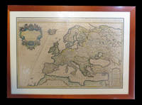
1690ref. 192941690. S.l. Alexis Hubert Jaillot 1680. Une grande carte 892 x 592 mm compose de deux feuillets contrecolls sous cadre moderne. Attractive 892 x 592 mm carte de la fin du XVIIÂme avec rehauts aquarells du temps. Elle s'orne d'un important cartouche aux armes du Grand Dauphin Louis de France et s'agrmente en marge gauche de la figuration de vaisseaux ayant pris part un combat naval. Kupcik Cartes gographiques anciennes p. 159. Papier trÂs lgÂrement oxyd. Prsence de rares et claires rousseurs ou petites tches. Deux plissures et une infime perforation en marge suprieure droite. Du reste belle condition. b42961 unknown
ref. 16-6140Paris: 1653. Folio. 30 x 43.2cm. Defective contemporary thick paper covers. Title page and dedication page with losses. Handcolored in outline. One map with loss in lower right corner and one map with tear in lower right corner Sixteen double page maps complete some with waterstains visible verso.Rare to find such a large ensemble of Sanson's maps. Reference: Bibliothèque nationale de France; ark:/12148/btv1b530780775/; Bibliothèque nationale de France département Cartes et plans GE A-592 RES . Paris: 1653. unknown
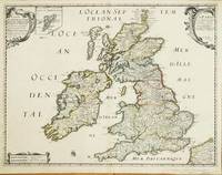
ref. 10523Paris: 1640-c.48. No binding. Good. 405 x 530 mm. early outline colour small lower margin centrefold split repaired otherwise in good condition. A rare map in this second produced by Nicolas Sanson 1600-67 and published by Melchoir Tavernier 1594-1665 and Pierre Mariette c.1602-58. Separately published the map displays a shortened Scotland and exaggerated south west north east slant to Ireland. In later states it would be published in Pierre Mariette's 'Les Cartes Generales de Toutes les Parties du Monde' from 1658. Sanson was France's premier cartographer and helped to lift the field onto another level during his career. With an attractive cartouche upper left and right and an inset map of the Shetland Islands. This second state is determined by the addition of Mariette's imprint to the cartouche upper right. Provenance: private English collection since 2006. Pastoureau 1984 Tavernier IIE 106; Shirley R.W. BI to 1650 506 pl. 80 st. 1. 1640-[c.48] unknown
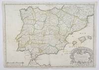
1658ref. 356952Paris.: Tavernier. 1658. Dampstain cover mot of the image also some coffee spots otherwise good. 42.5x57.2x.01 cm. Image size 41x55.5 to neatline. An uncommon map of Spain and Portugal with outline color. weight: 0.1 lb. Engraved by Melchior Tavernier. Tavernier. unknown
1747ref. 20246PARIS SANSON 1747 une carte dépliante sur papier ligné filigrané, reliure bradel cartonné in-octavo (12,6 x 19 cm) recouvert d'un papier velin saumon, titre à l'encre brune sur une etiquette de papier ligné blanc au trois quart centre de la première de couverture, carte ancienne colorée d'époque en vert , rouge et jaune, cartouche non coloré. Format total dépliée : 47 centimètres de haut par 60 centimètres de large (Size: 23 x 18 inches), 1747,
ref. 86020Paris Pliure centrale. Format 43x58 cm marges comprises. Carte fraîche et sans accidents. Carte conservée roulée.
1809ref. 017059Paris Jean Md d'Estampes 1809 Une carte repliée, format in-8°, aux frontières rehaussées sous chemise d'époque. Dimensions de la carte une fois dépliée: 75 cm x 53 cm. (chemise défraîchie, quelques rousseurs, brunissure aux plis).
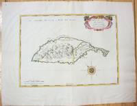
1658ref. M7057Paris 1658. Very Good;. Notes: An early map of the Island of St. Christopher that includes a decorative compass rose in sea area and an ornamental title cartouche in top right decorated with scrolls ribbons and fruit. This is the first printed map of St. Kitts published in "Cartes Generales De Toutes Les Parties Du Monde." With wide margins. Size : 314x429 mm 12.36x16.89 Inches Coloring: Original Outline Coloring cartouche and compass hand coloured Category: Maps West Indies Other Islands; unknown
1780ref. M5125Paris 1780. Excellent. Size : 490x690 mm 19.25x27.125 Inches Coloring: Hand Colored in Outline Category: ; Maps Asia Middle East Holy Land & Palestine unknown
1745ref. 18850Amsterdam Chatelain 1745 une carte ancienne gravée sur cuivre (Copper etching) en noir . Format : 17 x 20,5 cm, Échelle au1:200,000,000ème, pli central vertical normal venant d'un atlas ( vertical centerfold), avec note dans la marge en haut à droite : Tome IV Page 267, pour "l'introduction à l'histoire générale et politique de l'univers, Ou l'on voit l'Origine, les Révolutions, l'Etat présent, & les Intérêts des Souverains" ; Commencée par Mr. le Baron de Pufendorff ; complétée et continuée jusqu'à 1745 par Mr. Bruzen de la Martinière, 8 volumes in-12, 1745 à Amsterdam chez Zacharie Chatelain Editeur,
1674ref. ag658Jaillot H. Carte 1674 Cartes en une partie, 42 par 56 cm ; frontières surlignées en couleur, mouillures marginales, n'atteignant pas la carte, bel exemplaire. Livraison a domicile (La Poste) ou en Mondial Relay sur simple demande.
1676ref. bb3407Jaillot H. Carte 1676 Cartes en deux parties, 53 par 90 cm ; frontières surlignées en couleur, très bel exemplaire. Livraison a domicile (La Poste) ou en Mondial Relay sur simple demande.
1676ref. ag661Jaillot H. Carte 1676 Cartes en deux parties, 53 par 90 cm ; frontières surlignées en couleur, petites déchirures marginales, bel exemplaire. Livraison a domicile (La Poste) ou en Mondial Relay sur simple demande.
1695ref. bb3406Jaillot H. Carte 1695 Carte de 43 x 57 cm en une partie : frontières colorées ; petites déchirures marginales sans gravité, bon exemplaire. Livraison a domicile (La Poste) ou en Mondial Relay sur simple demande.
1695ref. ag659Jaillot H. Carte 1695 Carte de 43 x 57 cm en une partie : frontières colorées ; petites déchirures marginales sans gravité, bon exemplaire. Livraison a domicile (La Poste) ou en Mondial Relay sur simple demande.
1675ref. bb3400Jaillot H. Carte 1675 Carte de 41 x 56 cm en une partie : frontières colorées ; petits défauts, très bon exemplaire. Livraison a domicile (La Poste) ou en Mondial Relay sur simple demande.
1675ref. ag657Jaillot H. Carte 1675 Carte de 41 x 56 cm en une partie : frontières colorées ; petits défauts, très bon exemplaire. Livraison a domicile (La Poste) ou en Mondial Relay sur simple demande.
1674ref. ag662Jaillot H. Carte 1674 Carte de 43 x 57 cm en une partie : frontières colorées ; petites déchirures marginales sans gravité, bon exemplaire. Livraison a domicile (La Poste) ou en Mondial Relay sur simple demande.
1651ref. 284611651 une carte ancienne gravée sur cuivre (Copper etching) en noir . Format : 44 x 58 cm, par Nicolas SANSON carthographe, 1651 [s.n.] Editeur,
1662ref. 280971662 une carte ancienne gravée sur cuivre (Copper etching) en noir . Format : 46,5 x 58 cm, par Nicolas SANSON carthographe, 1662 [s.n.] Editeur,
1745ref. 18871Amsterdam Chatelain 1745 une carte ancienne gravée sur cuivre (Copper etching) en noir . Format : 17 x 19,5 cm, Échelle au1:200,000,000ème, pli central vertical normal venant d'un atlas ( vertical centerfold), avec note dans la marge en haut à droite : Tome V Page 117, pour "l'introduction à l'histoire générale et politique de l'univers, Ou l'on voit l'Origine, les Révolutions, l'Etat présent, & les Intérêts des Souverains" ; Commencée par Mr. le Baron de Pufendorff ; complétée et continuée jusqu'à 1745 par Mr. Bruzen de la Martinière, 8 volumes in-12, 1745 à Amsterdam chez Zacharie Chatelain Editeur,
1745ref. 18867Amsterdam Chatelain 1745 une carte ancienne gravée sur cuivre (Copper etching) en noir . Format : 17 x 19,5 cm, Échelle au1:200,000,000ème, pli central vertical normal venant d'un atlas ( vertical centerfold), avec note dans la marge en haut à droite : Tome V Page 117, pour "l'introduction à l'histoire générale et politique de l'univers, Ou l'on voit l'Origine, les Révolutions, l'Etat présent, & les Intérêts des Souverains" ; Commencée par Mr. le Baron de Pufendorff ; complétée et continuée jusqu'à 1745 par Mr. Bruzen de la Martinière, 8 volumes in-12, 1745 à Amsterdam chez Zacharie Chatelain Editeur,
1745ref. 18868Amsterdam Chatelain 1745 une carte ancienne gravée sur cuivre (Copper etching) en noir . Format : 17 x 19,5 cm, Échelle au1:200,000,000ème, pli central vertical normal venant d'un atlas ( vertical centerfold), avec note dans la marge en haut à droite : Tome V Page 177, pour "l'introduction à l'histoire générale et politique de l'univers, Ou l'on voit l'Origine, les Révolutions, l'Etat présent, & les Intérêts des Souverains" ; Commencée par Mr. le Baron de Pufendorff ; complétée et continuée jusqu'à 1745 par Mr. Bruzen de la Martinière, 8 volumes in-12, 1745 à Amsterdam chez Zacharie Chatelain Editeur,