Sanson d'Abbeville, NicholasBiblio.com
SANSON d'ABBEVILLE (Nicolas);Livre Rare Book
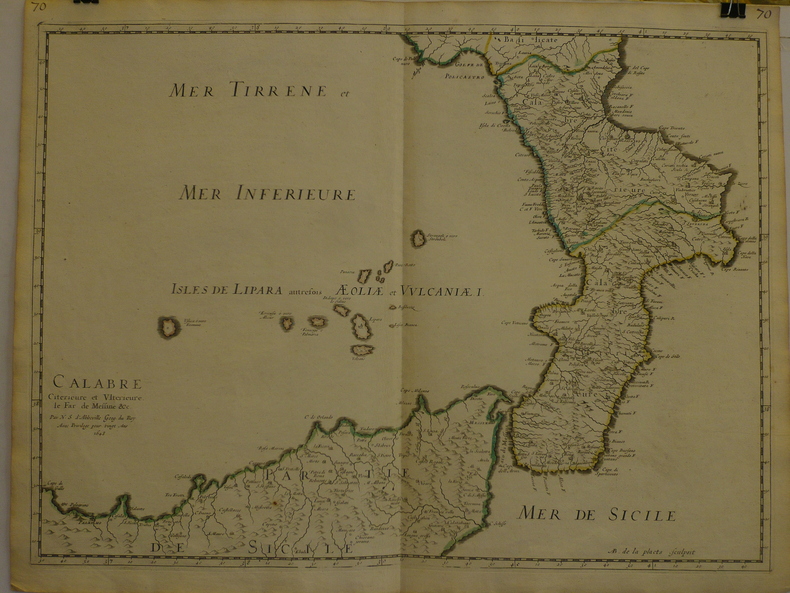
Calabre citérieure et ultérieure, le far de Messine &c.
1648réf. LBW-9691648 409 x 558 mm.
Librairie Le Bail · Paris, France200,00 €
1 001 résultats
réf. 3239Americas: Amsterdam Francois Halma 1705. Copper engraved map of Canada by N. Sanson from Halma's Algemeene Werelde Beschryving Vol. 3 Black and white; title in Dutch; verso blank; strapwork title cartouche. Attractive small map of Canada and the Great Lakes a reduced version of one of the most influential seventeenth century maps of the French and English colonies in North America. It concentrates on the region of greatest French interest. The entire Great Lakes basin and the St. Lawrence River are shown in great detail. The most important aspect of the map is the first appearance of L. Erie ou du Chat as a recognizable lake on an atlas map. This delineation influenced the cartography of the region for more than 100 years and was not superceded until Delisle's "Carte du Canada" in 1703. The map is also an outstanding source for Indian tribal names and locations. Two names:Aouentsiouaeron and Attiouandarons appear here for the first time. Lake Superior and Michigan Lac du Puans are left open-end to the west. Embellished with a nice title cartouche and engraved by Anthoine d'Winter. This is the third state. Published in Francois Halma's Dutch edition of A. Pherotee de la Croix's Nouvelle Methode Pour Apprendre facilement la Geographie Universelle. Dark impression; dampstaining to lower margin just entering plate; centrefold and 2 further folds to fit in binding. Nicolas Sanson d'Abbeville.1600-67 ' father of the French cartography' and founder of the Sanson firm. Atlas ' Cartes générales de toutes les parties du Monde' 1658-70 and a pocket atlas in 4 parts 1652-1705. Sanson's small maps from A. Phérotée de la Croix's Nouvelle Methode Pour Apprendre Facilement la Geographie Universelle. first published in 1652 and engraved by A. Peyrounin were copied several times by various map publishers. Johann David Zunners made copies of Sanson's maps for his German translation of Die Gantze Erd-Kugel in 1679. Johannes Ribbius and Simon de Vries published copies in 1682 and 1683 with new maps engraved by Antoine d'Winter. The plates were later sold to Francois Halma who used them in 1699 and then again in 1705 with the titles re-engraved in Dutch. François Halma 1653 - 1722 Dutch publisher/printer; dealer/auction house. Cartographer and publisher of maps active in Utrecht Amsterdam Franeker and Leeuwarden. Published 'Description de l'Univers' 1700; 'Algemene Wereldtbescrijving' 1705; 'Corpus Inscriptionum' 1707 and 'Lexicon Philosophicum' 1713. Keoman: Hal 1; Phillips 528; Burden #575; Kershaw #138; McCorkle #683.5. Americas Canada Great Lakes New France Niew Vrankryk Amsterdam Francois Halma 1705 unknown
1648réf. LBW-9691648 409 x 558 mm.
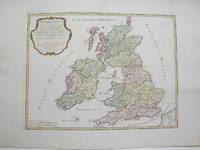
1754réf. M3766Paris 1754. Excellent. Size : 410x540 mm 16.125x21.25 Inches Coloring: Hand Colored Category: ; Maps Europe Ireland;; Maps Europe United Kingdom unknown
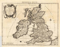
1696réf. 23767Amsterdam: Covens 1696 -1700. Other. In very good to excellent condition. A small tear at the left side. 392 by 517mm 15½ by 20¼ inches. 392 by 517mm 15½ by 20¼ inches. Copper engraving uncolored as published. Covens unknown
réf. 3249Americas: Amsterdam Francois Halma 1705. Copper engraved map of Brazil by N. Sanson from Halma's Algemeene Werelde Beschryving Vol. 3 Black and white; title in Dutch; verso blank; Attractive small map of Brazil; title cartouche surrounded by garland of leaves in centre of country. This map appeared in Algemeene Weereld-Beschryving nae de Rechte Verdeeling der Landschappen Plaetsen Zeeën Rivieren &c. Geographisch Politisch Historisch Chronologisch en Genealogisch a Dutch edition of A. Phérotée de la Croix's Nouvelle Methode Pour Apprendre Facilement la Geographie Universelle which first appeared in 1690. Dark impression; minor dampstain at top of centre fold. Nicolas Sanson d'Abbeville.1600-67 ' father of the French cartography' and founder of the Sanson firm. Atlas ' Cartes générales de toutes les parties du Monde' 1658-70 and a pocket atlas in 4 parts 1652-1705. Sanson's small maps from A. Phérotée de la Croix's Nouvelle Methode Pour Apprendre Facilement la Geographie Universelle. first published in 1652 and engraved by A. Peyrounin were copied several times by various map publishers. Johann David Zunners made copies of Sanson's maps for his German translation of Die Gantze Erd-Kugel in 1679. Johannes Ribbius and Simon de Vries published copies in 1682 and 1683 with new maps engraved by Antoine d'Winter. The plates were later sold to Francois Halma who used them in 1699 and then again in 1705 with the titles re-engraved in Dutch. François Halma 1653 - 1722 Dutch publisher/printer; dealer/auction house. Cartographer and publisher of maps active in Utrecht Amsterdam Franeker and Leeuwarden. Published 'Description de l'Univers' 1700; 'Algemene Wereldtbescrijving' 1705; 'Corpus Inscriptionum' 1707 and 'Lexicon Philosophicum' 1713. Keoman: Hal 1; Phillips 528. Americas South America Brazil Amsterdam Francois Halma 1705 unknown
réf. QWA-18448Albin Michel, 1989, in-8 br. (14,5 x 22,5), 387 p., ex-libris, bon état.
2025réf. __1382052901OUP Oxford 2025. Paperback. New. 5.12x0.59x7.28 inches. OUP Oxford paperback
réf. 0805917675.Gunknown_binding. Good. Access codes and supplements are not guaranteed with used items. May be an ex-library book. unknown
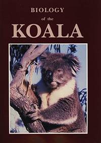
1990réf. Alibris.0038416Surrey Beatty and Sons. 1990. Hard cover. Fine in fine dust jacket. 336 p. illustrations bibliography index. . You will obtain a current view of the knowledge of the biology conservation and care of koalas from this book. The range of topics i comprehensive and a substantial body of new information is included. There is a substantial reassessment of the phylogenetic affinities of the koala; several contributions reviewing the dynamics and status of natural populations; reassessments of our knowledge of diet; a substantial review of digestion which sheds new light on digestive function in hind gut fermenters; the first description of the social system in natural populations of koalas; new information on the endocrine control of reproduction; a substantial body of information on the impact of Chlamydia on koalas; and papers on management. The text includes 31 papers from experienced scientists who have worked in their respective fields. This reference volume emanantes from the Third National Symposium sponsored by the World Koala Research Corporation held in February 1988. Surrey Beatty and Sons hardcover
1991réf. 30970Sydney Chipping Norton: Surrey Beatty & Sons / World Koala Research Corporation 1991. c1990 for 91 ed. Hardback large tall quarto dustjacket very good condition in very good dustjacket three colour plates black & white photos & plates black & white drawings figures tables frontispiece drawing front & rear endpaper minimal foxed spots edges few tiny pinhead marks pastedowns. Heavy 1.4 Kg and extra postage may be requested to destinations outside Australia. 336 pp. This fascinating comprehensive and substantial book gives a current view of the biology conservation and care of koalas. There is a reassessment of the phylogenetic affinities of the koala; several contributions reviewing the dynamics and status of natural populations; reassessments of our knowledge of diet; a substantial review of digestion which sheds new light on digestive function in hind gut fermenters; the first description of the social system in natural populations of koalas; new information on the endocrine control of reproduction; a substantial body of information on the impact of Chlamydia on koalas; and papers on management. The text includes 31 papers from experienced scientists who have worked in their respective fields. This reference volume emanates from the Third National Symposium sponsored by the World Koala Research Corporation held in February 1988. Surrey Beatty & Sons / World Koala Research Corporation hardcover
1859réf. 30434Imp. & Lithographie Vve Marius Olive | Marseille 1859 | 16 x 24.50 cm | broché
1859réf. 30434Marseille: Imp. & Lithographie Vve Marius Olive 1859. Fine. Imp. & Lithographie Vve Marius Olive Marseille 1859 16 x 24.50 cm broché The first edition published in a small number of copies. Autograph inscription from M. de Pongerville at head of front cover. A small tear at head of spine light foxing to covers handsome interior condition. Rare. Imp. & Lithographie Vve Marius Olive unknown
2014réf. BN582237Bouquins 2014. 2014. Softcover. Berlin Berlin David Sanson Bouquins paperback
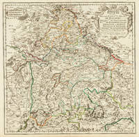
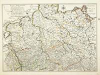
1703réf. 32775Paris 1703. Tadelloses Exemplar. 420 by 420mm 16½ by 16½ inches. Original antiker Kupferstich in zeitgenössischem Grenzkolrit. Dargestellt wird der bayrische Kreis um 1650 im Norden von Eger bis nach dem benachbarten Insbruck im Süden. Im Westen noch mit Ulm a.d. Donau und im Osten bis Linz. Die einzelnen Bezirksämter u. Bistümer deutlich durch das schöne Grenzkolorit herausgearbeitet. Zeigt Ober- u. Niederbayern sowie die Oberpfalz. Rechts oben große dekorative Rollwerkstitelkartusche links oben kleiner Meilenzeiger. Gestochen von R. Cordier. Nicolas Sanson der Ältere 20. Dezember 1600 in Abbeville Frankreich; 7. Juli 1667 in Paris war ein französischer Kartograph. Seine Vorfahren stammten aus Schottland. In den Jahren 1618 bis 1667 schuf Sanson etwa 300 einzelne Karten sowie Atlanten und illustrierte Texte. Seine Arbeit wurde von seinen Söhnen Nicolas Sanson 1626 Schottland; 27. August 1648 in Paris Adrien Sanson 1708 und Guillaume Sanson 1703 seinem Neffen Pierre Duval 1619; 1683 seinem Enkel Pierre Moulard Sanson 1730 und Gilles Robert de Vaugondy 1688; 1766 fortgeführt. Wikipedia Speculum Orbis/Loeb San.VA53 unknown
1703réf. LBW02524Paris chez l'autheur 1703 417 x 560 mm.
réf. 18-1027Paris: 17th Century European Publisher 1648. 22 x 16 inches. Very Good. 17th Century hand colored map of Lower Lombardy. Some toning and two one-inch tears at bottom edge. Text in French. Scarce.Nicholas Sanson 1600-1667 is considered the father of French cartography in its golden age from the mid-seventeenth century to the mid-eighteenth. Over the course of his career he produced over 300 maps. His success can be chalked up to his geographic and research skills but also to his partnership with Pierre Mariette. Previously Sanson had worked primarily with the publisher Melchior Tavernier. Mariette purchased Tavernier’s business in 1644. Sanson worked with Mariette until 1657 when the latter died. Mariette’s son also Pierre helped to publish the Cartes générales de toutes les parties du monde. [Paris]: 17th Century European Publisher, [1648]. unknown
réf. 3402Paris: 1652. No binding. Fair. 375 x 530 mm. very detailed map in original outline colour two wax marks otherwise in good condition. Beautifully engraved map of Germany from Sanson's folio atlas entitled 'Cartes Generales de Toutes les Parties du Monde'. Shirley 'Atlases in the BL' T.San-2a; Pastoureau Sanson VB no. 133. 1652 unknown
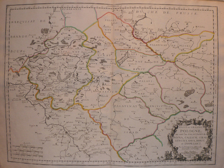
1659réf. 122141659 Limites aquarellées. 1 carte gravée sur cuivre, 43 x 53 cms. P. Sanson 1659
1683réf. LBW-6971683 182 x 276 mm.
1698réf. 6703sans lieu [Amsterdam], sans nom [Pierre Mortier], sans date [circa 1698]. In-8 de [2]-30 pages, 25 cartes, 1 pl., 26 pages, couverture de papier marbré du temps (traces de plis au dos, coins un soupçon cornés).
1988réf. R200114111Sand et Conti. 1988. In-Folio. Relié toilé. Bon état, Couv. convenable, Dos satisfaisant, Intérieur frais. 224 pages. Nombreuses cartes et illustrations en couleur et noir et blanc, dans et hors texte, dont frontispice. Contreplats illustrés d'hémisphères. Titre et auteur dorés sur le 1er plat. Tampon sur la page de faux titre. Un livret de plusieurs pages désolidarisé du reste de l'ouvrage. 2 photos disponibles.. . . . Classification Dewey : 912-Atlas, cartes et plans
1988réf. BN528811Sand & Tchou 1988. 1988. Hardcover. Atlas du monde 1665 de Nicolas Sanson d'Abbeville Atlas du monde 1665 de Nicolas Sanson d'Abbeville Mireille Pastoureau et Nicolas Sanson Sand & Tchou hardcover
réf. 0666936196.Ghardcover. Good. Access codes and supplements are not guaranteed with used items. May be an ex-library book. hardcover
réf. 1332655343.Gpaperback. Good. Access codes and supplements are not guaranteed with used items. May be an ex-library book. paperback
1712réf. 82342Parisiis, Delineabat Petrus Moullart-Sanson , 1712, 55x75cm, Carte colorisée. Pliure centrale. Bon état.