TARDIEU, NICOLAS HENRI,Biblio.com

1694 risultati
rif. #[70062]Oval portrait of Nicolas le Camus French statesman and politician. Below the portrait a coat of arms. Etching and engraving on hand laid paper 228 x 320 mm. engraved by Nicolas Henri Tardieu 1674-1749 after Hyacinthe Rigaud 1659-1743 c. 1700. In fair condition cropped within platemark some paper loss in the top right edge of the sheet a vertical crease in the left edge. Two dark spots in the caption below the image remains of mounting to the verso. References: LeBlanc iv.5: 5; Nagles xviii111: 5. unknown
1847rif. 100091370Firmin didot frères 1847. couverture défraîchie bords frottés tranche ternie intérieur propre mouillure bonne tenue de la reliure. in8. 1847. Cartonné. iconographie en noir et blanc cartes dépliantes Firmin didot frères unknown
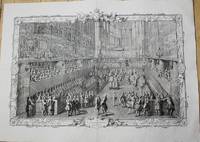
1722rif. P5187Paris 1722-31. Very Good. Notes: A pair of superb early 18th century French copper engraving showing the day of the coronation of Louis XV from Lever du Roi to the Royal Feast. The plates and frames are designed and engraved by Pierre Dulin Perrot Cochin Larmessin Duchange Tardieu Beauvais Desplaces Dupuis Edelinck Chereau Audrand Petit Haussard Jaurat Devret Simonneau Berey Bailleul and Putheau. The Coronation of Louis XV King of France and Navarre in the Church of Reims Sunday October XXV MDCCXXII. Image Size : Platemark Size : 543x794 mm 21.38x31.26 Inches Paper Size : 628x870 mm 24.72x34.25 Inches Coloring: Black & White Medium: Copper Engraving Categories: Portraits Royalty; Views Europe France Others; unknown
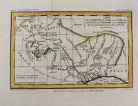
1797rif. M10801Paris 1797. Very Good. Notes: Important early map of present day southern Iraq. Size : 132x208 mm 5.20x8.19 Inches Coloring: Hand Colored Category: Maps Asia Middle East Iran Iraq; unknown
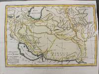
1797rif. M10803Paris 1797. Very Good. Size : 195x288 mm 7.68x11.34 Inches Coloring: Hand Colored Category: Maps Asia Middle East Iran Iraq; unknown
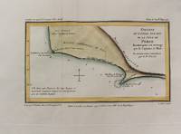
1797rif. M10802Paris 1797. Very Good. Notes: Map of Northern side of the Persian gulf Iran. Size : 98x176 mm 3.86x6.93 Inches Coloring: Hand Colored Category: Maps Asia Middle East Iran Iraq; unknown
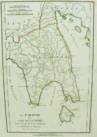
1786rif. M6642Paris 1786. Very Good;. Size : 326x215 mm 12.83x8.46 Inches Coloring: Original Outline Coloring Category: Maps Europe Greece Macedonia; unknown
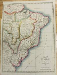
1821rif. M2689Paris 1821. Very good. Size : 407x545 mm 16x21.5 Inches Coloring: Original Hand Coloring Category: Maps South America Countries; unknown
1783rif. M2768Paris: Le Clerc Nicolas Gabriel 1783. Excellent. Size : 238x480 mm 9.375x18.875 Inches Coloring: Hand Colored Category: ; Maps Europe Ukraine Le Clerc, Nicolas Gabriel unknown
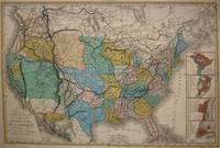
1848rif. M7518Paris: A. Bes & F. Dubreuil Fils c. 1848. Very Good. Folding map flattened and backed acid-free tissue paper for long-term preservation. Two marginal tears repaired expertly. Notes: A scarce large-scale map of the Mexican-American War era and of the entire West. To the very north the boundaries of the United States extend well into future British Columbia and within the current states of Washington and Oregon is carved the District of Columbia which was owned by the British. California Arizona and Nevada are together and California's central valley is highlighted for its gold deposits. The map is based upon the Eustache Herisson map of the United States 1799 and its major cities. As various publications were made 1826 1834 the map started to take shape. Various projections of the Rocky Mountains were used based off of the Humboldt and Pike projections. Much of the Northwest is based off of the Lewis and Clark expedition. This particular map is a scarce and important example as it focuses on the changes brought about by the Mexican-American War. The major differences in this regard are a small inset map of Central America and the delineation of the Mexican-American border; as this map shows all the territory that the United States had captured since the onset of the war. Five inset maps depict Mexico and the cities of Washington Boston Philadelphia and New York. Size : 509x662 mm 20.04x26.06 Inches Coloring: Original Hand Coloring Category: Maps United States; A. Bes & F. Dubreuil Fils unknown
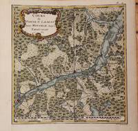
1762rif. M9032Paris 1762. Very Good backed on acid free tissue paper for long term preservation left margin is extended. Notes: Fine and scarce French 18th century map of St. Lawrence River and Quebec. The course of the river to the East is from Montreal and passing through the Quebec City and it extends to Tadoussac. Size : 220x215 mm 8.66x8.46 Inches Coloring: Hand Colored Reference: Kershaw vol.II #659. Category: Maps Canada East Quebec; Maps Canada East Quebec St. Lawrence River; unknown
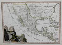
1819rif. M8213Paris. c. 1819. Very Good. Notes: Rare first edition of this important map of Mexico and the South & Western US. This map is based on the works of Humboldt Pike and Lewis & Clark. Size : 222x298 mm 8.75x11.75 Inches Coloring: Hand Colored in Outline Category: Maps Central America Mexico; unknown
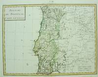
1750rif. M6691Paris c. 1750. Very Good;. Notes: Engraved by Pierre Francois Tardieu. Size : 346x462 mm 13.62x18.19 Inches Coloring: Original Hand Coloring Category: Maps Europe Portugal; unknown
1785rif. M10371Paris c.1785. Excellent wide margins. Notes: A fine early plan of Warsaw is based upon the 4-sheet plan of Warsaw by Pierre Ricaud de Tirregaille entitled Plan de la ville de Varsovie first published in 1762 and Antonio Rizzi-Zannoni's single sheet version of the map published in 1772. Pierre Ricaud de Tirregaille a French Architect and Engineer worked in Warsaw as a surveyor and as an army engineer. Crown Marchal Bielinski commissioned Tirregaille to prepare a detailed plan of the city of Warsaw which resulted in the first map of Warsaw based upon a scientific survey. Rizzi-Zannoni's plan published in 1772 of which we have an example coincided with the efforts of Polish Nobles to enlist the assistance of French "democracy" experts in Paris including Rosseau and Malby to help restructure the Polish "Republic" on the eve of the first partition. Size : 345x455 mm 13.58x17.91 Inches Coloring: Hand Colored Category: Maps City Maps; Maps Europe Poland Lithuania; unknown
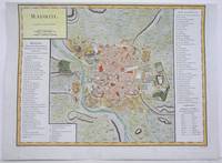
1792rif. M4250Paris 1792. A tear on the right margin beyond the plate mark has been repaired upper margin shaved closely otherwise very good. Notes: A detailed and decorative city plan of Madrid and vicinity with a list of major edifices in two panels on the left and right hand sides. Size : 330x435 mm 13x17.125 Inches Coloring: Hand Colored Category: Maps City Maps; Maps Europe Spain unknown
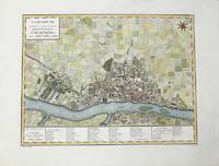
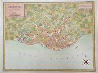
1792rif. M4211Paris 1792. Very Good upper margin has been extended. Notes: Map of Lisbon capital of Portugal published in late 18th century. Antoine-François Tardieu 1757-1822 was a French geographical engraver and publisher active in Paris during the late 18th and early 19th centuries. Size : 340x447 mm 13.375x17.625 Inches Coloring: Hand Colored Category: Maps City Maps; Maps Europe Portugal unknown
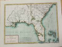
1799rif. M5632Paris c. 1799. Very Good. Notes: The map depicts Florida during its time under Spanish control. Numerous Indian villages are located and roads are shown connecting early settlements. There are no engraved political divisions indicating the mapmaker's bias toward either the territorial claims of Spain or the United States. The map provides an excellent view of the Gulf Coast with a dramatically over-sized Tampa Bay. Numerous Indian villages are located and roads are shown connecting early settlements. The Bahamas are also well delineated. Size : 335x440 mm 13.125x17.25 Inches Coloring: Hand Colored Category: Maps United States South Florida; Maps United States South States; unknown
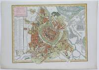
1792rif. M4116Paris 1792. Excellent. Notes: A detailed and decorative city plan of Vienna and vicinity with a list of major edifices on the left hand side. Size : 345x440 mm 13.625x17.25 Inches Coloring: Hand Colored Category: Maps City Maps; Maps Europe Austria unknown
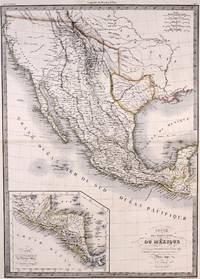
1842rif. M7906Paris: P. Lehuby c. 1842. Very Good;. Notes: A rare and important version of Lapie's Mexico map circa 1842 which depicts Texas as an independent Republic. With an inset map in the lower left of Guatemala. Size : 550x395 mm 21.65x15.55 Inches Coloring: Original Outline Coloring Category: Maps United States South;Maps United States South Texas;Maps Central America Mexico; P. Lehuby unknown
1950rif. 289372Istra 1950. Etat Correct coins émoussés bords frottés couverture ternie livre jauni. in8. 1950. Cartonné. Istra unknown
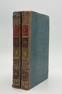
1820rif. 89082Paris: Madame Veuve Courcier 1820. Fine. One of the earliest explorations of Senegal Madame Veuve Courcier Paris 1820 13.2 x 21.1 cm Relié First edition illustrated with 4 engraved plates by Ambroise Tardieu portrait of Diai-Boukari in marabout attire from Foutatoro view of the Foutatoro army on the march view of the sources of the Rio Grande and the Gambia view of Timbo; and a large folding map at the end of the first volume copy signed by the author on the verso of the title page of vol. I. Contemporary half calf bindings spines decorated with gilt roll tooling in place of raised bands title and volume labels in red calf paper covered boards speckled blue edges small wormhole to the lower hinge of the first volume. Shortly after the Treaty of Paris returned Senegal to France Molliena mere naval clerk and survivor of the Medusa shipwreckwas sent to Africa by the French government on a geographical and political mission Sent to explore the sources of the Senegal and Gambia rivers Mollien was also tasked with countering British expansion in the region. At the end of volume 2 are found an itinerary and glossaries of the Iolof Wolof Poule Peul and Serer languages along with geographical observations on Mollien's discoveries by Eyries. Madame Veuve Courcier hardcover
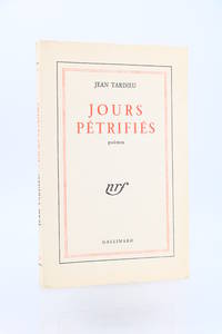
1954rif. 89913Paris: Gallimard 1954. Fine. Gallimard Paris 1954 14.2 x 19.5 cm Broché First edition one of 50 copies numbered on pure wove paper the only deluxe issue.A fine copy. Gallimard unknown
1948rif. 91074Paris: Gallimard 1948. Fine. Gallimard Paris 1948 12 x 18.8 cm Broché First collected edition one of 13 numbered copies on pur fil paper our copy being one of 3 hors commerce the only copies on deluxe paper.A fine copy. Gallimard unknown
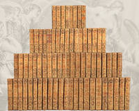
1784rif. 88246s. l. Kehl: Imprimerie de la Société Littéraire-Typographique 1784. Fine. « Divine Voltaire ora pro nobis ! » Exceptional copy on large paper and contemporary binding Imprimerie de la Société Littéraire-Typographique s. l. Kehl 1784-1789 14 x 21.7 cm 70 vol. reliés The Kehl edition the most renowned edition of Voltaire's works illustrated and published on deluxe paper. It was printed on five different types of paper and only the deluxe editions such as ours on laid paper feature engravings. These are naturally the most sought-after and rarest copies. Binding in full painted sheep decorated with a honeycomb motif smooth spine tooled with gilt fleurons fillets and compartments light beige calf lettering and volume pieces gilt chain-roll border on covers marbled endpapers gilt roll on edges all edges marbled contemporary binding. Two volumes nos. 50 and 70 with slight variations in gilt tools on the spines and with orange morocco lettering pieces edges and covers treated somewhat differently. General condition of the 70 volumes: bindings with light rubbing to corners gilt a little dulled occasional foxing a few wormholes and old restorations not affecting the text. 28 volumes vols. 4 5 8 10 11 13 16 17 19 20 24 27 28 33 34 35 36 37 43 48 61 62 63 65 66 67 68 70 with cracked joints at the ends and 20 volumes vols. 8 11 12 14 16 18 33 34 37 42 46 49 53 56 57 60 65 66 68 70 with damaged caps. Two editions were published at the same time. Our copy belongs to the prestigious in-8 edition on large paper published in 70 volumes the other edition being in-12 format in 92 volumes. It is richly illustrated with 125 etched plates: - There are 17 portraits including 3 of Voltaire: a frontispiece portrait by N. de Largillière engraved by P. Alex. Tardieu; one drawn from Houdon's bust by Moreau le Jeune and engraved by P. Alex. Tardieu; and one allegorical portrait by Louis Croutelle after Moreau le Jeune belonging to the second series of illustrations of Voltaire's works executed by Moreau for the publisher Renouard. The 14 other portraits include an allegorical frontispiece of Frédéric-Guillaume Prince of Prussia depicted in profile in a medallion by Dambrun after Moreau le Jeune; a portrait of Henry IV by Pourbus engraved by Tardieu; one of Charles VII engraved after the original in the King's Cabinet by Mavieri; another of Agnès Sorel drawn by Moreau the Younger after the original in the King's Cabinet and engraved by Mavieri; one of Joan of Arc engraved by Beisson; followed by the Count of Dunois engraved after the original in the King's Cabinet by J. B. Fosseyeux; one of Louis XIV drawn by Moreau Le Jeune after C. Le Brun engraved by J. B. Fosseyeux; one of Charles XII engraved by P. Alex. Tardieu after the original in the King's Cabinet; one of Pierre I engraved by P. G. Langlois after a painting by L. Caravaque; one of Madame du Châtelet after Marie Anne Loir and engraved by P. G. Langlois; one of the Count of Argental after J. Defraine and engraved by J. B. Fosseyeux; one of Frédéric II of Prussia painted from life by Van Loo and engraved by P. G. Langlois; one of Catherine II of Russia engraved by J. B. Fosseyeux; and one of d'Alembert after De La Tour engraved by N. F. Maviez. - 93 engravings by Moreau le Jeune including 44 figures for le Théâtre engraved by Lingée Simonet de Launay Trière Halbou Duclos Romanet Dambrun de Longueil Delignon Le Mire Le Veau 10 for la Henriade engraved by Masquelier Delignon Dambrun Patas Gutemberg Helman Simonet Duclos Romanet 21 for la Pucelle engraved by Simonet Dambrun Halbou Baquoy Trière Delignon de Longueil Croutelle and Duclos 4 for the Contes in verse engraved by Langlois Duclos Delignon and Le Veau and 14 for the Romans engraved by Trière Duclos de Longueil Dambrun Baquoy Delignon Simonet Langlois and Halbou. - 14 scientific plates in volume 31 illustrating the experiments of Newton Descartes and Leibniz. - 1 battle Imprimerie de la Société Littéraire-Typographique unknown
rif. 42546174-nnew. unknown