73 981 résultats
réf. DADAX1558602976New unknown
réf. DADAX1590302591New unknown
réf. DADAX184472011XNew unknown
réf. DADAX1933456469New unknown
réf. DADAX1931707987New unknown
réf. DADAX3775729992New unknown
réf. DADAX3764366427New unknown
réf. DADAX3764368624New unknown
réf. DADAX8174362932New unknown
réf. DADAX3775722165New unknown
réf. DADAX3764366869New unknown
1963réf. 20886Country Life 1963. Sm. folio Revised Edition with a frontispiece and 507 fine photographs a number full-page in the text small neat inscription on front free endpaper; original green buckram upper board framed and lettered in gilt gilt back gilt top green endpapers a near fine copy in price-clipped dustwrapper the latter weith one minor loss at bottom corner. Revised version with additional photographs and updated text of the original edition of 1956. Hussey's masterly trilogy is the definitive study. This is the second volume; each volume is complete in itself. Very scarce especially in the dustwrapper. Country Life, hardcover
1957réf. 20944Architectural Press 1957. Roy. 8vo. First Edition with a frontispiece and 231 photographs and detailed drawings small neat contemporary signature on front free endpaper; red cloth gilt back backstrip mildly sunned but all gilt just legible else a very good bright clean crisp copy. With the trade ticket of Parkers of Oxford on front paste-down. Nice copy of this standard reference. Ottley 2692. Architectural Press, hardcover
2006réf. S8035In English. Soft cover book 30x22.5 cm 152 pp. ill. The large scale map of Cyprus 139 x 64 cm coloured using the aquarelle technique was drawn up in 1542 by the Cypriot Leonidas Attar. Attar was appointed by the Venetian authorities as a specialist in irrigation works and military fortifications which he undertook together with Michelle and Girolamo Sanmicheli in both Venice and Cyprus; at the same time he acquired the technical knowledge and experience in the drawing up of maps. Probably for strategic and military reasons the map remained hidden in the archives of Venice from the 16th century onwards and until a few years ago it was scarcely known. The discovery and study of the map by the authors has demonstrated that it is a very important primary source for cartography and for the history of Cyprus. The map shows the features of administrative and political cartography designed to furnish territorial information for governmental purposes. In the background of the map is depicted the crowned lion of Venice and the emblem of the Order of the Sword that was founded by the Lusignan King Peter I as well as the novel image of a tongue in a vice a feature that recalls the punishments meted out to blasphemers. The map gives important information on the topography and morphology of Cyprus with its eleven administrative districts approximately six hundred villages numerous religious monuments and archaeological sites. Bank of Cyprus paperback
1945réf. 2956Paris: Monts et Vaux L'Estampe Moderne 1945. Limited Numbered . Hardcover. Near Fine/No Jacket. Folio - over 12" - 15" tall. Robert Sterkers. Paper cover over laid in plates Hard cover over plates Hard to discern material and in publishers slip case which has some minor tears at bottom Exemplaire sur rives No 314 of 320 copies. 1011-205pilluscolor. Vingt Eaux-Fortes originales de Robert Sterkers. French Text Heavy book extra shipping Monts et Vaux L'Estampe Moderne hardcover
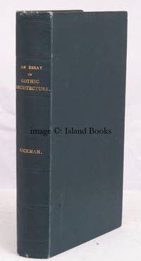
1825réf. 19647Longman Hurst Rees Orme & Co. 1825. 8vo. Third Edition with an engraved frontispiece and 14 engraved plates and EXTRA-ILLUSTRATED by the addition of 10 small engraved illustrations of churches and a long relevant cutting mounted on rear endpapers three separate signatures on blank preliminary some very light age-staining mainly marginal to a few plates; nineteenth century green cloth gilt back red sprinkled edges patterned endpapers an unusually well-preserved firm clean copy. THE FIRST SYSTEMATIC TREATISE ON GOTHIC ARCHITECTURE IN ENGLAND and by far the most influential - Rickman's nomenclature was adopted by most subsequent writers and continues in use to this day. The work was first published in Liverpool in 1817 instancing 833 examples with a second slightly larger version appearing two years later. The present edition lists well over 3000 buildings mainly churches the majority inspected personally by Rickman AND EXTENDS THE SCOPE OF THE WORK TO INCLUDE IRELAND SCOTLAND AND WALES. This is the penultimate edition published during the author's lifetime and includes new lithographed plates by the author. A most attractive copy. See Eastlake pp.122-126. Longman Hurst Rees Orme & Co., hardcover
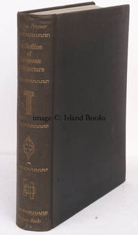
1960réf. 19802Penguin 1960. 4to. Jubilee Edition with frontispiece and over 600 photographs and numerous plans in the text; original black cloth gilt back a near fine copy. First published as a humble Pelican in 1943 Pevsner's mammoth survey rather more than an 'outline' became the most widely influential account of the subject in the half-century that followed. It has been successively enlarged and expanded reaching its fifth English edition in 1957 and translated into virtually every major European language. THE JUBILEE EDITION IS HOWEVER THE ONLY VERSION TO APPEAR IN THIS FORM. IT ADDS FOR THE FIRST TIME A MAJOR SECTION ON GERMAN BAROQUE AND INCLUDES A CONSIDERABLY EXTENDED SURVEY OF THE ARCHITECTURE OF THE TWENTIETH CENTURY. A lovely copy Penguin, hardcover
réf. SONG0300037376Used: Good unknown
réf. SONG0713473363Used: Good unknown
réf. SONG1873936397Used: Good unknown
réf. SONG8789438035Used: Good unknown
réf. SONG0226254100Used: Good unknown
réf. SONG0226080498Used: Good unknown
réf. SONG0262681013Used: Good unknown
réf. SONG0292730721Used: Good unknown