1 440 résultats
1911Very Good Turkish, Ottoman (1500-1928) Original cromolithograph mounted on cloth. Folded. Some foxing and slimming on creases. Oblong double elephant folio. (97 x 107 cm). In Ottoman script. Shows the Bosphorus, Istanbul city with detailed place names. Black Sea at North, Marmara Sea at South and the Princes' Islands seen at southwest area. Mapmaker not described usual like in Turkish military maps. An extremely rare the Bosphorus map with its unusual size. Not in TBBMM library (The Grand Assembly of Turkish Republic Liibrary). Not in Military Libraries in Turkey.
1916Very Good Turkish, Ottoman (1500-1928) Original color map. Folded. Oblong atlas folio. (50 x 60 cm). In Ottoman script. Shows Rhodes and Tilos Islands. Scale: 1/200.000. Hegira: 1332 = Gregorian: 1916. Not description on map-maker. This is one of the series of the Bonn projection maps which are the first map series in modern techniques in Turkey and the Ottoman Empire. This is one of the series of the Bonn projection maps which are the first map series in modern techniques in Turkey and the Ottoman Empire. In order to produce these maps covering Turkish territory, Reconnaissance Branch was incorporated into The Mapping Commission. The maps were produced in the datum based on the latitude and longitude of Ayasofya Mosque in an equal area Bonn Projection. The field works for the 123 sheets covering the country were conducted by 76 staff. The production was completed in 18 years starting from east-west. Fieldworks continued without stopping except in the years 1914 and 1920. This map series called also reconnaissance maps contributed a lot to producing 1:25.000 scale maps. A very detailed and attractive map of Rhodes Island showing its harbors and Ottoman place names.
1922Very Good Turkish, Ottoman (1500-1928) Original color map. 65,5x63 cm. In Ottoman script. This rare and decorative Gallipoli map including Hellespont, Gallipoli Peninsula, Suvla Bay, Seddülbahir, and Tenedos, the places of Gallipoli Aar in 1915 (Dardanelles Campaign) during World War 1, separated two map views. Seddulbahir and Suvla Bay at north and Straight, Peninsula, and its shores with Tenedos (now Bozcaada) at the southwest of the map. It's a very detailed and rare map printed with the series of "History of the Dardanelles Campaign" after the seven years of war. The Gallipoli campaign, also known as the Dardanelles campaign, the Battle of Gallipoli or the Battle of Çanakkale (Turkish: Çanakkale Savasi, or, Muharebâti), was a military campaign in the First World War that took place on the Gallipoli peninsula (Gelibolu in modern Turkey), from 17 February 1915 to 9 January 1916. The Entente powers, Britain (with Anzacs), France, and Russia, sought to weaken the Ottoman Empire, one of the Central Powers, by taking control of the Turkish straits.
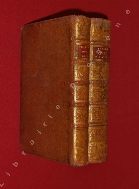
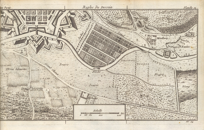
1714réf. 21565Paris, Jean-Baptiste Coignard, 1714 ; in-4°, veau brun, dos à nerfs décoré et doré, pièce de titre grenat, tranches rouges (reliure de l'époque) ; [16], 290, [1] pp., 2 vignettes d'en-tête gravées à l'eau-forte par Le Clerc et 10 planches déplaintes par de Rochefort.
1948Very Good Arabic Original chromo-lithograph map in brown tones. On a special paper with an ongoing blindstamped "Regestre Robur" during the borders. Folded. 70x100 cm. In Arabic. Scale: 1 /1.000.000. Chipped on margins, split on folded traces. Slight discoloration and one stain on lower margin. Otherwise a good copy. An attractive and detailed map of Syria shows the capital (as Aleppo n that map), other cities like Damascus, Raqqa, Homs, Latakia, Ayn al-Arab, Idlib, Hama, Deir Ez-Zor, Jarabulus, et alli. And it shows Turkey on the north (as Turkey containing Hatay and Alexandrette), The Mediterranean shores of the land as well as Lebanon and Palestine (and Jerusalem) on the west, Sharq al-Urdun (Jordan) and Iraq on the south and east. It's very detailed on showing the roads spread throughout the land like railways and ancient roads from the Roman period. Additionally this roads can be followed to the other Arabic countries and regions on the map. This map was calligraphed by Kamel Al-Baba, (1905-1991), who was a Lebanese contemporary / modern calligrapher. He is the son of famous calligrapher Mokhtar Al-Baba. Cannot be found in WorldCat.; Not in Library of Congress Map Collection. Very scarce.
réf. 013826François Cureau de La Chambre (1630-1680), médecin ordinaire du roi, médecin des bâtiments du roi, médecin de la reine Marie-Thérèse et des enfants de France, médecin du chancelier Pierre Séguier, fils du philosophe et médecin Marin Cureau de La Chambre. P.S., sd [1668-1669], 1p in-4. Sur parchemin. Document avec uniquement le recto signé « La Chambre » et au dos une note d'une autre main « pour servir de quittance. » (3 lignes). Le document n'a pas été rempli ensuite au dessus de la signature mais devait concerner les 2400 livres d'appointements de La Chambre en tant que médecin ordinaire pour l'année 1668. [328-2]
réf. 95450A Paris, Duchesne, Libraire, 1765 (tome I) et 1755 (tome II), 2 volumes in-8 de 202x125 mm environ, Tome I : (1) f, 1 frontispice, (4) ff. (titre, epitre, préface, approbation et privilège), 436 pages + 30 planches / (1) f., Tome II : (1) f., 1 frontispice, (4) ff. (titre, epitre, préface), 343 pages + 4 planches dépliantes. Pleine basane granitée fauve, dos à nerfs portant titres dorés sur pièces de titre bordeaux, orné de caissons à motifs dorés, coupes dorées, gardes marbrées, tranches jaspées, ex-libris sur les premiers contreplats. Erreur de pagination : p. 296 suivie de 257, 258 ... jusqu'à la fin du volume (texte cohérent sans manque), coins émoussés, 2 coiffes légèrement ébréchées, frottements sur les coupes et mors, rousseurs, bordures de quelques planches brunies et fendillées, très rare de trouver ces deux volumes ensemble.
1755réf. 16350Paris, C.A. Jombert, 1755 ; in-8 ; veau fauve marbré, dos lisse à faux-nerfs et décors dorés, pièce de titre grenat, tranches rouges (rel. de l’époque) ; XV, (1 bl.), 114, (2) pp., 24 pl. gravées h.-t., la plupart dépliantes.
1802réf. 15907Nismes, Veuve Belle, An X-1802 ; in-4 ; veau marbré, dos lisse à faux-nerfs, décoré dans le style de Bozérian, titre doré, roulette décorative dorée d'encadrement des plats, roulette sur les coupes (rel. de l'époque) ; XXIX, 588 pp., 1 tableau dépliant h.t. et 1 pl. gravée sur cuivre par Savin.
1894Very Good Turkish, Ottoman (1500-1928) Original color map. Folded. Oblong folio. (35 x 52 cm). In Ottoman script. Color lithograph. It shows Sudan and West Africa, Atlas Ocean shores, Sahra Desert, and other parts of Africa. Scale: 1:15.000.000. A very detailed and attractive map. Slightly fading. Otherwise a very good copy. Dated Hegira: 1310 = [Gregorian 1894]. [EARLY OTTOMAN MAP of SUDAN] Sudan. Sâye-i Türkiye Hazret Gazi Sultan Abdülhamid Hân-i Sâni'de Maarif Umûmiye Nezâret-i Celîlesi ruhsatiyle meshur Haset tarafindan Fransa Cemiyet-i Cografya âzâlarindan mütesekkil komisyona mahsûs tanzîm edilmis oldugu son defaki atlasinin tercümesi olarak bu def'a Erkân-i Umûmiyye Dairesi Besinci Fen Subesi'ne me'mûr piyade mirlivâlarindan saâdetlü Ali Seref Pasa ve rifatlubinbasi fütûvvetlü Muhyiddin Efendi maarifetleriyle tertib ettirilmistir. Ali Seref Pasa or Hafix Ali Esref. He was a soldier, who was schooled in Paris as a cartographer around 1862. Already in Paris he published his first atlas with 22 maps, called 'Yeni atlas'. Upon his return to Istanbul he became a chief cartographer at the Maatbaa-i amire Printing Press in Beyazit, which was the successor of the Muteferrika press from 1727. Among others he translated the large Kiepert map of Anatolia to Ottoman. He died in 1907, leaving his large project of a gigantic map of Anatolia in 100 sheets unfinished. Ali's name is often misunderstood or even listed as two different people: Ali Seref Pasa and Hafiz Ali Esref. Until the surname law adopted on June 21, 1934, Turks did not have surnames. They were born with one first name and were until the adulthood described only as sons or daughters of their parent's names. Later they were given titles such as Effendi (Sir), Bey (Chief) or Hanim (Madam) for higher classes, or they were given names according to their work or class. The names were not inherited by children until 1934, when the surname law was enforced. The map maker Ali received names Seref, the honourable, and Pasa, the dignitary. He was also known as Hafiz, the memorizer of Qur'an and Esref, Proud. So Ali Seref Pasa would have a meaning 'Honourable Dignitary Ali, and Hafiz Ali Esref, Memorizer of Qur'an, Proud Ali. Daruttibaa - Matbaa-I Amire Printing Press: The first press in the Muslim world, called Daruttibaa, was founded in Istanbul by Ibrahim Muteferrika in 1727, with a permission of Sultan Ahmeet III. It was located in Muteferrika's house. The first book was published in 1729 and until 1742 sixteen other works followed. After Muteferrika's death, the press was supressed for printing, as printed books were considered dangerous. In 1796 the press was purchased by the government and moved to Uskudar in Istanbul, and in 1831 finally to Beyazit, where it was renamed to Matbaa-i Amire in 1866. The press was closed in 1901 and was reopened in 1908 under the name 'Âmire' In 1927 the name changed to State Printing House. The press still exists and is known for publishing school and educational books. Extremely rare. Not in OCLC.; Not in TBMM Map Collection.
1927The full title is :American Architecture of the Twentieth Century. A series of photographs and measured drawingsof modern civic, commercial and industrial buildings". New York: Architectural Book Publishing Company, 1927-1929. There are 139 plates in 3 Volumes of 7 Parts. Plates loose as issued in 3 portfolios:Vols.1 & 2 cloth Vol.3 (Part 7) paper covered boards with cloth spine. Seven parts, each containing 20 full page plates with title page and table of contents in Vols. 1 and 2. Virtually complete except for one plate (#10 in Vol.2 Part 6 illus. floor plan of Bellevue Psychiatric Hospital. This is one of five plates illustrating the building). Missing too is the preface by Lewis Mumford in Vol.3 (part 7). Portfolios 1 and 2 cloth spines split and frayed but complete, plates are generally very good although there is some minimal edge darkening and soil. A half a dozen plates in Volume 2 have small moisture stain on edge, not affecting image.Vol.3 (Part 7) Very Good overall condition. Spines of Vols.1 & 2 titled in gilt and Vol.3 (Part 7) reproduces title page on the cover. Contents of Volume 1 include Raymond Hood's American Radiator Building; McKenzie, Voorhees & Gmelin, New York Telephone Building; U.S. Army Supply Base in Brooklyn by Cass Gilbert & Grauman's Metropolitan Theatre by Wm. Lee Woollett. Volume 2, Part 4 entirely devoted to 4 buildings designed by Bertram Grosvenor Goodhue;& Holabird and Root, 333 North Michigan Avenue apartment building. 3 add'l.buildings in Volume 3 Part 7 including the Masters Apartments/Roerich Museum Building by Corbett, Harrison & MacMurray and the R.J. Reynolds Building in Salem, N.C. by Shreve & Lamb and the Stewart Building in New York by Warren & Wetmore. All buildings illustrated by photos, plans and details. Rarely seen this complete. These books will be securely wrapped and packed in a sturdy box and shipped with tracking.
1927Telephone Talk was the glossy bimonthly publication of the British Columbia Telephone Company. It was written by employees for employees to present information of interest to those engaged in the plant, traffic, commercial, operating, accounting and other departments of the service. Each issue is replete with black and white photos and information on topics such as: company, industry and technological news, traffic levels, expansion plans, personnel announcements, publicity and social events, deaths, weddings, lists of exchanges, and more. As such, these issues serve as a vital preserve of rare and fascinating British Columbia history. This volume covers topics including: Miss K. Perrin joins as health supervisor; New West office upgraded - super photos; New York Engineer describes latest developments i.e. transmitting photos over phone lines; the truth about instrument zoning; Excitement at Duncan office; Diary describes observations on Chilliwack line; New cable successfully laid from Galiano Island to Point Grey - 9 pages of text and good photos; New Trans-Gulf circuits opened; sleeping car reservations by phone; Joe Gagnon; Phone expansion in Bay store; Seymour remodeling complete; Operating room photos; Coal, Travelling Men and Toll Lines Feature Nanaimo; High Poles removed from Seymour St. - 6 pages of text and great photos; Miss E.R. Walker - manages traffic on Vancouver Island; Cobble Hill Exchange; photo of updated Ladysmith office; Coast now linked with Okanagan by phone; Miss A. Falconer of the Port Coquitlam office; Successful Canadian jubilee broadcast from Ottawa; Photo of Chemainus Office; Royal Alexandra Apartments Fire - phones used from burning buildings by reporters; Company will have its own line to Vernon; Photo of public phones/'Pay Stations'; Photo of Belmont office near Victoria; Table of phones in use per province in Canada; Six pages of info. and great photos re: Kootenay; Battling Storm King; Mexico City can now communicate with Vancouver; Direct cable to be laid to West Vancouver; Article on poles; and more. Half-leather binding. Average wear. Ink stamp of company executive E.P. LaBelle upon top edge of text else unmarked. Binding intact. Substantial wear to backstrip with some chips missing. Book
réf. 11-0952London: Waterlow & Sons 1913. Large map measuring 124 x 103 cm. 49 x 40 inches. Mounted on canvas. Very attractive. London: Waterlow & Sons, 1913. unknown
1897Very Good Turkish, Ottoman (1500-1928) Original engraved map on the silk handkerchief made in Yildiz Palace for the 'Iane Sergisi' [i.e. Exhibition of the Social Assistance] in the period of Sultan Abdülhamid II. In its decorative frame. Frame size: 53,5x53,5 cm; map size: 38x38 cm. In Ottoman script. Scale: 1/600.000. Several minimal splits, minor foxing, and slight stains on cloth. Otherwise in good condition. A rare and decorative 1897 silk handkerchief map of the Greco-Turkish War in 1897, which was the only war in which the Ottoman army was victorious during the reign of Abdulhamid 2, is a fine example of Ottoman / Turkish cartographic textiles made in Ottoman court (Yildiz Palace textile workshops). This beautiful map depicts an attractive war scene from the 1313 Greek War on the upper half, and it's engraved a map of Balkan & Greek lands on its lower half. War painting has 'Melona' signature in Ottoman script. The map shows Thessaloniki [i.e. Salonica] Bay on the west; Yanya [i.e. Ioanna] Vilayat on the east; lands of Greece, Galos Bay, Uzi Strait on the south and Dimetoka and Avalonia areas in the Serefiye, Ergiri sanjaks on the north in its period. Written on the map, "Baht-i himâye-yi feyzvâne-i cenâb-i hilâfetpenâhide evlad-i süheda ve mecrûhin-i asakir-i sâhâne", [i.e. It was printed for the "Iane Sergisi" (i.e. The Social Help Exhibition) in the high memory of our soldiers who were martyred and veterans in the Greek War under the patronage of the Sultan.]. The Greco-Turkish War of 1897, also called the Thirty Days' War and known in Greece as the Black '97 (Mauro '97), or the Unfortunate War (Atychis polemos), was a war fought between the Kingdom of Greece and the Ottoman Empire. Its immediate cause was the question over the status of the Ottoman province of Crete, whose Greek majority long-desired union with Greece. Despite the Ottoman victory on the field, an autonomous Cretan State under Ottoman suzerainty was established the following year (as a result of the intervention of the Great Powers after the war), with Prince George of Greece and Denmark as its first High Commissioner. This was the first war effort in which the military and political personnel of Greece were put to test since the Greek War of Independence in 1821. For the Ottoman Empire, this was also the first war effort in which the reorganized military personnel were put to test. The Ottoman army was under the guidance of a German military mission led by Colmar Freiherr von der Goltz, who had reorganized it after the defeat in the Russo-Turkish War (1877-1878). The conflict proved Greece was wholly unprepared for war. Plans, fortifications and weapons were non-existent, the mass of the officer corps was unsuited to its tasks, and training was inadequate. As a result, the numerically superior, better organized, equipped and led Ottoman forces pushed the Greek forces south out of Thessaly. Almost all of the aids made to the families or disabled people of those who were martyred in the 1897 Ottoman-Greek War (such as printing this map) were made within the framework of the donations of "Evlâd-i Süheda and Malûlîn-i Guzât-i Asâkir-i Sahane". People and citizens of all classes and beliefs, including members of the Ottoman court, ministers, bureaucrats, civil servants, merchants and tradesmen, participated in this aid campaign at the end of the 19th, beginning of the 20th century. Not in OCLC.
1912Features: Big Improvements by Northern Pacific During 1912; Through Service Seattle to Texas; O.-W. R. & N. Enter Vancouver; Will Carl Gray Succeed L.W. Hill? - article with photo of Gray; Dangers Attending Hauling Explosives; New H-H-1 Locomotive Design; Seattle's Greatest Opportunity; Bush Terminal Company to Build on Harbor Land - article with photo of Model Loft buildings at the New York Bush Terminal, similar to those to be built on Harbor Island; Portland's Proposed Harbor Front Development and the Commission of Public Docks - major article; South and Central American Trade; Great Prospects for Vancouver, B.C.; The Official Statement of the [Seattle] Port Commission re: improvements and facilities; Economy of the [Seattle] Municipal Plan (part 4) - major article which includes official map of Grand Trunk Pacific Railway showing proposed extension to Vancouver and Seattle, plus map of new thoroughfare donated to Seattle by Great Northern Railway with franchise for Interbay-Ballard Route; Bogue Plans for Tacoma Harbor Are Impressive - major article with map showing City section of harbor plans; Casualties to Pacific Coast Shipping for Year 1911 - Four full pages of fine print document the voluminous incidents of the year including the vessel and damage it sustained; Photo of Strathalbyn's bow after collision; Review of Marine Insurance and Shipping Law; Big Company to use Panama Canal - International Mercantile Marine; and more. 44 pages including several pages of nostalgic ads, some illustrated in black and white, featuring local marine and rail interests. Printed upon glossy coated stock. Average wear. Binding intact. Few library markings to front cover. A well-preserved copy of this highly-informative memento of Pacific Northwest transportation over a century ago. 12" x 9". Magazine
1932réf. 21719Paris, Ernest Leroux, 1932 ; 2 tomes in-4° (Texte et Album), broché ; 276 pp., [2] ff. de tables ; [11] ff. de planches de Plans, 247 planches photographiques de 1 ou 2 vues chacune, pour un total de 386 pp.
1895Very Good Turkish, Ottoman (1500-1928) Original color map. Folded. Oblong folio. (35 x 52 cm). In Ottoman script. Color lithograph. A very detailed and attractive Ottoman map of America. Scale: 1:12.000.000. Otherwise a very good copy. Slightly chipped extremities. Dated Hegira: 1311 = [Gregorian 1895]. Ali Seref Pasa or Hafiz Ali Esref. He was a soldier, who was schooled in Paris as a cartographer around 1862. Already in Paris he published his first atlas with 22 maps, called 'Yeni atlas'. Upon his return to Istanbul he became a chief cartographer at the Maatbaa-i amire Printing Press in Beyazit, which was the successor of the Muteferrika press from 1727. Among others he translated the large Kiepert map of Anatolia to Ottoman. He died in 1907, leaving his large project of a gigantic map of Anatolia in 100 sheets unfinished. Ali's name is often misunderstood or even listed as two different people: Ali Seref Pasa and Hafiz Ali Esref. Until the surname law adopted on June 21, 1934, Turks did not have surnames. They were born with one first name and were until the adulthood described only as sons or daughters of their parent's names. Later they were given titles such as Effendi (Sir), Bey (Chief) or Hanim (Madam) for higher classes, or they were given names according to their work or class. The names were not inherited by children until 1934, when the surname law was enforced. The map maker Ali received names Seref, the honourable, and Pasa, the dignitary. He was also known as Hafiz, the memorizer of Qur'an and Esref, Proud. So Ali Seref Pasa would have a meaning 'Honourable Dignitary Ali, and Hafiz Ali Esref, Memorizer of Qur'an, Proud Ali. Daruttibaa - Matbaa-I Amire Printing Press: The first press in the Muslim world, called Daruttibaa, was founded in Istanbul by Ibrahim Muteferrika in 1727, with a permission of Sultan Ahmeet III. It was located in Muteferrika's house. The first book was published in 1729 and until 1742 sixteen other works followed. After Muteferrika's death, the press was supressed for printing, as printed books were considered dangerous. In 1796 the press was purchased by the government and moved to Uskudar in Istanbul, and in 1831 finally to Beyazit, where it was renamed to Matbaa-i Amire in 1866. The press was closed in 1901 and was reopened in 1908 under the name 'Âmire' In 1927 the name changed to State Printing House. The press still exists and is known for publishing school and educational books. Extremely rare. Not in OCLC.; Not in TBMM Map Collection.
1927Very Good Turkish, Ottoman (1500-1928) Original bdg. Large roy. 8vo. (24 x 20 cm). In Ottoman script. (Old Turkish with Arabic letters). 16 p., 15 chromo-lithographed maps. Some markings on the two maps. Otherwise a very good copy. First edition of this scarce atlas for Turkish primary schools drawn and published by Turkish geographical educators and cartographers in the early Republican period of Turkey. This fine atlas was printed in London, in a period after the proclamation of the Republic, before the Letter Revolution in 1928. Duran studied in Istanbul and Paris. He worked as a geography teacher in various high schools then he became a lecturer and a manager at Ankara Gazi Education Institute for a while. He was known for his writings on various topics and especially for his works on geography. Born in the imperial period, Duran signed the first cartographic studies of the Republic of Turkey with the transition to the Republican administration. Özege 8764.
Oblong folio (245 x 320 mm), 12 tinted lithograph isometrical views, and 12 lithograph plans on 11 sheets (of which one sheet has 2 plans), and an additional 8vo coloured lithograph 'Laying out of mixed plantations' bound at the rear, some light dust-soiling but generally clean, orig. publisher's cloth-backed wrappers, the upper wrapper with a printed label 'Morton's Farm Building, 24 plates. price 10s 6d.' The tinted lithographs provide bird's eye views of barns and other farm buildings, most of considerable size and sophistication. Each view is accompanied with a plan. OCLC records three copies only, at the National Library of Scotland, The National Art Library and Canadian Centre for Architecture.
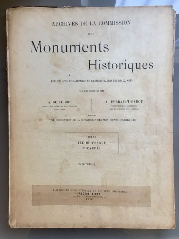
réf. 22002Paris, Eugène Bigot, s.d. 19 fascicules, en feuilles, chemise cartonné de l'éditeur (exemplaire défraîchi et incomplet).
1916Very Good Turkish, Ottoman (1500-1928) Contemporary red cloth. Roy. 8vo. (24 x 16 cm). In Ottoman script (Old Turkish with Arabic letters). [1], 229, [1] p., many b/w and color ills., 30 chromo-lithographed maps. Wear and fading on spine, some ex-library stamps on the colophon and several blank pages, ownership ink inscription and signature on the first page-overall a good copy. First edition of this rare Ottoman atlas for the primary schools in the late Ottoman Empire, including beautiful 30 chromo-lithographed maps of the Ottoman land according to administrative regions (provinces) and richly illustrated with b/w plates of the cities and provinces in the Middle East. Map list: 1. World map 2. Complete Imperial Ottoman 3. Arabian Peninsula 4. Anatolia 5. Asia Minor 6. Marmara and Black Sea 7. Aegean (The Archipelago) 8. Demography of Anatolia and Syria, Libya, etc 9. Administrative map of Anatolia 10. Map of mines of Anatolia 11. Agricultural map of the Imperial Ottoman 12. Arabian Peninsula 13. Map of the Edirne Vilayat [Adrianople Province of the Ottoman Empire] 14. Map of the Bosphorus 15. Map of the Hüdavendigâr Vilayat [Brusa Province] 16. Maps of Izmit and Biga Sanjaks 17. Map of Aydin Vilayat and Mentese Sanjak 18. Map of the Konya Vilayat 19. Maps of the Adana Vilayat and the Mediterranean Sea 20. Maps of the Erzurum and Ankara Vilayats 21. MAps of Kastamonu Vilayat and Bolu Sanjak 22. Map of the Trebizond Vilayat 23. Maps of the Van and Bitlis Vilayats 24. Maps of the Sivas and Harput Vilayats 25. Maps of the Bagdad and Basrah Vilayats 26. Map of the Mosul Vilayat and Day al-Zor Sanjak 27. Map of the Aleppo Vilayat and Urfa Sanjak 28. Map of the Syria and Beirut Vilayats 29. Map of the Arabia 30. Maps of the Yemen vilayat and Asir Sanjak. This atlas was printed four times for the different classes of the early Turkish / Ottoman schools, during World War 1 (two times in 1916) and the National Struggle (two times in 1921). Geylangil was born in Istanbul in 1887 and studied in Aleppo and Baghdad. Geylangil, who also studied economic geography, taught geography at many schools, including Galatasaray High School. Until his death, he wrote 14 books on geography, most of which were geographical atlases. In 1941, he was among the founding members of the Turkish Geographical Society. Özege 23216.; TBTK 11481.; We couldn't find any copy of this edition worldwide.
1868Very Good Turkish, Ottoman (1500-1928) Contemporary quarter leather bdg. Rebacked boards. Foolscap 8vo. (18 x 12 cm). In Ottoman script (Old Turkish with Arabic letters). 220 p. Very rare early book of the concise biographies of 137 people who served as admirals in the Ottoman Empire between 1352 and 1853, written by Mehmed Izzet Pasha (d. 1853), son of Turkish admiral Abdullah Râmiz Pasha (d. 1813). Ceridehâne Printing House was founded for publishing Ceride-i Havâdîs [i.e. The Journal of News], which was the first semi-official newspaper in the Ottoman Empire. This journal was published from 1840 to 1877 and was founded by William Nosworthy Churchill (1796-1846), a British-born journalist who moved to Turkey aged 19. He was the cause of a diplomatic incident that resulted in the temporary severance of diplomatic relations between Britain and the Ottoman Empire. Babinger p. 323/2.; Özege 6951.; Library of Congress. Karl Süssheim Collection, no. 1336., OCLC: 11810438, 880485954.
1761réf. 16534Lyon, J.M. Bruyset, 1761 ; in-8, veau fauve marbré, dos à nerfs décoré et doré, pièce de titre grenat, roulette sur les coupes (reliure d’époque) ; (4), XVI, 283 pp. grand plan dépliant (446 X 580 mm), dessiné et gravé par Jacquemin en 1747.
1869réf. 116154Morel 1869 Paris, se vend chez A. Morel, librairie-éditeur, Bibliothèque de l'Architecture (série des Etudes d'Architecture Historique), 4 volumes en demi-chagrin vert de deux teintes différentes selon la série à laquelle le volume appartient, environ 45x35 cm, 1869 (première série), 1880 (deuxième série). Première série :Tome I : 44 p.- 112 planches. Tome II : 85 planches (dont la 18 bis). Seconde série : Tome 1 : 3 p. - 105 planches. Tome 2 : 95 planches. Des frottements sur les reliures, des taches sur les plats, coins émoussés, des rousseurs. Bon état pour le reste.
1854réf. 48328Zürich, Meyer und Zeller, (1854-) 1879. 4to. Contemporary halfcalf. Gilt spine, gilt letterinf. Fronthinge weakening. 1. Bericht (title without year): pp. (66-) 100 - 2.: pp. (110-) 155 - 3.: X,(73-) 116 - 4.: 34,(2) pp. - 5.: (4),(131-) 188 pp. - 6.: VIII,(245-) 320 pp. - 7.: (2),(4),69,(2),XII,(2) pp. - 8.: VIII,58 pp. and 85 lithographed plates, each with numerous illustr., 2 views (complete). Siebenter berich has 2 titlepages, the first: ""Résultat des Recherches exécutées dans les Lacs de la Suisse Occidentale depuis l'année 1866 decrit par V. Gross, F.-A. Forel et Edm. de Fellenberg"". The second: ""Pfahlbauten. Siebenter Bericht. Von Ferdinand Keller"". A few minor brownspots, internally clean.The work was published in ""Mittheilungen der antiquarischen Gesellschaft in Zürich"", Bde IX,,XII,,XIII,,XIV,.XV,,XIX, a. XX. The work has successively belong to three well-known Danish archaeologist: Georg Sarauw, Axel Steensberg and J. Troels-Smith with their names on front free endpaper.Troels-Smith is internatonally known as one of the pioneers in Pollen Analysis, especially with his work ""Pollenanalytische Untersuchungen zu einigen Schweizerischen Pfahlbauproblemen"" founded on his excavations on the ""Pfahlbauten"".