Cole, Doris; Karen Cord TaylorMareMagnum

1.751 Ergebnisse
1990Book is in excellent condition. Binding is solid and square, covers have sharp corners, exterior shows no blemishes, text/interior is clean and free of marking of any kind. 143 pages, book concerns firm of Howe, Manning and Almy, designers of over 500 projects, producing sturdy, comfortable and adaptable buildings. designers of the first low-income public housing in Boston.
1911Very Good Turkish, Ottoman (1500-1928) Original color map on cloth. Oblong atlas folio. (49 x 60 cm). Toponyms in Turkish with Arabic letters. In Ottoman script. Scale: 1/25.000. [MAP of ISTANBUL / CONSTANTINOPLE] Küçükköy, Petnahor, Makriköy, Kagidhane [Kagithane]. A rare Istanbul map including some old Byzantine toponyms.
1910Very Good Turkish, Ottoman (1500-1928) Original color litographed plate. 18x41 cm. In Ottoman script (Turkish with Arabic letters). Two-paged plate. A rare color lithographed plate from Mehmed Esref's 'Muhtasar Umûmî Atlas'. A very detailed plate showing Europe's and the US' demographic structure in 1922 with very attractive detailed statistical schemes. Besides the usual demographic scheme, there are 28 European states on the plate: Germany, France, Spain, Russia (Soviets), England, Italy, Poland, Romania, Holland, Norway, Estonia, Czechoslovakia, Austria, Switzerland, Lithuania, Yugoslavia, Portugal, The United States of America, Hungary, Sweden, Denmark, Latvia, Belgium, Greece, Finland, Avrupa-yi Türkî [i.e. Turkey in Europe], Albania. Mehmed Esref (1846-1912) was a Turkish / Ottoman military cartographer and educator in the Ottoman military school [Mekteb-i Harbiye] active in the first part of the 20th century, and he prepared and published many separate maps and atlases more besides this one.
1981Best.-Nr. 2091502135307671Repair Committee 1981. Soft Cover. Fine. Volume: 1 Repair Committee paperback
2008Best.-Nr. 2091502135421350Asaka City Board of Education 2008. Soft Cover. Fine. Number of books: 1 Asaka City Board of Education paperback
1999Best.-Nr. 2091502135419417Gunma Prefecture Tamamura Hachiman Shrine 1999. Soft Cover. Fine. Number of books: 1 (Gunma Prefecture) Tamamura Hachiman Shrine paperback
1995Best.-Nr. 2091502135419421Ibaraki Prefecture Repair Committee 1995. Soft Cover. Fine. Number of books: 1 (Ibaraki Prefecture) Repair Committee paperback
1990Best.-Nr. 2091502135421354Shizuoka Prefecture Conservation and Restoration Committee 1990. Soft Cover. Fine. Number of books: 1 (Shizuoka Prefecture) Conservation and Restoration Committee paperback
1987Best.-Nr. 2091502135420377Yokohama City Sankeien Hoshokai 1987. Soft Cover. Fine. Number of books: 1 (Yokohama City) Sankeien Hoshokai paperback
2000Best.-Nr. 2091502135420248Hyogo Prefecture 2000. Soft Cover. Fine. Number of books: 1 Hyogo Prefecture paperback
1979Best.-Nr. 2091502135306742Company repair committee 1979. Soft Cover. Fine. Volume: 1 Company repair committee paperback
Best.-Nr. DADAX3927258601Brand: Gingko Press 0000-00-00. hardcover. New. 9.25x1.00x12.25. Buy with confidence. Excellent Customer Service & Return policy. Brand: Gingko Press hardcover
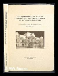
1995Best.-Nr. 424672Tainan Taiwan : Dept. of Architecture National Cheng Kung University 1995. 1st edition. Hardcover. Near fine copy in the original colour-printed boards. Remains particularly well-preserved overall. Physical description; 208p. Notes; Sponsored by Chen Chung Ho Foundation organized by the Dept. of Architecture National Cheng Kung University and held at Kaohsiung and Tainan in March 1995. Tainan, Taiwan : Dept. of Architecture, National Cheng Kung University hardcover
Best.-Nr. 6336ou scènes historiques,monuments, médailles,costumes,armes, portraits,esquisses biographiques,éphémérides,sites pittoresques,châteaux,édifices,églises,monastères,cultes religieux,curiosités naturelle,peinture de moeurs, coutumes,cérémonies civiles militaires et religieuses, contes,légendes,traditions populaires,impressions de voyage,géographie,statistique, commerce, littérature, poésie,beaux-arts,théâtre,musique,rédigé par une société de littérateurs sous la direction de Léonard CHODZKO sixième édition.Grand in 4 demi-cuir marron glacé à bandes,bords biseautés, dos lisse,pièce de titre fers à froid sur les plats.1 feuillet de justification des différents tirages, celui-ci est à 1000 exemplaires, œuvres de l’auteur, prospectus, portait gravé de l’auteur en frontispice, titre,1 feuillet de table des matières,et du placement des gravures, complet des planches et de la carte.Au bureau central 1846-1847
2006Best.-Nr. 2091502135305757Senshuuji 2006. Soft Cover. Fine. Volume: 1 Senshuuji paperback
1999Best.-Nr. 2091502135305747Tamamura hachimangu 1999. Soft Cover. Fine. Volume: 1 Tamamura hachimangu paperback
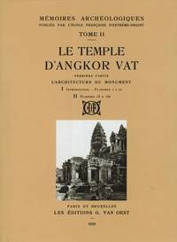
1995Best.-Nr. 4911Bangkok Thailand: S D I Publications / Bruce Miller 1995 . Limited Facsimile edition. Hardcover. Fine/fine. Quartos cloth in fine publisher's slipcase. Note: the shipping weight is estimated at 20 lbs / 9 kg so it will require an additional fee at cost. Copy no. 826 of 999 copies. This 3-volume boxed set reprints Part 2 of the MEMOIRES ARCHEOLOGIQUES of the L'Ecole Francaise d'Extreme-Orient originally published at Paris 1929 ff. These volumes cover architecture sculpture and bas-reliefs. With hundreds of plates illustrations. Text in French. Printed on paper meant to withstand heavy library usage. A number of the sculptures were destroyed since the French did these surveys in the Twenties. S D I Publications / Bruce Miller hardcover
1786Best.-Nr. A1025A Paris, chez Didot fils - 1786 – 10 planches dépliantes et une table du toisé des bois en grume. En fin de volume, une Table des quarrés et des cubes, dont les racines commencent à l'unité et vont jusqu'à dix mille. Où l'on expose des méthodes abrégées, tant pour l'évaluation des surfaces et des solides circulaires que pour le développement des courbes, et pour l'extraction des racines quarrées et cubiques par de nouvelles règles fort simples.
1900Very Good German Original b/w city plan. Atlas folio. (58x47 cm). In German. Folded. [CITY PLAN of BRAILA -IBRAIL-] Stadtplan von Braila. Scale (Masstab): 1/10.000. No cartographer. 33 descriptive articles on bottom-right corner of the plan. Slightly chipped at extremities of paper and soiling. It shows Braila and Donau. Braila (Turkish: Ibrail) is a city in Muntenia, eastern Romania, a port on the Danube and the capital of Braila County.
Best.-Nr. Ranta, HelenaIn Pristine Condition. unknown
Best.-Nr. 101626Lyon, Bernoux et Cumin, 1899, 1 volume in-4 de 285x190 mm environ, 436 pages, 2 ff. (tables), 7 pages (catalogue et présentation d'un ouvrage "Histoire de Lyon"), demi-basane moderne vert olive, dos à nerfs ornés portant titres dorés, gardes de couleurs, couvertures et dos conservés. Illustré de 20 portraits d'Architectes, et deux gravures (Le Bon Architecte et Le Mauvais Architecte par Philibert Delorme). Exemplaire numéroté 495/625 sur vélin blanc. Bon état.
1900Very Good Turkish, Ottoman (1500-1928) Original color map on cloth. Oblong: 67x75 cm. In Ottoman script. Folded originally. A very detailed map. Scale: 1:210.000. Shows Shkodra Lake, its shores, Bog Mountains, Karadag (Montenegro), Iakoh, Has etc. [MAP of OTTOMAN PROVINCE of BALKANS-ALBANIA] 52 Ipek (Peja). 53 Yakoh. 59 Akola. 60 Iskodra (Shkodra).
1876Very Good German Original color map on cloth. Chipped on folded places. Otherwise a clean copy. Oblong atlas folio. (46 x 52 cm). Scale: 1/300.000. Toponyms in German. Shows Gallipoli [and the Hellespont, Edremid Gulf, Imbros, Tenedos, Lesbos (Midilli), Aivali (Ayvalik) and North Aegean shores of Anatolia]. A sheet of the collection of 'The general map of Central Europe'. appeared in the years between 1873-1876 with the work of Joseph Ritter von Scheda, (1815-1888) who was a general, geographer and cartographer.
1927Very Good Turkish, Ottoman (1500-1928) Original color map. Chipped on folded places. Folded. Slightly toning on paper. Oblong atlas folio. (62 x 89 cm). In Ottoman script. Map of New Europe. Scale: 1/10.000.000. Gregorian: 1927. It's printed from 'Sudi Bey' Map Corpus. This was a map serie printed in the early Republican period in Turkish with Arabic letters. Very decorative map with its color flags of various countries longitudinal on right and left sides of map. Sudi printing house was an Ottoman / Turkish publisher who was one of the longest-running of Turkish publishers.
1927Very Good Turkish, Ottoman (1500-1928) Original color map. Chipped on folded places. Folded. Slightly toning on paper. Oblong atlas folio. (63 x 94 cm). In Ottoman script. Map of New Oceania. It shows Australia, Bahr-i Muhit-i Kebir, Pacific Ocean, New Zealand, Micronesia et alli. Scale: 1/20.000.000. Gregorian: 1927. It's printed from 'Sudi Bey' Map Corpus. This was a map serie printed in the early Republican period in Turkish with Arabic letters. Very decorative map with its color flags of various countries longitudinal on right and left sides of map. Sudi printing house was an Ottoman / Turkish publisher who was one of the longest-running of Turkish publishers.