1 440 résultats
1911Very Good Turkish, Ottoman (1500-1928) Original cromolithograph color map. Repaired. A good copy. Oblong atlas folio. (50 x 60 cm). In Ottoman script. [MAP of the BOSPHORUS] Bogaziçi; Kavaklar: Rumeli Kavagi, Belgrad, Hisarlar. Shows Asian and European shores, topography with detailed place names in its Bosphorus part of Anadolu and Rumeli Kavagi of Istanbul. At east, Belgrad; at northeast, Black Sea. No information on mapmaker. Hegira:: 1327 = Gregorian: 1911. Scale: 1/25.000. Rare.
1912Very Good Turkish, Ottoman (1500-1928) Original chromolithograph folded map mounted on cloth. A good copy. Oblong atlas folio. (47 x 60 cm). In Ottoman script. Scale: 1/200.000. Shows Vathy, Arkioi, Leipsoi, Nekaria, Patmos, Kos, and Fournoi Islands in Greek archipelago with Smyrna shores at east. A decorative and rare map.
1898Very Good Turkish, Ottoman (1500-1928) Original color map. Folded. Atlas folio. (82 x 57 cm). In Ottoman script. Scale: 1/400000. A clean copy. Including Azerbaijan, Dagestan, Mahaçkala, Tbilisi, Yerevan, Darband, et alli. A fine map of Caucasus and shores of Caspian Sea. Extremely rare.
2003Top of book is bumped otherwise minor shelfwear to extremities. Dustjacket has a few small nicks and tears along top edge. Dustjacket has shelfwear and rubbing. ; Winchester Studies, 4.III: the Anglo-Saxon Minsters of Winchester; 1.26 x 11.02 x 8.82 Inches; 300 pages; Property and Piety comprises an edition and translation, with extensive commentary, of thirty-three Anglo-Saxon and Norman documents relating to the topography and minsters of early medieval Winchester. These texts record the physical effects on the city of the foundation and expansion of the three neighbouring minsters, and also of the removal of the New Minster to Hyde in about 1110. They record political, religious, and cultural aspects of the tenth-century reform of Benedictine monasticism, of which Winchester was a leading centre. The splendid New Minster refoundation charter, composed by Bishop AEthelwold and granted by King Edgar in 966, is here translated for the first time. A full examination is also made of the old minster confirmation charter, probably fabricated in the reign of AEthelred. The volume also includes all Anglo-Saxon grants of land within Winchester and a reappraisal of the evidence for the beneficial hidation of the surrounding estate of Chilcomb. This volume is part of a three-book study in the Winchester Studies series of the Anglo-Saxon Minsters of Winchester, including 4.i, The Anglo-Saxon Minsters by Martin Biddle and Birthe Kjolbye-Biddle, and 4.ii, The Cult of St Swithun by Michael Lapidge.
18318vo., First and Sole Edition, endpapers very lightly spotted; attractively bound in contemporary green half morocco, straight-grain cloth boards ruled in gilt, back gilt extra with five raised bands, second compartment lettered and ruled in gilt, all other compartments tooled and ruled in gilt, marbled endpapers, marbled edges, covers very lightly age-scuffed else a most attractive copy. Scarce, especially in this condition. Anderson, p.183.
réf. 11433ARCHWashington D. C.: Smithsonian Institution Press 1979 520 pp. Original brown cloth covers w/ gilt title on spine and gilt decoration on front cover. Binding very bright and clean. Faint sunning to bottom edges. INSCRIBED AND SIGNED BY JAMES M. GOODE ON HALF-TITLE PAGE. DJ has light edge wear w/ approx. 1/4" closed tear from top edge of front panel. Illust. w/ numerous b/w photos. Contents very nice. . Inscribed & Signed by Author. First Edition. Hard Cover. Very Good/Very Good. 4to - over 9¾" - 12" tall. Smithsonian Institution Press Hardcover
réf. ria9781468465839_inpPaperback. New. New Book; Fast Shipping from UK; Not signed; Not First Edition; tenant is looming in importance. The owner is having more influence on the building. As Gerald D. Hines has said there are indications that the desire for more discretionary time will lead to more residential high-rises dose to or in t paperback
1911Very Good Turkish, Ottoman (1500-1928) Original color map. Folded. Chipped and slightly tears on extremities. Slightly stained and yellowing on paper. Oblong atlas folio. (50 x 60 cm). In Ottoman script. [MAP of the BOSPHORUS / CONSTANTINOPLE] Kavaklar: Rumeli Kavagi, Hisarlar. Shows the Bosphorus, and its Kavaklar and Hisarlar shores. Mapmaker is not described. Scale: 1/25.000. Mubde-i tul: Hagia Sophia. This is one the serie of the Bonn projection maps which are the first map series in modern techniques in Turkey and the Ottoman Empire. This is one the serie of the Bonn projection maps which are the first map series in modern techniques in Turkey and the Ottoman Empire. In order to produce these maps covering Turkish territory, Reconnaissance Branch was incorporated into The Mapping Commission. The maps were produced in the datum based on the latitude and longitude of Ayasofya Mosque in equal area Bonn Projection. The field works for the 123 sheets covering the country were conducted by 76 staff. The production was completed in 18 years starting from east west. Field works continued without stopping except in years 1914 and 1920. This map series called also reconnaissance maps contributed a lot to producing 1:25.000 scale maps. Hegira: 1328 = Gregorian: 1911. A good copy. Very scarce.
1924This is a very good hardcover copy in the publisher's original dark red cloth with a gilt emblem on the front cover and title to the spine. Spine sunned. Completely clean inside and out. Introduction by Ralph Adams Cram. 98 black & white photographs. 11" high X 8" wide, iv, + 98 plates. This book will be securely wrapped and packed in a sturdy box and shipped with tracking.
2003réf. SKU0614026Wiley 2003-12-01. hardcover. New. 11x0x8. New Textbook Ships with Tracking Wiley hardcover
réf. 14020Paris, Furne, Jouvet, (1867-1870 ). 4 volumes grand in-4, [dimension: 280 x 186 mm] de Portrait, (4), 743, (1) / (4), 703, (1) / (4), 752 / (4), 744 pp. Demi-basane tabac , dos lisse. (Reliure de l'époque.) fortes rousseurs,reliures bon etat,
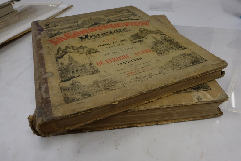
1889réf. ARCH120MEdité par Dujardin & Cie, Paris, 1889. Quatrième année. (28x35,5cm.) 2 volumes : 636pp + 104 planches. Plans en n&b. Couverture rigide. Epidermures sur les premières et dernières pages, couverture abîmée par le temps. L’intérieur reste en bon état.
1983200 pages. Glossary. Bibliography. Index. "Profusely illustrated with both original and archival maps, drawings and photographs this important study reflects the highest standards of scholarship and research throughout its pages" - from dust jacket. Clean and unmarked with light wear. Dust jacket now preserved in glossy new archival-grade Brodart. A quality copy. Book
1999"For the first time, Nanaimo's historic treasures are documented in a single, comprehensive survey." - page 7. 90 pages. Index by street address. Glossary of architectural terms. Biographical sketches of architects. Black and white reproductions of photos accompany text describing noteworthy structures from downtown/old city, Harewood, Newcastle, Northend, Southend, and Chase River. Some structures documented here have already been torn down. Valuable documentation of Nanaimo's architectural heritage. Unmarked with moderate wear. A quality copy. Book
1929réf. 0008568Praha: Nakladatele Kvasnicka a Hampl 1929. First edition. Good. 4to 36 pages plus plates for 615 photographs in its original rehinged pictorial cloth portfolio light wear to some plates. Note: will require higher shipping fee due to weight. Introduction and legends on plates also in English French and German. The 615 photos of interiors exteriors and rrelated landscapes are primarily printed three to a leaf or two but with a dozen or more singles. Nakladatele Kvasnicka a Hampl hardcover
1891réf. DEMO014105IPhiladelphia: John Y. Huber 1891. First edition. Hardcover. Very Good. 53 inserted portraits. Quarto 745 pages blue cloth repaired hinge some internal cracking unopened; ex libris Frank D. Kellogg. In addition to a comprehensive history this work incorporates nearly 200pp. of the Proceedings of the Celebration of the 100th Anniversary of the Organization of the U.S. Supreme Court. It includes the remarks by Chief Justice Melville Fuller and Justices Field & Harlan. Grover Cleveland spoke and chaired the Executive Committee. Etched portraits by Albert & Max Rosenthal. 53 inserted portraits. Author Carson became Attorney General of Pennsylvania. John Y. Huber hardcover
1903Very Good German Original color map. Folded. A stamp of S. H. Weiss, Constantinople. Elephant folio. (82 x 65 cm). In German. Scale: 1/864.000. [MAP] Karte von Bulgarien mit Ostrumelien und Tu?rk. Thrakien.; Mit kartographischen und statistischen Beilagen zum Versta?ndnis der orientalischen Krise. Showing Bulgaria, Balkans, and Eastern Roumeli, and Turkish / Ottoman Thrace. A rare map. OCLC: 43528174.
réf. 67810, L'architecture d'aujourd'hui 1945, 1945 couverture illustre de l'editeur original, 140 pages + 50 ads. bon etat.
1994Minor shelfwear. Minor bumping to 1 corner. Faint foxing. Dustjacket is protected in mylar. ; 1.18 x 10.79 x 8.5 Inches; 360 pages; Roman architecture is extraordinarily rich, both in terms of the techniques and materials used and in the variety of buildings constructed, many of which are still visible today. Roman Buildings places emphasis on the technical aspects of that architecture, following the process of building through each stage, from quarry to standing wall, from tree to roof timbers. The author examines the different techniques involved in building in brick and in stone and wood, and how these materials were obtained or manufactured. He also discusses interior decoration and looks at the practical aspects of water supply, heating and roads. Each type of building required special tools and these are described, using both surviving examples and modern parallels. The Romans constructed many spectacular feats of engineering, producing magnificent monuments such as the Pantheon and Pont du Gard. This book looks at these large-scale public buildings but also at more modest homes and shops. The result is a thorough and systematic examination of Roman building, with over 750 illustrations, including the author's own drawings. Roman Buildings contains a foreword by Professor Michael Fulford.
1968No marks or inscriptions. No creasing to covers or to spine. A lovely clean very tight copy with bright unmarked boards and no bumping to corners. Dust jacket not price clipped with small tears to very well rubbed edges. 502pp. A vast number of black & white photographs plus some drawings covering the fifty years of Soviet architecture since 1917, some one to a page, usually more. Covers four periods - 1917 to 1932, 1933 to 1941, 1941 to 1954 and 1955 to 1967. Main descriptive text in Russian over 58 pages.. Introduction also in English and French. All pictures with Russian, French and English captions. Publisher uncertain. Extremely scarce. From the Personal Library of the late John Dumbreck, Emeritus Professor of Russian Studies at the University of Manchester. We are also selling a large number of other books from Professor Dumbreck's Collection including some signed and authored works.
1943réf. TECH1133(Wien 1943). 4°, 68 Bl. Manuskriptdruck + 30 gef. Abb. in Kart.-Umschl. m. Leinenbindung, zus. in Leinenband m. ms. geschrieb. Rückenschildch., die Abb. sind sep. in Umschlaglasche am inn. Vorderdeckel, Rü. stärker ausgebleicht, Ecken etw. bestoß., abgegriff., papierbed. gebr., Bibl.-Expl. mehrf. gestemp.
1998réf. 7708EΚΚΛΗΣΙΕΣ Î£Î¤Î—Î ΕΛΛΑΔΑ ΜΕΤΑ ΤΗΠΑΛΩΣH τόμοι 6 Ιn greek with extensive english summaries. Six volumes; soft cover 28 cm 1700 pp. rich illustration. Separate volumes also available. Ask for details at demmath@hotmail.com. ============================================================== The shipping cost estimated by the system covers books weighing up to 750 gr.; a surcharge depending on the actual weight and destination applies for heavier books. National Technical University paperback
1910Very Good Turkish, Ottoman (1500-1928) Original color map on cloth. Oblong eephant folio. (64 x 573 cm). Toponyms in Ottoman script. [MAP of BALKANS] Filibe [Plovdiv]. A very detailed map. Shows Plovdiv and mountains, rivers around it. Extremely rare.
1846réf. 0008413London: Richard Bentley 1846. First edition. Hardcover. Very Good. Steel Engravings and woodcuts. 8vo; ix 437 pages contemporary 3/4 brown morocco marbled papers rubbed extremities tight all edges gilt 10 steel Engravings and 19 wood engravings. Nathaniel Armstrong Wells was a high-born wealthy man of mixed parentage: three-fourths European one quarter African. Richard Bentley hardcover
19518vo., First Edition, with double-page map as frontispiece, 91 plates on 64 and numerous illustrations in the text,neat signature on front free endpaper; original printed wrappers, a remarkably bright, clean copy in unclipped dustwrapper. THE FIRST ISSUE OF THE FIRST EDITION OF THE FIRST WORK IN PEVSNER'S MONUMENTAL SERIES. Published as Penguin BE1, this unassuming volume marked the beginning of the most popular architectural survey of the twentieth century. VERY SCARCE IN THE ORIGINAL BLUE DUSTWRAPPER (not issued until 1954). Buildings of England 1; Cherry PC1, PJ1.